Willis Wall

CELEBRATE THE OUTDOORS

40 years outdoors experience, extensive info on Mt. Rainier’s Wonderland Trail, original music, equipment reviews, off trail videos, other peaks in Mt. Rainier NP

  • About
  • Wonderland Trail
    • Willis Wall's Views on the Wonderland Trail
    • Wonderland Trail: Complete Video Series
    • Wonderland Trail Backcountry Camps
    • Alternate Wonderland Trail Camps
    • The Northern Loop Trail
    • Wonderland in 13 Minutes CCW
    • Wonderland Enhancement Videos
    • Early Season Challenges
    • Wonderland Shorts
    • Hiking the Wonderland Trail (2006 DVD)
    • My Wonderland
    • Wonderland Trail Post 2006 flood (2007)
    • Pain and Suffering: Wonderland Trail in 3 Days
    • Wonderland Trail 2010: the "selfie" 3 day hike
    • Wonderland Trail Transits 32-39
    • Western Loop
    • Mowich Rivers 2023
    • Mowich Rivers 2012
    • Annual Compilations
    • Wonderland Trail Photo Gallery
    • Mt Rainier 7Up Hikes
    • Filming the Trail
    • Past Updates
  • Willis Wall Blogs
    • Willis Wall Blog
    • 60
    • Blog Posts Reference
    • 68/35
  • 35 Years in MRNP
    • 35 Years in MRNP
    • Mt. Rainier Hikes 2018
    • Mt. Rainier All Trails gallery
  • 360 Videos
    • 360 Videos
  • Grand Tour (MRNP)
    • Grand Tour (MRNP)
  • Travel
  • Off Trail
  • Video Guide
    • Complete Video Guide
    • Biking Mt. Rainier
    • Eliot Creek Crossing: Timberline Trail
    • Paradise to Camp Muir
    • Hurricane Ridge Road Bike
    • Mt. Baker Highway 542 bike
    • Washington Pass Bike (Cascades)
    • Mowich Lake Road
    • Films under construction
  • Shorts
    • On The Rocks
    • The Spit
    • Enchanted Valley Chalet Tour
    • Look Up!
    • Wonderland Short: Jaunt to Summerland
    • Wonderland Short: 2011
    • Wonderland Short: 2015
    • Wonderland Short: Emerald Ridge
    • Wonderland Short: Frozen
    • Wonderland Short: Stevens Canyon washout area
    • Mt. Rainier West Mini Loop
    • Longmire to Muir to West Side Road
    • The Hummock
    • Peakaboo
    • The Other Campground
    • West Side Road
    • Carbon Glacier
    • The Seattle Viaduct (SR99)
    • Off Trail
    • Lane Peak Gully
    • Sunshine Point
    • Chasing Turbo
    • Mt Kilimanjaro
    • Rainier in Fall
    • Skyline Trail Improvements
    • Old Black Diamond
    • Left of Spring
  • Music
    • Music
    • Audio Samples
    • Anthology
  • Search
  • Contact
    • Contact Willis Wall

Durston Wapta pack on the Wonderland Trail, Mt. Rainier (2 circuits)

Durston Wapta 30 Pack Review

October 08, 2024 by Willis Wall

My go to smaller pack for the past 10 years has been a customized Zimmerbuilt Quickstep (1700 ci) made out of DCF. This has served me well for day hikes, peak bagging and even some longer fastpacks, like the Wonderland Trail (93 miles over 3 days, with good weather kit). The DCF material has held up well despite a fair amount of bushwhacking through tight brush, trees and scraping on rock. However, when Durston introduced the larger capacity Wapta (32L in size L), which would expand my uses to larger load outs, I pulled the trigger on its first release.

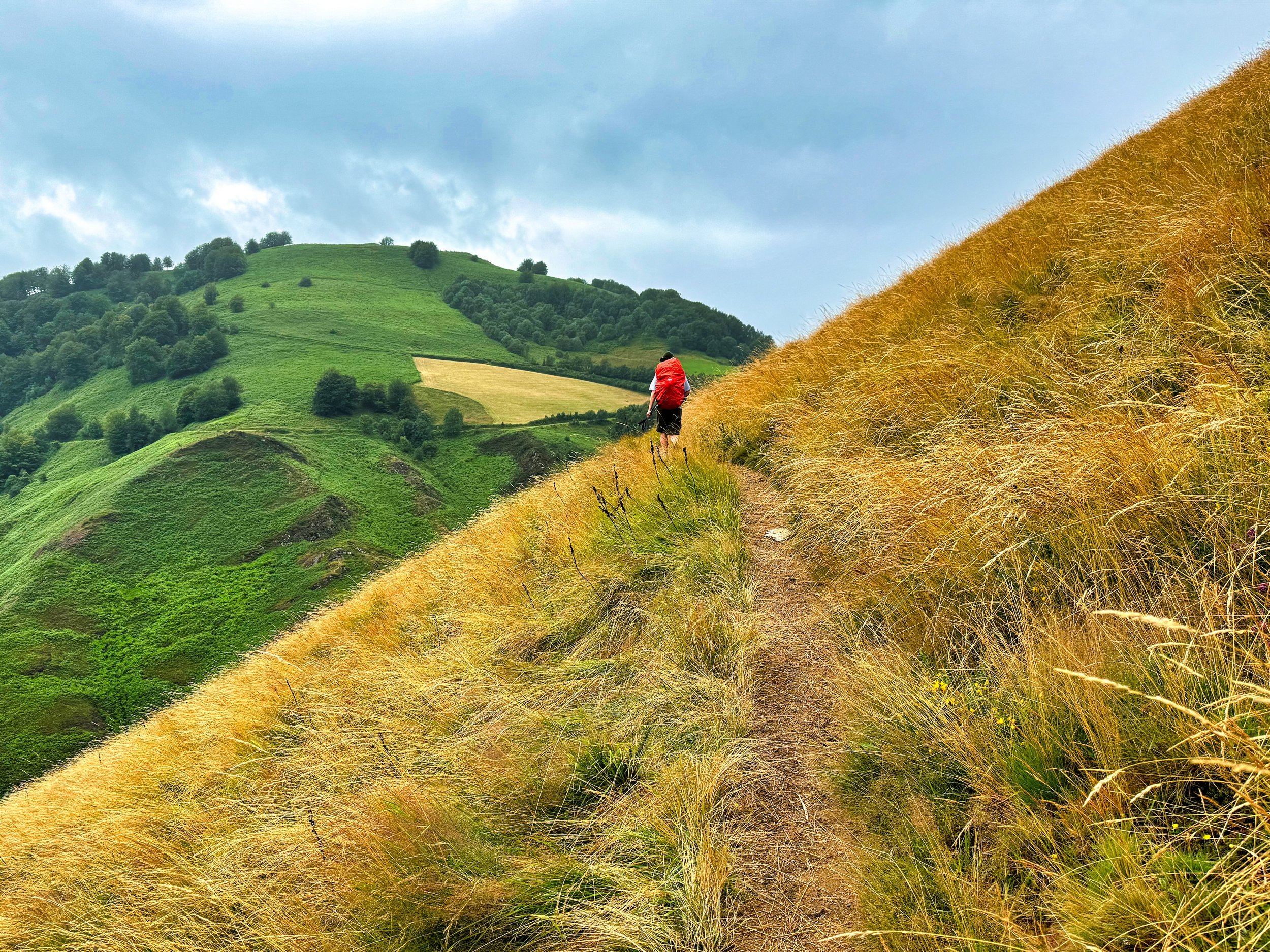
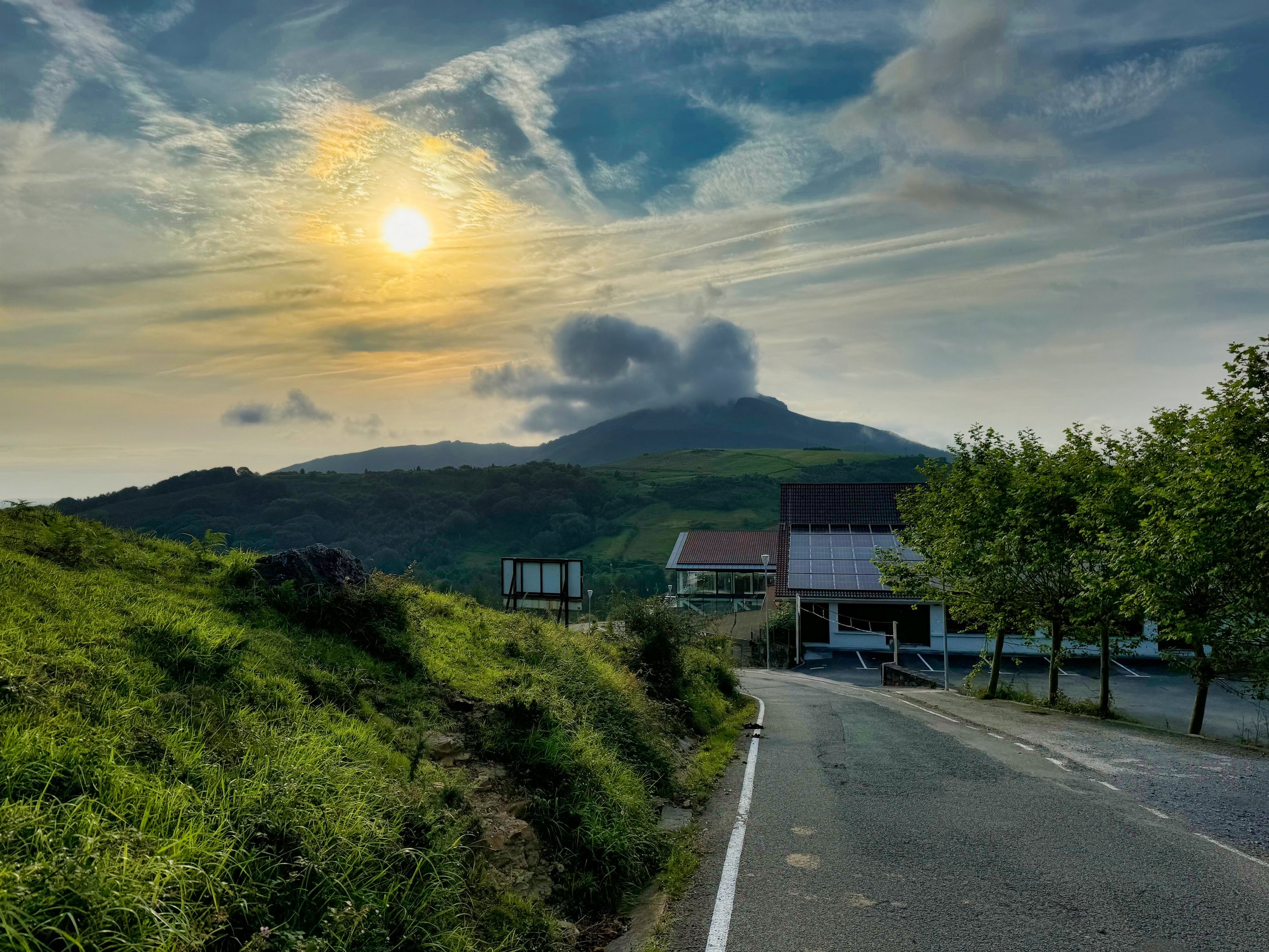
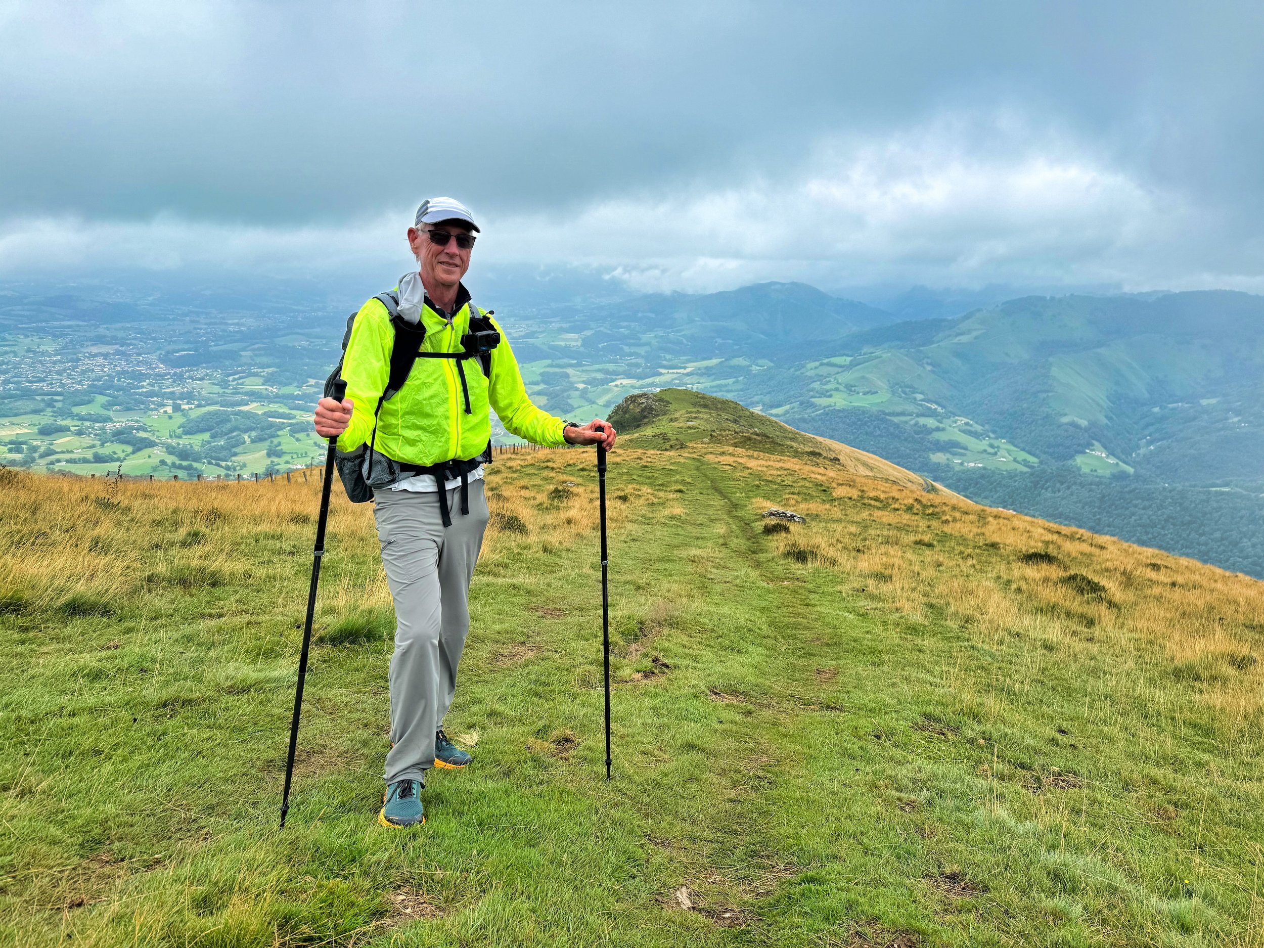
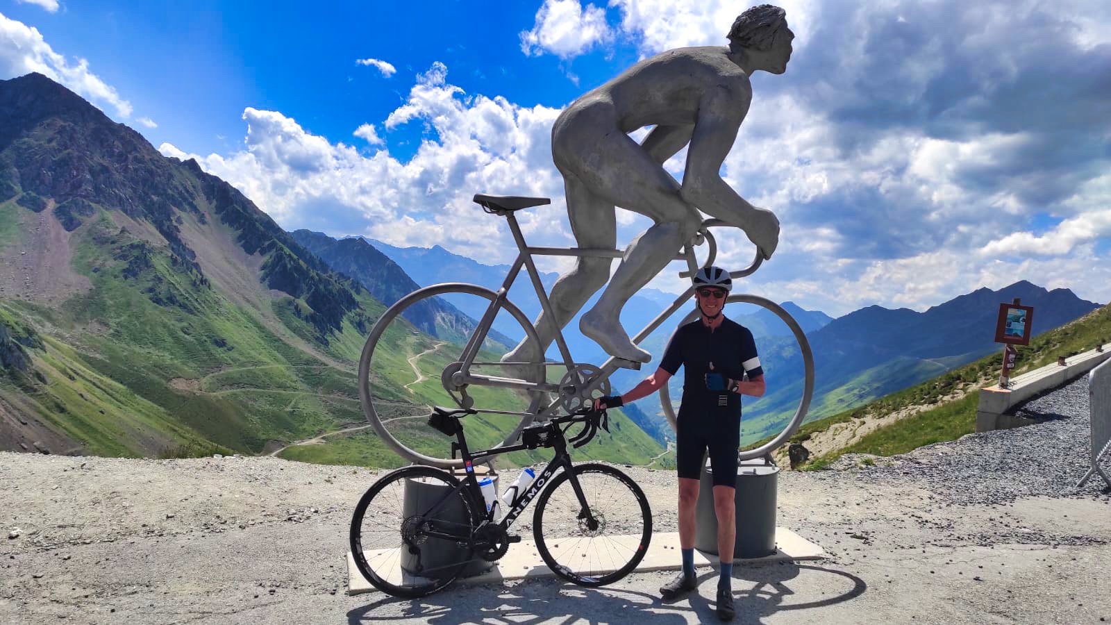
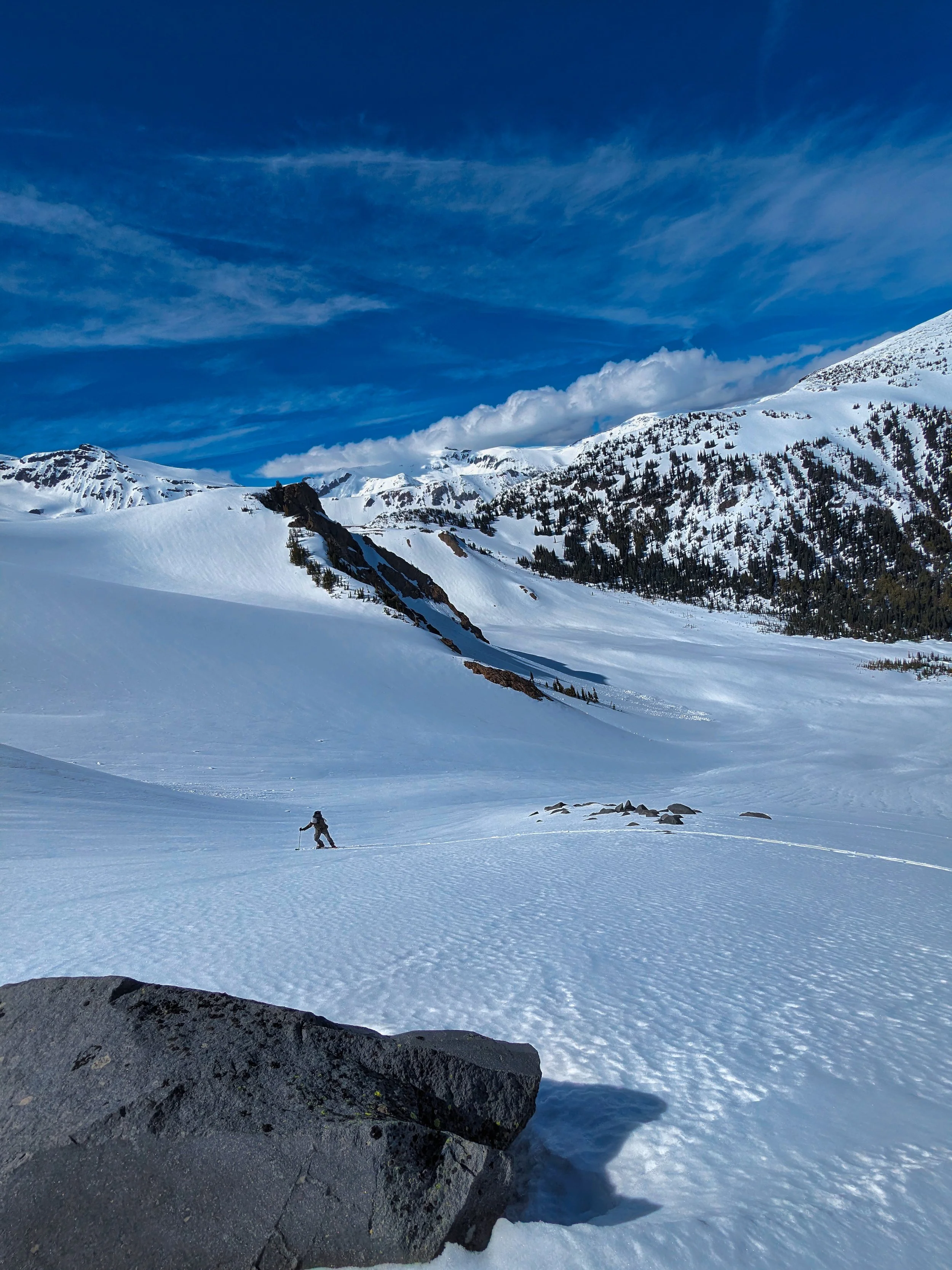
Durston Wapta in the Pyrenees (sans hip belt)

The Durston website provides all the technical details, both in writing and in the video, so readers should check the site out for the particulars. With the exception of a long term review, which is impossible as of this post because the pack has been out for less than a year, I have used the pack in enough varied conditions to render an opinion.

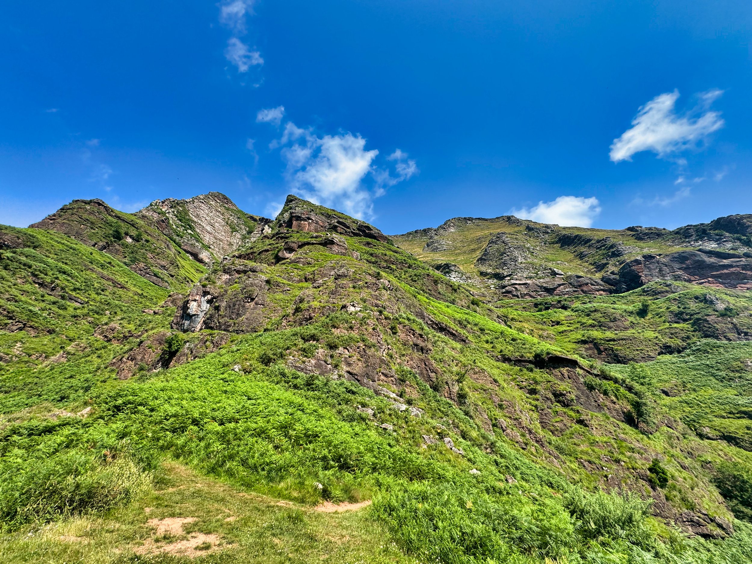
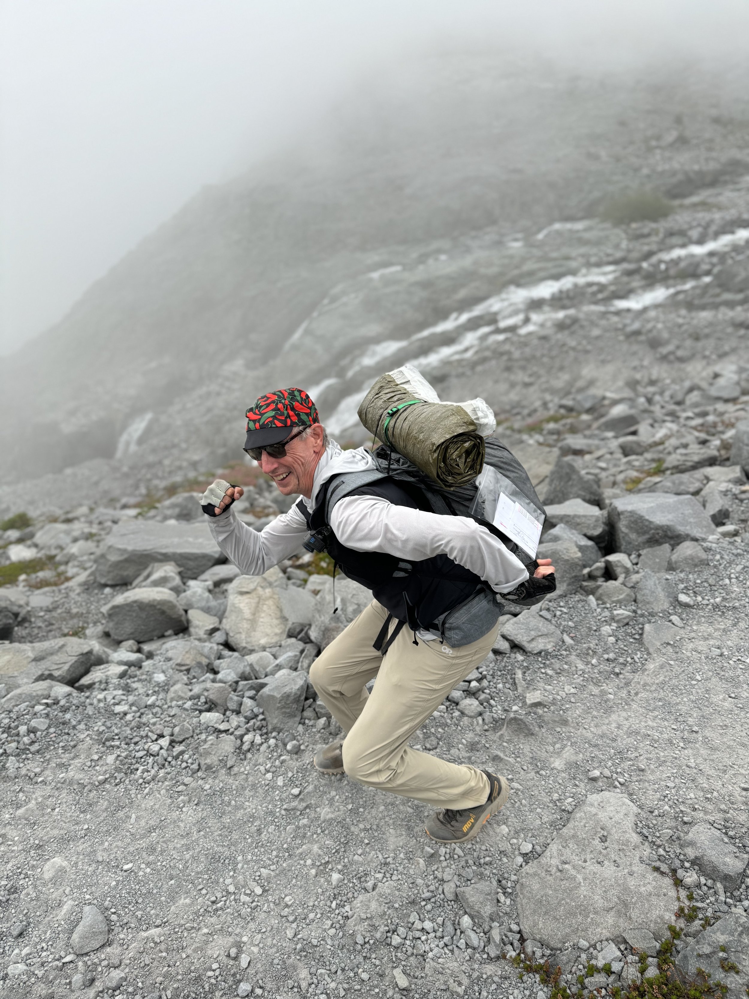
Difficult 'schwacking: I got beat up but the Wapta emerged unscathed

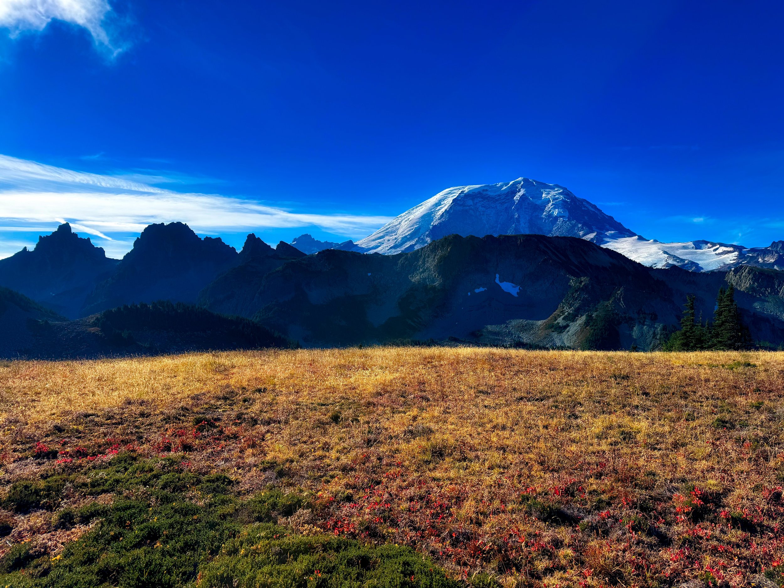
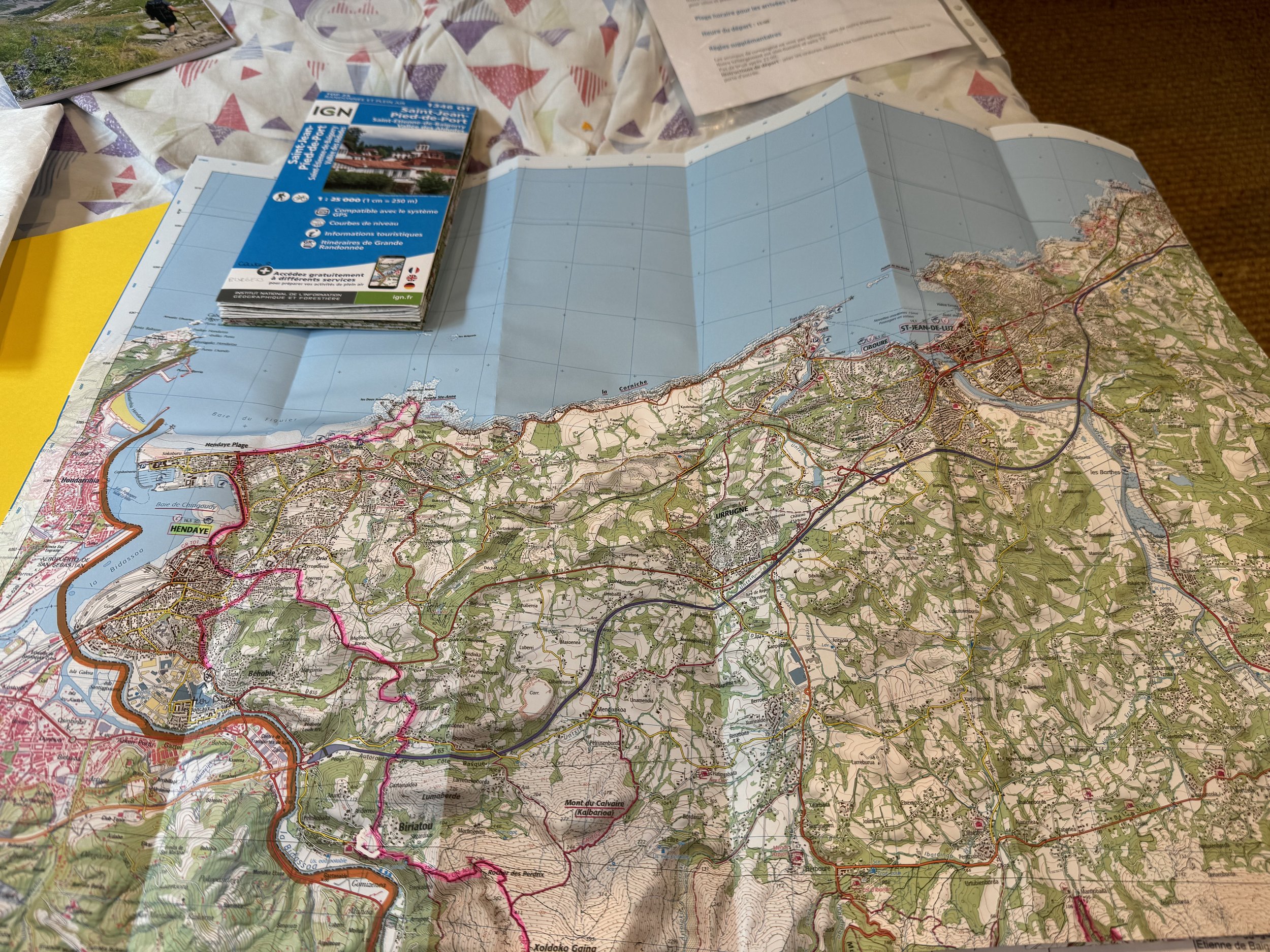
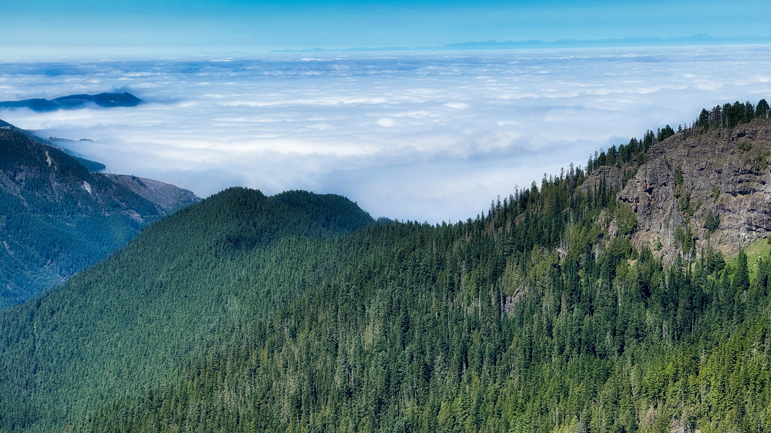
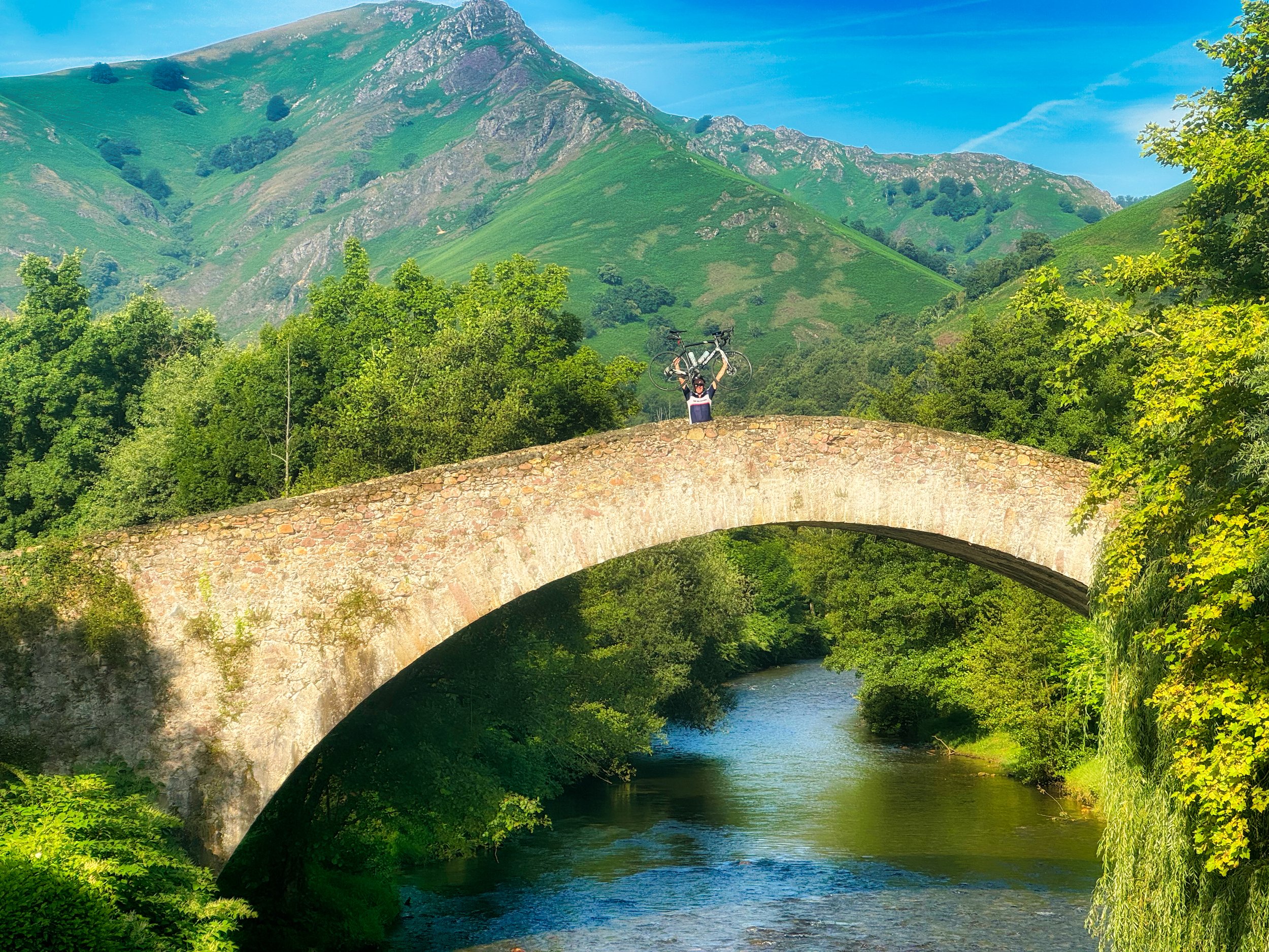
TRAVEL • I took the Wapta on a month long journey to the east coast, to Spain, then France. This entailed packing for multiple uses, including airplane and train travel where the pack could fit under the seat in front of me. I did of course also have a carry on roll aboard, along with the Wapta. • BIKING • I used the pack on 3 of my 7 biking days across the Pyrenees, primarily to use my shoulder mounted camera, but also to stash some items instead of cramming them into the rear pockets of a cycling jersey. The Wapta also did duty for one of my excursions where I biked to a distant trailhead, then hiked back. • HIKING • Immediately following my cross Pyrenees bike trip, the pack was on my back for 6 days hiking Section 1 of the GR10. I also did the Wonderland Trail twice as a YoYo, with each excursion lasting 3 days. • PEAK BAGGING • So far this year I’ve only done a few outings, but they were brutal on the pack.

Durston Wapta top strap handles bulky items

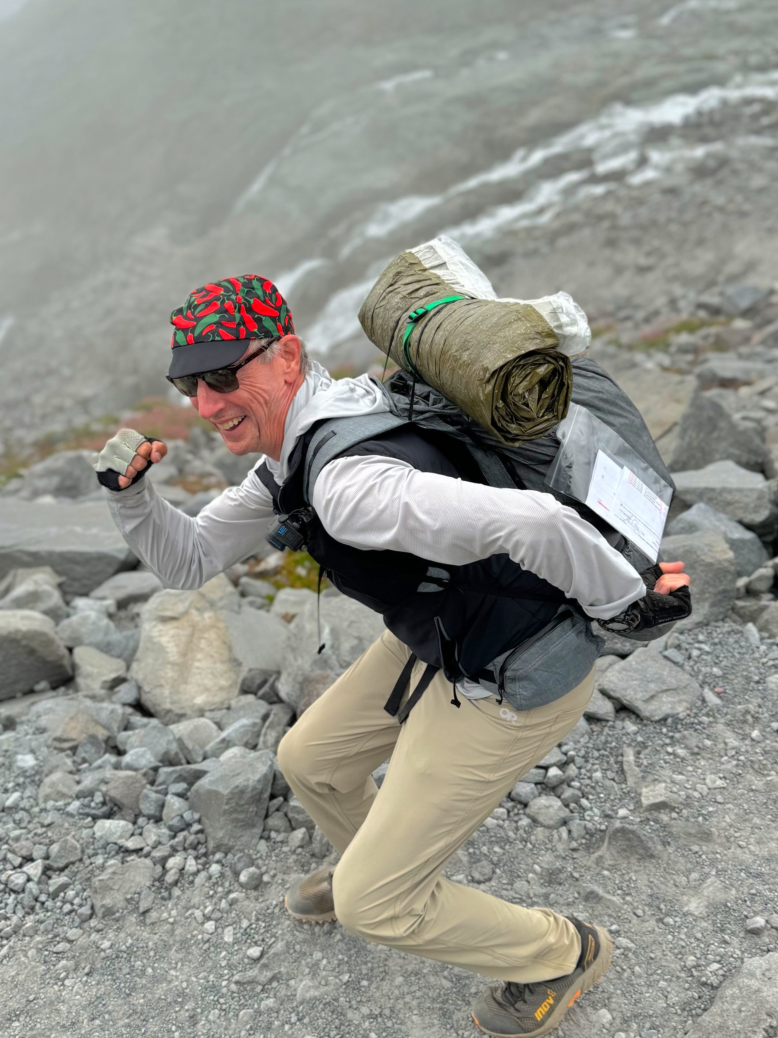
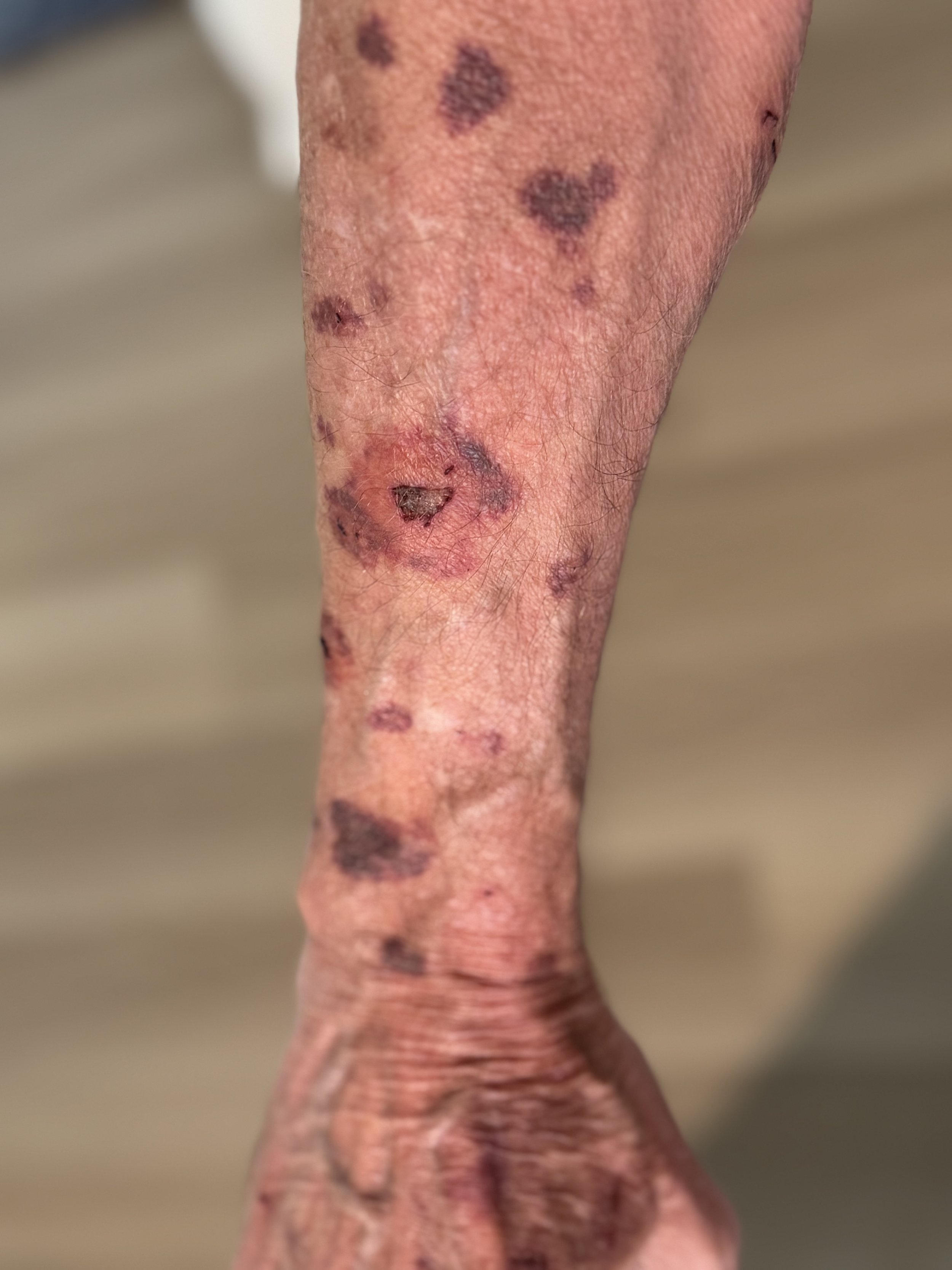
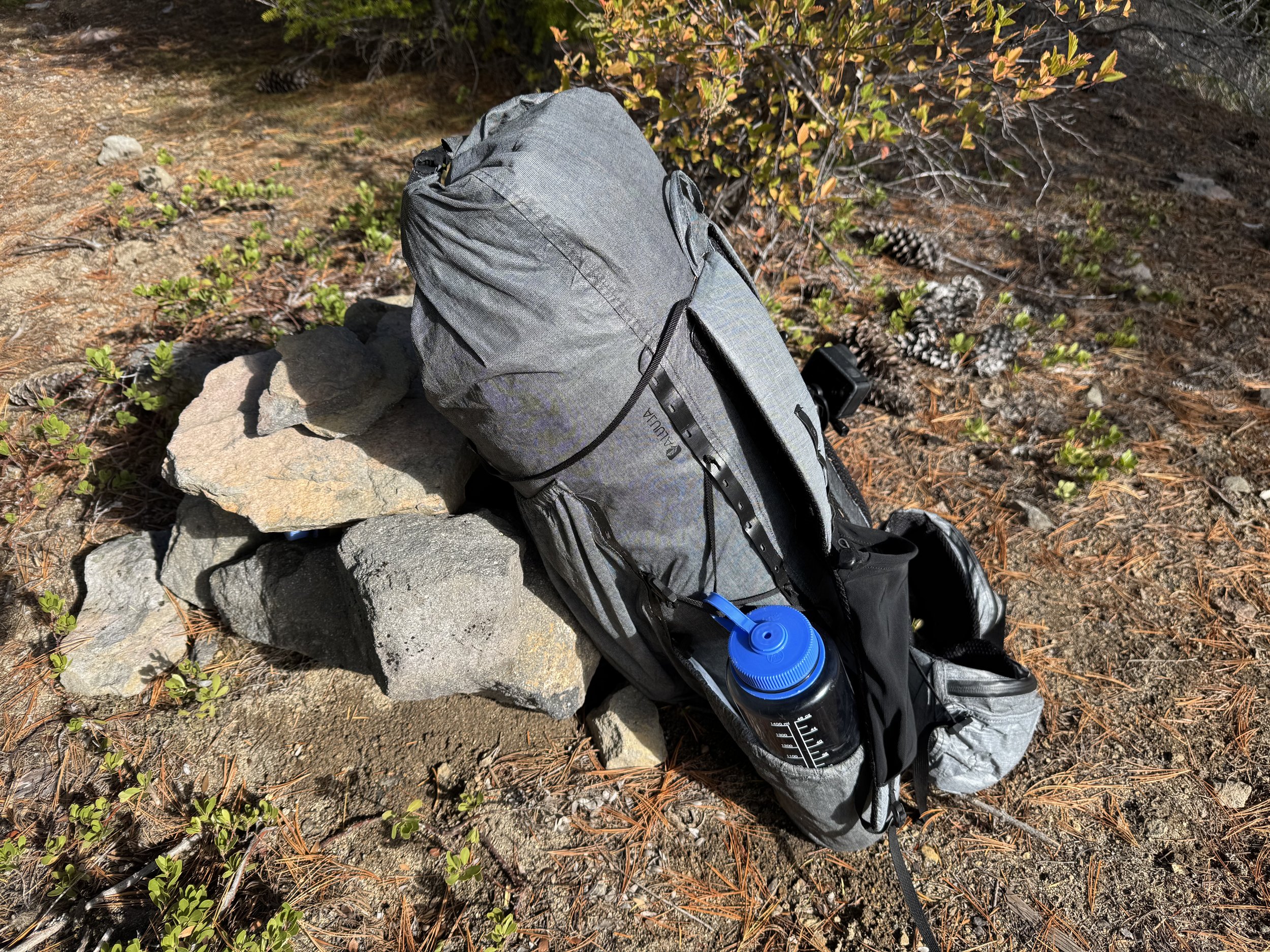
PARTICULARS • SIZE: I ordered the Wapta in size L, which is 32L. The hip belt size M fit my frame perfectly (32 waist). This larger capacity than my usual smaller packs gave me a lot of flexibility. The pack was not too large to use as a minimal day pack…on the Pyrenees bike trip I removed the hip belt and barely put anything in the pack body, so it cinched down nicely and did not interfere with cycling, the exception of course being the sweat factor from being on one’s back whilst tackling big climbs in the heat of July. For day hikes there was plenty of space; same for peak bagging. I tested the pack to its volume limits on Mt. Rainier’s Northern Loop Trail in October, where the temperatures (and weather) required more gear. I had one overnight so packed a NeoAir XTherm pad, an OR Helium Bivy, and a Nunatak 15 degree bag. Add in two days of food requiring an Ursack (staying in a cross country zone) and additional warm clothing, and I was just able to get 2 twists on the roll top closure when everything was in the pack. This was more than my 3 day Wonderland hikes despite carrying 6 pounds of food, as my kit then was considerably less bulky • FEATURES • This is the first pack I’ve owned where I could actually get the water bottles out of the side pockets without having to take the pack off. Nice. The top strap came in handy when I packed a bulky Blizzard Survival Tube for my CCW Wonderland trip as my shelter and sleep system; it was always secure and didn’t cant to one side or the other. I like the solid fabric front pocket, and I didn’t worry about items sliding out the top when I was bent over ‘schwacking because the elastic is tight and robust. The standard side straps were used when I had to fold and secure my poles whilst peak bagging, and I could also clip a large nalgene in when I knew my posture would not always be upright. Although I occasionally stowed a hat and/or gloves in the bottom pocket, I actually didn’t use this much. However, I am thankful that the material is solid and not mesh, as of course this is where the pack makes contact with the ground every time you take it off. Finally, the side pockets were where I stowed my inReach, spare battery pouch, Nuun tablets, ibuprofen and fold up toothbrush, and there was room for more. Of note, on another pack I own the side pockets actually interfered or made contact with my arms during locomotion..not a problem with the Wapta. The shoulder pockets I use for my phone and headlamp. • COMFORT • This is the most comfortable pack I have ever used. Granted, I never exceeded probably 15 pounds, even fully loaded with food and liquid. But even at its heaviest, I hardly noticed it on my back and never had to stop to relieve the shoulders or stretch. I go long periods without stopping, upwards of 3 hours, and even then it will only be for 5 minutes or so. This is the ultimate measure of a pack for me…do I need to take it off? Not this pack. Also, I trot the downhills, and the bounce is minimal. Despite no internal frame, it feels like the hip belt actually takes some measure of weight off the shoulders.• DURABILITY • So far I am a big fan of the Aluula Graflyte. I’ve been out in some mucky weather, where I placed the pack on wet, muddy, pineneedly crud. Any crud cleans up easily, and it’s also the first pack I’ve owned that didn’t retain at least some stains. But the ultimate test was one bushwhack that lasted nearly 5 hours, through chest high grabby bushes and tightly spaced trees with dead poky branch stubs. My arms had numerous blood spots and bruises from being stabbed or scraped (I’m old with thin skin), my legs got trashed, and the pack would catch on said branches, or the roll top buckle would catch to the point of breaking branches. Even the skinny side straps got snagged but emerged intact. On another peak I had to crawl upwards through high alpine trees to reach the summit block, sometimes scraping against rock and snagging branches at the same time with a fair amount of my body weight adding to the mix. So far, once the pack was cleaned after an excursion, the material looks the same as when I unpacked it on arrival. This stuff is tough. Lastly I’ll add that it did fairly well in continuous rain or mist over multiple days, and although I can’t say the contents were bone dry, there was no standing water in the pack and things were only slightly damp (the pack is seam sealed).

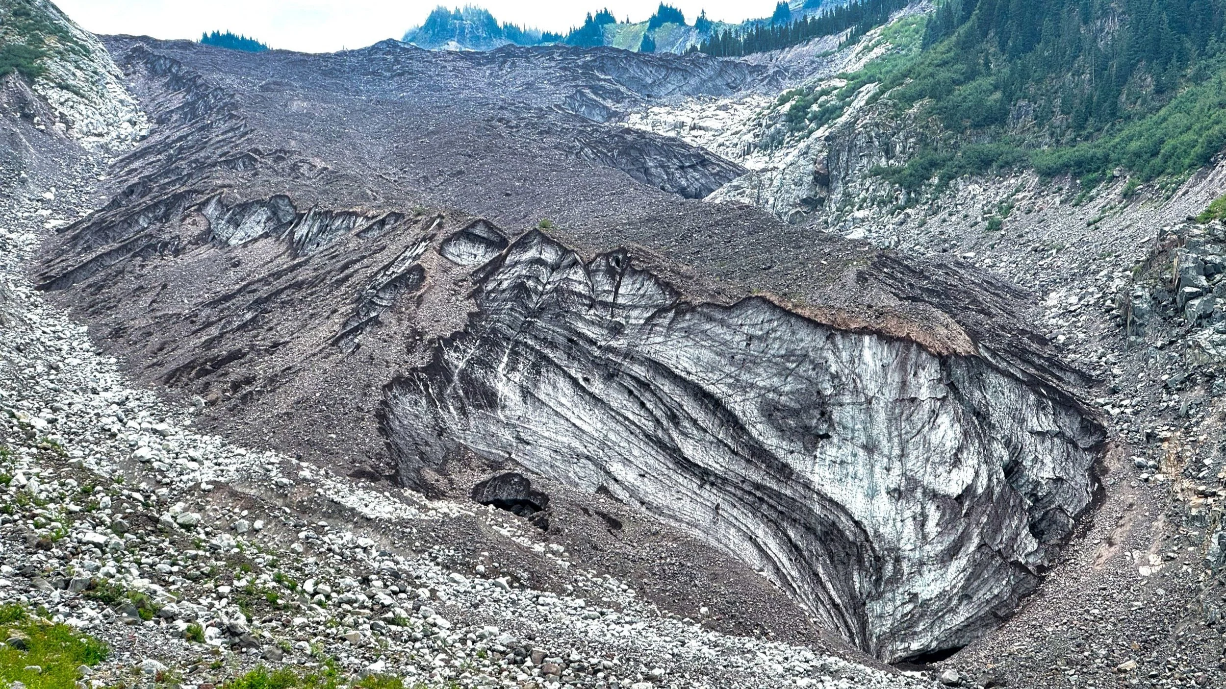
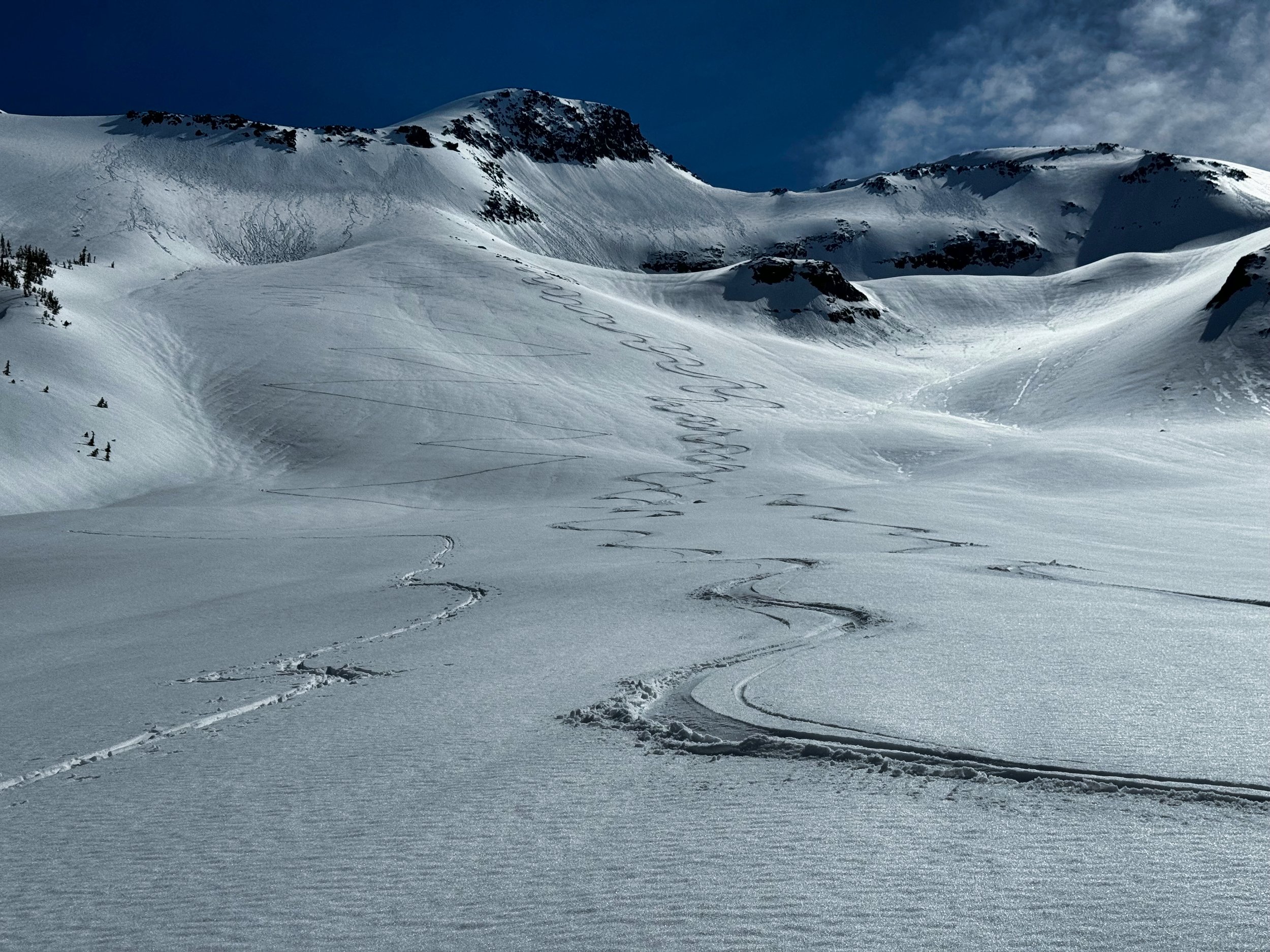
Durston Wapta at max volume on peak bagging trip

Wapta dual air mesh strips invite pine needles if 'schwacking

ANNOYANCES: There’s not much to say here, but no pack is perfect. The buckle design is such that, vice what I usually see, the cinch is on the interior and one merely presses the sides to release. When I was doing contortions during bushwhacking, the belt released a number of times when it was pressured in a bent position. When buckling, it is hard to do it by feel. I usually have to see the two ends of the buckle to easily engage it (including the sternum strap). To wit, when I was going through airport security in France, I had to unbuckle the pack for an inspector because she couldn’t figure out how to release it. • The roll top closure is generally fine, but reference what I wrote about bushwhacking…in close quarters in tightly packed trees, it’s a loop on top of the pack that will surely invite unwanted branches into its midst, pulling you backwards or stopping you in your tracks as you have to reverse to untangle. • The dual air mesh strips on the back certainly add to the comfort factor of the Wapta, but I recently spent over 30 minutes with a tweezer trying to expunge pine needles embedded in the tiny holes (reference the 5 hour bushwhack above), and I didn’t get it all.

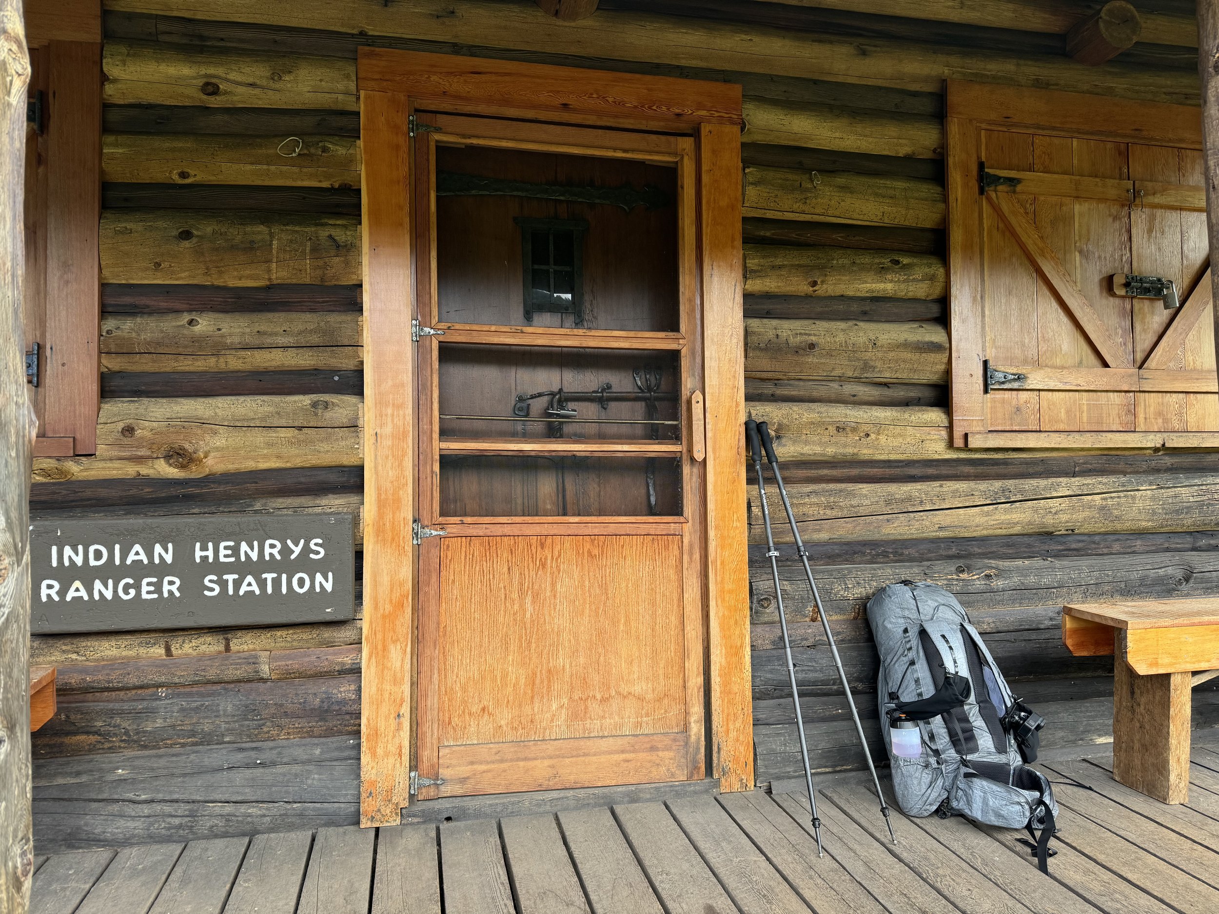
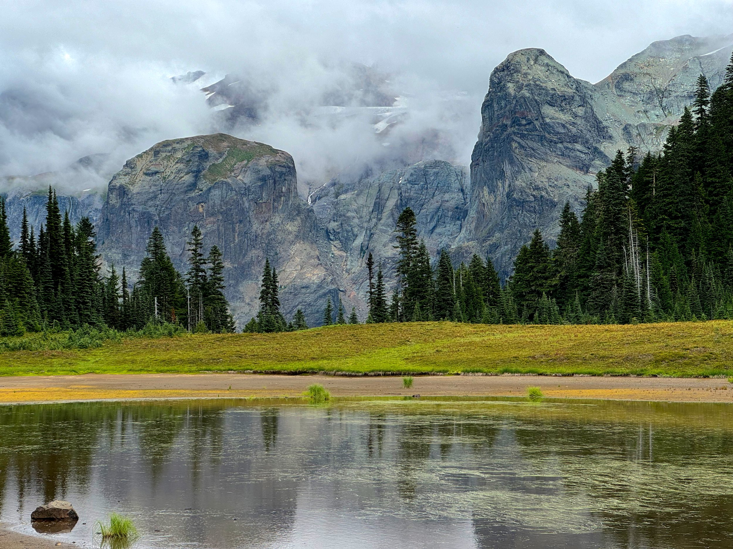
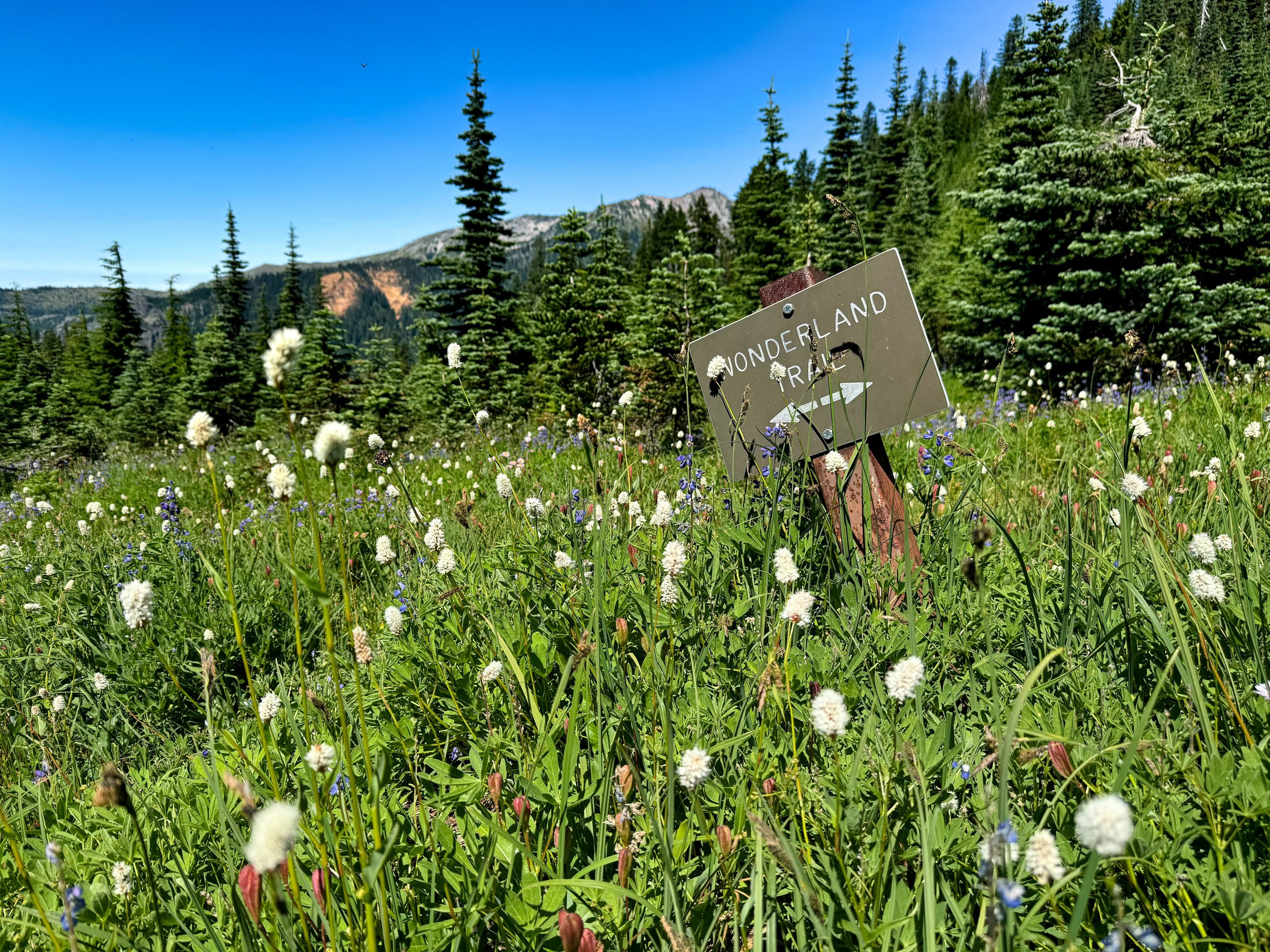
Durston Wapta not at max capacity for 3 day Wonderland Trail trip (107 miles)

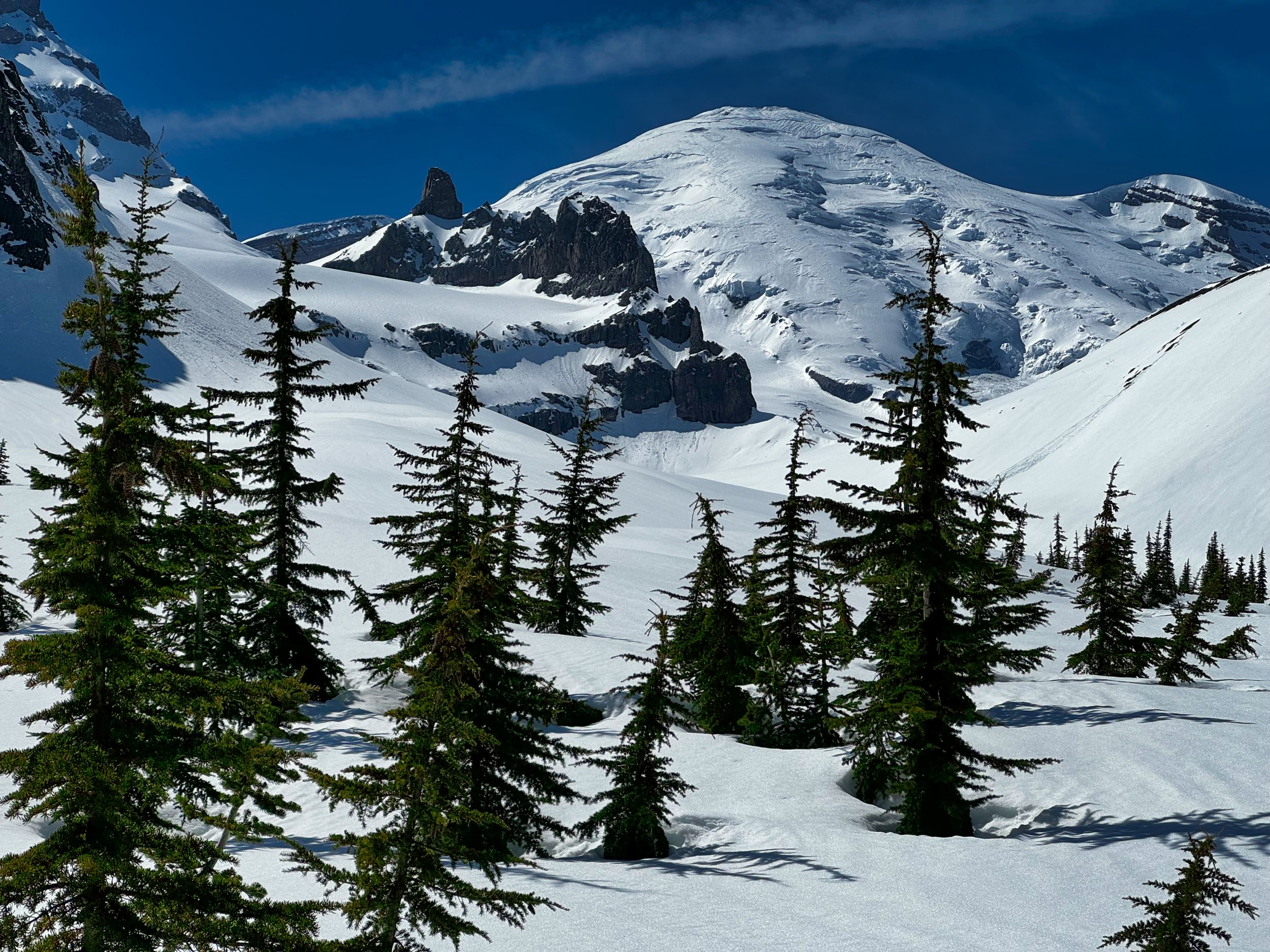
Durston Wapta on the GR10 (France)

CONCLUSION: Aside from the few minor annoyances mentioned above, everything about this pack is a winning combo, making it the most useful and comfortable all around pack in my closet. The design, the sturdiness of materials, and even the looks are top notch. Kudos to Durston for offering such a well thought out tool to the hiking/biking/traveling/peak bagging/fast packing community. Durston Iceline Poles: You may notice them in a few shots; I used these all season on every trip (including the GR10, they packed in the roll aboard), but had to put them aside when one of the tips inadvertently broke off without me noticing; with continued use I actually wore down some of the carbon lower pole section. I contacted Durston about this and surmised that I would need a replacement lower section…the response was prompt and I received notice that they would ship out a lower section when the new Iceline batch was in stock (December), free of charge. Add that to the accolades list for Durston; excellent customer service for their excellent products, albeit with the waits that are common with “cottage” or smaller companies. Disclaimer: I paid full price for these products and have no affiliation with Durston

October 08, 2024 /Willis Wall
durston wapta pack review, durston wapta pack

Mt. Rainier from the Pigeon Peak summit

Northern Loop Trail (MORA) with Peak Bagging

October 04, 2024 by Willis Wall

I’m working on the Mountaineer’s “100 Peaks in Mt. Rainier National Park” list, albeit at a leisurely pace. I decided to combine items on the to do list…video the backcountry camps along the Northern Loop, take photos of the ranger cabin cabinets at Lake James and Mystic Lake (per request), and tag a couple of remote peaks on the list: Pigeon Peak (4280’) and Tyee Peak (6000’), then end by completing the NLT.

McNeeley Peak shortly after departing Sunrise

This was my second foray onto the NLT from Sunrise, with the first outing mapping the other campsites (Berkeley Park/Fire Creek/Lake James) and scoping out the route to Pigeon Peak. That was an out and back and made for a long day, logging 27 miles with 7,000’ of vert. I knew I would need an overnight to do the whole NLT and bag two peaks, so I got a permit for the Tyee cross country zone.

Near Windy Gap, Northern Loop Trail (Mt. Rainier)

Day 1: Pigeon Peak I had an idea what was ahead of me for Pigeon, in that I had probed the route on the prior trip; I knew it was gonna be nasty. After crossing the West Fork of the White River, I climbed to the trail jump off point around 4,000’ elevation. Conditions: tall, feet grabbing bushes and tightly packed trees, including dead ones with pointy broken branches that wreaked havoc on my old man thin skin. As the hours wore on bloody patches from cuts adorned my sleeves and my feet got wet crossing the main creek, which was in a deep ravine. It took me nearly 3 hours to finally make my way to Pigeon Peak, which at least had a view to the mountain and the river below. There is no doubt that the only people coming here were the ones, like me, that had to tick this peak off a list. On the return I followed a slightly lower contour and had easier going, taking advantage of elk trail when the opportunity arose. When I finally bashed through the brush and set foot on the trail, I was relieved, to say the least. As I climbed towards Windy Gap the rain started falling, just to ensure that my shoes would not dry out for the next day. I secured my food in an Ursack and laid out my bivy (OR Helium), glad that I had brought this more robust shelter. I anticipated colder temps and did not want to take a chance on being cold, so a NeoAir XTherm pad and Nunatak 15 degree bag kept me toasty all night.

View from Tyee Ridge

Day 2: Tyee Peak/NLT I knew I had a long day ahead of me, but I purposefully slept in until past 7, as the Tyee Peak climb was first on the docket. The morning was clear and it didn’t take long to adjust to my soaked shoes. Unlike the day before, the “off trail” travel to Tyee was on a well established social trail, across the Tyee ridge all the way to the base area of Tyee Peak; sweet! The sun was out and the temps were cool but not cold. The description for Tyee was to go past the peak and approach from the west; I climbed to the saddle but the west ridge was crowded with tightly spaced small trees. Perhaps it was all the stick poking and pack catching I endured from the day before, but as I climbed I opted to follow a line around the base of the peak to the east side. This was doable but probably not prudent, as the scrambling was more difficult than the “moderate scramble” description, with one move bordering on class 4. However, nothing scared me and I did find a way to the summit, enjoying the 360 degree vistas. I found it interesting that Tyee Peak is listed as 6,000’ elevation but the USGS marker on top read 6040’. I probably would have lingered there longer but I knew it was a long day ahead to complete the NLT. I did not want to downclimb the way I had ascended so started down the woodsy west ridge, finding the way so much easier, and obviously the way I should have ascended in the first place. Tyee Peak was my #74 on the list. Soon I was back on the social trail to reconnect with the NLT.

Mt. Rainier from Tyee Peak (6,000')

I had one more camp to map on the NLT, that being Yellowstone Cliffs. Once complete, I pondered backtracking from there, or even cutting across the Elysian Fields, but I figured I may as well finish the Northern Loop in its entirety. I launched off for the downhill section, continuing CCW. By now my legs were steely from prior bikes and hikes so I was able to trot the entire downhill to the turn to parallel the Carbon River. This was the third time I was on this trail section this year, and I reveled in the ease of on trail travel and automaton like locomotion; end of season fitness is always fun. The timing worked out great in that I arrived at Mystic Lake right before sunset, with fantastic light for photography. This was also the first time I had seen anybody since starting out, chatting with two people who were staying at Mystic Camp. I mean, it’s only October 2nd, and over two days I only see a few people?

Sunset on Mystic Lake, Mt. Rainier

The rest of the evening had me motoring consistently (I had 10 more miles to Sunrise) with no low points physically or mentally. I stopped at Skyscraper pass to try some 10 second exposures for the star show, and again at the junction with the NLT to Berkeley Park. Earlier I had estimated that I would arrive at Sunrise before 11 PM, and I was pretty much spot on: I reached my vehicle at 10:51 PM. It was also 29 degrees; no wonder I had been wearing 3 layers for hours. Aside from my spotty bruised skin, along with some minor scrapes, I had a very enjoyable outing; breathing in the crisp alpine air, enjoying hard earned fitness that comes from not just a few months of activity, but years of consistent movement. Make no mistake, I am thankful and grateful for being healthy enough to do these kinds of outings at age 69. This day’s stats: 25 miles/9,000’ elevation.

Mt. Rainier from Skyscraper Pass

October 04, 2024 /Willis Wall

Björn hiked with me for two days on the GR10

Hiking Section 1 of the GR10 (7/16-22/2024)

September 11, 2024 by Willis Wall

An earlier post was about biking across the Pyrenees. During the research phase, I saw that the ending point of the bike, St Jean de Luc (France), was just a short train ride to Hendaye, the start point of the GR10 route that transits the French side of the Pyrenees. Why not hike some of that since I was already there?

My first inclination was do to it “williswall style”, meaning long days. But then I discovered Respyrenees, an outfit that would transport my luggage to each stopover point. I figured that after the bike trip, just following their recommended day by day trip would be in order. I could expect to be hiking 5 to 8 hours per day, and arrive at each night’s accommodations before dinner time.

A little more about Respyrenees: I was arriving in France packed for my time spent in Maine beforehand, along with biking accoutrements and hiking gear. I had a carry on rollaboard suitcase along with my backpack (Durston Wapta). Were this just a hiking trip, I probably could have made do with packing my stuff on my back day to day. Logistically, however, I needed to deal with luggage. Respyrenees offered transport in addition to GR10 specifics. I had a packet waiting for me at the first night’s accommodation prior to the hike that included a hard copy of turn by turn directions/descriptions of the whole section. Also, detailed 1:25,000 maps were in the packet. I arrived with the navigation app already loaded on my iPhone. This app was essentially the same format as the cycling trip, with the route ahead, verbal cues and information when appropriate, and an aural warning (in English) that told you when I was off track…in my case I had it set for 20 meters, but that is adjustable. I found that putting my iPhone in Airplane mode and the battery on Low Power Mode, I never had to recharge during the day. This of course depends on how many photos and video you are taking, as these activities eat up battery power. Although each night I approached my hotel with that slight anticipation of “I hope my luggage is here”, I needn’t have worried: it was always waiting for me. The one exception was a shorter day when I arrived around 2 PM and the road system to get there was circuitous. My “porter” had already called and told the hotel that he would be arriving at 3, and so he did. I simply sat outside and enjoyed a cold Panaché (beer and 7-up, refreshing without too much alcohol) and relaxed. In sum, Respyrenees provided great support and material, and if you need to call them (as I did once checking on something before the trip) there is someone there who speaks excellent English. They also provide a phone number if you have an emergency or for some reason can’t make your intended destination…they will come assist. I will use them again, highly recommended!

The complete photo set of each day (numbered 1.1, 1.2 etc) can be found here on the Willis Wall Flikr site.

Detailed maps and a hard copy of turn by turn guidance (I also had it in my phone) provided by Respyrenees

These descriptions of each day are from the Respyrenees books

Day 1: Hendaye to Ibardin With your feet in the water, you will leave the beach and the bay of Hendaye, to reach the first foothills of the Pyrenees through green landscapes and sites with a strong Basque imprint. Behind you, magnificent views of the immensity of the Atlantic coast open up. You will reach the Col d’Ibardin (Venta Elizalde) I stopped at a cafe before leaving town and bought an excellent lunch for later; this was the only day that a lunch was not provided. Strava Stats: 12 miles/2900’

Leaving the Atlantic on the start of GR10, Hendaye

Hendaye in the background as one climbs into the foothills of the Pyrenees

Day 2: Ibardin to Sare During this stage, the path will pass by the massif of La Rhune (Larrun: place of pasture, in Basque), considered as the first Pyrenean summit of the chain and which, from the top of its 905m, remains the sacred mountain of the Basques and a place full of history. Then you will reach the pretty village of Sare and its typically Basque architecture which has managed to integrate the originality of the surrounding environment. I ran into many hikers on the section around Larrun, it was a very popular spot. There is a train which carries people to the summit. Strava Stats: 12 miles/2500’

Morning start leaving Ibardin

Typical Basque architecture

Day 3: Sare to Esteben Borda During this stage, you will cross at first the pleasant and preserved Basque countryside before arriving at Ainhoa, a magnificent village-bastide of the XIIth century. Then, crossing small summits and passes, the route goes around the Ereby (583m), further on the Atxulegi (617m), and soon appears the Zuccata pass, a superb belvedere. From there, depending on the weather conditions, you can reach the Col des Veaux by the trail or, if the weather is good, by staying on the ridge, off the GR10, continue to Gorospil Peak (691m), and enjoy the panorama of the Basque mountains. I stayed on the ridge for this day, enjoying fine weather, and had a fabulous lunch in Ainhoa. The accommodation for the evening, Esteben Borda, was essentially a farm with a row of sparse rooms. The evening meal was very meat heavy and kinda slow, but this was the only place to overnight without the day being significantly longer. Strava Stats: 14 miles/2900’

Leaving Sare on the GR10

Crosses near the Aubépine Chapel, Mt Atsulai

Day 4: Col des Veaux to Bidarray The GR10 continues to alternate between the Pyrenean summits and mountain villages that have a strong Basque identity. The trail heads in the direction of the Col de Méhatché situated at an altitude of 716m. You pass into a rocky landscape that is home to the Griffon Vultures that circle high above, before the descent to Bidarray village. As the stage is short, you can make a return trip to the top of Artzamendi and enjoy a wide panorama: from the ocean to the first high peaks of the Pyrenees. Indeed this day was short, but not necessarily easy. The descent through the “Terrible Rocks” was on a narrow path with steep stepdowns. Poles were in order as was hand work. Bidarray was a very cool village that was hosting a mountain foot race, ranging from 65 to 25 kilometers. We “ran into” many runners when we left Bidarray the next morning, but they soon branched off onto a different trail. Strava Stats: 7 miles/1400’

Typical road walking on the GR10

Looking up at the “Terrible Rocks”

Inside the chapel in Bidarray

Day 5: Bidarray to St Étienne de Baïgorry Today’s sporty stage is one of the most beautiful hiking routes in the Basque Country. From the charming village of Bidarray, you will start the ascent towards the Iparla ridges which, from the bottom of the valley, look like a long, impassable wall. On the heights of these superb red sandstone cliffs, you walk along the void but at a respectable distance. From there, you will still enjoy an immense panorama….then you will go down again in the direction of Saint Étienne de Baïgorry, magnificent village of the Basque Country, with many typical buildings of the Bas-Navarra architecture. Today I was joined by Björn, whose wife left the trail to travel by train to meet him at our end point, St Jean Pied de Port. Most of the day was socked in (but with no rain), so wide ranging vistas were scarce. Still, the description was apt, and we thoroughly enjoyed ourselves on this trek, both enjoying the wide ranging topics and humor of our conversations. Strava Stats: 12 miles/4200’

Cloudy views on Day 5

Pyrenean Ibex on the hills above Saint Étienne de Baïgorry

Day 6: St Étienne de Baïgorry to St Jean Pied de Port. From the banks of the bucolic Nive des Aldudes, the itinerary in the heart of the Basque Country rises above St Étienne de Baïgorry to reach the Oylarandoy massif. The rest of the itinerary leads to a new summit with a beautiful panorama: the Munhoa, culminating at 1021m and overhanging St Jean Pied de Port that you will reach after a long descent. Surrounded by pink sandstone ramparts, the medieval city of St Jean Pied de Port seduces with its paved streets lined with old houses, it old bridge over the Nive river, its picturesque facades on the waterfront, its covered way and its imposing citadel reworked by Vauban, whose silhouette dominates the roofs of the city. This day started out with rain for us, and if not raining then some of the higher reaches had sideways blowing mist. We also had a cool encounter with circling Griffon vultures riding the currents. Although I had stashed my rain jacket, I did take to wearing a cycling jacket to keep the biting wind at bay. We lost the track at a high point and where we showed being back on we had to gently wade through a large flock of sheep. Strava Stats: 13 miles/3200’

A cycling jacket keeps the biting wind at bay above St Jean Pied de Port

Ending point, St Jean Pied de Port on the Nive River

Hiking this part of the GR10 was completely different from my usual fare in the Cascades. The peacefulness of the meandering country roads, the intense green, the open vistas, the trail deep in forest or exposed on hills, the grazing sheep, cows and horses…we were even buzzed by Griffon Vultures on Day 5…made this a splendid trek. Add in the excellent meals of Basque food, wine, cheese and cakes; well, I can only say I savored every bit of it.

September 11, 2024 /Willis Wall
GR10 Section 1, hiking the GR10

Nearing the top of the Stevens Canyon climb, below Reflection Lake

RAMROD 2024 9/4/24

September 05, 2024 by Willis Wall

RAMROD (Ride Around Mt. Rainier in One Day) returned for its 40th anniversary in a new iteration for 2024…September 4th vice the usual July date, and for the first time going clockwise. For a while the ride was in jeopardy, when earlier the park refused to issue the appropriate permits. However, probably due to the persistence of the sponsor, Redmond Cycling Club, the way was cleared for the event with the new date and changes. Weather was excellent, cool in the morning hours and very tolerable heat wise in the afternoon.

VIDEO at end of blog

Getting ready for a 5 AM start, Enumclaw, WA

The T shirt

I’ve cycled in and around the park extensively over the years, so am quite familiar with the climbs and descents in any direction. The week prior I had biked (on my vintage Gary Fisher mountain bike) from Longmire (Cougar Rock campground) to White River to position myself for the one day hike back. For RAMROD I was on my Trek Émonda with a new cassette sporting a 32 in the back, making the long but not too steep climbs just right for the bike. The descents were also faster, as I can pedal the bike to 40 MPH.

The ride was very well supported with water and food stops, along with logistical support…this is a well organized ride, so kudos to the myriad volunteers. As an aside, the bib numbers were from (#1) oldest rider to youngest, and I was sporting a medium low double digit number…now I’m looking forward to a single digit on future rides, ‘cause I’m planning on doing it again. Thanks to Sherwin and his 3 buds from Portland, who invited me to join their group on the last 30 miles or so. This was greatly appreciated after 120 miles of solo work.

September 05, 2024 /Willis Wall
RAMROD, RAMROD 2024

Wet flora pervaded on my Wonderland Trail hike #36

Wonderland Trail YoY(o) August/2024

September 01, 2024 by Willis Wall

Willis Wall under a 13 lb load (utilizing a Blizzard Survival Tube)

Why the strange title? Well, the first “Yo” went well, starting from Longmire and proceeding CCW, finishing Wonderland Trail #36. However, weather was wonky and I delayed my permit an extra day hoping for a better forecast. Didn’t happen, as the second “Y(o)” had to be cut short after the second day (2/3) of a CW circuit. In sum, when one is hiking in rain and continuous wet weather, trying to cover 30 miles with no chance to stop and dry out the feet, well…I ended up at White River with macerated heels and blisters forming. Although physically I was good for the last day, the condition of my feet was not prime for a 33 mile day in continuing wet conditions. I pulled the plug and got a ride back to my vehicle in Longmire from a buddy who was camped at White River. My new plan was to return in better weather and complete that last section, White River to Longmire, to complete Wonderland Trail #37.

THERE ARE TWO VIDEOS AT THE END OF THIS POST FOR WONDERLAND TRAIL HIKES #36 AND #37

INTRO: I decided on attempting a YoYo this year, trying to capitalize on probably my best fitness level in some time. The foundation was laid by 2 years of consistent and targeted cycle training, culminating in my cross Pyrenees bike trip. Then it was 6 days hiking on the GR10, followed by a leg tuner on Mt. Rainier’s Western Loop. These activities put me in good stead to pull off two 3-day Wonderland Trail hikes, planned with one day of rest in between. I departed on the CCW loop from Longmire on August 14th.

Rare sun break in Ohanapecosh Park, Wonderland Trail

August 14: DAY 1 (36 miles/10,900’) I hit the trail at 5:30 AM. Although I never encountered rain, the skies were cloudy and offered just one momentary view of the tippy top on the mountain, just above Indian Bar. However, the day was dry and I enjoyed myself hiking this section, even the slight grind at the end of the day to Sunrise camp. I had lively encounters with hikers along the way and these conversational breaks fit into my schedule perfectly.

Carbon Glacier, Mt. Rainier National Park

August 15: DAY 2 (44 miles/8,900’) This was my longest day this year, but things went well and I was able to motor consistently to 2 AM. Most of the day I was hiking in the marine layer with fog and limited views, and eventually this presented my lower legs with the dreaded wet, overhanging soaking grass and brush. No amount of beating the flora with poles ahead can stop the infiltration of feet seeking moisture missiles.

Emerald Ridge, Wonderland Trail

August 16: DAY 3 (27 miles/6,100’) The wetness continued well into the afternoon, passing a socked in St. Andrews Lake. However, by the time I was climbing to Emerald Ridge, things had dried out for some nice views below the cloud layer. This respite from moisture came to a screeching halt with the crossing of Kautz Creek, a knee deep, short but rushing silt laden torrent. Thankfully this occurred before nightfall, as navigation through this area is not well marked. Although I have high familiarity with the trail, some of these river crossings change dramatically year to year so past reference is sometimes irrelevant and can actually lead me astray (“well, this is where it USED to be”). By the time I reached the dreaded sign atop Rampart Ridge announcing that there’s still 2 miles to Longmire, my shoes had at least stopped making squishing noises. Thankfully there was no damage to my feet. Another Wonderland was in the books!

Sky reflection in Kiya Lake

August 19: Y(o)…DAY 4 (31 miles/8,400’) I left Longmire after two down days with the hopes that the weather would cooperate for the CW loop. This first day proved to be good, in that there was no rain. The lack of views of the mountain was not a deterrent to the cool views below the cloud bases. The skies were opening up a bit and I enjoyed a fabulous sunset at Golden Lakes, chatting it up with 4 men taking in the ambience after their swim. I bid them adieu and trotted off for the South Mowich River camp, knowing that it would be dark by the time I transited the Mowich River crossing. At least this time I knew where the bridges were from just a few days ago, and there were no problems making my way to the camp. I settled in at site 2 in my cozy bivy setup, and even woke to a moon shining through the trees early in the morning. It looked like it was going to be a good day!

Aurora Lake, Klapatche Park

August 20: DAY 5 (30 miles/9,200’) Sure, it started out OK, with a good temperature and dry conditions on the climb to Mowich Lake. I donned my Rocky Socks in anticipation of gross brush from Ipsut Pass. As I was talking to my video camera about how the only thing that could be worse than the wet brush soaking my legs, sometimes obscuring the feet grabbing wet rocks hidden beneath, would be if it were raining. Bingo! Here comes the rain, and once in the forest I donned all my rain gear, including pogies and rain pants, which I seldom wear (or pack, for that matter). I figured the rain pants would help dry my soaked pants underneath, and this proved to be true; body heat did the trick. But I can’t stand wearing rain pants and took them off at the bottom of the descent, figuring I’d rather just deal with wet legs. I didn’t take many photos the entire day as I was damp…all the time. Hiking in the middle of a cloud made for 100 foot views. I hit Skyscraper Pass while it was still light but turned on the headlamp at Frozen Lake, feeling the damage that was being done to my feet from being wet all day. The Rocky Socks work well, I’ve used them for years, but internal moisture builds up over 16 hours and maceration was taking its toll. When I arrived at White River I knew I could not continue with the blisters that had started to form, especially over 33 miles and another wet day. I had to call it. A buddy of mine was there and the next day he gave me a ride back to Longmire.

Mystic Lake; typical views for most of day 5 of my YoYo attempt

The crappy weather plaguing the area finally came to an end with a good forecast from August 28th on. I made my plans to finish off that last section and drove to the park on Tuesday, August 27th and secured 4 nights at Cougar Rock Campground, which is just shy of two miles from Longmire. I walked down to Longmire on the Wonderland for a coffee stop and WiFi check, which technically covered that last bit of the Wonderland that I would miss by being at Cougar Rock. The plan: bike from Cougar Rock the next day to White River, get some sleep, and hike that final section from White River to Cougar Rock the following day.

My vintage mountain bike used for positioning from Cougar Rock campground to White River

August 28: Positioning DAY (47 miles/5,600’) Timing was a factor for this bike trip; I did not want to be on the roads after dark, plus I did not want to be entering the White River entrance before the 3 PM timed entry cutoff. Bicycles are exempt from the timed entry, but it is uncool to ride to the head of the line and I didn’t want to spend time in a queue. Therefore I slept in and left at 11:30 AM, figuring it would take about 6 hours to cover the distance based on prior experience (RIMROBOD). I was using my vintage Gary Fisher mountain bike (for leaving in the woods) and I had the extra weight of minimal overnight gear and 2 days of food. The timing, however, was spot on and I entered the park around 5:30 PM. After finding a suitable spot shy of White River where I could park (for the retrieval) and stash the bike, I walked up to White River. Thumb twiddling and napping ensued until I finally set off just past 4 AM for the hike.

Morning alpenglow at Summerland

August 29: White River to Cougar Rock Campground (31 miles/7,300’) What a difference gorgeous weather makes. DRY feet, crisp air, alpenglow and sunrise. I was closing in on Summerland around 6 AM with the mountain dressed in pinkness, revealing just a little more as I climbed higher. No one was astir, so I had the views to myself. I’ve always maintained that some of the best experiences on the trail are those off times, early and late, when most backpackers are in their tents. The sun was finally cresting when I went over Panhandle Gap, and my transit across Ohanapecosh Park was sublime. This was making up for all the misery and wetness I had experienced prior, and it was still morning! Essentially I breezed through the day, my legs hardened with all the elevation gains and losses accumulated over the prior month, both on trail and in the saddle. I hiked the portion between Maple Creek camp and Reflection Lakes with a newfound trail buddy, Sarah. This distracted both of us from the long climb involved in that section, and Sarah was glad to have me along for negotiating the bypass of the recurring washout area. We parted ways as she departed for Snow Lake; the only downer after that were the scores of people ignoring the ropes at Reflection Lake and tromping all over the shoreline. Otherwise, my earlier prediction of arriving before dark was spot on, ending with me having at beer at my camp spot picnic table whilst waiting for the hot water to gin up in the van, done at 7:15 PM. I had Wonderland Trail #37 in the books, albeit not exactly according to my YoYo plans. Nevertheless, this was truly one of the most interesting outings I’ve had in the park, for many different reasons. Happy Hiking everyone!

September 01, 2024 /Willis Wall
wonderland trail trip reports, wonderland trail in 3 days, hiking the wonderland trail

Mt. Rainier from the Kautz Creek Trail

Mt. Rainier Western Loop

August 10, 2024 by Willis Wall

Mt. Rainier’s Western Loop: 35 miles/8300’ elev

Each year I do an excursion to pummel my downhill legs prior to a 3 day Wonderland Trail hike. Last year that was the Northern Loop Trail, which was especially hard because I had done no hiking the month prior. That 38 miles with 9800’ of elevation gain was a tough one, taking me 18 hours to finish. It did the trick though, and my method has proven itself over many years. Of course, this is assuming one has an excellent fitness base to work from. NOTE: A video chronicle is at the end of this post.

This year I decided on a slightly easier hike, that being the Western Loop in Mt. Rainier National Park. Now, the Western Loop is not an official or even unofficial trek in the park, it was something I came up with in 2016 to complement other loop hikes. That blog, titled “How to Experience Mt. Rainier in Short Segments”, was written to aid hikers in dealing with only walk up permits that year. It was my aim to describe various hikes around the park where one could experience the best parts of the Wonderland, and more.

Because the Western Loop involves using the West Side Road for the return trip, the aim of the hike is to cover the glorious western part of the trail, one of the loveliest sections and most remote, during the daylight hours and utilizing the road for a relatively fast return. However, stashing a bike is almost mandatory, as the last 6 miles involve 3 more miles on the West Side Road and 3 miles on the main drag to return to the starting point, Kautz Creek trailhead. It works, however, and sometimes you just have to think out of the box.

Cloud Sea in the lowlands

On August 6th I stashed my bike at the parking area of the West Side Road, then drove to the Kautz Creek trailhead to begin my hike at 5:30 AM. This trail is 5.7 miles, intersecting the Wonderland Trail at Indian Henry’s Hunting Ground. From there I proceeded CW over Emerald Ridge and St. Andrews Park, ending this portion of the trip at the North Puyallup camp.

Lillies on the Kautz Creek Trail

Let the return phase begin; I hiked the 3 mile North Puyallup Trail to gain the West Side Road, then trotted the road (utilizing the shortcut to Round Pass via the Round Pass Trail) to the parking area where my bike was stashed…this road walking phase was 9 miles. Then it was coasting 3 miles down the West Side Road to the intersection with the Longmire/Paradise road and a mild 3 mile ride back to my vehicle. All in all I traveled 35 miles over 16 hours to complete the loop. Consider that my trail hiking was 11 hours, so the majority of my day was spent reveling in the western part of the park. I even took well over an hour at St. Andrews Lake relaxing and talking to other hikers, and leisurely hiked the last bit from St. Andrews Lake to North Puyallup engaged in lively conversation with hiker Julia.

“The Sign” above Klapatche Park, Mt. Rainier

As I write this it is 4 days later; I am still sore. This is a good thing, as I know the legs will be prepared for multiple days of 8000’ of elevation gain and loss. These “shock” sessions really work. One must consider that I have an extensive cycling base (I recently cycled across the Pyrenees) and my hiking base is OK, having hiked 6 days on the GR10. This difficult day of hiking was the last phase of my preparations.

August 10, 2024 /Willis Wall
mt rainier western loop, mt rainier west side road, hiking the wonderland trail

Fabio strikes a pose in La Nive des Aldudes, France

Bike across the Pyrenees 7/7-14/2024

August 08, 2024 by Willis Wall

At probably the height of my cycling fitness in retirement, I wanted to try a week long cycling journey in Europe and decided on an 8 day excursion across the Pyrenees, starting on the Med and ending on the Atlantic. I originally booked a guided trip with a luxury outfitter, and my wife had planned and secured all the travel arrangements, including a follow up trip hiking the GR10. However, that trip canceled due to not meeting the minimum number of participants, and I was in a bit of a quandary. That’s when we discovered Vélorizons, a French based service that offered the exact same itinerary over the same time frame we had already planned. Another bonus was the tour price was significantly cheaper than my previously booked luxe version. Although not billed as guided, the services offered were extensive…hotels, meals, and a dedicated guide (Valentin) who transported our luggage, arranged for dedicated lunch stops (or would pack a lunch for you), was always available for emergency service or bike repair, and was generally incredibly responsive to the needs of any of us 14 clients. I especially was grateful when I had to skip cycling on Day 6 in an attempt to recover from heat stress. I rode in the van and witnessed his careful shopping of fresh food for our lunch and was grateful for the history and local knowledge he shared with me throughout the day.

Welcome to cycling country!

On 3 of our cycling days I wore my backpack, mostly as a means to record video (87 GB of 4K/60fps files). NOTE: the video is at the end of this post. I didn’t quite know what to expect, as I was the only US person in the group (but I did tag along with the two Aussies at times along the way). Without exception, everyone on this trip was extremely friendly, with French, Danes, Swiss, and German clients, along with aforementioned Australians. Although French was spoken at length of course, someone always filled me in on the topics and Valentin conducted all the meetings in English as the common language. Simply put, this was a wonderful group of fascinating people, and I believe I got more out of this eclectic mix of nationalities vice if everyone been from “The States.”

Typical view of sparsely traveled roads near Le Port, France

These would have been hard days even without the heat, but I was especially whacked over the first 4 days and had difficulty recovering in the evening, barely able to choke down the excellent evening meals. My stats for the first 5 days: Day 1: 70 miles/5700’ • Day 2: 70 miles/9400’ • Day 3 (last 40K): 24 miles/1200’ • Day 4: 58 miles/8000’ • Day 5 Queen Stage (Col d’Aspin and Col du Tourmalet): 47 miles/6400’ I was determined to do these classic climbs and teetered on the edge of heat stress, stopping frequently on the Tourmalet to douse my head in any available water and/or just sit for a few minutes in any shade that presented itself. It was both painful and exquisite at the same time, trying to push aside the suffering and just take in the surreal landscapes I was pedaling through. Valentin at one point came back to check on me to see how I was faring, but I finally caught up to the group and recovered somewhat on the downhills and flats for the rest of the day.

Roadside spectators

Willis Wall on Col d’Aspin

Day 7: Astounding day, with cool weather and unbelievable scenery. This day also had the hardest climb of the tour, the Col de Bagargi, so I was ecstatic to finally be back in climbing form, probably due to the cooler temperatures. One of the Aussies broke off for the harder route so I spent the day riding with his buddy Fabio.

This last day was from Estérençuby to St Jean de Luz (55 miles/4600’) and we all gathered for the farewell lunch near the beach. I had rented a bike so saw it loaded on top of the van, we all said our goodbyes, and I walked to my nearby hotel for the evening. The following day I would be off to Hendaye to continue my immersion in Basque country by hiking a week on the GR10…TBC!

Our guide Valentin shopping for that day’s lunch

More about Vélorizons; I packed my bike shoes, pedals, and helmet plus a Garmin Edge 540 and radar. I rented a higher end bike (which importantly had a 34 in the back for climbing) and was quite pleased with it. I’m sure the company has to tend to the brakes after these excursions because the steepness and twisting turns of many of these downhill sections required extensive braking. Vélorizons supplies you with an app with all the navigation, but if one elects to use this as the primary then ensure you have a mount for your phone. I loaded each day into my Garmin and that worked famously…almost too good because every climb that came up was displayed with all the color coded grades and constantly reminded you that yes, you have more 8 or 10 percent coming up. Sometimes it’s better not to know. As I mentioned, our guide Valentin was exceptional (although technically this was not a guided ride, as each rider was responsible for their own pace and navigation). His briefings were thorough, he was always available to answer questions, and we were all on WhatsApp and had a way to contact him at any time. I would not hesitate to recommend this company to anyone…many of the clients had done other trips with Vélorizons so were return customers…as will I, probably for an Alps transit, and hopefully enjoy cooler weather!

Happy cyclists at the end spot, St Jean de Luz. Guide Valentin front row, third from right

August 08, 2024 /Willis Wall
cycling across the pyrenees, france bike trips, velorizons

Incubus 50 years later: FRONT-Dave, Steve (aka Willis Wall), Bill, Mark….REAR-Ronnie (drums), Darrell (bass and lead singer), Reggie (keys), Tim (guitar), Mike (original bass player)

Incubus (Original) 50 Year Reunion Gig

August 07, 2024 by Willis Wall

Where to start on this one, but I’ll synopsize: I became friends with Darrell Dodge in the 7th grade, and we played in a rock band (Travis) in HS from 1970-1973. Then I was off to college as a music major (trumpet). Darrell joined a band after HS graduation called “Incubus’ (not to be confused with the 90’s Incubus, this group preceded them by 20 years). In my sophomore college year I went to see Darrell’s new band and was impressed. I asked Darrell to talk with his Incubus band and see if they wanted to try horns…at this point I had become close friends with fellow classmates Mark (trombone) and Dave (sax). We came up with a set and did our first gig (with no prior practice) with Incubus at our college (University of Maine, Orono). After that Incubus went from being a rock band to a funk band in a matter of weeks. We enjoyed 3 years of lucrative tours, much to the detriment of my college social life (I was playing most weekends). Upon graduation Dave went to NYC to do further studies and Incubus did another year with trumpet player (Bill) and a female singer. Whew.

Incubus 1997…same lineup as above

Now segue about twenty years later; somehow we all got together in 1997 to play a couple of gigs in Orono, Maine. I had hung up the horn but practiced for 6 months prior to be able to play that weekend, thankfully with Bill as the other trumpet player (selected cuts of those gigs are available below).

Then, at the end of last year (2023), one of the band members started texting about a possible 50 year reunion. My first response was, “yeah, my horn playing days are over…the last time I played was 27 years ago.” But then, all the other members were like, “Yeah, that would be cool, count me in!” So I could either sit on the sidelines or “horn up.” I dusted off the trumpet in January and endured months of ugliness, basically relearning how to play a finicky instrument. Luckily I barely reached a minimum level just a week before the June 28th Gig at Lost Valley Ski Resort in Maine. It’s hard to describe, but all of us, close to 70 years old or older, just clicked like no time had passed; we did two rehearsals of 4 hours each, then hit the stage for a 3 hour gig. To be up there playing with such fine musicians (I was really the only one who was “non current”) was surreal, something I thought would never happen again. It seems the relationships one establishes early in life just carry through to the coffin. A simply incredible experience.

Incubus 1976 promo photo

The entire gig is available for viewing in the following 4 part series. The original bass player, Mike, was present and introduced the band but was unable to play at that time due to health reasons. We had a professional sound manager and I had access to 4 different video streams. And yes, we were a 70’s band so the crowd was kinda old, like us. This blog is a bit off the “outdoors” topics I usually do but hey, it’s my non monetized site so there you go. Listen in if you remember bands like Chicago, Tower of Power, Stevie Wonder, Steely Dan, and even (gag), K.C. and the Sunshine Band (it was the disco era so we had to do some of those covers). In honor of the passage of time, Mark’s daughter sang and played guitar on a few tunes, and Dave’s daughter was on stage playing flute with him on “Colour My World.” We are slated to do a 51st Reunion gig at Lost Valley on August 8th, 2025. Below you will also find a compilation of our 1997 reunion gigs, and “25 or 6 to 4” over 50 years.

Lastly, here’s a compilation of Chicago’s 25 or 6 to 4 with performances in 1976, 1997 and 2024.

August 07, 2024 /Willis Wall
Incubus original group
2 Comments

The Enchanted Valley chalet in June, 2024

ONP: Enchanted Valley 6/7/24

June 13, 2024 by Willis Wall

Oh, Enchanted Valley. Ever since my 2014 trip to revisit this iconic place, I’ve returned every few years. In 2014 the chalet was hanging over the eroded river bank and in danger of collapsing into the river course. On that trip I ran into Jeff Monroe, the house mover who was eventually employed by the park (Jeff made his services available for free) to move the chalet 100 feet away from the brink. Today it sits in the same place, only a few feet from the further eroded bank. As of this writing the river’s main course is a distance away, but there is always the chance that it will redirect itself to the channel that abuts the chalet.

Enchanted Valley, ONP

I talked to a ranger who was working the site and he informed me that the chalet is only used today as a storage facility for gear. The chalet is inhabited by deer mice and nobody sleeps in it anymore, nor it is open to the public. The building still rests on the support beams used in the move and is slowly sagging and deteriorating from lack of use and maintenance. The park has yet to take positive action concerning the building…move it another 100 feet to a safer location, dismantle it, dismantle it and reconstruct it in a different location, or let nature take its course until the building eventually collapses. Perhaps the latter is the easiest option because it requires no effort or decision?

The astounding canopy of the trail to Enchanted Valley, ONP

Aside from the chalet, this hike is a splendor of green, especially this time of year. The round trip is 28 miles with 3,700’ of vert, making for a great first hike of the year for unaccustomed hiking legs. Although the valley is indeed charming, the trip along the river course is simply astonishing in its flora, covering every foot of the understory and the trees themselves. Moss, ferns, water…repeat. Another bonus, the Graves Creek Campground does not accommodate trailers or larger RVs, so when I arrived at 4 PM the evening before my hike (Thursday), there were only 3 sites occupied on the board (including myself). I parked the van in site 4 next to the river, and relaxed after the 4 hour drive, the last 45 minutes over pothole hell. I set my alarm for 6:30 AM, a leisurely start insuring a good breakfast with coffee. I was feeling floppy on those last return miles, departing the chalet by 2 PM, but made it back to the van well before dark, spurred on by the enticement of a cold beer and a hot shower. This was a fabulous way to kick start the season!

Fern explosion

Fire Creek, ONP

June 13, 2024 /Willis Wall

Our skin track and turns below Meany Crest, Mt. Rainier National Park

MRNP: Meany Crest Ski 4/14/24

April 17, 2024 by Willis Wall

Yours truly lagging behind (photo by Peter)

I teamed up with Peter to venture into the still closed park for a ski outing. This time of year Highway 410 is closed to access the White River entrance, so we biked 410, being clear of snow, and were able to continue to the White River entrance and a little bit beyond, occasionaly pushing the bikes over snow patches until we finally ditched them and took to skinning the remaining 2 miles of road to the trail head.

There is still enough snow to skin from the Fryingpan Creek trail head to Summerland, interrupted by negotiating creek crossings and snow covered bridges in the going. But the weather gods smiled upon us with mild temps and sunny skies; once out of the trees we were traversing a winter wonderland, untouched with the exception of bear tracks (which we followed for a time). Our original plan was to end run Summerland and continue up towards Panhandle Gap, but the beautiful slope ahead of us below Meany Crest beckoned with much better skiable terrain. Peter is a “young fella” and set in the skin track, forging ahead with ease. He has considerably more experience with backcountry skiing and I picked up some good tips and techniques from observing him and with direct inquiries. Our high point was 6600’ and we enjoyed wettish but smooth snow for a most excellent run. I elected to chill while he took another stab at it, and I watched him hammer up the track and be back within 20 minutes. Oh, to have that twenty something energy and strength again!

A winter wonderland in April, Mt. Rainier National Park

Once we got past the Fryingpan creek crossings and back onto our previous track, the going was smooth (exceptions of course: recrossing the creeks). It is amazing how much terrain you can cover just shushing along on skis on a gentle slope, faster than running pace. We eventually regained the road where, crossing paths with 2 other guys who also subjected themselves to this exotic experience of pain and pleasure, we free heeled back to the bikes without skins. Boy was I glad to get out of those boots after 10 hours, as they are not completely dialed in and I have to deal with a couple of hot spots. Back on the bikes a short climb got us to 410 and it was coasting all the way to our waiting vehicles, arriving at 8 PM with just enough light left to leave the headlamps in the pack. Stats for the day: 15 miles skiing with 4000’ elevation gain, and 14 miles RT biking adding another 1400’ of elevation for a total trip length of 29 miles and 5400’. Not the longest day I’ve had, but hard in that those other muscles not called upon for lift skiing were taxed for sure. Just another great day in the mountains!

April 17, 2024 /Willis Wall
meany crest mt rainier, skiing mt rainier, summerland mt rainier
  • Newer
  • Older

© 2025 Willis Wall Multimedia

all rights reserved