Hiking Section 1 of the GR10 (7/16-22/2024)
An earlier post was about biking across the Pyrenees. During the research phase, I saw that the ending point of the bike, St Jean de Luc (France), was just a short train ride to Hendaye, the start point of the GR10 route that transits the French side of the Pyrenees. Why not hike some of that since I was already there?
My first inclination was do to it “williswall style”, meaning long days. But then I discovered Respyrenees, an outfit that would transport my luggage to each stopover point. I figured that after the bike trip, just following their recommended day by day trip would be in order. I could expect to be hiking 5 to 8 hours per day, and arrive at each night’s accommodations before dinner time.
A little more about Respyrenees: I was arriving in France packed for my time spent in Maine beforehand, along with biking accoutrements and hiking gear. I had a carry on rollaboard suitcase along with my backpack (Durston Wapta). Were this just a hiking trip, I probably could have made do with packing my stuff on my back day to day. Logistically, however, I needed to deal with luggage. Respyrenees offered transport in addition to GR10 specifics. I had a packet waiting for me at the first night’s accommodation prior to the hike that included a hard copy of turn by turn directions/descriptions of the whole section. Also, detailed 1:25,000 maps were in the packet. I arrived with the navigation app already loaded on my iPhone. This app was essentially the same format as the cycling trip, with the route ahead, verbal cues and information when appropriate, and an aural warning (in English) that told you when I was off track…in my case I had it set for 20 meters, but that is adjustable. I found that putting my iPhone in Airplane mode and the battery on Low Power Mode, I never had to recharge during the day. This of course depends on how many photos and video you are taking, as these activities eat up battery power. Although each night I approached my hotel with that slight anticipation of “I hope my luggage is here”, I needn’t have worried: it was always waiting for me. The one exception was a shorter day when I arrived around 2 PM and the road system to get there was circuitous. My “porter” had already called and told the hotel that he would be arriving at 3, and so he did. I simply sat outside and enjoyed a cold Panaché (beer and 7-up, refreshing without too much alcohol) and relaxed. In sum, Respyrenees provided great support and material, and if you need to call them (as I did once checking on something before the trip) there is someone there who speaks excellent English. They also provide a phone number if you have an emergency or for some reason can’t make your intended destination…they will come assist. I will use them again, highly recommended!
The complete photo set of each day (numbered 1.1, 1.2 etc) can be found here on the Willis Wall Flikr site.
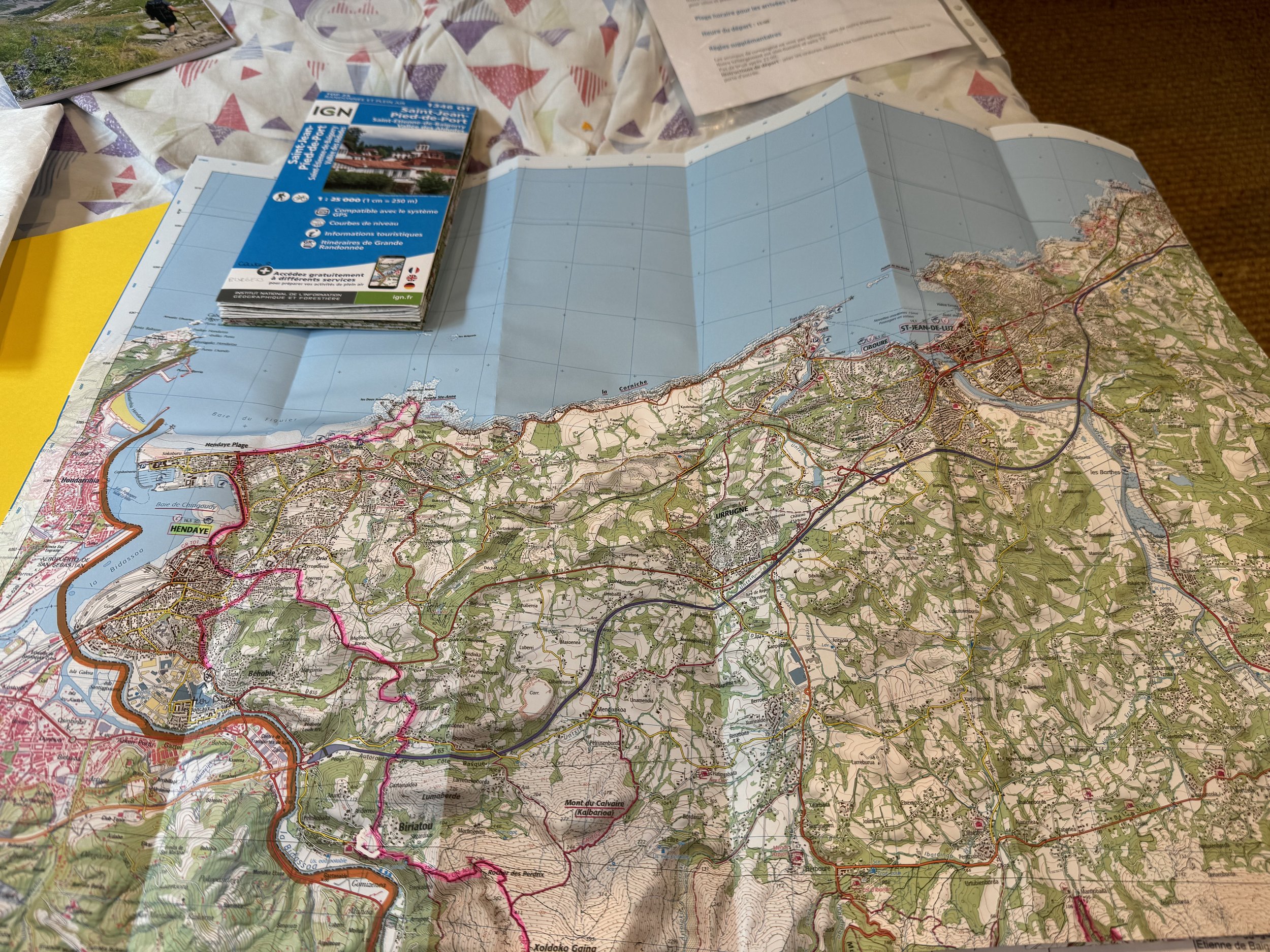
Detailed maps and a hard copy of turn by turn guidance (I also had it in my phone) provided by Respyrenees
These descriptions of each day are from the Respyrenees books
Day 1: Hendaye to Ibardin With your feet in the water, you will leave the beach and the bay of Hendaye, to reach the first foothills of the Pyrenees through green landscapes and sites with a strong Basque imprint. Behind you, magnificent views of the immensity of the Atlantic coast open up. You will reach the Col d’Ibardin (Venta Elizalde) I stopped at a cafe before leaving town and bought an excellent lunch for later; this was the only day that a lunch was not provided. Strava Stats: 12 miles/2900’
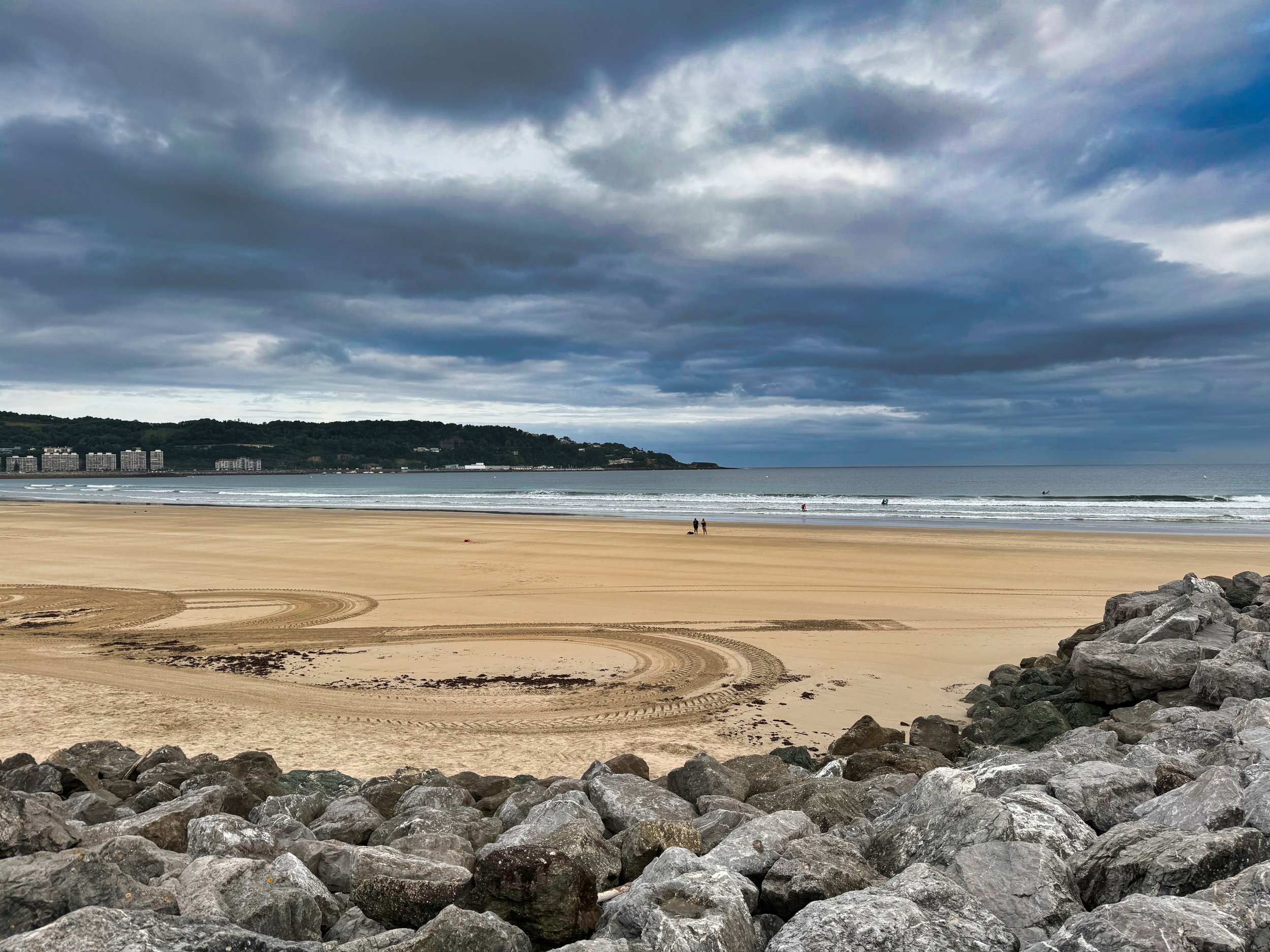
Leaving the Atlantic on the start of GR10, Hendaye

Hendaye in the background as one climbs into the foothills of the Pyrenees
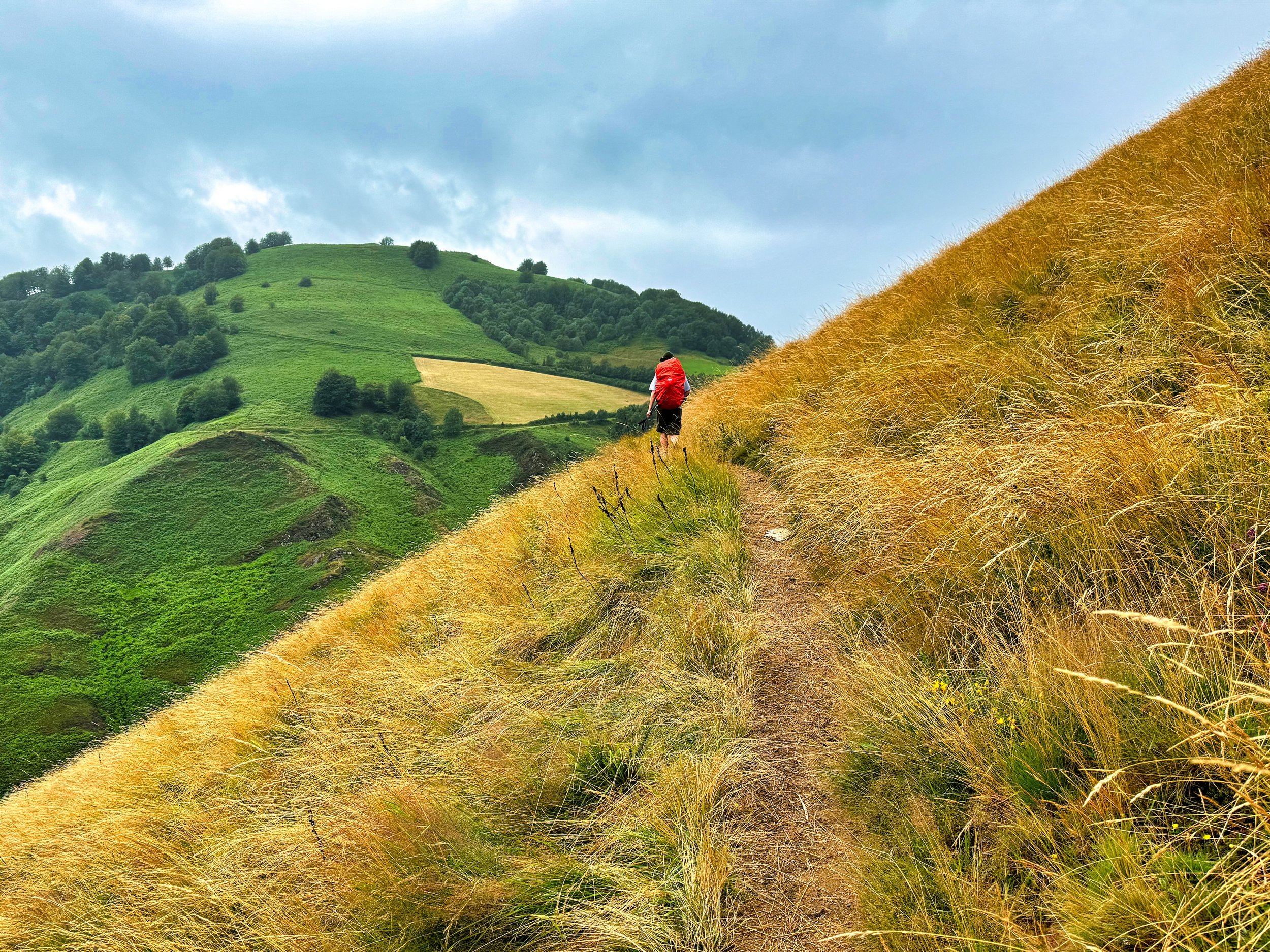
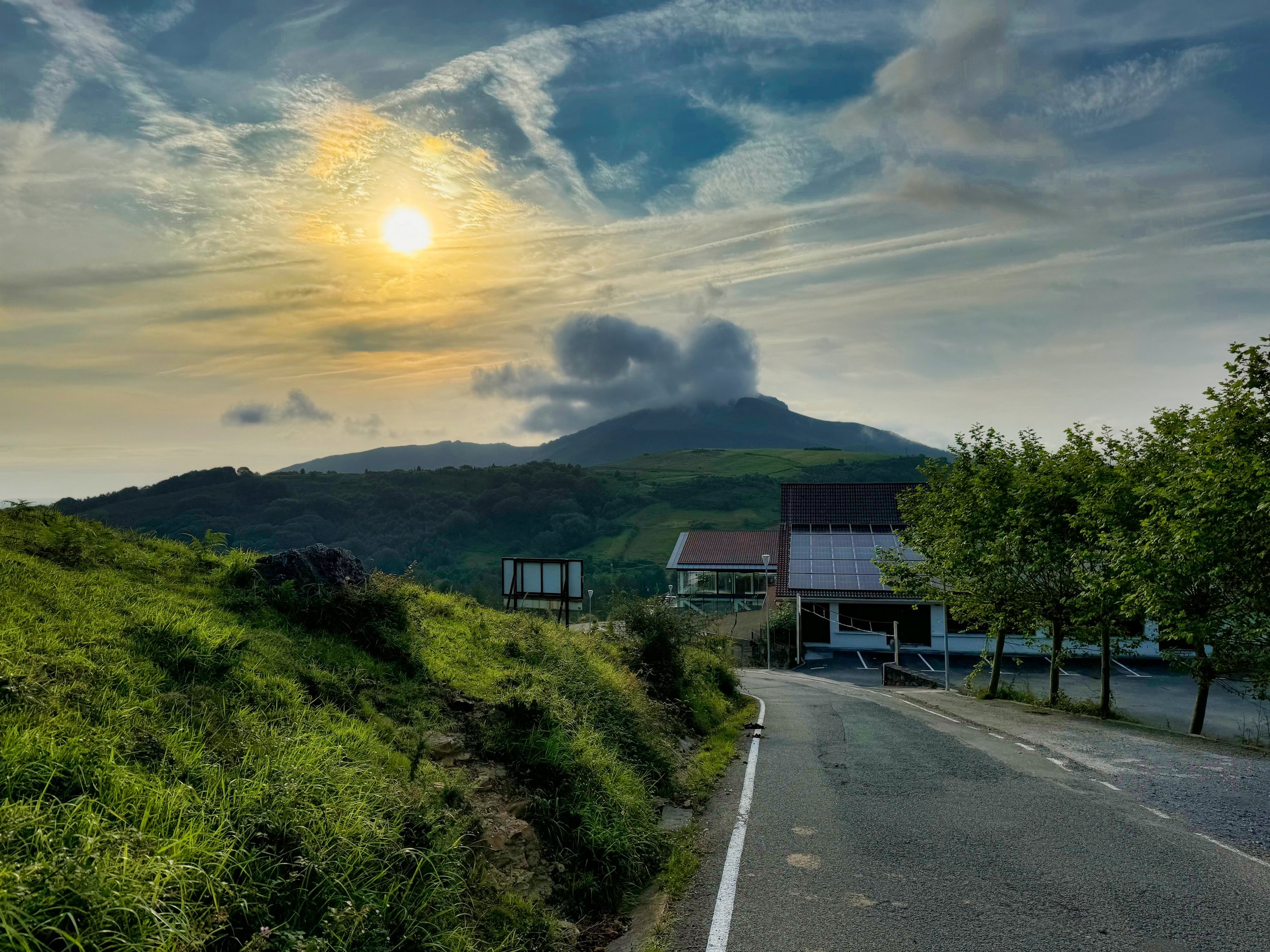
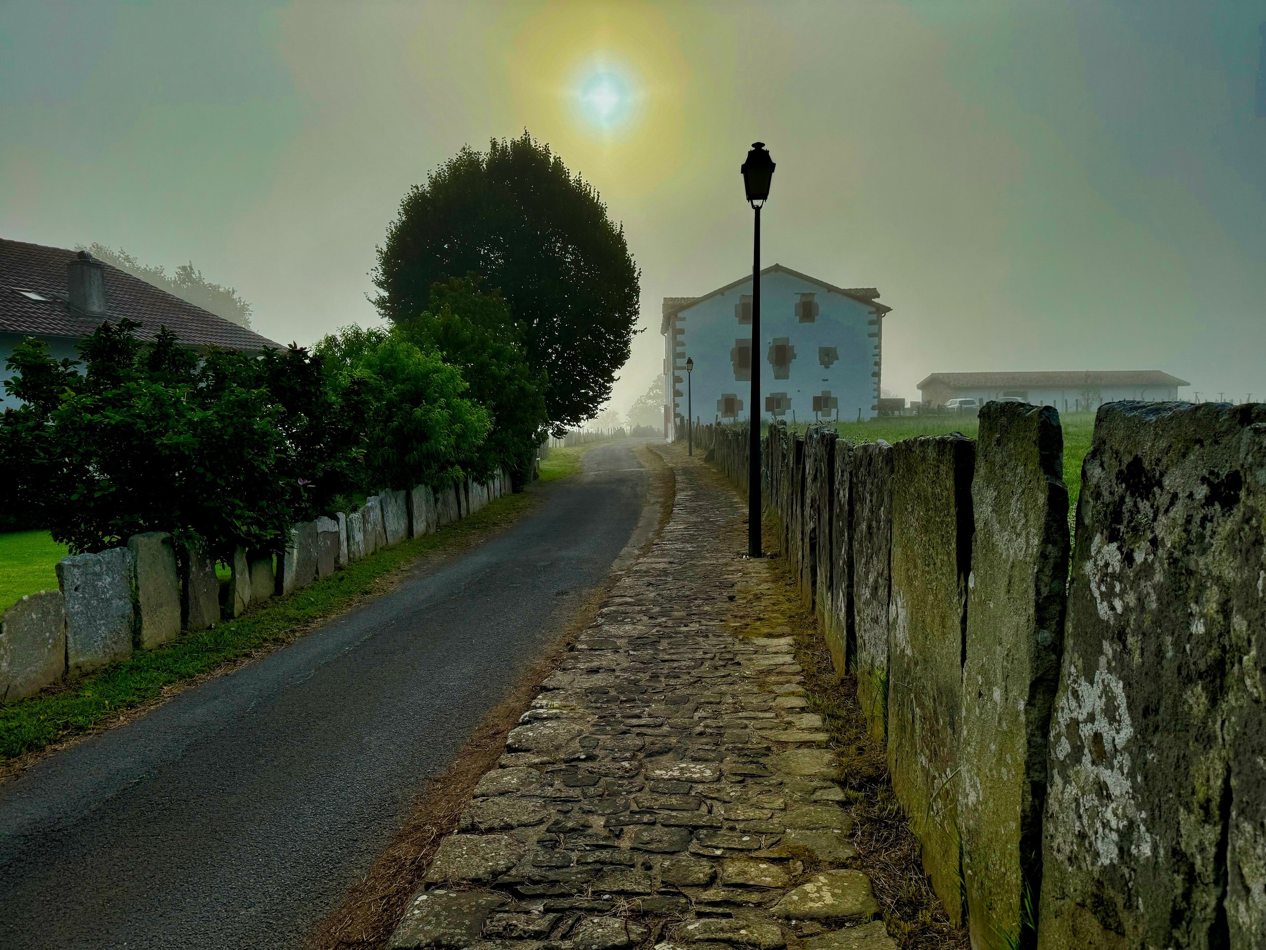
Day 2: Ibardin to Sare During this stage, the path will pass by the massif of La Rhune (Larrun: place of pasture, in Basque), considered as the first Pyrenean summit of the chain and which, from the top of its 905m, remains the sacred mountain of the Basques and a place full of history. Then you will reach the pretty village of Sare and its typically Basque architecture which has managed to integrate the originality of the surrounding environment. I ran into many hikers on the section around Larrun, it was a very popular spot. There is a train which carries people to the summit. Strava Stats: 12 miles/2500’
Morning start leaving Ibardin

Typical Basque architecture
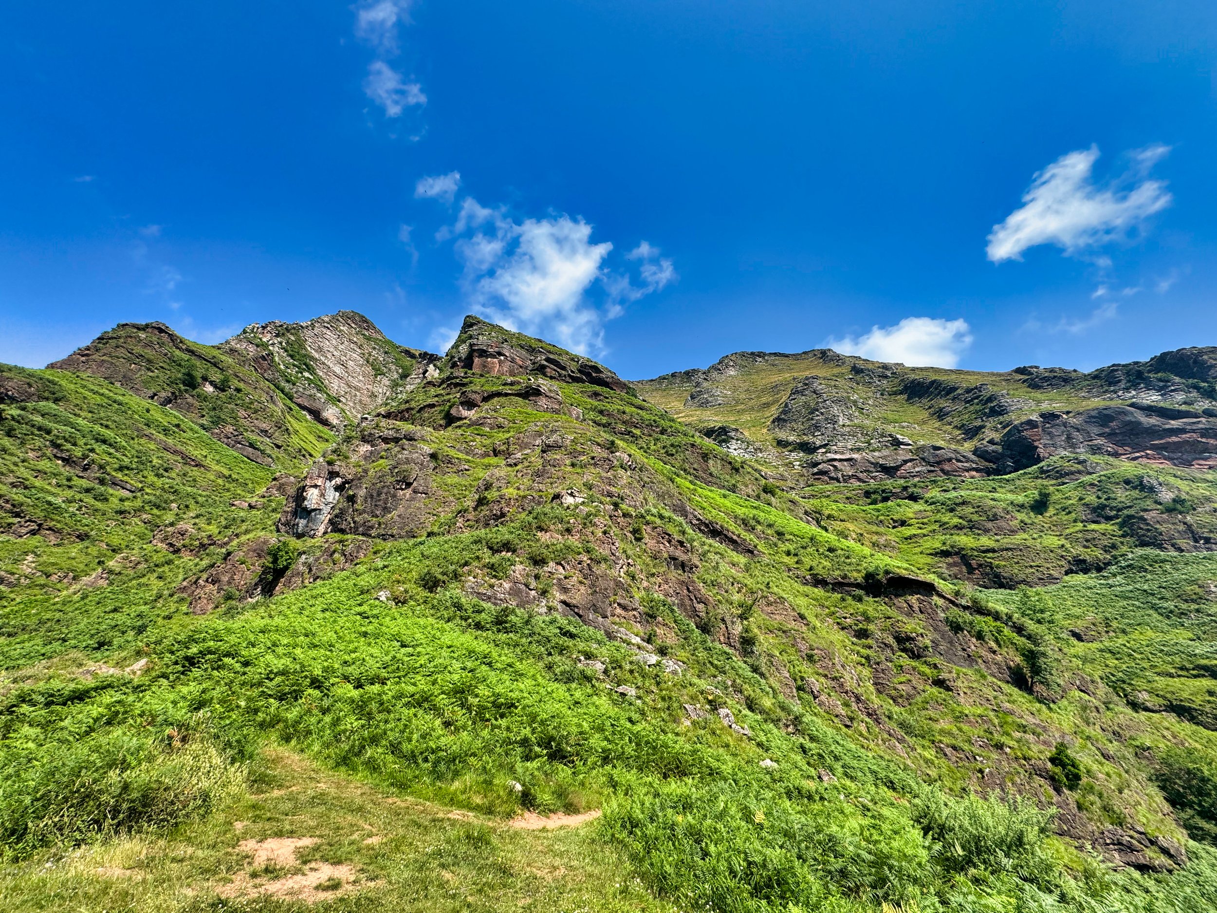
Day 3: Sare to Esteben Borda During this stage, you will cross at first the pleasant and preserved Basque countryside before arriving at Ainhoa, a magnificent village-bastide of the XIIth century. Then, crossing small summits and passes, the route goes around the Ereby (583m), further on the Atxulegi (617m), and soon appears the Zuccata pass, a superb belvedere. From there, depending on the weather conditions, you can reach the Col des Veaux by the trail or, if the weather is good, by staying on the ridge, off the GR10, continue to Gorospil Peak (691m), and enjoy the panorama of the Basque mountains. I stayed on the ridge for this day, enjoying fine weather, and had a fabulous lunch in Ainhoa. The accommodation for the evening, Esteben Borda, was essentially a farm with a row of sparse rooms. The evening meal was very meat heavy and kinda slow, but this was the only place to overnight without the day being significantly longer. Strava Stats: 14 miles/2900’
Leaving Sare on the GR10
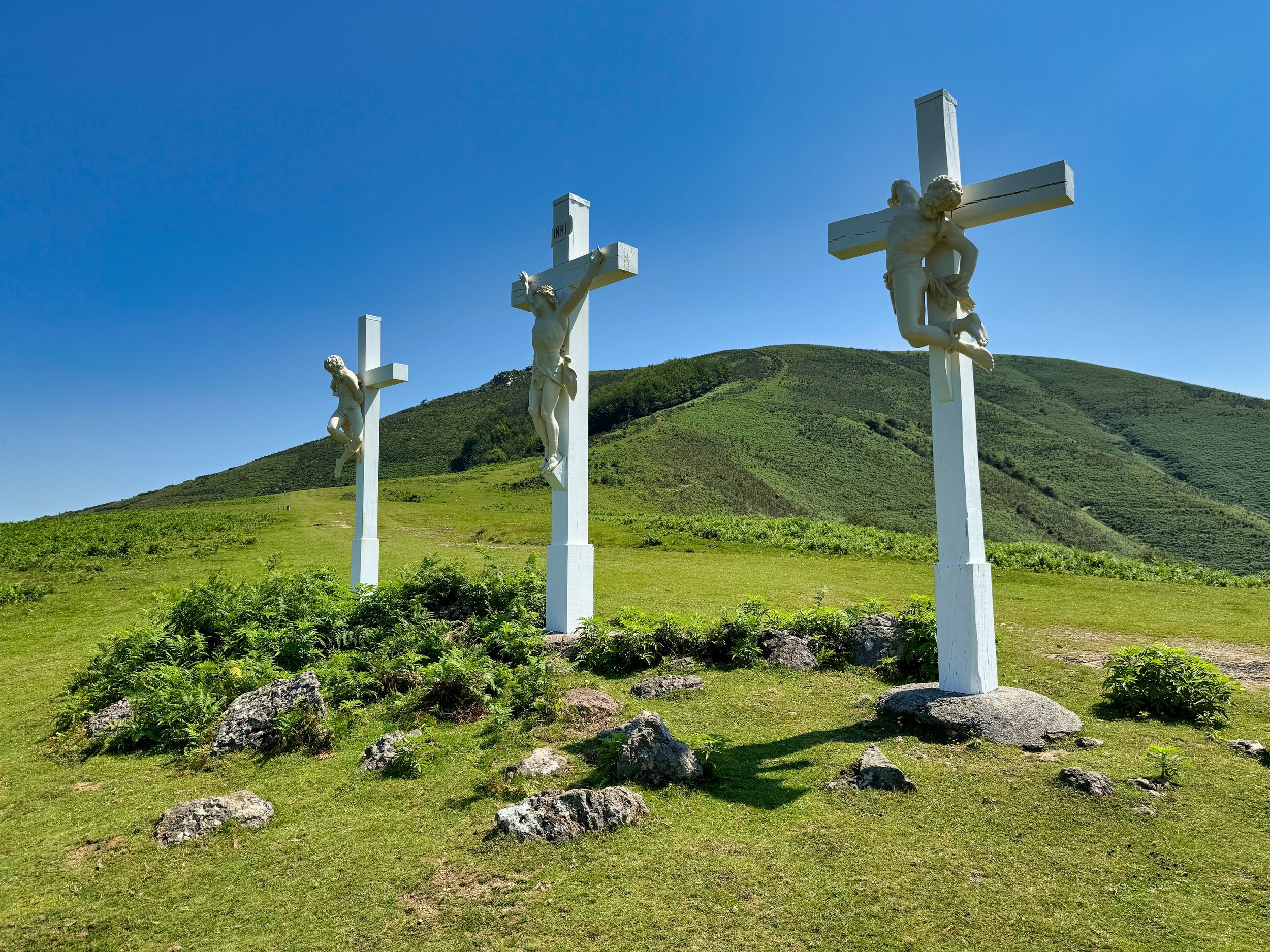
Crosses near the Aubépine Chapel, Mt Atsulai
Day 4: Col des Veaux to Bidarray The GR10 continues to alternate between the Pyrenean summits and mountain villages that have a strong Basque identity. The trail heads in the direction of the Col de Méhatché situated at an altitude of 716m. You pass into a rocky landscape that is home to the Griffon Vultures that circle high above, before the descent to Bidarray village. As the stage is short, you can make a return trip to the top of Artzamendi and enjoy a wide panorama: from the ocean to the first high peaks of the Pyrenees. Indeed this day was short, but not necessarily easy. The descent through the “Terrible Rocks” was on a narrow path with steep stepdowns. Poles were in order as was hand work. Bidarray was a very cool village that was hosting a mountain foot race, ranging from 65 to 25 kilometers. We “ran into” many runners when we left Bidarray the next morning, but they soon branched off onto a different trail. Strava Stats: 7 miles/1400’

Typical road walking on the GR10
Looking up at the “Terrible Rocks”
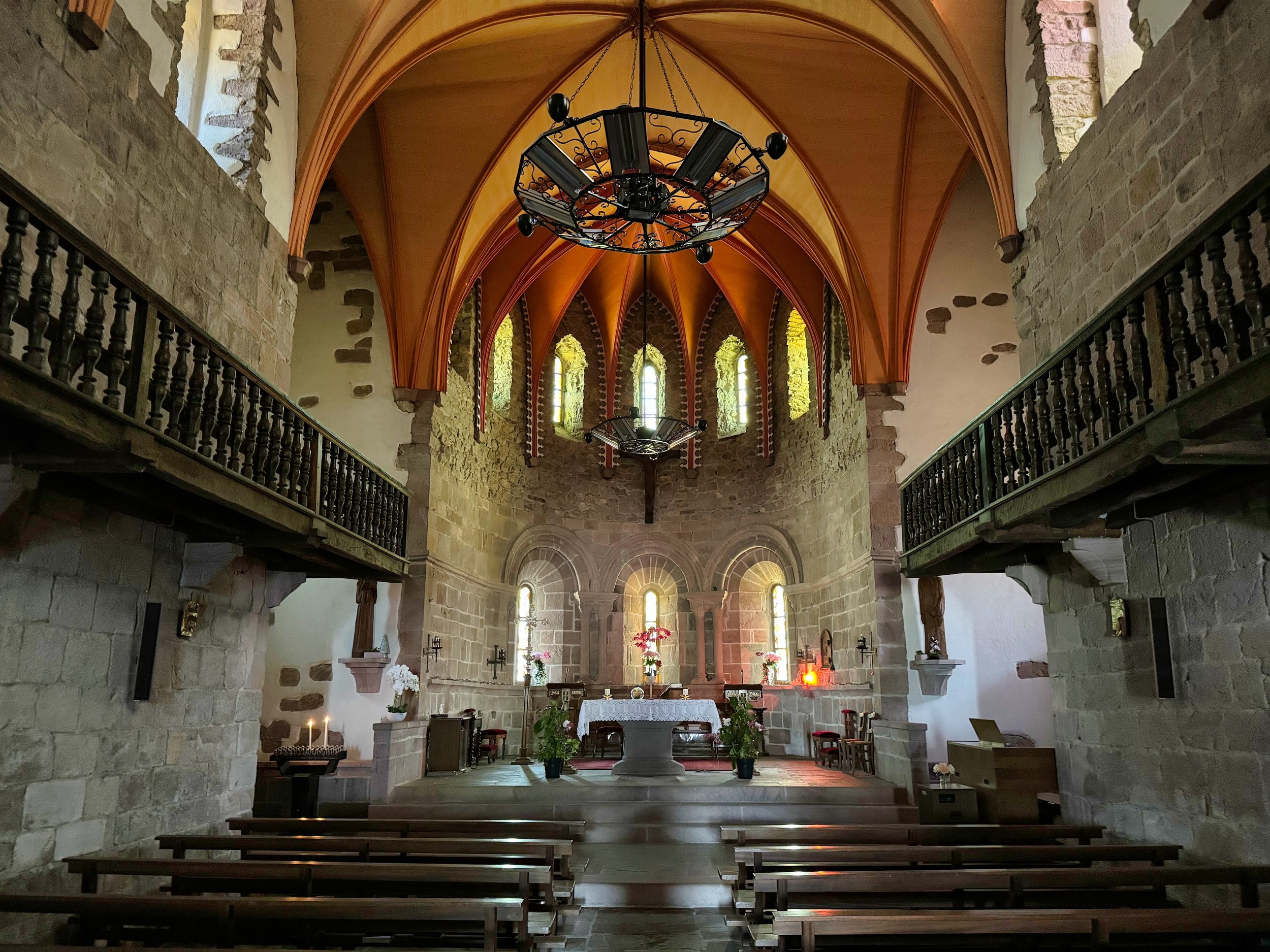
Inside the chapel in Bidarray
Day 5: Bidarray to St Étienne de Baïgorry Today’s sporty stage is one of the most beautiful hiking routes in the Basque Country. From the charming village of Bidarray, you will start the ascent towards the Iparla ridges which, from the bottom of the valley, look like a long, impassable wall. On the heights of these superb red sandstone cliffs, you walk along the void but at a respectable distance. From there, you will still enjoy an immense panorama….then you will go down again in the direction of Saint Étienne de Baïgorry, magnificent village of the Basque Country, with many typical buildings of the Bas-Navarra architecture. Today I was joined by Björn, whose wife left the trail to travel by train to meet him at our end point, St Jean Pied de Port. Most of the day was socked in (but with no rain), so wide ranging vistas were scarce. Still, the description was apt, and we thoroughly enjoyed ourselves on this trek, both enjoying the wide ranging topics and humor of our conversations. Strava Stats: 12 miles/4200’
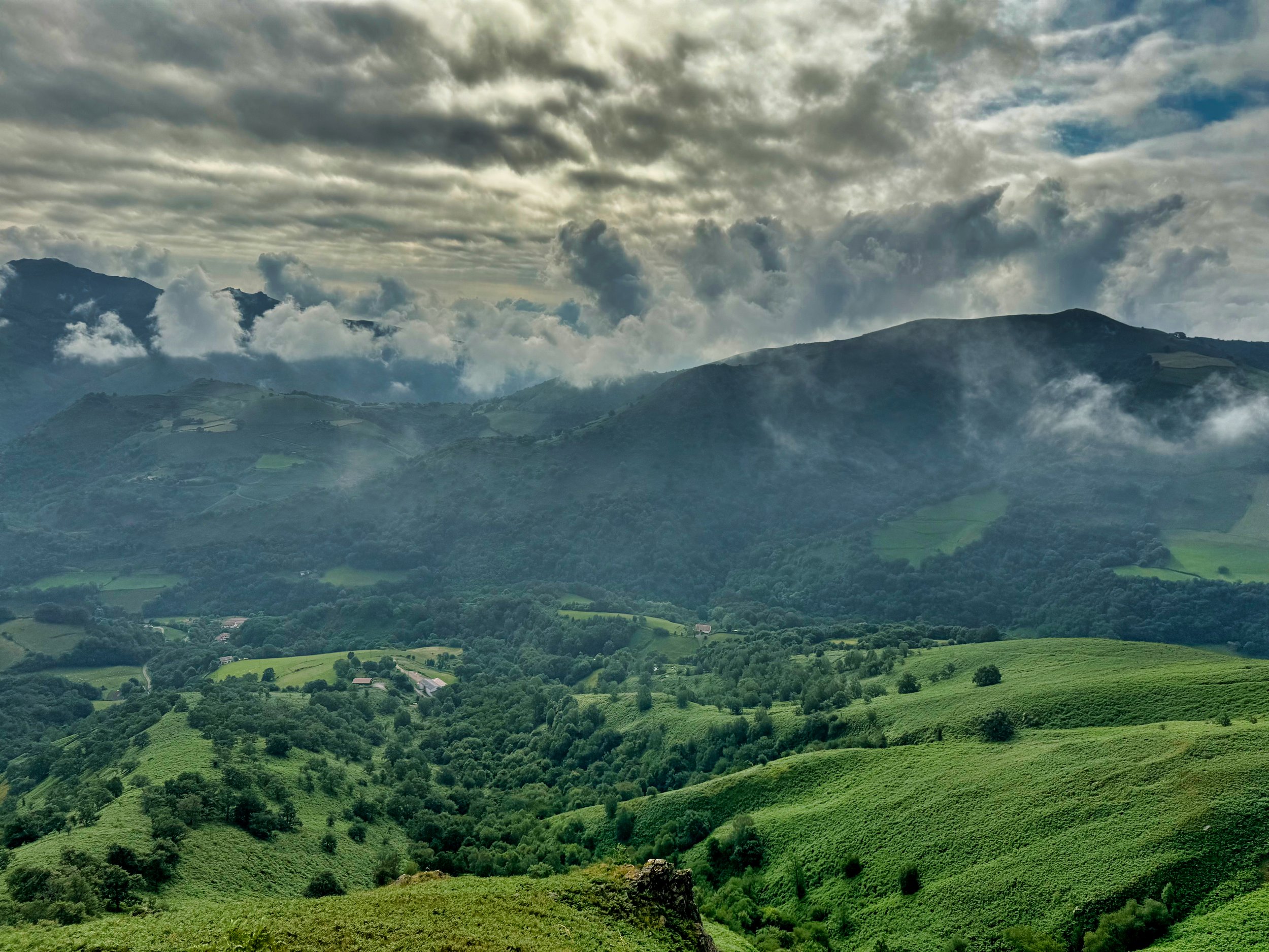
Cloudy views on Day 5
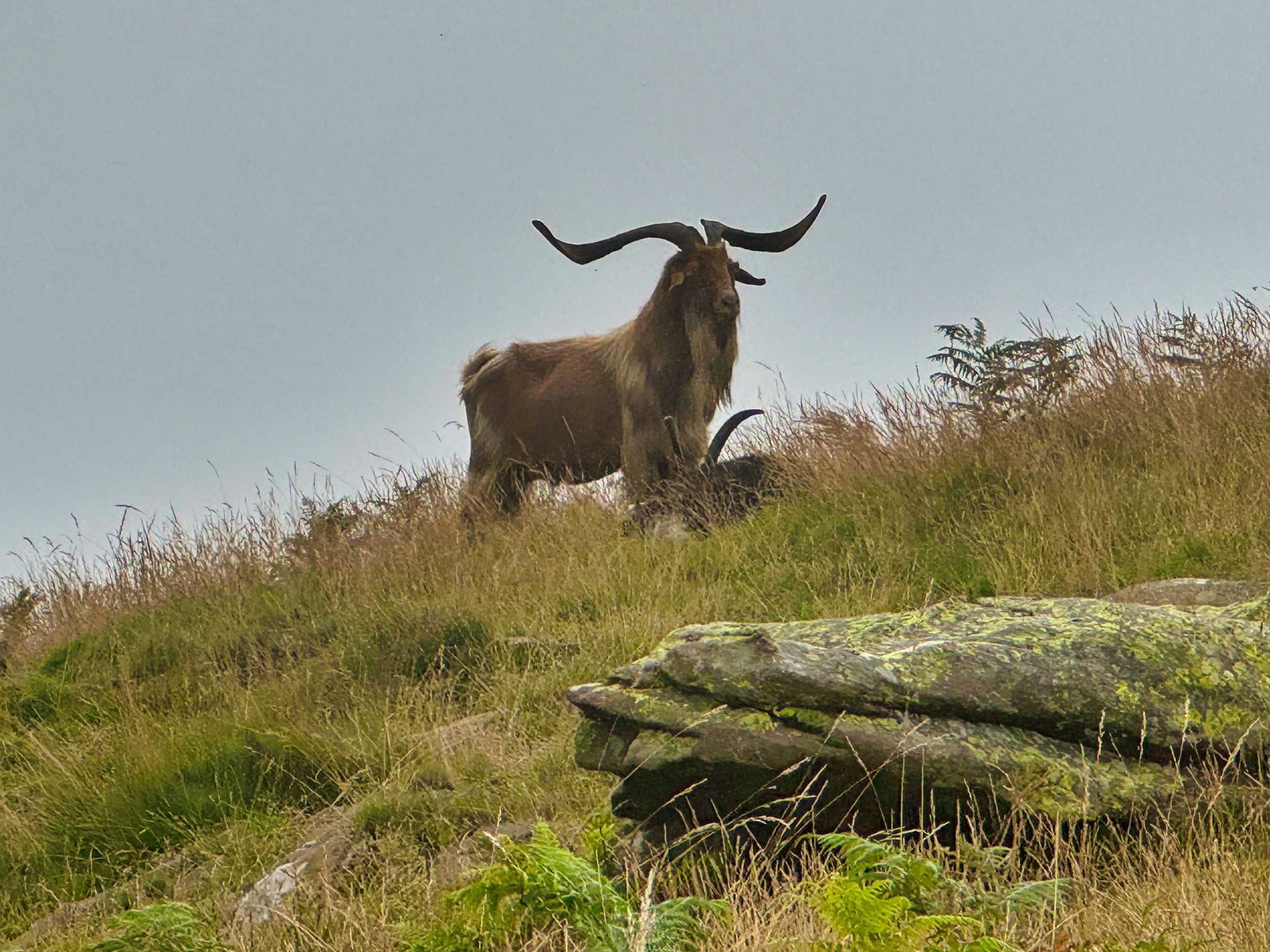
Pyrenean Ibex on the hills above Saint Étienne de Baïgorry
Day 6: St Étienne de Baïgorry to St Jean Pied de Port. From the banks of the bucolic Nive des Aldudes, the itinerary in the heart of the Basque Country rises above St Étienne de Baïgorry to reach the Oylarandoy massif. The rest of the itinerary leads to a new summit with a beautiful panorama: the Munhoa, culminating at 1021m and overhanging St Jean Pied de Port that you will reach after a long descent. Surrounded by pink sandstone ramparts, the medieval city of St Jean Pied de Port seduces with its paved streets lined with old houses, it old bridge over the Nive river, its picturesque facades on the waterfront, its covered way and its imposing citadel reworked by Vauban, whose silhouette dominates the roofs of the city. This day started out with rain for us, and if not raining then some of the higher reaches had sideways blowing mist. We also had a cool encounter with circling Griffon vultures riding the currents. Although I had stashed my rain jacket, I did take to wearing a cycling jacket to keep the biting wind at bay. We lost the track at a high point and where we showed being back on we had to gently wade through a large flock of sheep. Strava Stats: 13 miles/3200’
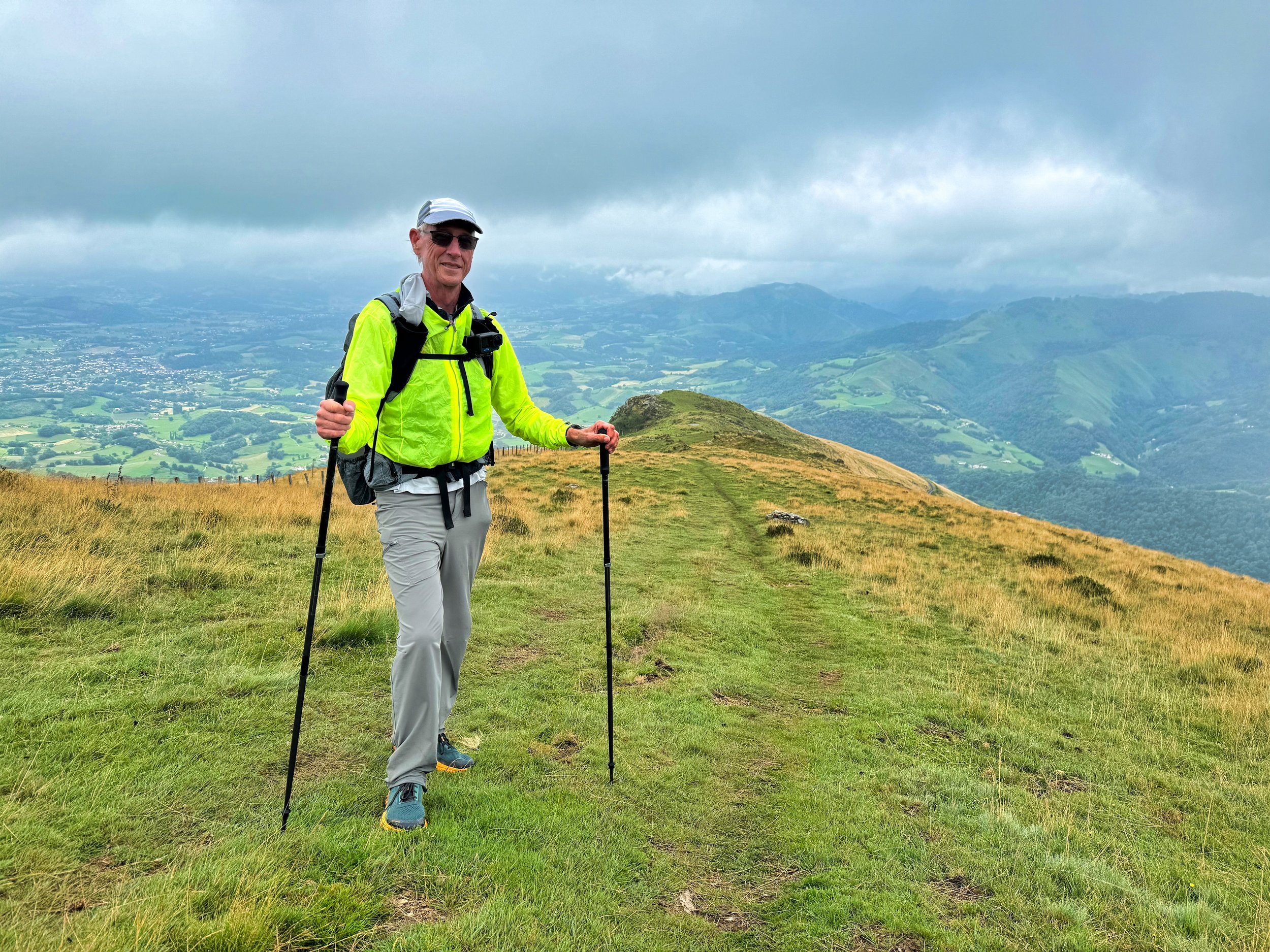
A cycling jacket keeps the biting wind at bay above St Jean Pied de Port
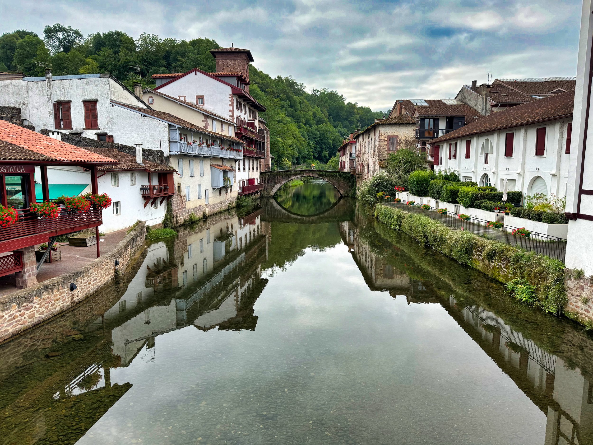
Ending point, St Jean Pied de Port on the Nive River
Hiking this part of the GR10 was completely different from my usual fare in the Cascades. The peacefulness of the meandering country roads, the intense green, the open vistas, the trail deep in forest or exposed on hills, the grazing sheep, cows and horses…we were even buzzed by Griffon Vultures on Day 5…made this a splendid trek. Add in the excellent meals of Basque food, wine, cheese and cakes; well, I can only say I savored every bit of it.