Willis Wall

CELEBRATE THE OUTDOORS

40 years outdoors experience, extensive info on Mt. Rainier’s Wonderland Trail, original music, equipment reviews, off trail videos, other peaks in Mt. Rainier NP

  • About
  • Wonderland Trail
    • Willis Wall's Views on the Wonderland Trail
    • Wonderland Trail: Complete Video Series
    • Wonderland Trail Backcountry Camps
    • Alternate Wonderland Trail Camps
    • Loop Hikes
    • Wonderland Related Videos
    • Wonderland Shorts
    • Hiking the Wonderland Trail (2006 DVD)
    • Wonderland Trail Transits 32-40
    • RAW
    • Mowich Rivers 2023
    • Mowich Rivers 2012
    • Annual Compilations
    • Wonderland Trail Photo Gallery
    • Mt Rainier 7Up Hikes
    • Filming the Trail
    • Past Updates
  • Willis Wall Blogs
    • Willis Wall Blog
    • 60
    • Blog Posts Reference
    • 68/35
  • 35 Years in MRNP
    • 35 Years in MRNP
    • Mt. Rainier Hikes 2018
    • Mt. Rainier All Trails gallery
  • 360 Videos
    • 360 Videos
  • Grand Tour (MRNP)
    • Grand Tour (MRNP)
  • Travel
  • Off Trail
  • Crystal Mtn Ski Tour
  • Video Guide
    • Complete Video Guide
    • Biking Mt. Rainier
    • Eliot Creek Crossing: Timberline Trail
    • Paradise to Camp Muir
    • Hurricane Ridge Road Bike
    • Mt. Baker Highway 542 bike
    • Washington Pass Bike (Cascades)
    • Mowich Lake Road
    • Films under construction
  • Shorts
    • When the Sun is Low
    • On The Rocks
    • The Spit
    • Enchanted Valley Chalet Tour
    • Look Up!
    • Wonderland Short: Jaunt to Summerland
    • Wonderland Short: 2011
    • Wonderland Short: 2015
    • Wonderland Short: Emerald Ridge
    • Wonderland Short: Frozen
    • Wonderland Short: Stevens Canyon washout area
    • Mt. Rainier West Mini Loop
    • Longmire to Muir to West Side Road
    • The Hummock
    • Peakaboo
    • The Other Campground
    • West Side Road
    • Carbon Glacier
    • The Seattle Viaduct (SR99)
    • Off Trail
    • Lane Peak Gully
    • Sunshine Point
    • Chasing Turbo
    • Mt Kilimanjaro
    • Africa
    • Rainier in Fall
    • Skyline Trail Improvements
    • Old Black Diamond
    • Left of Spring
  • Music
    • Music
    • Audio Samples
    • Anthology
    • Incubus
  • Search
  • Contact
    • Contact Willis Wall

The SHLOB (Southern Loop Longmire Out and Back)

September 17, 2026 by Willis Wall

In the Loop Hikes section I have the north, east and west covered with various hikes. I decided to represent the south portion through Stevens Canyon with an out and back, Longmire to Nickel Creek. On the return I hiked the Stevens Canyon road from Box Canyon.

In the past I have disparaged this section of the trail, citing road noise, lack of views, and especially some poor trail conditions where overhanging brush obscured underlying loose rocks. It was a section to be endured, not enjoyed.

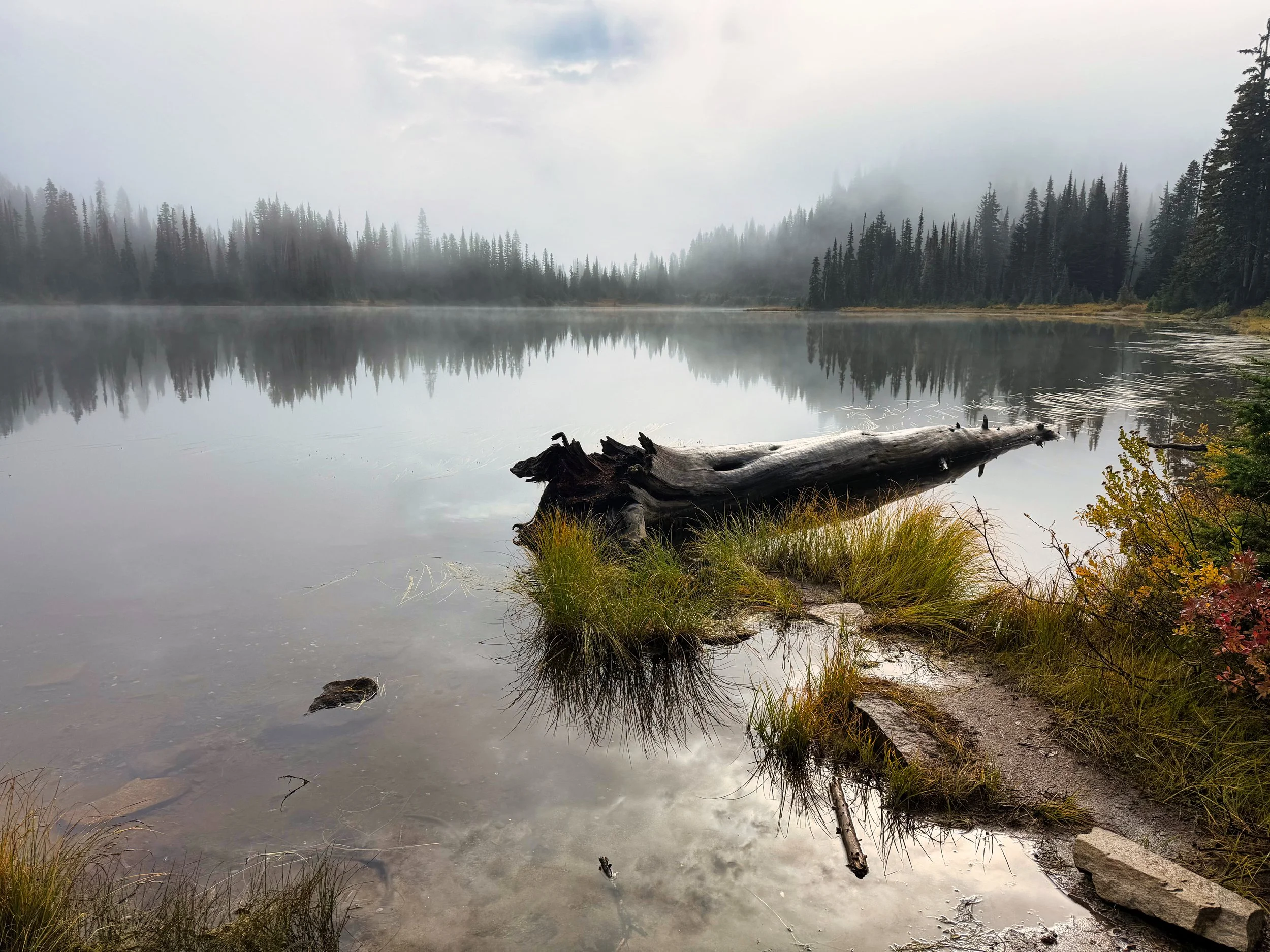
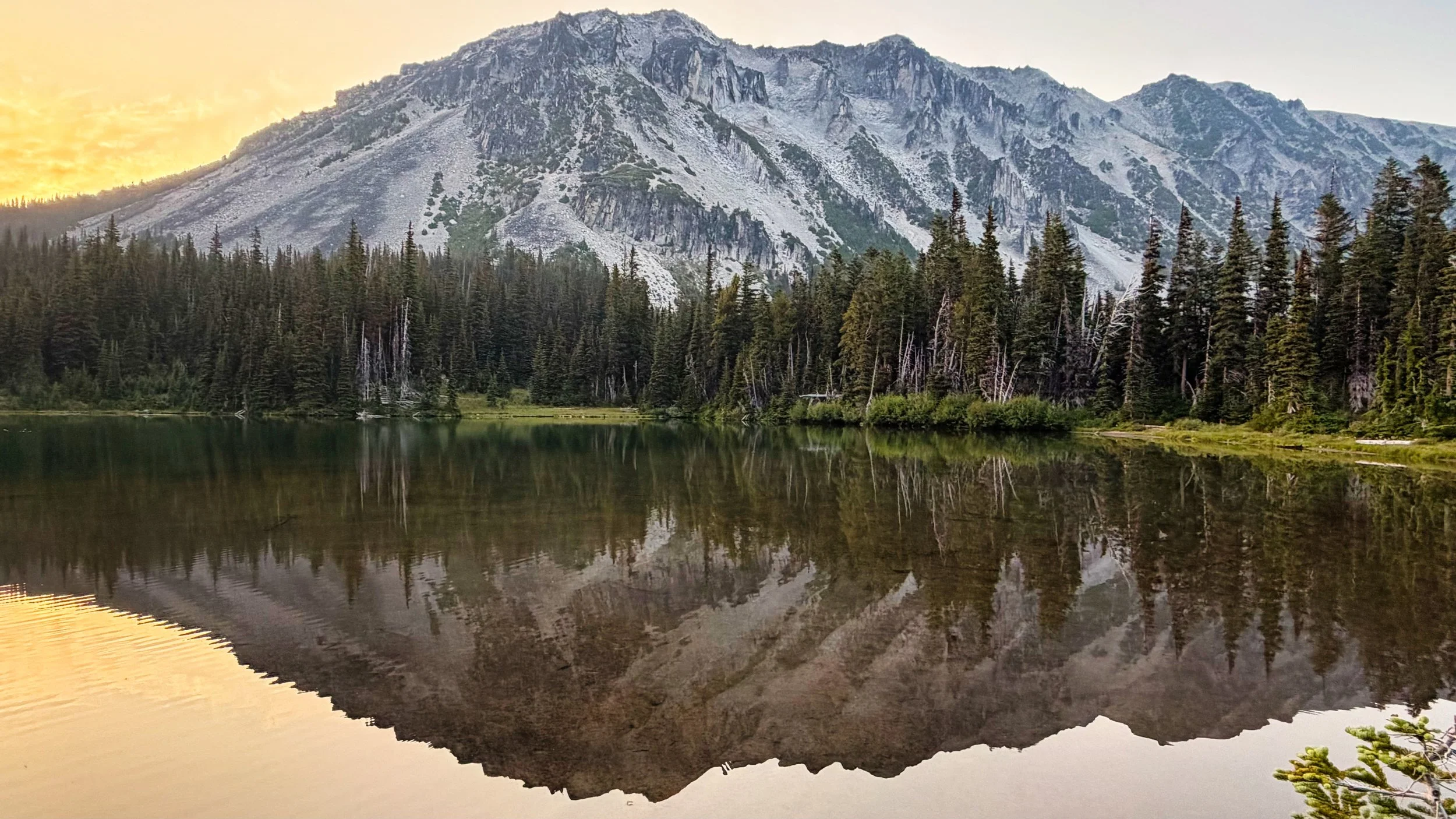
Reflection Lake

However, park trail crews have addressed most of these issues and this recent transit found mostly good footing and nary a branch to brush against. The only annoyance is the necessary bypass of the recurring washout area, finally abandoned in 2024 due to continued erosion since the flood of 2006; there wasn’t much hill left to put a trail in.

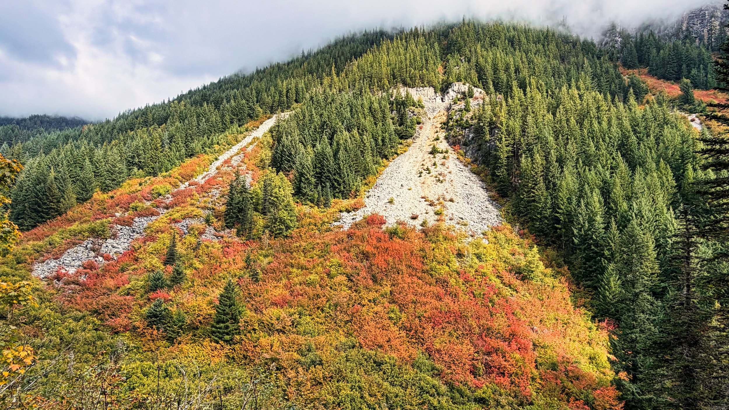
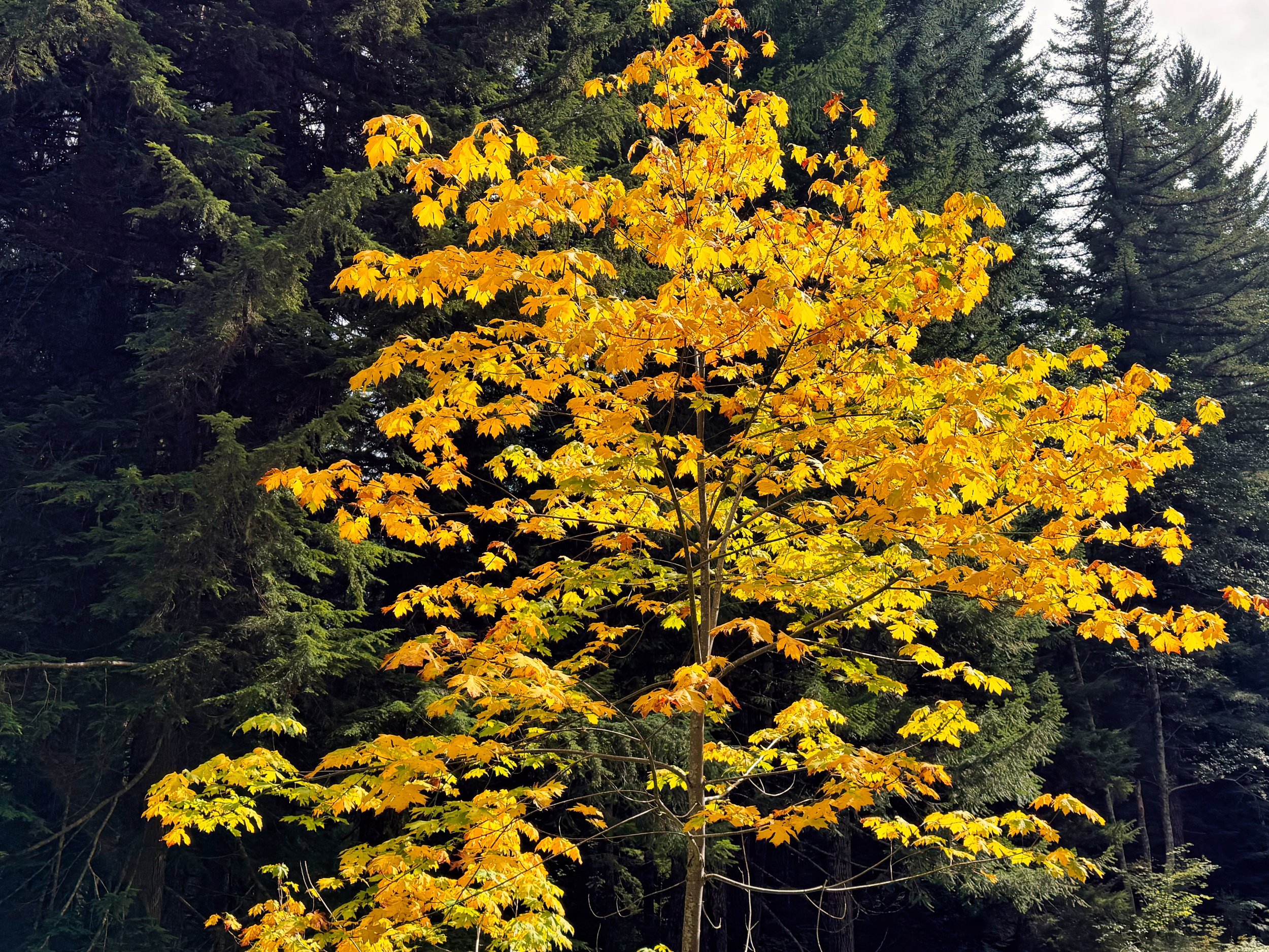
Fall foliage along The SHLOB

I did this hike in a day, covering 27 miles with 5,500’ of climb, but an overnight (Paradise River/Maple Creek/Nickel Creek camps) would be an alternative and/or pickup (or hitch) for the return. It was also a misty, overcast day, representative of the PNW; it can’t always be sunny in my vids!

September 17, 2026 /Willis Wall
mt rainier wonderland trail, stevens canyon mt rainier, reflection lakes mt rainier

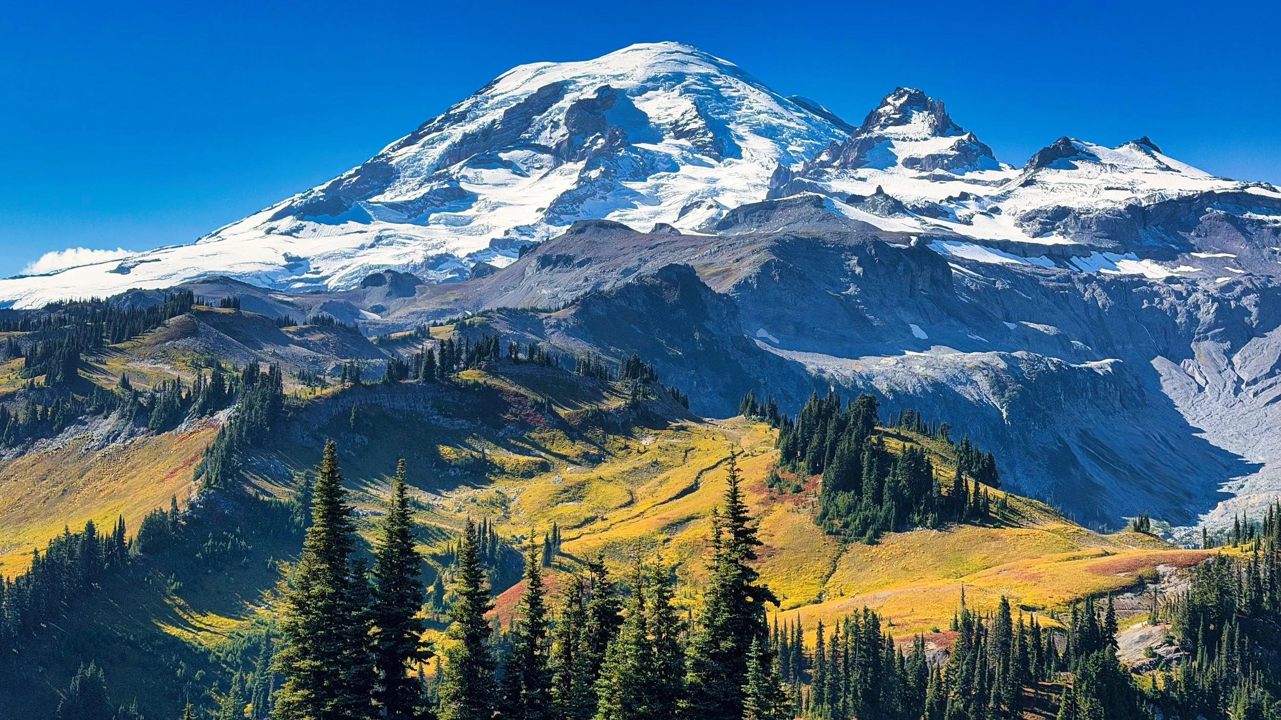
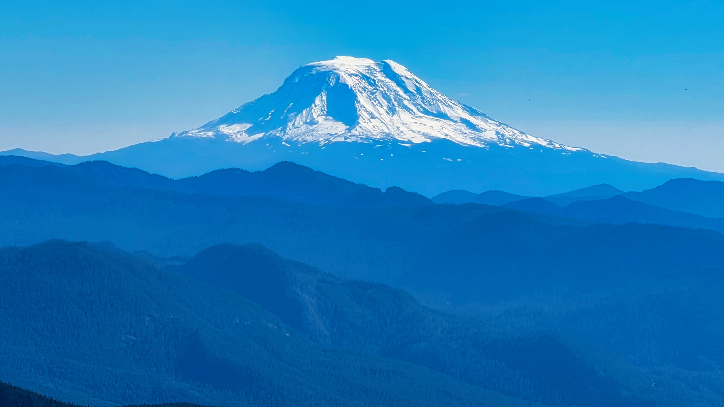
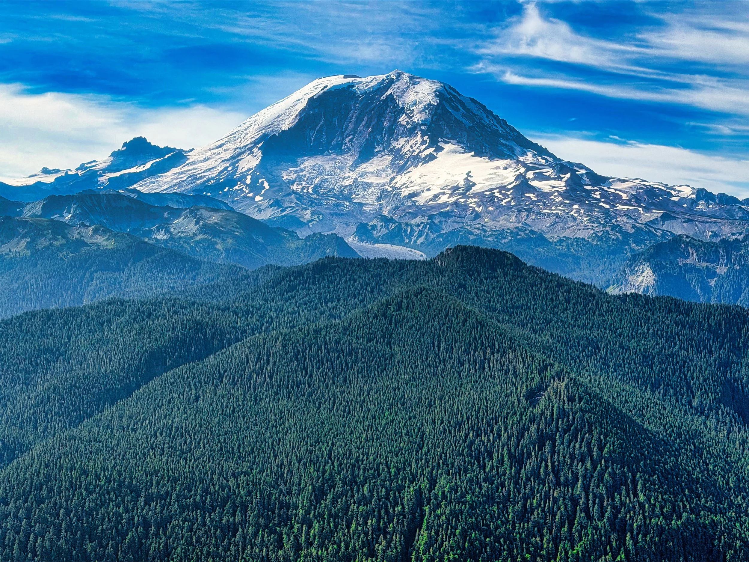
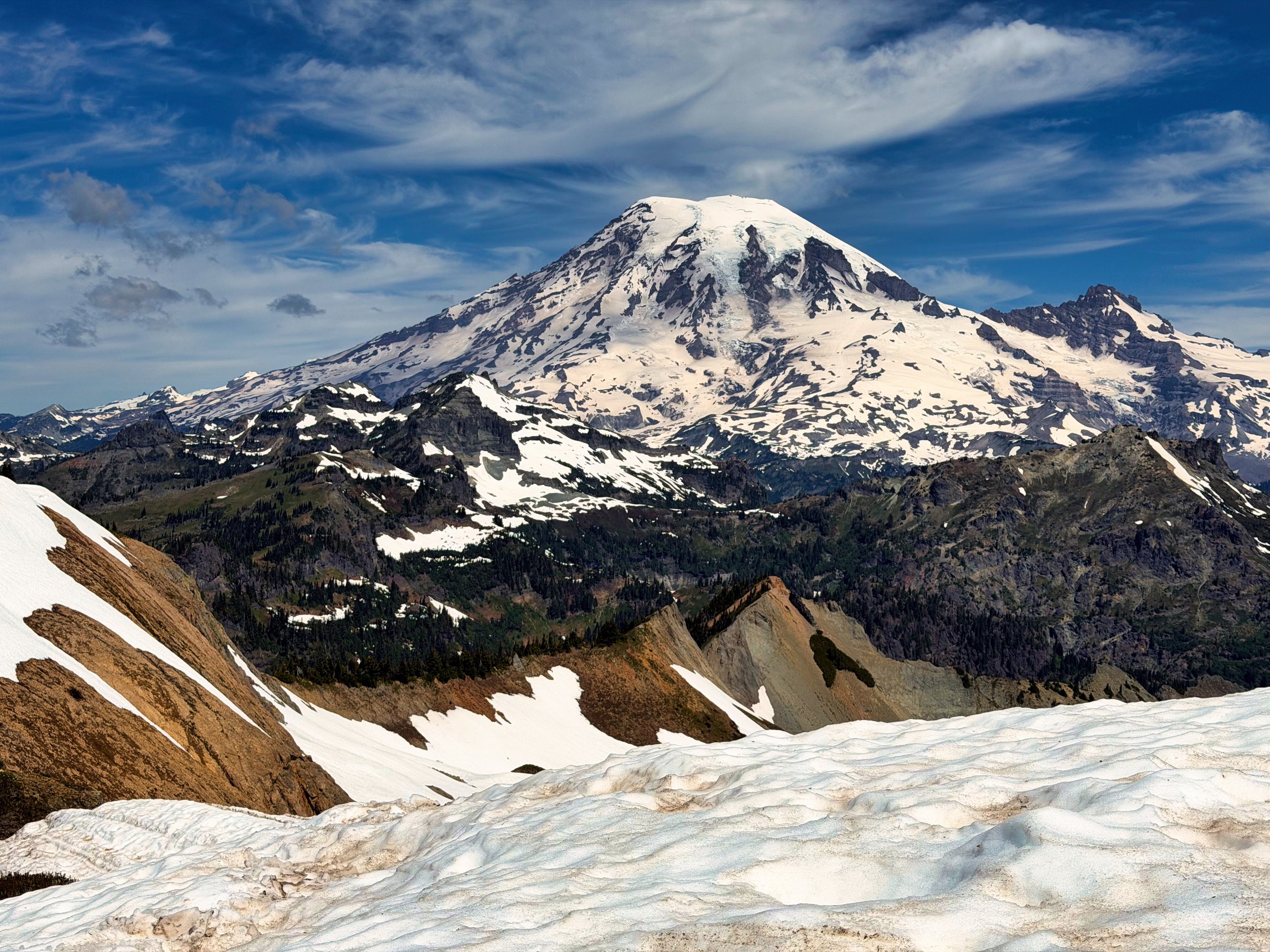
Mt. Rainier from Point 5930 on the Cowlitz Divide, part of the Eastern Loop

Mt. Rainier Eastern Loop

September 16, 2026 by Willis Wall

It’s been 13 years since I’ve done the Eastern Loop, so with this year’s closure of the Wonderland Trail (north section) I figured I’d revisit. The Eastern Loop utilizes the Wonderland Trail, the East Side trail, the Owyhigh Lakes trail and the Cowlitz Divide trail. There are no “gettin’ there” miles on this loop, you are either in glorious alpine or in fabulous old growth. NOTE: video of this loop at end of article

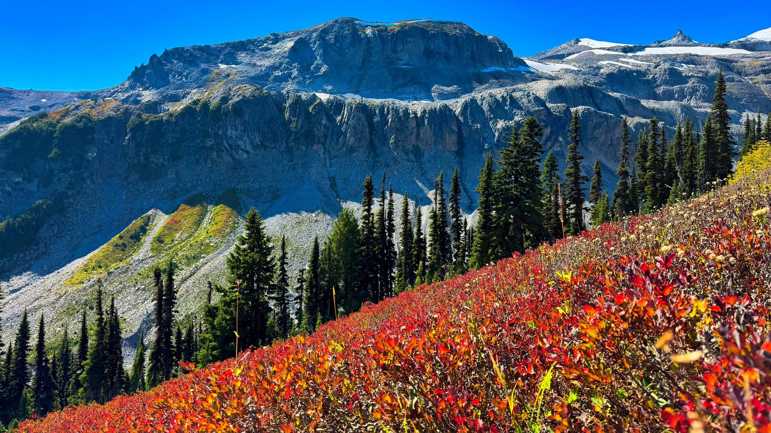
Meadows above Indian Bar

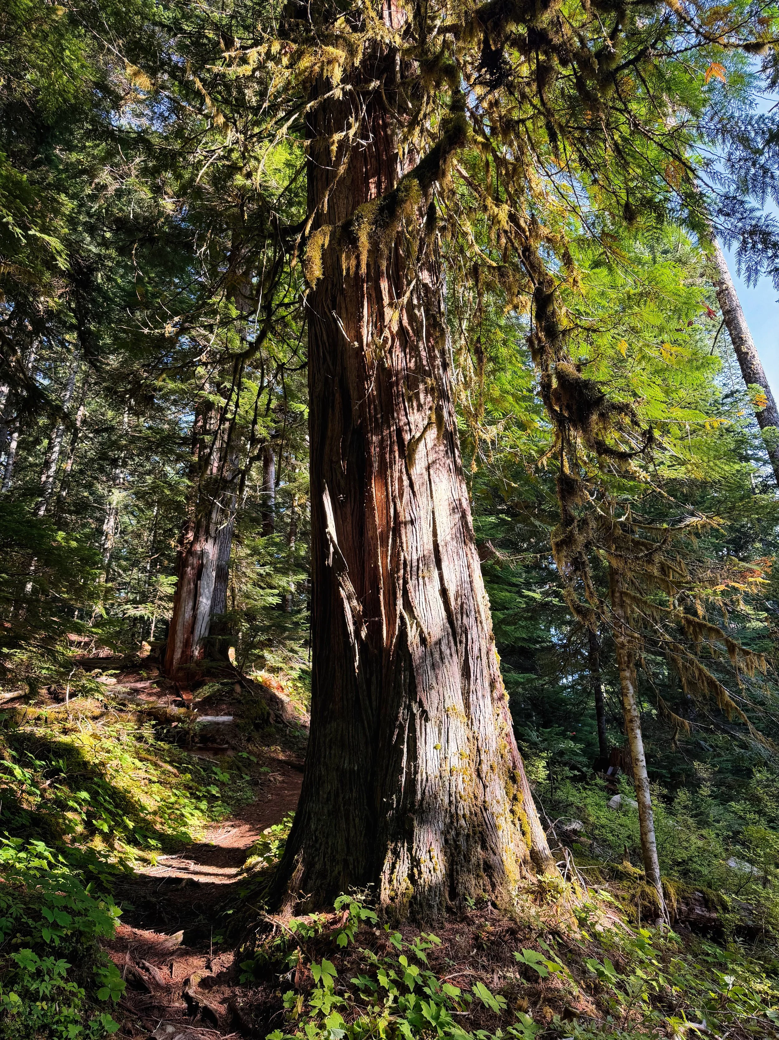
Old growth spendor on the East Side trail, part of the Eastern Loop

When hiking the Wonderland Trail, one is constantly bouncing between lower and higher elevations due to the valleys carved by the glaciers and rivers. This loop allows one to linger in both the alpine and old growth without interruption. My iteration (CCW) started/ended at the Owyhigh Lakes trailhead near White River. I walked the short .5 miles to the Fryingpan Creek trailhead (picking up the Wonderland Trail), then gradually climbed through lush forest, eventually switch backing up to Summerland. There’s a definite border just above Summerland, where meadows and flowers stop and rock begins. The transit past Panhandle Gap (6780’), through Ohanapecosh Park and the descent to Indian Bar is sublime. One of the best vistas in the park is gazing across the valley below to the cliffy expanse and the glaciers that spawn the Ohanapecosh River. Mountain goats abound in this area. In early summer the sloped meadows above Indian Bar are lush with purple flowers, then in the fall sparkle in red when the sun shines through the blueberry bushes.

View from my bivy at Olallie Creek camp

Indian Bar is another wildly popular gem, sporting its iconic shelter, Wauhaukaupauken falls and surrounding meadows. In the fall it is not uncommon to see bears gorging on blueberries here. Then off you go to transit the Cowlitz Divide, undulating with in and out views of Mt. Adams. I had a permit to stay at Olallie Creek camp, a short distance on the Cowlitz Divide trail. That first day entailed 16 miles with 4800’ of climbing.

The next morning started my ramble through old growth forest lasting most of the day. The East Side trail stays in this zone until one has climbed enough on the Owyhigh Lakes trail to experience the transition to the more hardy trees typical of higher elevations. After passing the Owyhigh Lakes (with the impressive Governors Ridge behind) the trail is smooth, wide and inviting all the way to the trailhead and my waiting vehicle (Day 2 stats were 21 miles with 3600’ of elevation). TOTAL for the loop: 37 miles with 8200’ of elevation gain. All in all, this is a spectacular hike and, IMHO, one of the best transits one can do in the park.

Mt. Adams from the Cowlitz Divide

September 16, 2026 /Willis Wall
mt rainier eastern loop, hiking mt rainier, mt rainier loop hikes

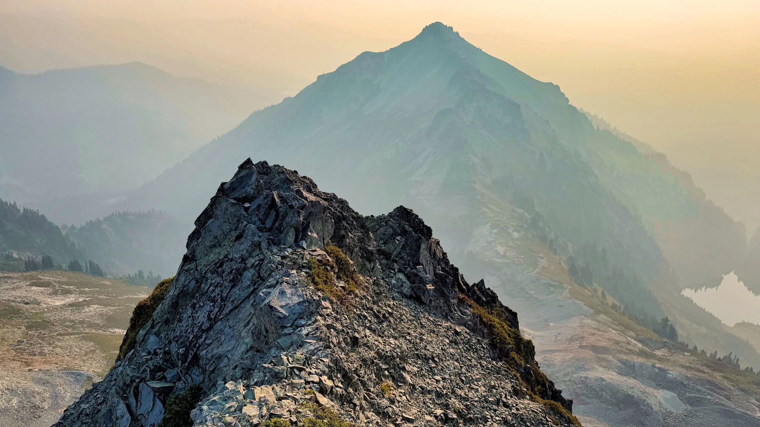
Smoky view of Stevens Peak from Boundary Peak

Stevens/Boundary Peaks: 8/12-13/2026

August 17, 2026 by Willis Wall

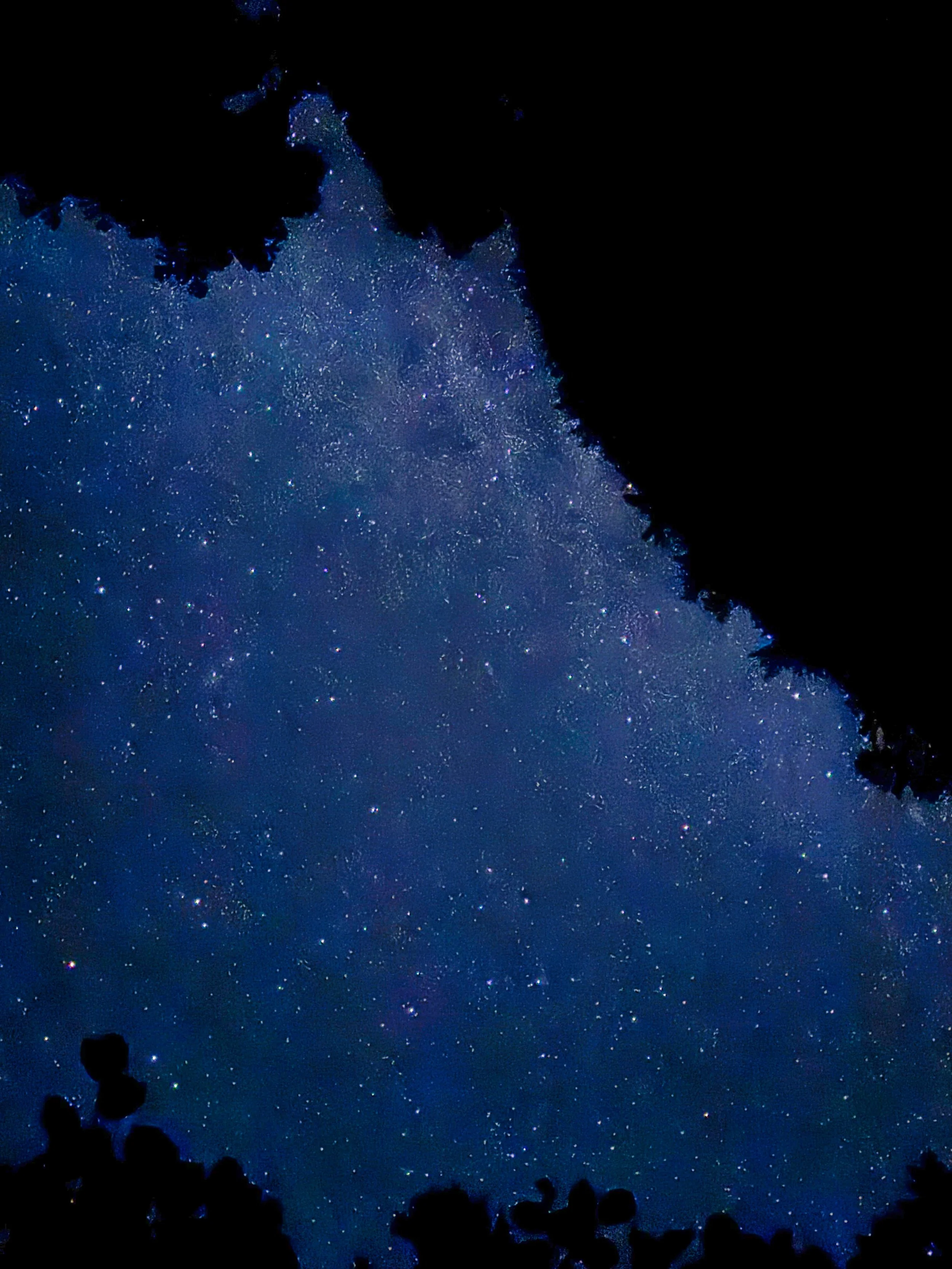
I had it in mind to hike the Wonderland this week, but the Grand Park 2 fire put the kibosh on that. Instead I opted to add a few more peaks to my Rainier 100 Peaks list, with Stevens (#81) and Boundary (#82). The trailhead for these peaks on the south side is Tatoosh 161 off FS 5270. I had been on this a few weeks before with Michelle, where we overnighted in our vehicles and hiked to tag Tatoosh peak. She pointed out that "hey, you can approach both peaks right from here (an intersection with the main trail and climbers track) and avoid doing that whole Unicorn glacier mess." For that trip I had my RAV4 and it was totally fine for the road, but this time I was hanging in my van and no way was I going to take that (there was one washed out section with a gully in the road). So I decided to park at Longmire and bike to the trailhead, about 20 miles. I got a late start after a big breakfast and stashed the bike off the side of the road, ready to ambulate. I had a permit in hand for up to 2 nights in the Tatoosh cross country zone, although I was confident I would only need one night out. Taking Michelle's advice, I had downloaded a GPX file from someone who had done the same itinerary. Most of my peak bagging has been from vague descriptions where I basically find my own way, but I gotta admit having a track from someone who had made the trip before was tremendously helpful and probably saved me a lot of time. I arrived at the saddle between the 2 peaks right around 6 PM, pretty sure I could get Stevens done before dark. The worst part of the trek was getting around a gully from the saddle. After that the scramble itself was fairly straightforward and I found myself on the summit just before 7. Unfortunately, the cloud layer was low so far reaching views were lacking. I had it in mind to bivy at the saddle where I had left my food, but when I came across a perfect spot with a tarn nearby, I decided to leave that scramble for the next morning and made camp just before 8 PM. I was surprised to see I had 5G service so called my wife for a chat..in the middle of nowhere without seeing another person for 2 days. When I hung up the cloud layer was low but within an hour the stars started to appear. I set up a camera and time lapsed (night mode) for over 4 hours. Nothing like laying on your back and waiting for the occasional Perseid streaker to light up your night, not to mention myriad satellites passing overhead. I shut the camera off with predawn light and got up and going around 6 AM. The dreaded gully awaited, but from this lower vantage point I could see that I could bypass most of it by circling left and staying on meadow and hugging cliff bands. Once at the saddle I had a food break and then immediately was on the scramble for Boundary. Getting started was confusing, as there are small cliffs in the way before going on a sidehill track before making a beeline for a summit. After a few false starts I got past that barrier and followed my downloaded track left side of Boundary until it was time to swing up to the final section. Although Boundary is described as a moderate scramble, I thought it was a bit harder than Stevens (described as a difficult scramble). The skies were clearer but now a bit smoky, so I could at least enjoy some hazy views from the smallish summit. Careful down climbing had me back at the saddle at 9 AM and I regained my bike at noon. Most of the 7 mile FS stretch was downhill this time on the bike, but then the 12 miles on Skate Creek road was all uphill, although at a gentle grade. All in all, the plan worked out splendidly, with plenty of time to shower and enjoy an early mediocre dinner at the Longmire Inn, sipping a hot cider on the porch and enjoying the evening breezes. Bruising on my arms from pokey branches and occasional slides on rocky scree, along with a few other minor injuries, did not detract from the satisfaction of spending alone time in the Tatoosh and seeing a plan come together with goals accomplished! Note: the summit elevations for both peaks differ according to source. The ones I published here are from the Mountaineers “100 Peaks in Mt. Rainier National Park” guide.

August 17, 2026 /Willis Wall
mt rainier stevens peak, mt rainier boundary peak, peak bagging mt rainier

Mt. Rainier from Bearhead East (6049’)

The Bearheads

August 09, 2026 by Willis Wall

A few years ago my daughter and I discussed doing the Bearheads as a day hike with her dog, as these peaks are outside the national park boundary (in the Clearwater Wilderness). Easy peasy, drive just short of the Mt. Rainier Carbon River entrance and turn left on the bridge, continue to the trailhead and presto, a few miles in and you’re on the trail to Bearhead Mountain. Now, with the closure of the Fairfax bridge and no access to the Carbon River entrance or Mowich Lake, getting to the Bearheads becomes a whole different ball game. There are dues to pay.

Evening approaches at Twin Lake

Aside from hiking many miles to this area from Sunrise or Longmire, one can drive to Wilkeson and proceed via FS roads 7710 and 7720 to a trailhead. This road is not for your average SUV if you value your oil pan and a pristine paint job, a higher clearance vehicle is in order. It’s 11 miles of rough, rocky and pitted road. Then, after a short distance on trail, one must negotiate the Rooster Comb ridge, which can be slow going with a lot of class 3 moves. Nothing tricky or particularly dangerous here, just not for the average hiker who is not used to these sorts of trails. Finally you arrive at Summit Lake, which in the past was very popular with families because of its easy access. We proceeded another 1.5 miles on to camp for the evening at Twin Lake, making for a shorter second day with an eye towards getting back to the vehicle and driving out during daylight. This plan, in fact, worked out perfectly, driving in Friday afternoon and reaching Twin Lake with plenty of time to set up, eat and relax.

Smoke in the distance but not for us (Bearhead Mtn)

5 AM was the alarm time the next morning and we were ambulating by 6. After tagging the two peaks and descending the Rooster Comb (we got off track a couple of times but it didn’t cost us that much time) we arrived at the vehicle just before 4 PM. Plenty of time to drive out and get some pizza in Wilkeson before heading back to Michelle and John’s place. Many thanks to these two who did the driving and led the trip, a tremendous favor for yours truly. This trip was a success on all counts, with great weather, no injuries and excellent company, tagging two more difficult to reach summits on the Mt Rainier 100 Peaks list. The video highlights the drive in and some of the more difficult spots on the Rooster Comb Ridge and a few other areas. Filmed in 4K, run time 35 minutes.

August 09, 2026 /Willis Wall
bearhead mountain, bearhead east, peak bagging mt rainier

Mystic Lake at 8:30 PM, July 21

Mt. Rainier: Northern Loop Trail 7/21/26

July 23, 2026 by Willis Wall

The last time I did a 1 day transit of the Northern Loop Trail was in 2023, so I returned to survey it. This 34 mile trek with over 10,000' of climbing is a perfect trainer for a 3 day Wonderland. Although the skies were somewhat hazy from smoke, I was looking forward to the Berkeley Park section, abloom with every kind of wildflower; it did not disappoint. I spend some time on the West Fork White River crossing, as it has completely changed this year with 2 new bridges and some irksome foraging in between. In the end one is forced into going feet wet to pick up the trail on the Windy Gap side (this trip from Sunrise is a CCW transit). Another problem area this year is the wooded section between Windy Gap and the Carbon River, rife with blowdowns. I counted 124 on the NLT section to the Carbon River suspension bridge, and I provide a sampling of what the hiker is in store for. As of this date it may be quite a while before trail crews address these blowdowns (lack of staffing?) so buckle up and endure. The video ends at the Winthrop Creek crossing since the rest of the journey back to Sunrise was in darkness. Despite some difficulties, the NLT remains a gem and delivers a cornucopia of sights, smells, sounds and physical challenge. Filmed in 4K, run time 39 minutes.

July 23, 2026 /Willis Wall
northern loop trail, mt rainier northern loop, hiking mt rainier

Mt. Rainier from the summit of Tatoosh Peak (6310’)

Tatoosh Peak (6310')

June 23, 2026 by Willis Wall

Tatoosh Peak is classified as a hike because there is a trail all the way to the summit. This is a peak on the Mountaineers 100 Peaks in Mt. Rainier National Park list, and brings my total to 77. To access the trailhead, one must negotiate FS 5270, which is in fairly good condition but does have a gully section in the road that would be problematic for a lower slung vehicle, along with some pretty deep potholes. I touched bottom in my vehicle with 8" of clearance, but on the return managed a better route. This hike occurred on the solstice, June 21st, 2026 with absolutely beautiful weather. I joined Michelle (fellow peak bagger) for this hike. Filmed in 4k, run time 11 minutes.

June 23, 2026 /Willis Wall
tatoosh peak, mt rainier 100 peaks list

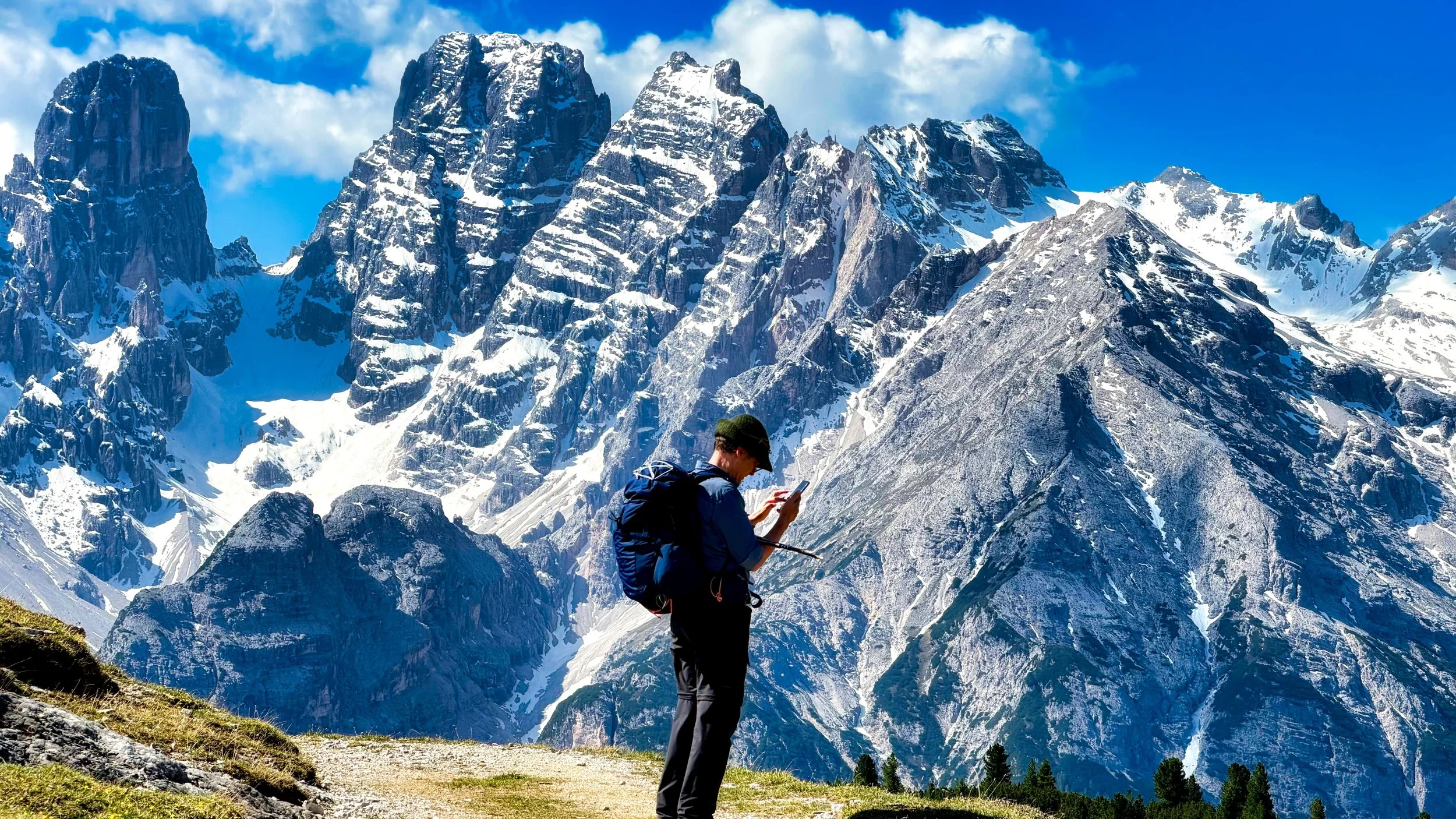
Hiking partner Björn checking the map on Strudelkopf, Dolomites

Italy: E5 and the Dolomites

June 06, 2026 by Willis Wall

TWO years ago I hiked section 1 of the GR10, and on that trip I met Björn and his wife. Björn and I hit it off right away, and we ended up hiking the last 2 days together. Some months ago it struck me that it would be cool to get together again for a hike somewhere in Europe, and I floated the idea in such a way that he could have easily passed. Luckily, he jumped right on it, proposing plans for hiking in Italy for a week, as this was on his radar for a May vacation anyway. Soon he provided a detailed itinerary for hiking 3 days on the E5 in Italy (The E5 spans 3,200 km across Europe, from France to Italy), then making our way to Toblach/Dobbiaco for 4 days of day hiking. Convinced he was serious, I (actually my wife) immediately planned transportation to and from Milan. From Milan trains would do the trick.

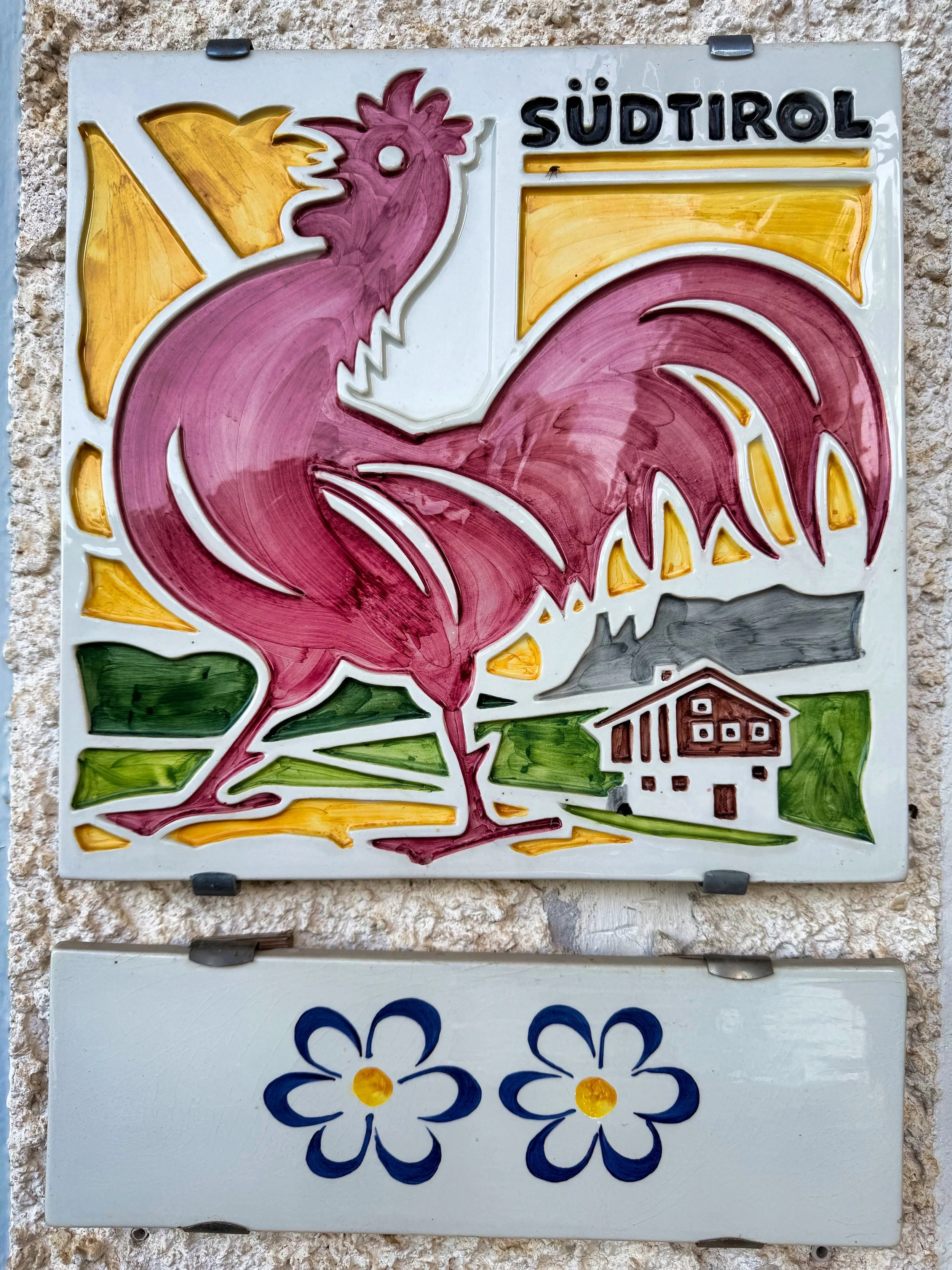
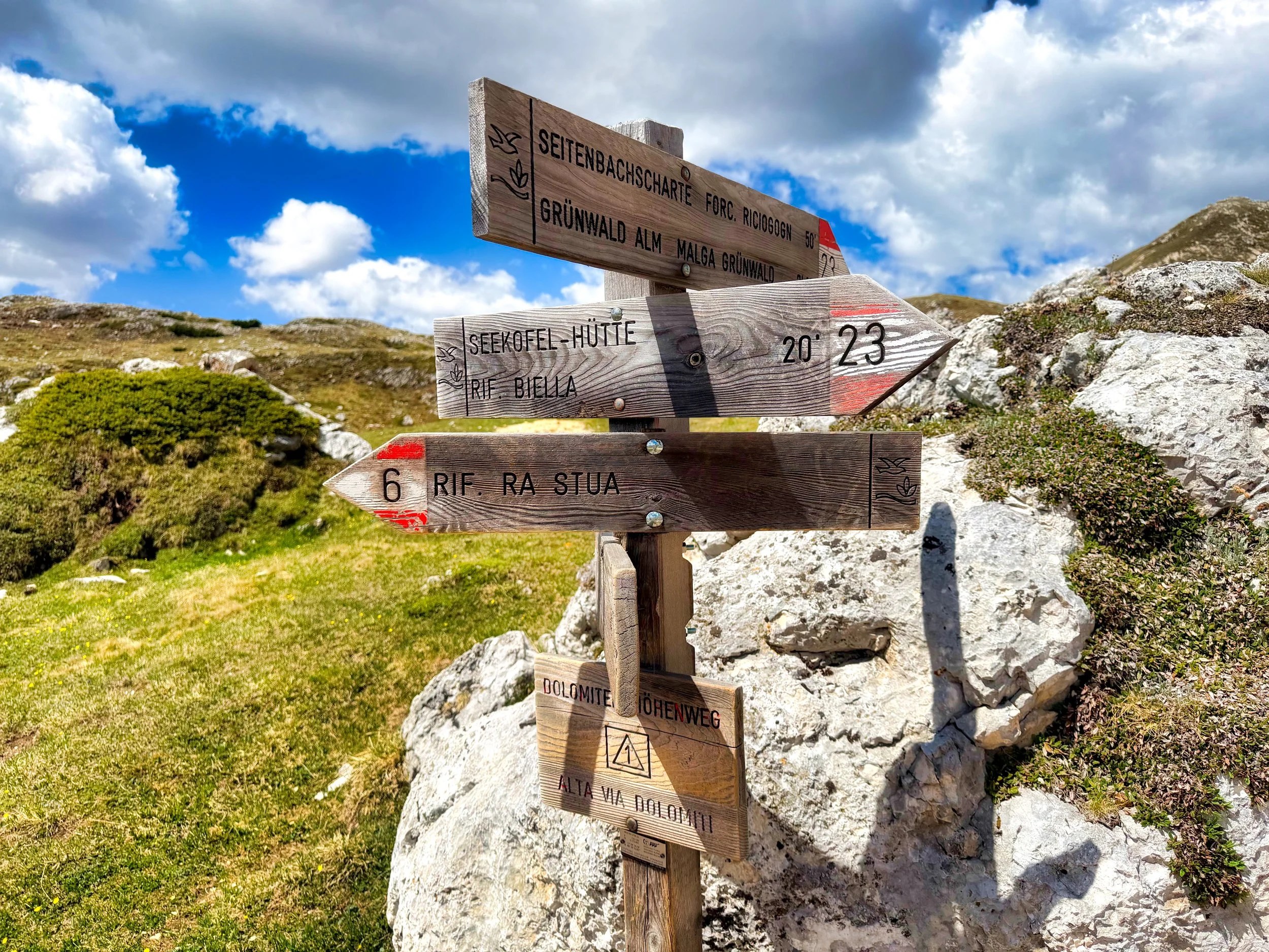
Signage

Why Toblach/Dobbiaco? People from South Tyrol are Italian citizens legally, but culturally and ethnically they are predominantly German-speakers with an Austrian history. Because the region was annexed by Italy from Austria after World War I, most residents possess a unique, dual binational identity. You will see dual names in this region, one German and another Italian. Björn got a kick out of our Monte Specie hike because the German name is Strudelkopf.

We planned on meeting the afternoon of May 22nd in Bolzano (Bolzen) where we had accommodations, and our arrival times by train were close enough to meet at the train station. After check in, we roamed the town, very vibrant with many eateries and bars with outdoor seating. The atmosphere was cool and young. Our plan was to set off from Bolzano around 8 the next morning for our first day of hiking (and my first day of hiking this year) with an ambitious day of 15 miles with 6,500’ of climb (1981 meters).

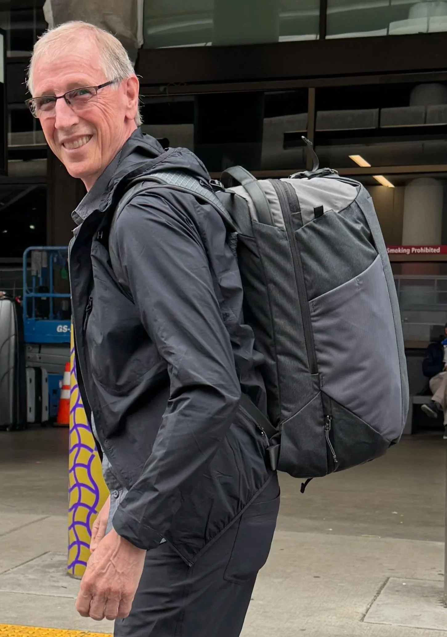
My 20 lb pack legal carry on for a 10 day trip

But first, let’s talk about packing. In 2024 I did two back to back events, the first one biking across the Pyrenees, the second hiking section 1 of the GR10. Despite the two disciplines, packing for that was easy; one suitcase and one backpack. During the bike portion our luggage was transported to each night’s lodging, and for the hike I hired Respyrenees. Not only did they provide all the hiking details, with maps and phone GPS for a self guided tour, they also transported my rollaboard to each night’s accommodation. A simple day pack did the trick whilst on foot. Not so for this hike: I needed to carry everything with me for the entire trip. 3 days on E5, then multiple trains to get to Dobbiaco, where we stayed for 4 nights to day hike, then trains back to Milan for my flight home. I wanted a legal airline carry on sized pack (40L) which would be comfortable enough to hike all day and also have organizational compartments akin to a dedicated travel pack. A Nemo pack ticked off all the boxes. It even had a separate shoe compartment, as my wife suggested I should not be wearing gross, smelly hiking shoes on the airplane(s). My final result: the Nemo pack came in at just under 20 pounds, including a 4.7 ounce day pack, rolled up nicely inside, which was good for the day hikes out of Dobbiaco.

E5: approaching first night’s lodging

E5 DAY 1: Bolzano to Madonna di Pietralba We started off (Saturday, May 23rd) with concerns of heat that morning, but it never got too bad for us, especially considering the huge climb at the beginning (4,000’/1200 meters). The day had a mix of forest and road walking, actually quite pleasant. Cricket sound reminded me of growing up in New England, and Cuckoo calls fit right in for my Austrian buddy. Speaking of Björn, his multilingual chops were very handy. German? good; Italian? fine; French? he got by. English? probably better than mine. Also, what really clicked, we were simpatico with pace, breaks, coffee stops etc. Neither one of us had to speed up or slow down to accommodate the other. No one grumbled or got testy. This was true for every day. But this Day 1 had us arriving at our hotel close to 9 PM, something I am intimately acquainted with but not the usual thing for Björn. No matter, he never complained and our arrival with low sun hitting the mountains beyond was sublime. We were happy we had eaten dinner in one of the towns a few hours earlier, though, so all we had to attend to was cleaning up and getting some shuteye. STATS: 15 miles (24 kilometers) with 6,500’ (1980 meters) of climbing.

Bletterbach Canyon, Italy

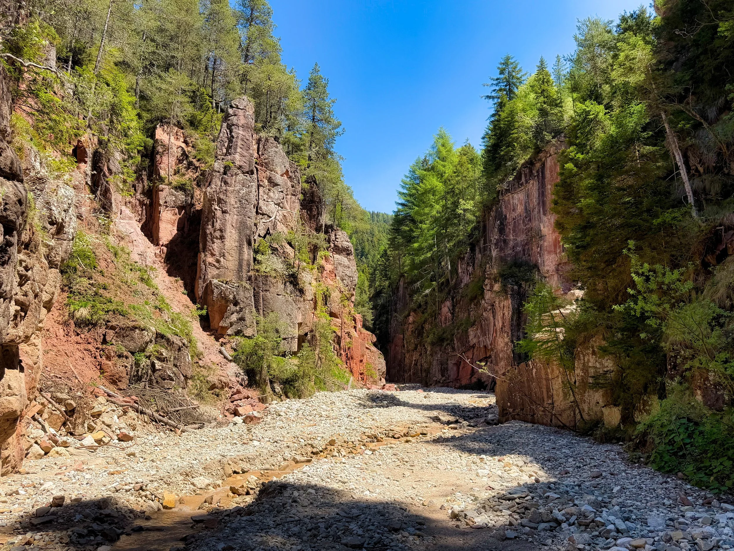
E5 DAY 2: Madonna di Pietralba to Redagno di Sopra (May 24th) This was to be a relaxed day, with a later start and an earlier finish with just 6 miles (9.7 kilometers) and 1,300’ (400 meters) of climb. Probably the highlight of the day was traveling through the Bletterbach natural monument, a deep gorge where day hikers were all wearing helmets checked out from the visitors’ center. We stopped for coffee and strudel whenever an establishment was spotted and just enjoyed the stroll. Chirping crickets and birdsong were a constant background in the afternoon hours, and the meal at Thomaserhof was outstanding. Also spotted: horses, donkeys and a giant anthill.

Church in Oberradein, Italy

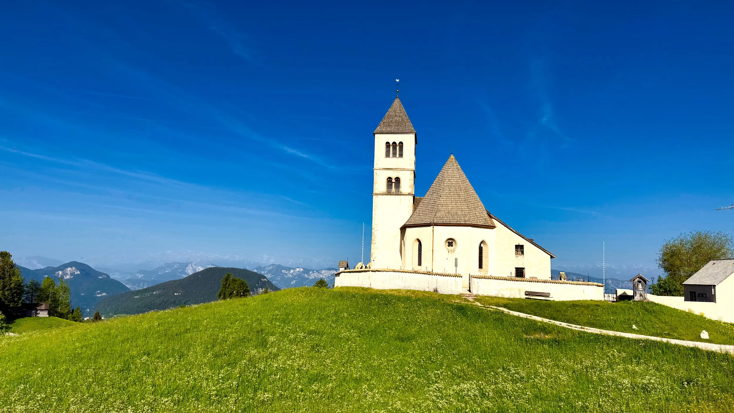
E5 DAY 3: Oberradein to Gfrill This last hike was not especially hard, but we had planned to catch a bus at Gfrill to take us to that night’s lodging. We still had to climb over 3,200’ (975 meters) over 14 miles (22.5 kilometers) so the morning hours were spent with this in mind, not hurrying but eyeing what was ahead. By midafternoon we relaxed in the final hours, knowing we had plenty of time to catch that last bus. More woods, cows, churches, ponds and coffee stops awaited us along with trail and road, beautiful weather and some far reaching vistas. Bus secured, we overnighted at Salorno. The next day we took multiple trains to finally end up in Dobbiaco. The trains and busses we used (care of a Südtirol pass) were included with our lodging, and a day didn’t go by without us on one or the other.

Coffee stop on the Strudelkopf hike

DOBBIACO: Monte Specie/Strudelkopf Once we arrived at Dobbiaco we spent the afternoon wandering the village and shopping for food as our suite had a kitchen. With no real prior plan, we had a sit down to determine where to hike the next day. We decided on tagging this peak, hoping for views, and continuing around to drop back to the valley, making for a horseshoe shaped hike. Off we set on the morning of May 27th, boarding the 7:06 bus to our drop off point. At first we were accompanied by the sound of traffic and distant gun shots(?), echoing off the cliff walls from the valley below. But then the views starting coming, and before we knew it we were yodeling through a tunnel and hugging a sheer cliff track, concentrating on not stumbling but also pretty secure with a hand line along this section. When we reached the plateau of Strudelkopf, we were blown away by the 360 degree views to rocky crags and magnificent mountains. We were also surprised at the number of people up there, hinting that there was an easier way; dogs, infants in backpacks, kids and seemingly unfit people adorning the slopes kinda gave us that impression. However, there was plenty of space for everyone and we found a nice mound to get our snack and coffee on (thanks to Björn for packing a thermos of hot water, which we enjoyed on every hike). We also finally determined where the Tre Cime peaks were, a bit off in the distance but impressive nonetheless. The Dolomites live up to the hype! We finally set off to the other side of the mountain, stopping for coffee and a cold drink along the way. This stretch was mostly on dirt road but still quite pleasant. This was a good day indeed, as rain had been in the forecast for the afternoon but never appeared. STATS: 9 miles (14.5 kilometers)/3,800’ (1160 meters) of climb.

Junction sign in the Piccola Croda del Becco alpine

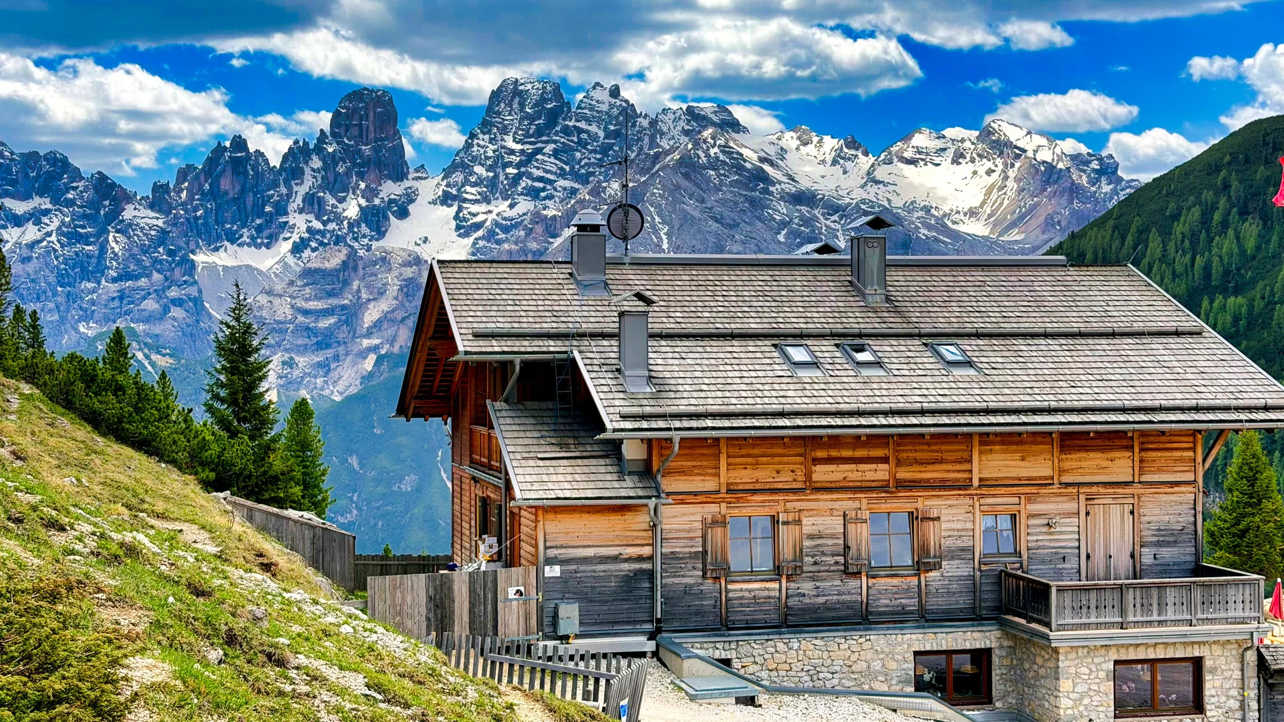
DOBBIACO: Piccola Croda del Becco Circumnavigation Today (May 28th) we decided on a loop hike, starting at Pragser Wildsee (lake and resort) and climbing to the alpine in a clockwise direction. Both the climb and descent on either side of the mount were interesting, with cabled handlines in the morn and slippery scree/rock in the afternoon. The refuge near the high point was not yet open (what, no coffee!), but we still had an ambling trek over the alpine area, again with far reaching mountainous views. Björn had a sharp eye in spotting some ibex on the slopes above, along with the occasional marmot. Prior to the descent, we once again perched on a knoll and snacked on biscuits, sausage, cheese and coffee, having to secure items from the brisk wind. Then it was down the scree and through the lower meadow to finish the loop on the other side of the lake. We made it just in time to catch the next bus back to Dobbiaco. Today’s hike: 9 miles (14.5 kilometers) with 4,100’ (1250 meters) of climb.

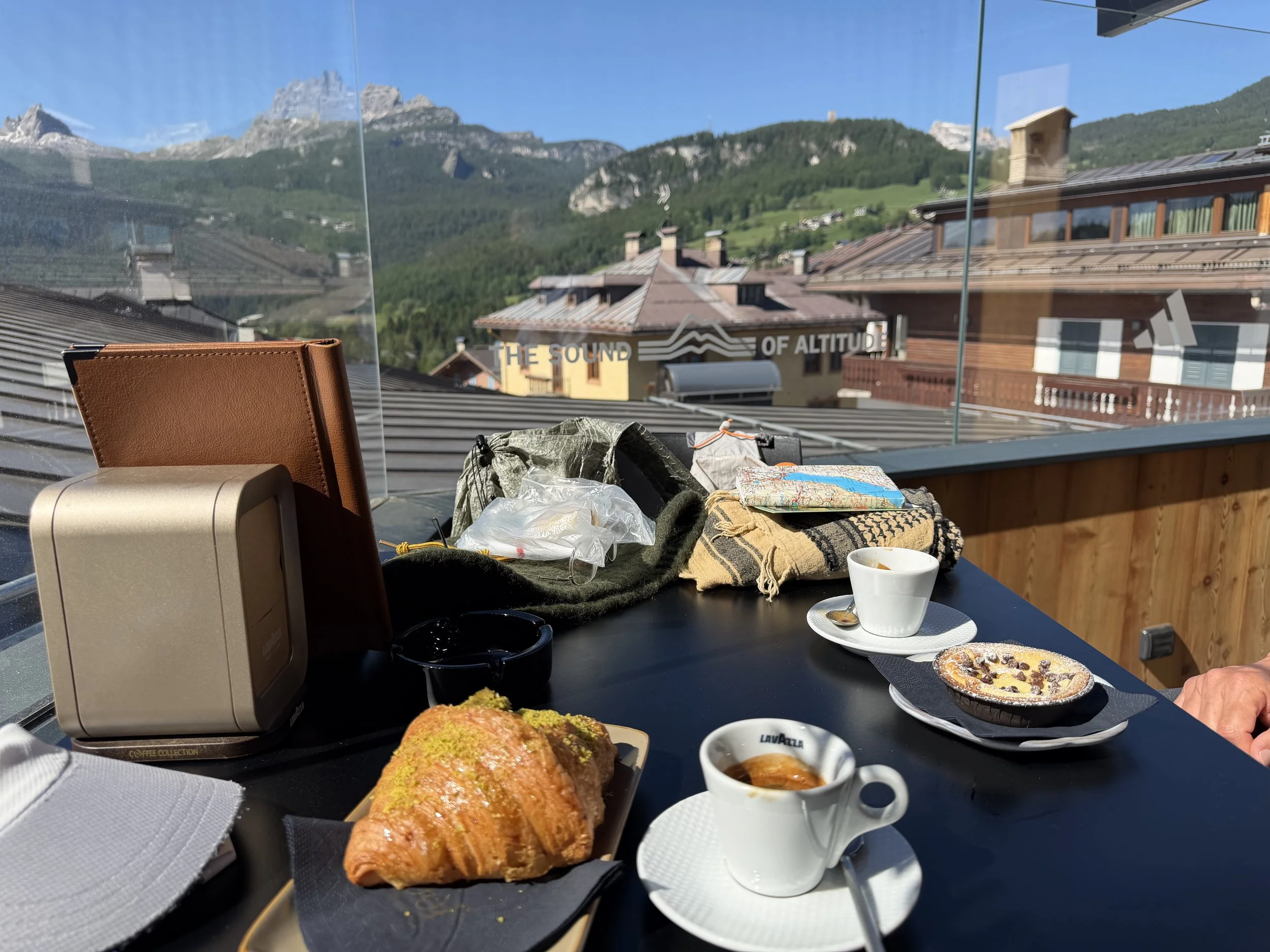
Cortina rooftop eatery

THE END For our last day in Dobbiaco, we decided to play the tourist and caught a bus to Cortina, spending the day looking in shops, having snack on a rooftop bar, checking out the local attractions, having lunch on a quiet patio and just gawking. The next day would have me leaving first via train to Milan, and Björn leaving a few hours later for his home in Austria. Here’s what I texted his wife after we parted: “…just wanted you to know that Björn was a great hiking partner, both physically and in spirit. He may tell you otherwise, but two guys who barely know each other in close quarters for a week is a big risk, and I thoroughly enjoyed his company the whole time. He claims to be grumpy but he is a fine, thoughtful person so I know better. Thanks for lending him out for the week!”

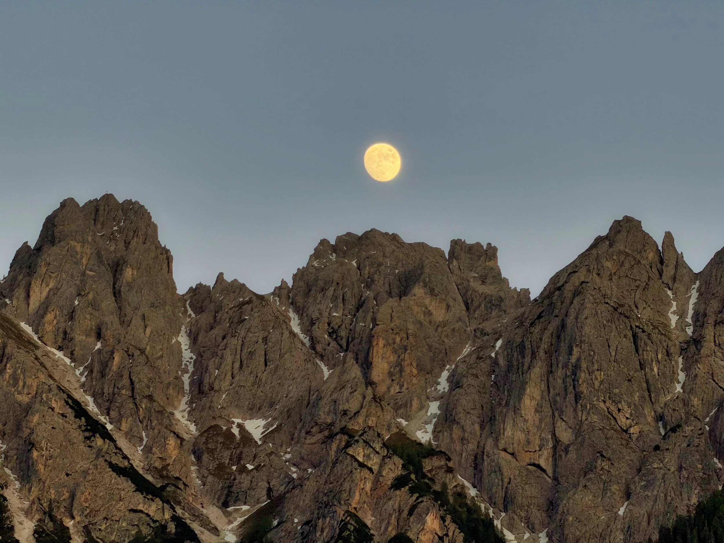
Moonrise from our patio in Dobbiaco, last evening

June 06, 2026 /Willis Wall
E5 Italy, hiking the E5, tre cime, dobbiaco italy, hiking the dolomites, hiking out of dobbiaco

Willis Wall on the first half of a Wonderland 48 hour transit (2010)

Fastpacking: The Big 4 and the Top 4

March 30, 2026 by Willis Wall

Doable, but usually 30-35 miles per day

4 pounds. That’s the goal; pack/pad/bag/shelter, a pound a pop. If I can keep the Big 4 under 4 lbs, then it leaves me about 10 pounds for all the rest. For years I’ve been toting about a 15 pound pack for summer season fastpacking, give or take a pound. A 15 pound pack is unnoticeable on my back, which is my ultimate test; to go all day and never NEED to remove my pack due to discomfort. A 15 pound pack weight is one of the most critical components of a septuargenarian trying to cover 30 to 40 miles and climb/descend 9-12 thousand feet per day. Clothing is another critical component of light weight. What combination of clothing will pack small and weigh less yet be comfortable for typical summer season weather AND be safe for unexpected harshness? Maybe consider this the Top 4: next to skin layer, windshirt, insulating piece and rain protection. I won’t get into footwear and bottom pieces, the individual will have to wear what works for them and is comfortable. Personally, I use hiking pants (never wear shorts) and trail runners for all conditions.

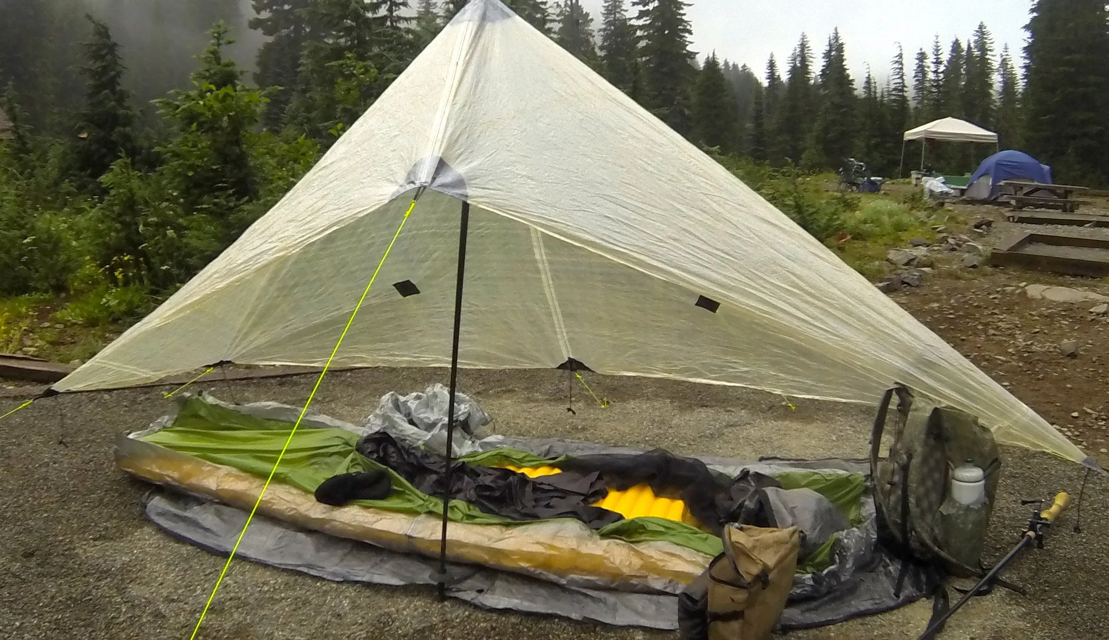
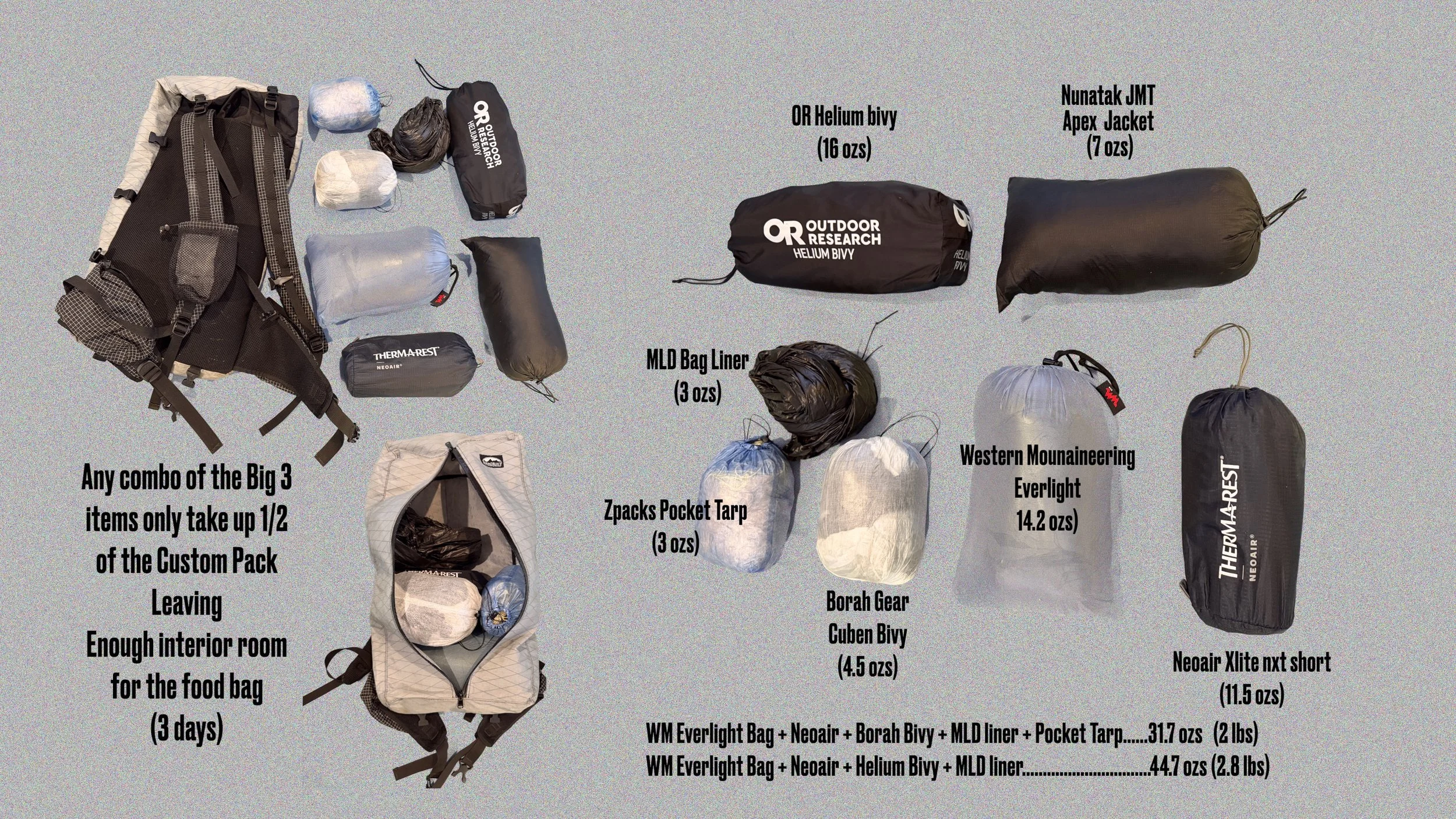
Let’s look at the Big 3. In the photo below I’ve included both a fair weather kit, which involves a light weight Borah Bivy at 4.5 ozs, or a “just in case” kit where I’m packing the more substantial Helium bivy. Even the fairweather kit also includes a 3 ounce full coverage tarp, as the Borah bivy is not waterproof, and there’s nothing more miserable than a bivy in the rain. The Helium has a full cover and clamshell entrance, but I’ve used it in foul weather and condensation is a problem if it’s closed most of the way. It’s a lot of protection though with sideways driving rain and is more comfortable in foul weather than a bivy/tarp combo.

If using a non WPB bivy, I pack the original Zpacks Pocket Tarp at 3 ozs (Mowich Lake, 2013)

I actually have a tent that weighs less than the Helium bivy, at just under 15 ozs, so a more traditional set up with tent, pad, and bag is still less than 4 pounds. I would only move to a warmer bag in a shoulder season when temps may dip closer to freezing during the night.

Big 3 (pad, bag, shelter) leave plenty of room in my custom Zimmerbuilt backpack

In sum, with my pack(s) usually weighing in around 1 pound, my Big 4 (Pack/Tent/Pad/Bag) will always be less than 5 pounds in the shoulder seasons and usually less than 4 pounds for a typical fastpack during the summer. Consideration: this blog is about fastpacking, not traditional backpacking where the user is spending a substantial amount of time in a camp site. When I’m covering 30-40 miles per day I’m usually ambulating 15-17 hours of that 24 hour period. This leaves just enough time to get set up for the evening anticipating an early getup, usually from 4-5:30 AM. Most times I end the day in the dark, and start the day in the dark. A good night is 7 hours of sleep. Fastpacking is a whole different animal from backpacking, but that doesn’t mean that one shouldn’t pay attention to their base weights. I did a few backpacks last year, and the only difference was I brought a tent and packed a warmer bag.

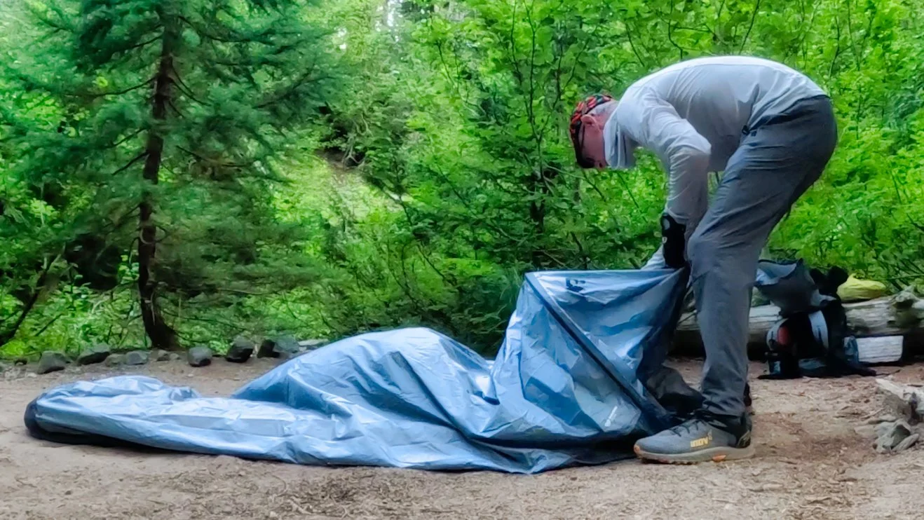
Setting up the OR Helium bivy for an overnight

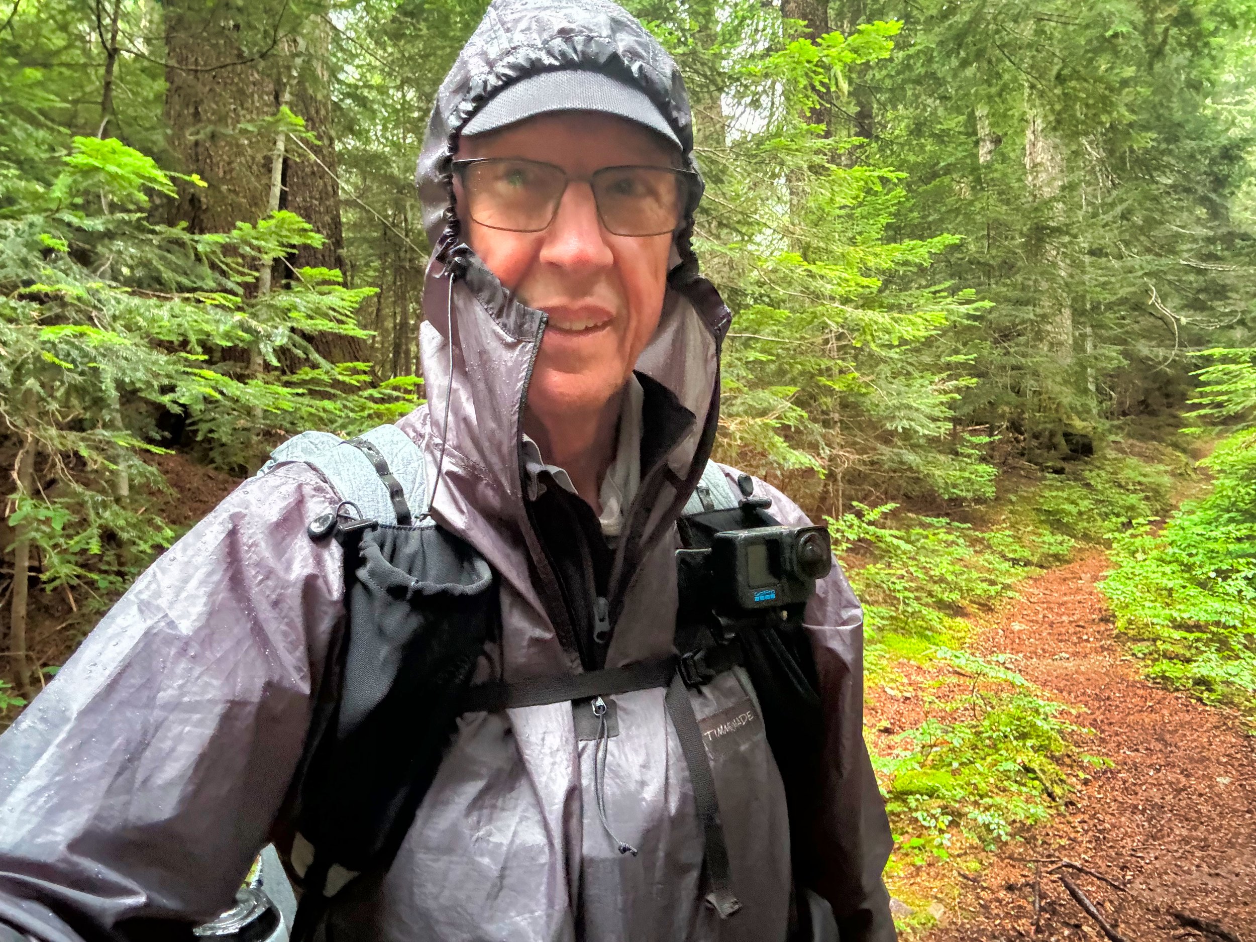
TOP 3: What is it? Well, aside from one’s next to skin layer, it’s clothing that is worn on top. Yes, I know some people have shorts, gaiters, merino leggings, sleep clothes and pants, etc, but for my purposes I only wear pants (which I wear to bed) and trail runners. The real secret sauce is how do you layer for anticipated conditions and unanticipated conditions? For instance, I never go on a jaunt without a proper rain jacket. In my case I pack a Timmermade Silpoly Megazip pullover. Despite all the wonder jackets out there that cost upwards of 1000 bucks, it has been proven that when one is expending energy, be it just walking or laboring uphill, eventually the jacket will wet out when it is no longer able to move the body’s moisture through the membrane and outer layer, especially in high humidity. Silpoly is a non permeable fabric, 100 percent waterproof. The key to it, and any other top piece, is ventilation. I’ve spent entire days in rain with a DCF poncho, but my core was dry because of the venting options on it. The Megazip lives up to its name in that there is a zipper on each side running from wrist to hips, along with a quarter zip in the front. Now I usually plan my short 3 day trips over good weather, but in 2024 I was trying to pull off a YoYo and the weather was just not cooperating. That Megazip was on and off constantly, especially in heavy mist where it’s not technically raining but everything is wet. It functioned well as long as I kept on top of the venting. This, of course, is also valid for a wonder jacket if it has good side and front zips, but the Megazip is a mere 5 ozs, packs very small, has a roomy fit (most pullovers are wider than zip jackets) and long to cover my hips.

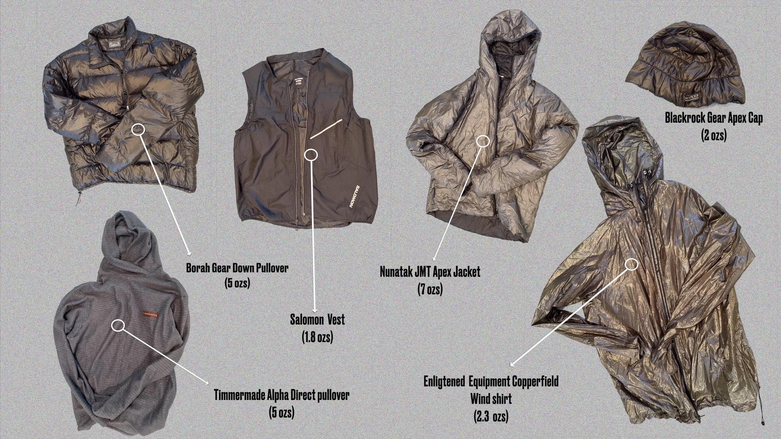
14 ozs for upper outerwear: Alpha Direct pullover, vest, EE windshirt and Timmermade Megazip Silpoly rain jacket (not shown)

Timmermade Megazip Silpoly Rain Pullover

The Megazip is the outermost layer of my Top 3, but what’s in between is very important. I start with a long sleeve hoodie (for sun protection) which is always on. If there’s a bite in the air I add the vest (2 ozs) to trap heat next to my core. If it’s a bit chilly I’ll add the Enlightened Equipment Copperfield wind shirt (2 ozs). If it’s downright cold, out comes the Timmermade Alpha Direct pullover at 5 ozs. Alpha Direct is an incredibly versatile textile, extremely breathable because of the open weave (making it an active piece vice down) but also extremely warm for its weight if covered by a windshirt or rain jacket. The versatility of Alpha Direct makes its way into my pack because it can serve as an active piece (I use the 2 oz vest to protect the shoulders of this delicate weave from pack strap wear) or as a static piece like a down jacket. That Borah Gear down pullover is also 5 ozs but I would never wear it while moving, the down would soon wet out. You’ll also see in the diagrams a Nunatak Apex JMT jacket. Apex is also a synthetic material and can be worn while active, slightly heavier at 7 ozs. In the past I’ve almost exclusively used this jacket as a static “around camp” type piece; it maintains warmth when wet but the outer shell is also highly water resistant. It, however, is not as practical as the Alpha Direct combos. I’m listing these two insulators here as an example of what’s available, but also I can make my own choices last minute before I step on the trail. The down pullover makes an excellent pillow when stuffed in a “pillow” stuff sack. Bottom Line, I can weather the changing weather, so to speak. For mere ounces, combinations of these pieces will take me through heat to near freezing temps in blowing wind.

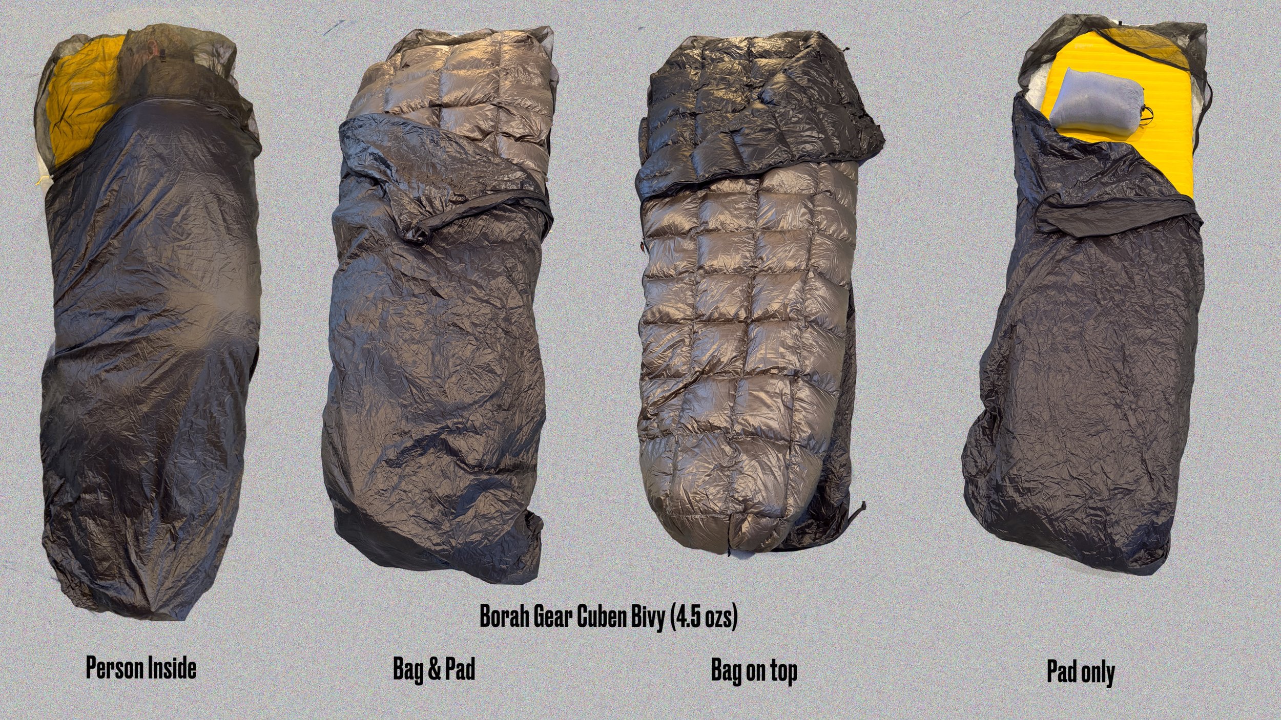
The Borah Gear Cuben Bivy (4.5 ozs) accommodates my Neoair Xlite NXT pad and Western Mountaineering Everlight bag

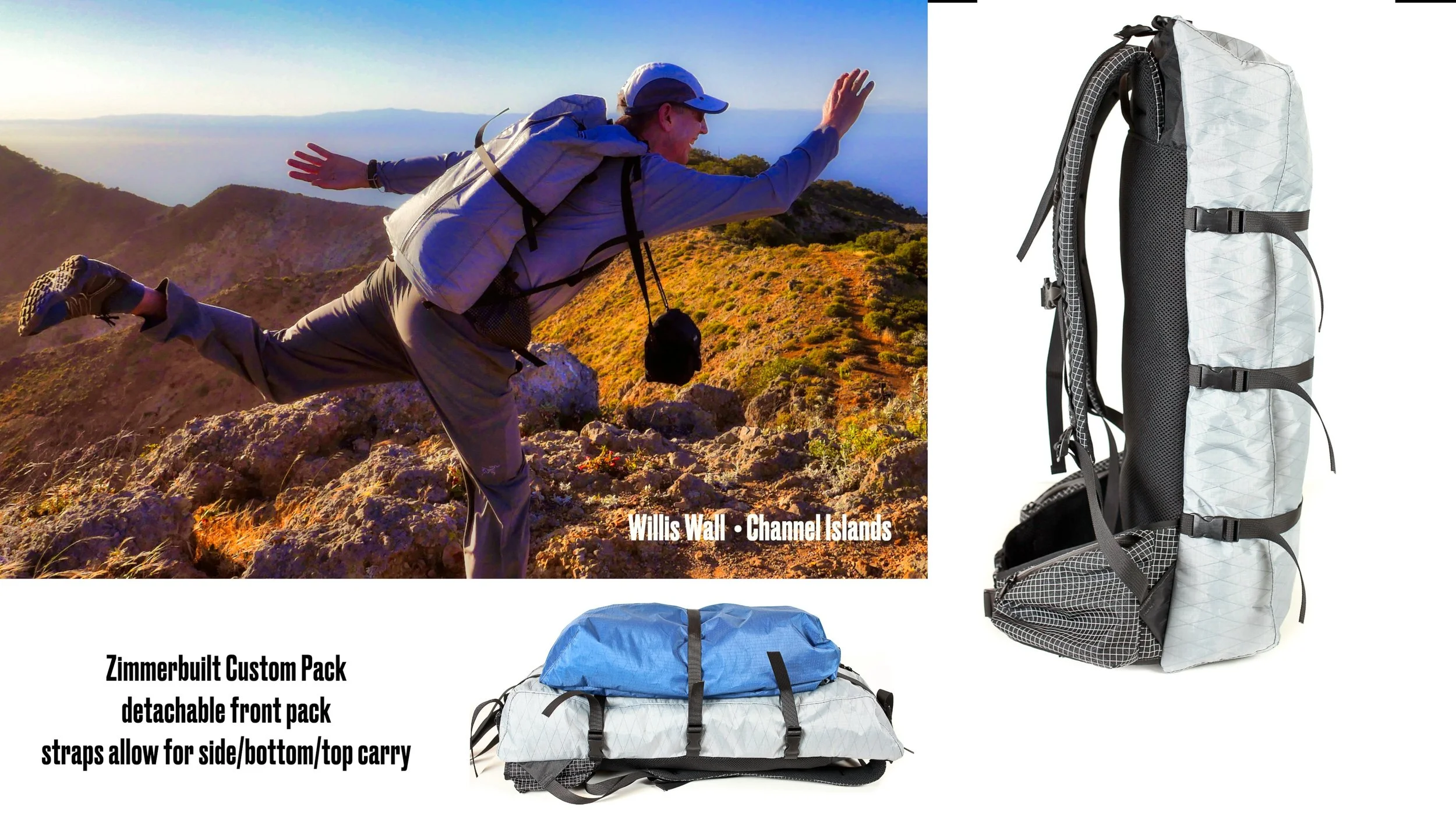
This coming ‘26 season I’m planning on using my custom made Zimmerbuilt pack for my anticipated fastpack of the Wonderland. It is a no-bounce pack with a center zip for access, purposefully built to lay against my back; most of my food along with any needed xtra water, plus my kit noted above and a small clothes bag will occupy this space. The detachable front bag (blue) will hold assundries I want ready access to during the day, along with that day’s food. The pack has two hip belt pockets. The detachable bag will also be used as a hang bag for the bear pole.

My Zimmerbuilt custom “Ultimate” pack system for fastpacking

With my Big 4 coming in under 4 pounds and my clothing kit at 14 ozs plus gloves, hat and extra socks, I’m looking at 5 pounds for the major items in the pack. That leaves me 10 pounds for those other items like sunscreen, glasses, foot kit, GoPro camera, InReach, phone, water tabs, 3 oz pillow etc, plus food and 1 liter of water. If my legs cooperate and the weather is fine, I may be able to get my total pack weight down to 12 or 13 pounds at the start of the trip. Every pound absent from my pack is energy returned for climbing and descending. This year, maybe even some running. 48 hours? One can reach.

Willis Wall on the 2023 Wonderland Trail 3 day transit (#35)

March 30, 2026 /Willis Wall
fastpacking the wonderland trail, pack contents for ultralight

A Turkey Vulture riding thermals at Pinnacles National Park

Retirement: The First 6 Years

March 20, 2026 by Willis Wall

I retired in March of 2020. In July of 2020, after selling our house, I bought a van and traveled to California to spend some time with my daughter. The to and fro allowed me to stop at places of interest, as did a few trips between Colorado and LA, then back the the PNW. I culled video over these past 6 years of outdoors and travel interest to put together this 10 minute video. My wife has a saying, “tick tock tick tock”; essentially, do it now while you still can, because you never know if there’s gonna be a later. These are just peeks, mostly represented by one clip per area or trip. Absent are many more forays of hiking, biking and skiing, but include a few selections of each. Keep moving!

LINKS to the more substantial trips: Wonderland Trail Hikes #32-40 • Hiking Switzerland • Hiking Section 1 of the GR10 • Bike Across the Pyrenees • Tanzania Safari • Mt. Kilimanjaro Northern Circuit and Summit • Sequoia National Park: 9 Lakes Loop • Yosemite National Park • High Sierra Trail/Mt. Whitney

March 20, 2026 /Willis Wall
willis wall video, willis wall travel video

Entrance to the Upper Palisades Lake camp

Alternate Wonderland Trail Camps update

January 28, 2026 by Willis Wall

Back in 2012 I spent the season on a massive project; time lapse the entire Wonderland Trail, including the alternate route over Spray Park, and film and map all the backcountry camps on the Wonderland. Turns out the camps project is still very popular to this day as people want to scope out the camps (especially if considering hanging) in advance. And then, on a Wonderland Facebook group, someone mentioned it would be nice to see the other camps in the park.

Initial sketch and finished camp overlay map

The popularity of the trail has grown exponentially over the past decade, and many times one of these alternate camps, not specifically on the Wonderland, are utilized to complete a circuit. This is especially true for the Northern Loop Trail, now commonly incorporated into a Wonderland circuit, or just as a circuit in and of itself. The Eastern Loop is also widely used.

Forest Lake from Forest Lake Camp

I started filming these other camps at the end of 2024, hitting all the ones on the Northern Loop plus Snow Lake. In 2025 I was able to film the remaining camps in the park, sans 2: Three Lakes and Shriner Peak. Shriner is a one-off, not connecting to any other trails, and Three Lakes is seldom used for Wonderland hikers (at least in the Facebook group), but I’ll probably film them this coming season just to finish up every camp.

Reference map for Lake George Camp in relation to the Wonderland Trail

This project has been a real delight, taking me back to areas of the park that I might not have visited any time soon. I especially enjoyed the trip to film Dick’s Lake Camp and Upper Palisades Camp on a beautiful July trip encountering few people. Since I don’t monetize this site, my payment is running into people on the trail that express appreciation for its content. I guess one would classify these efforts as a labor of love. Click Here for the Alternate Camps page

Yellowstone Cliffs on the Northern Loop Trail, near the same named camp

January 28, 2026 /Willis Wall
mt rainier backcountry camps, alternate camps for the wonderland trail
  • Newer
  • Older

© 2026 Willis Wall Multimedia

all rights reserved