Northern Loop Trail (MORA) with Peak Bagging
I’m working on the Mountaineer’s “100 Peaks in Mt. Rainier National Park” list, albeit at a leisurely pace. I decided to combine items on the to do list…video the backcountry camps along the Northern Loop, take photos of the ranger cabin cabinets at Lake James and Mystic Lake (per request), and tag a couple of remote peaks on the list: Pigeon Peak (4280’) and Tyee Peak (6000’), then end by completing the NLT.
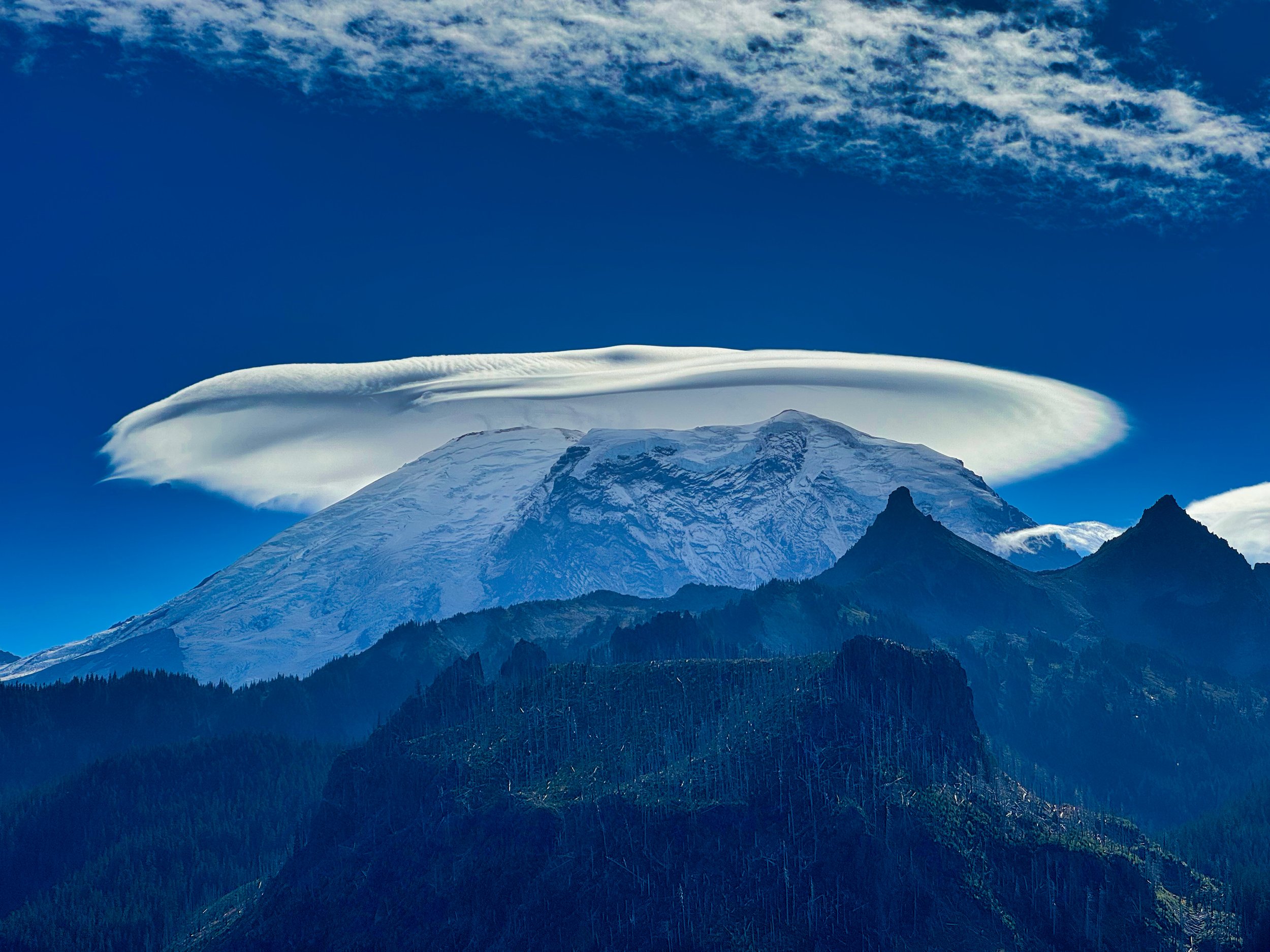
McNeeley Peak shortly after departing Sunrise
This was my second foray onto the NLT from Sunrise, with the first outing mapping the other campsites (Berkeley Park/Fire Creek/Lake James) and scoping out the route to Pigeon Peak. That was an out and back and made for a long day, logging 27 miles with 7,000’ of vert. I knew I would need an overnight to do the whole NLT and bag two peaks, so I got a permit for the Tyee cross country zone.

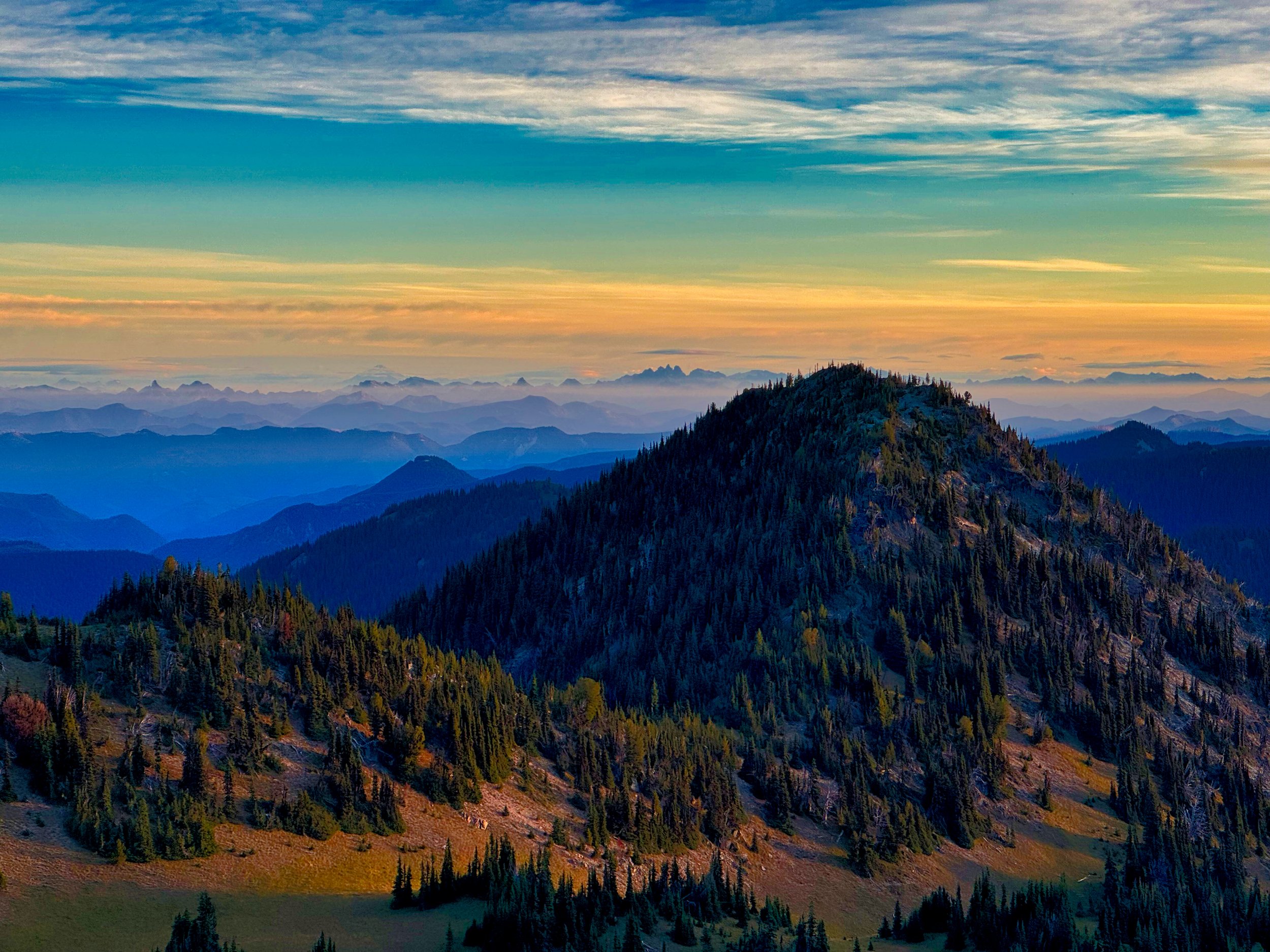
Near Windy Gap, Northern Loop Trail (Mt. Rainier)
Day 1: Pigeon Peak I had an idea what was ahead of me for Pigeon, in that I had probed the route on the prior trip; I knew it was gonna be nasty. After crossing the West Fork of the White River, I climbed to the trail jump off point around 4,000’ elevation. Conditions: tall, feet grabbing bushes and tightly packed trees, including dead ones with pointy broken branches that wreaked havoc on my old man thin skin. As the hours wore on bloody patches from cuts adorned my sleeves and my feet got wet crossing the main creek, which was in a deep ravine. It took me nearly 3 hours to finally make my way to Pigeon Peak, which at least had a view to the mountain and the river below. There is no doubt that the only people coming here were the ones, like me, that had to tick this peak off a list. On the return I followed a slightly lower contour and had easier going, taking advantage of elk trail when the opportunity arose. When I finally bashed through the brush and set foot on the trail, I was relieved, to say the least. As I climbed towards Windy Gap the rain started falling, just to ensure that my shoes would not dry out for the next day. I secured my food in an Ursack and laid out my bivy (OR Helium), glad that I had brought this more robust shelter. I anticipated colder temps and did not want to take a chance on being cold, so a NeoAir XTherm pad and Nunatak 15 degree bag kept me toasty all night.
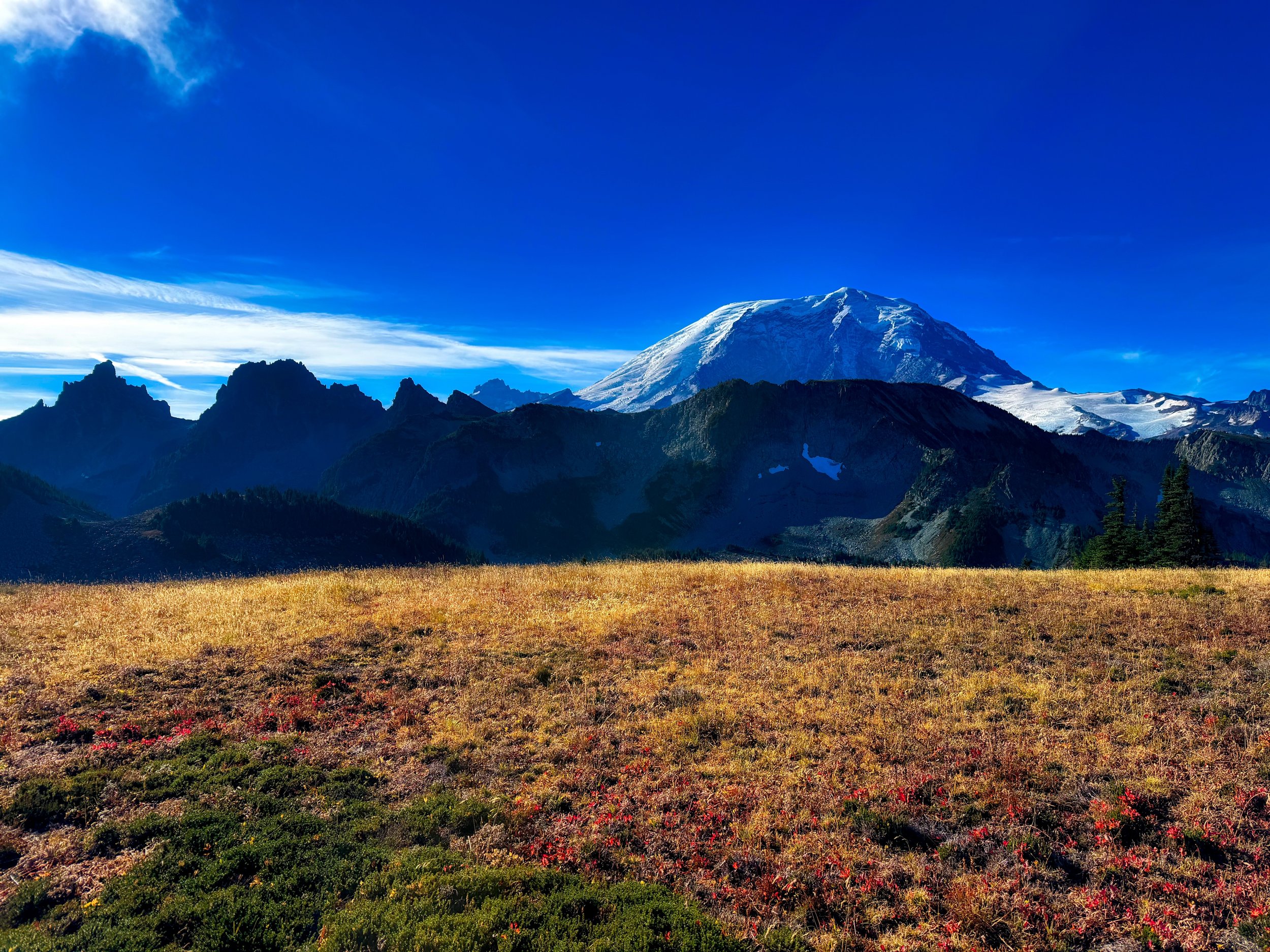
View from Tyee Ridge
Day 2: Tyee Peak/NLT I knew I had a long day ahead of me, but I purposefully slept in until past 7, as the Tyee Peak climb was first on the docket. The morning was clear and it didn’t take long to adjust to my soaked shoes. Unlike the day before, the “off trail” travel to Tyee was on a well established social trail, across the Tyee ridge all the way to the base area of Tyee Peak; sweet! The sun was out and the temps were cool but not cold. The description for Tyee was to go past the peak and approach from the west; I climbed to the saddle but the west ridge was crowded with tightly spaced small trees. Perhaps it was all the stick poking and pack catching I endured from the day before, but as I climbed I opted to follow a line around the base of the peak to the east side. This was doable but probably not prudent, as the scrambling was more difficult than the “moderate scramble” description, with one move bordering on class 4. However, nothing scared me and I did find a way to the summit, enjoying the 360 degree vistas. I found it interesting that Tyee Peak is listed as 6,000’ elevation but the USGS marker on top read 6040’. I probably would have lingered there longer but I knew it was a long day ahead to complete the NLT. I did not want to downclimb the way I had ascended so started down the woodsy west ridge, finding the way so much easier, and obviously the way I should have ascended in the first place. Tyee Peak was my #74 on the list. Soon I was back on the social trail to reconnect with the NLT.

Mt. Rainier from Tyee Peak (6,000')
I had one more camp to map on the NLT, that being Yellowstone Cliffs. Once complete, I pondered backtracking from there, or even cutting across the Elysian Fields, but I figured I may as well finish the Northern Loop in its entirety. I launched off for the downhill section, continuing CCW. By now my legs were steely from prior bikes and hikes so I was able to trot the entire downhill to the turn to parallel the Carbon River. This was the third time I was on this trail section this year, and I reveled in the ease of on trail travel and automaton like locomotion; end of season fitness is always fun. The timing worked out great in that I arrived at Mystic Lake right before sunset, with fantastic light for photography. This was also the first time I had seen anybody since starting out, chatting with two people who were staying at Mystic Camp. I mean, it’s only October 2nd, and over two days I only see a few people?

Sunset on Mystic Lake, Mt. Rainier
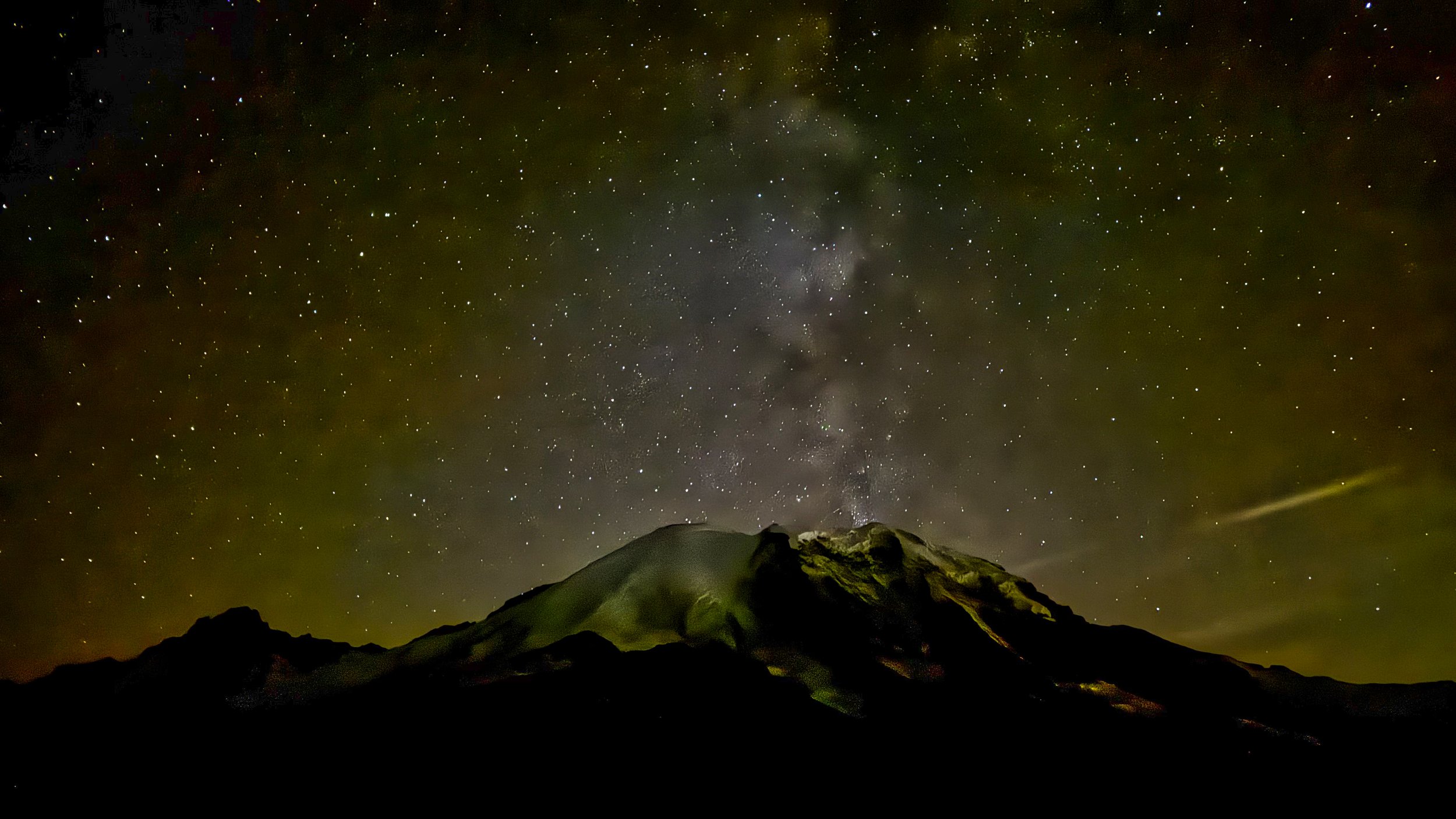
The rest of the evening had me motoring consistently (I had 10 more miles to Sunrise) with no low points physically or mentally. I stopped at Skyscraper pass to try some 10 second exposures for the star show, and again at the junction with the NLT to Berkeley Park. Earlier I had estimated that I would arrive at Sunrise before 11 PM, and I was pretty much spot on: I reached my vehicle at 10:51 PM. It was also 29 degrees; no wonder I had been wearing 3 layers for hours. Aside from my spotty bruised skin, along with some minor scrapes, I had a very enjoyable outing; breathing in the crisp alpine air, enjoying hard earned fitness that comes from not just a few months of activity, but years of consistent movement. Make no mistake, I am thankful and grateful for being healthy enough to do these kinds of outings at age 69. This day’s stats: 25 miles/9,000’ elevation.
Mt. Rainier from Skyscraper Pass