
Mt. Rainier Western Loop

Mt. Rainier’s Western Loop: 35 miles/8300’ elev
Each year I do an excursion to pummel my downhill legs prior to a 3 day Wonderland Trail hike. Last year that was the Northern Loop Trail, which was especially hard because I had done no hiking the month prior. That 38 miles with 9800’ of elevation gain was a tough one, taking me 18 hours to finish. It did the trick though, and my method has proven itself over many years. Of course, this is assuming one has an excellent fitness base to work from. NOTE: A video chronicle is at the end of this post.
This year I decided on a slightly easier hike, that being the Western Loop in Mt. Rainier National Park. Now, the Western Loop is not an official or even unofficial trek in the park, it was something I came up with in 2016 to complement other loop hikes. That blog, titled “How to Experience Mt. Rainier in Short Segments”, was written to aid hikers in dealing with only walk up permits that year. It was my aim to describe various hikes around the park where one could experience the best parts of the Wonderland, and more.
Because the Western Loop involves using the West Side Road for the return trip, the aim of the hike is to cover the glorious western part of the trail, one of the loveliest sections and most remote, during the daylight hours and utilizing the road for a relatively fast return. However, stashing a bike is almost mandatory, as the last 6 miles involve 3 more miles on the West Side Road and 3 miles on the main drag to return to the starting point, Kautz Creek trailhead. It works, however, and sometimes you just have to think out of the box.
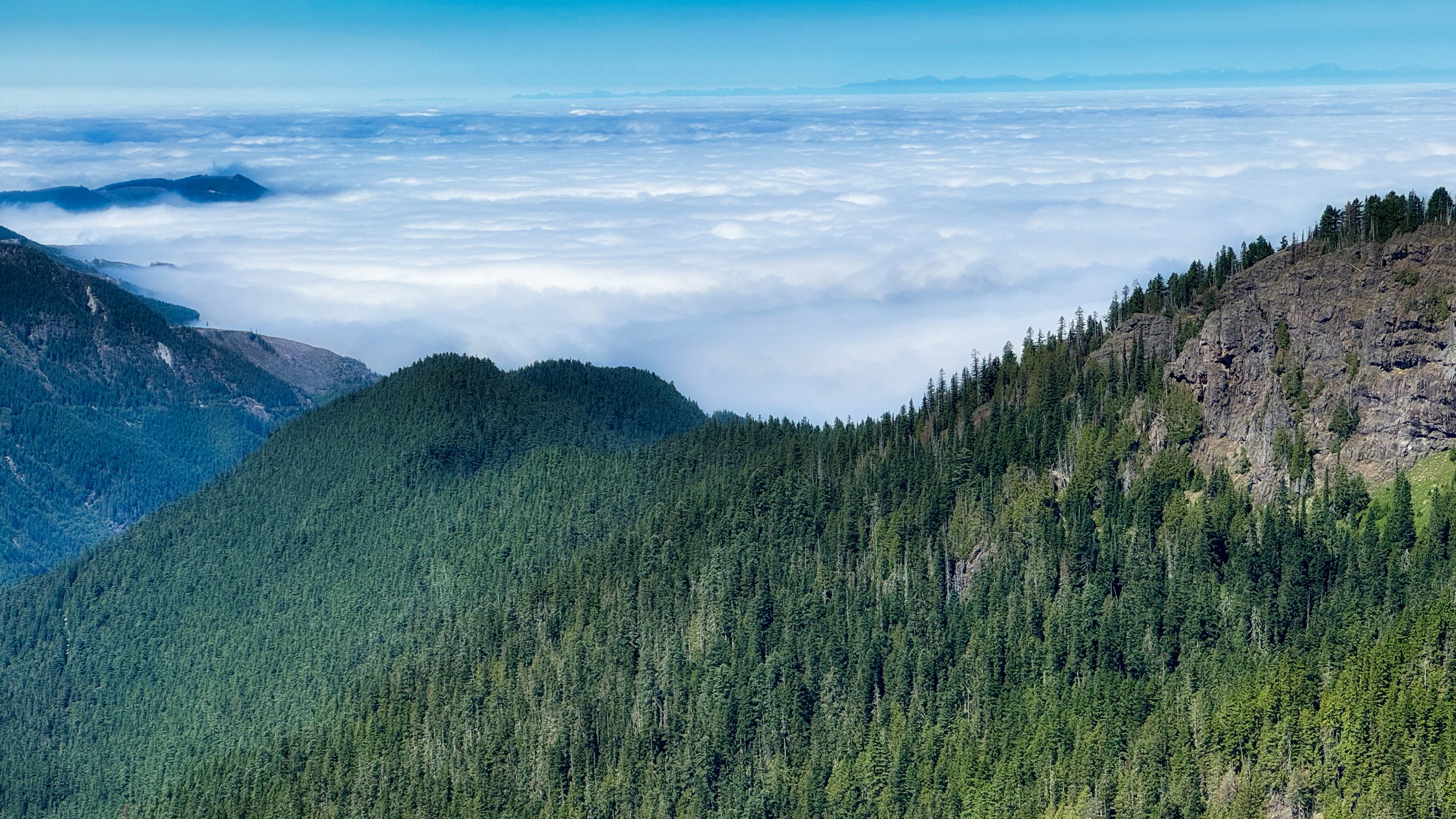
Cloud Sea in the lowlands
On August 6th I stashed my bike at the parking area of the West Side Road, then drove to the Kautz Creek trailhead to begin my hike at 5:30 AM. This trail is 5.7 miles, intersecting the Wonderland Trail at Indian Henry’s Hunting Ground. From there I proceeded CW over Emerald Ridge and St. Andrews Park, ending this portion of the trip at the North Puyallup camp.

Lillies on the Kautz Creek Trail
Let the return phase begin; I hiked the 3 mile North Puyallup Trail to gain the West Side Road, then trotted the road (utilizing the shortcut to Round Pass via the Round Pass Trail) to the parking area where my bike was stashed…this road walking phase was 9 miles. Then it was coasting 3 miles down the West Side Road to the intersection with the Longmire/Paradise road and a mild 3 mile ride back to my vehicle. All in all I traveled 35 miles over 16 hours to complete the loop. Consider that my trail hiking was 11 hours, so the majority of my day was spent reveling in the western part of the park. I even took well over an hour at St. Andrews Lake relaxing and talking to other hikers, and leisurely hiked the last bit from St. Andrews Lake to North Puyallup engaged in lively conversation with hiker Julia.
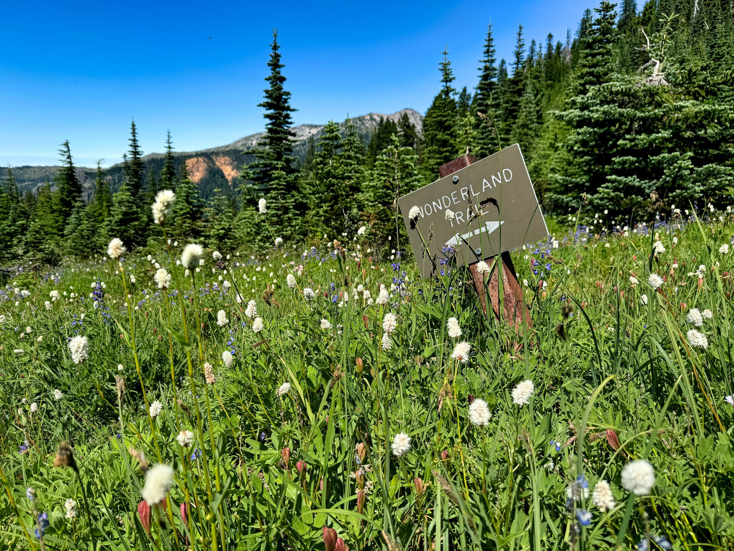
“The Sign” above Klapatche Park, Mt. Rainier
As I write this it is 4 days later; I am still sore. This is a good thing, as I know the legs will be prepared for multiple days of 8000’ of elevation gain and loss. These “shock” sessions really work. One must consider that I have an extensive cycling base (I recently cycled across the Pyrenees) and my hiking base is OK, having hiked 6 days on the GR10. This difficult day of hiking was the last phase of my preparations.