Willis Wall

CELEBRATE THE OUTDOORS

40 years outdoors experience, extensive info on Mt. Rainier’s Wonderland Trail, original music, equipment reviews, off trail videos, other peaks in Mt. Rainier NP

  • About
  • Wonderland Trail
    • Willis Wall's Views on the Wonderland Trail
    • Wonderland Trail: Complete Video Series
    • Wonderland Trail Backcountry Camps
    • Alternate Wonderland Trail Camps
    • The Northern Loop Trail
    • Wonderland in 13 Minutes CCW
    • Wonderland Enhancement Videos
    • Early Season Challenges
    • Wonderland Shorts
    • Hiking the Wonderland Trail (2006 DVD)
    • My Wonderland
    • Wonderland Trail Post 2006 flood (2007)
    • Pain and Suffering: Wonderland Trail in 3 Days
    • Wonderland Trail 2010: the "selfie" 3 day hike
    • Wonderland Trail Transits 32-40
    • RAW
    • Western Loop
    • Mowich Rivers 2023
    • Mowich Rivers 2012
    • Annual Compilations
    • Wonderland Trail Photo Gallery
    • Mt Rainier 7Up Hikes
    • Filming the Trail
    • Past Updates
  • Willis Wall Blogs
    • Willis Wall Blog
    • 60
    • Blog Posts Reference
    • 68/35
  • 35 Years in MRNP
    • 35 Years in MRNP
    • Mt. Rainier Hikes 2018
    • Mt. Rainier All Trails gallery
  • 360 Videos
    • 360 Videos
  • Grand Tour (MRNP)
    • Grand Tour (MRNP)
  • Travel
  • Off Trail
  • Video Guide
    • Complete Video Guide
    • Biking Mt. Rainier
    • Eliot Creek Crossing: Timberline Trail
    • Paradise to Camp Muir
    • Hurricane Ridge Road Bike
    • Mt. Baker Highway 542 bike
    • Washington Pass Bike (Cascades)
    • Mowich Lake Road
    • Films under construction
  • Shorts
    • On The Rocks
    • The Spit
    • Enchanted Valley Chalet Tour
    • Look Up!
    • Wonderland Short: Jaunt to Summerland
    • Wonderland Short: 2011
    • Wonderland Short: 2015
    • Wonderland Short: Emerald Ridge
    • Wonderland Short: Frozen
    • Wonderland Short: Stevens Canyon washout area
    • Mt. Rainier West Mini Loop
    • Longmire to Muir to West Side Road
    • The Hummock
    • Peakaboo
    • The Other Campground
    • West Side Road
    • Carbon Glacier
    • The Seattle Viaduct (SR99)
    • Off Trail
    • Lane Peak Gully
    • Sunshine Point
    • Chasing Turbo
    • Mt Kilimanjaro
    • Rainier in Fall
    • Skyline Trail Improvements
    • Old Black Diamond
    • Left of Spring
  • Music
    • Music
    • Audio Samples
    • Anthology
  • Search
  • Contact
    • Contact Willis Wall

Recent rains present a reflection opportunity near Kiya Lake

Wonderland Trail #40-The Leisure Hike (9/10-13/25)

September 15, 2025 by Willis Wall

My goal this year was to even up the numbers; complete 40 transits of the Wonderland Trail at age 70. It started with a trip the week before going CCW, but I was so hammered by heat and smoke that I had to bail at White River. That was a PITA because highway 123 is closed all of September. My wife spent over 2 hours getting to White River the next morning, then we had to drive over Chinook Pass 54 miles east to highway 12, then back to Packwood and the Skate Creek Rd to Longmire. That alone was over 3 hours, then we both had to wait over 20 minutes just to get out of the Longmire parking lot because of repaving and single lane operations. Add the 2 and a half hours home, and you’ve just spent the entire day in the car. This past week of September 8th originally had a poor forecast, therefore my attempt during the iffy smoke conditions. Otherwise it was wait until October and hope for a good weather window as the rest of the month was tied up. However, the forecast improved enough for another attempt, so I procured an almost optimal walk up permit at Longmire for September 10-13, opting for a 4 day trip vice my usual 3 day jaunts. Ideally, the camps for a 4 day trip would be Golden Lakes/Mystic/Indian Bar for approximately 20-25 miles per day. But Indian Bar was not available so my one long day would be Mystic to Nickel Creek at 31 miles. This, however, was good because that made the last day a short one of 14 miles. Links to July and August hikes (#’s 38 and 39)

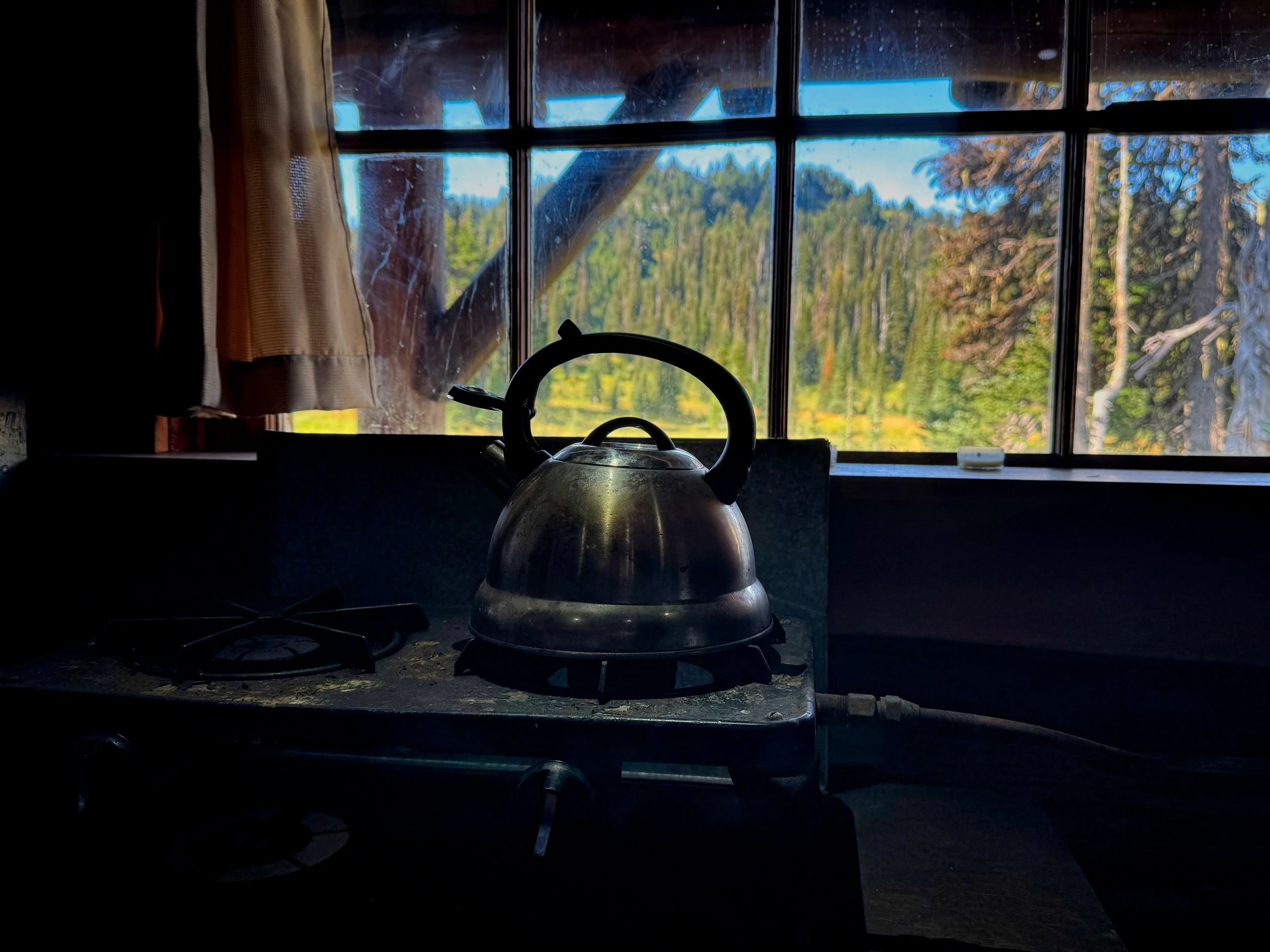
A rare look from inside Indian Henry’s ranger cabin

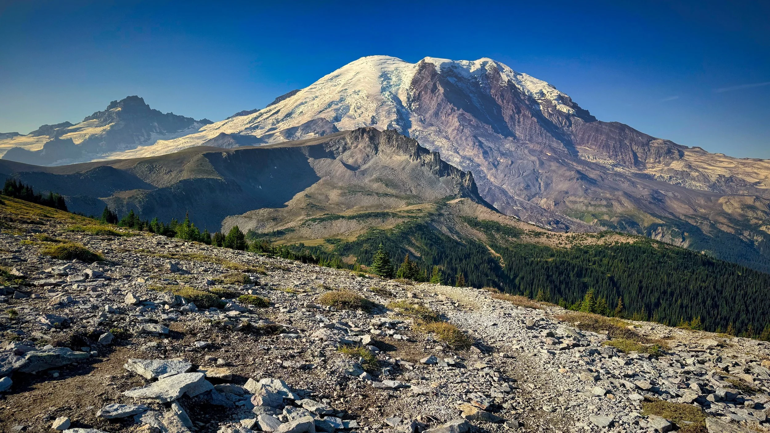
Day 1: Longmire to Golden Lakes CW (25 miles/8,300' elev) This section going CW all the way to Sunrise is now remote due to the lack of Mowich Lake and Carbon River access. It also sports consistent elevation gains and losses along the way compared to equivalent distances over the rest of the trail. I started out with a tinge of trepidation because of the lethargic and slow progress the previous week. What if my age was catching up, or my thyroid levels suddenly took a dive, etc? I've done the trail so many times in both directions that I can tell my progress based solely on the month, time of day and where I am on the trek. I have transited Silver Forest (a mile and a half before Golden Lakes) many times in the dark on previous hikes but I still had light to within a half mile of Golden Lakes; that was a good sign. I arrived at 8 PM and was tucked in and ready to sleep by 9, in an actual tent vice a bivy. That may sound a bit strange, but I haven't used a tent on the Wonderland since 2009. I pulled out a zpacks Plexamid (no longer made) that I had purchased before I retired more than 5 years ago, but never used. It took up a little more space in my Durston Wapta 30 but at under 15 ozs was actually lighter than some of my bivy options. [my pack weight for all 3 transits this year has come in at 16 lbs or less with food and 1 liter of H2O] I gotta admit, it was kinda nice to have the covered space to hang in. For those interested, this hike my sleep system was a Nunatak 40 degree Nano quilt and a NeoAir NXT short pad. Although not continuous, I got more than 8 hours of sleep...UNBELIEVABLE!
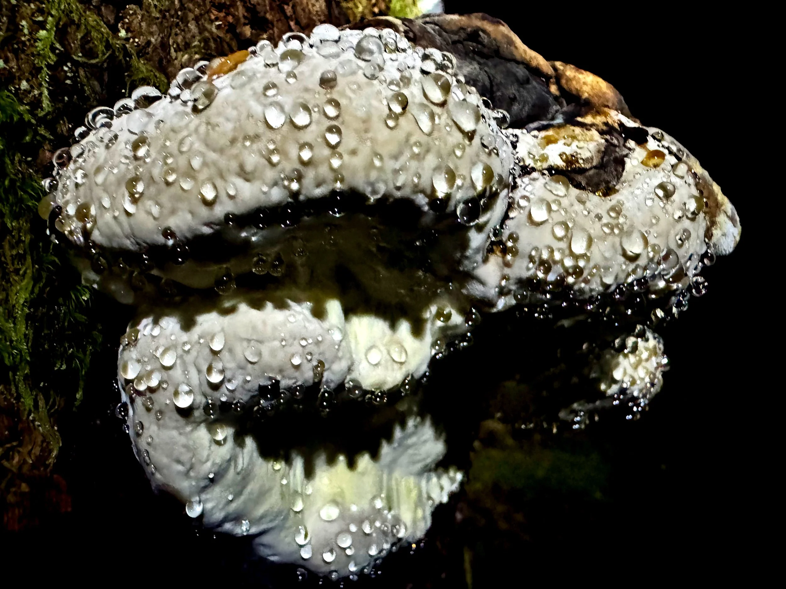
Droplets on fungi

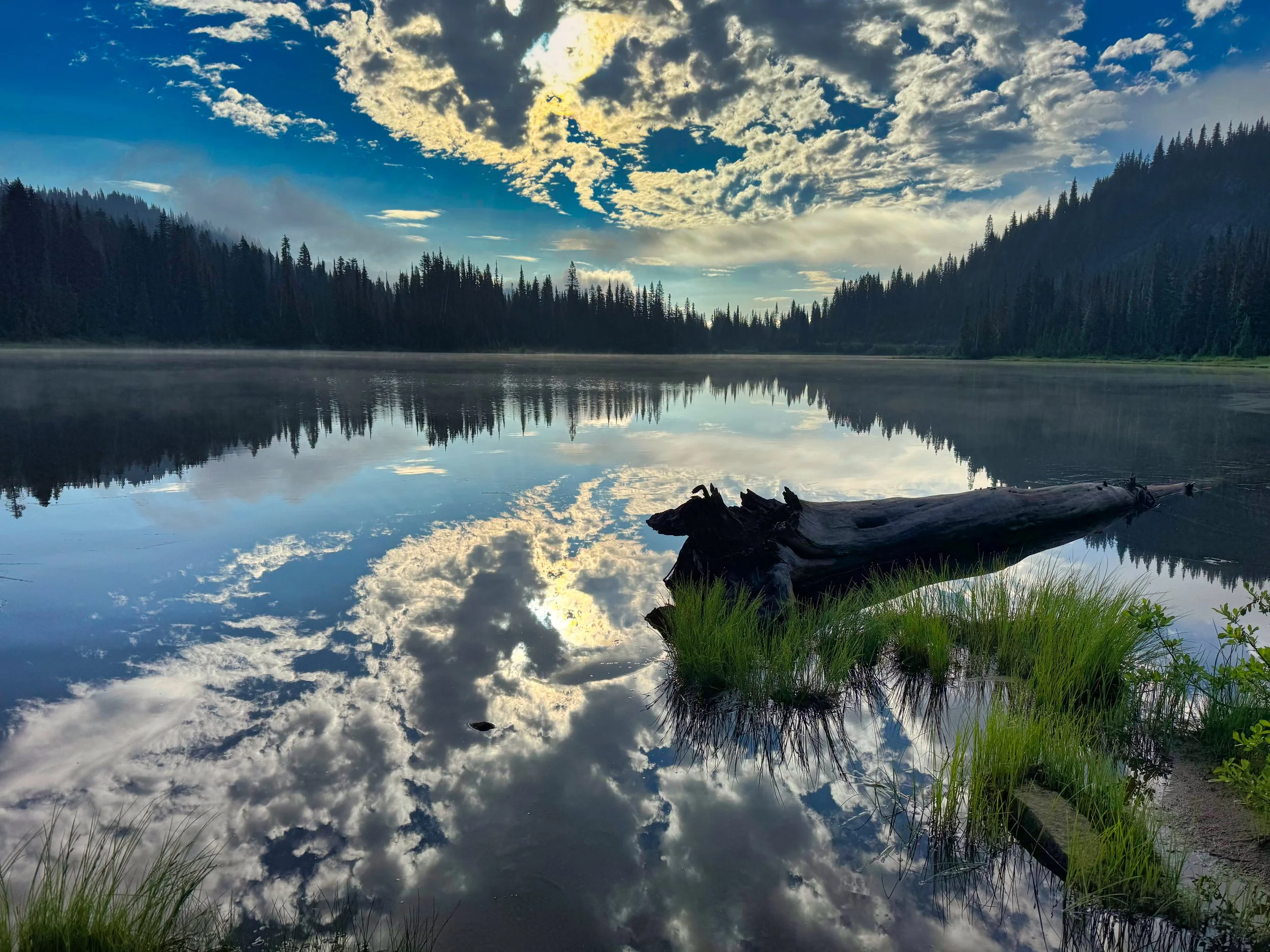
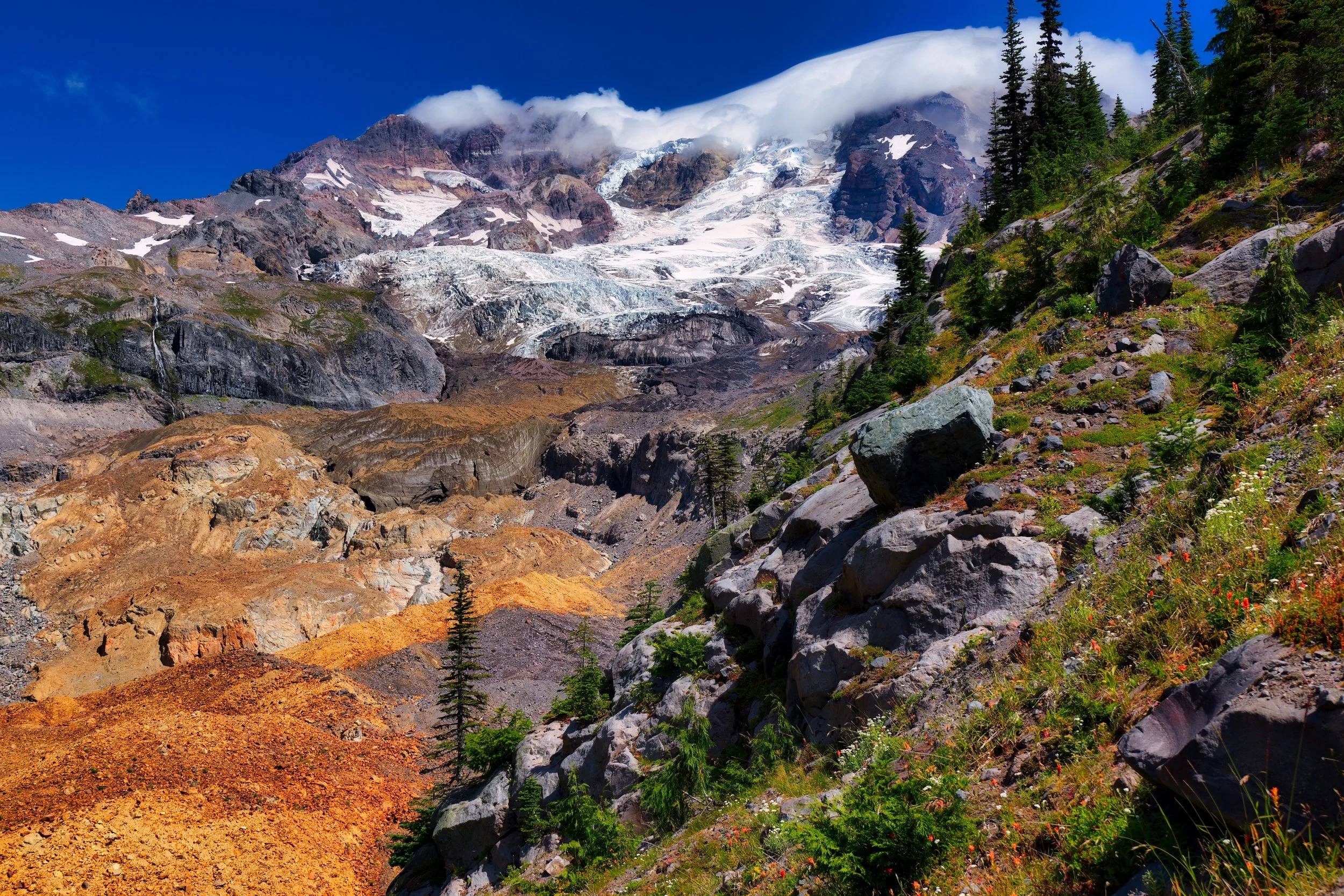
Day 2: Golden Lakes to Mystic Camp (25 miles/7,200' elev). Cool temps prevailed through most of the day, and I enjoyed the "good on the feet" downhill trot to the Mowich Rivers. Having already been over this stretch twice already, I knew exactly where the trail meandered across the flood plain. On my previous hike I marveled at the rechanneling of the South Mowich River and how the South and North mixed right before the North Mowich bridge. You could see the silty muddiness of the South on the right and the more grayish usual look of the North on the left. Cool. From there it was the climb to the now deserted Mowich Lake. I did run into two couples and we chatted for quite a while. Meeting interesting people on the trail is a big part of the experience. They even gave me the Pox, which is a drink they picked up in Mexico pronounced "posch". Then it was off to Spray Park, as I had done the lower route over Ipsut Pass in August. The low hanging clouds and light mist eventually gave way once I was above 5,000', and I thoroughly enjoyed the solitude of this part of the transit. I didn’t necessarily enjoy the rocks. It's hard to make time on the entire trail over Spray Park due to all manner of things to step over, around or on. I knew what I was in for and I was glad my feet were comfortable and blister free, unlike the blister under callus I had endured on hike #38. The light stayed with me until Moraine Park, so not a lot of time in the dark. I was worried when I arrived at Mystic because both bear poles were crowded with bags and there must have been 8 bear canisters on the ground. I envisioned the nightmare of someone poaching a site and me having to figure it out at 9:30 PM, but site #6 was free. I fiddled with setting up the tent and was finally bedded by 10:30, anticipating an early get up the next day.

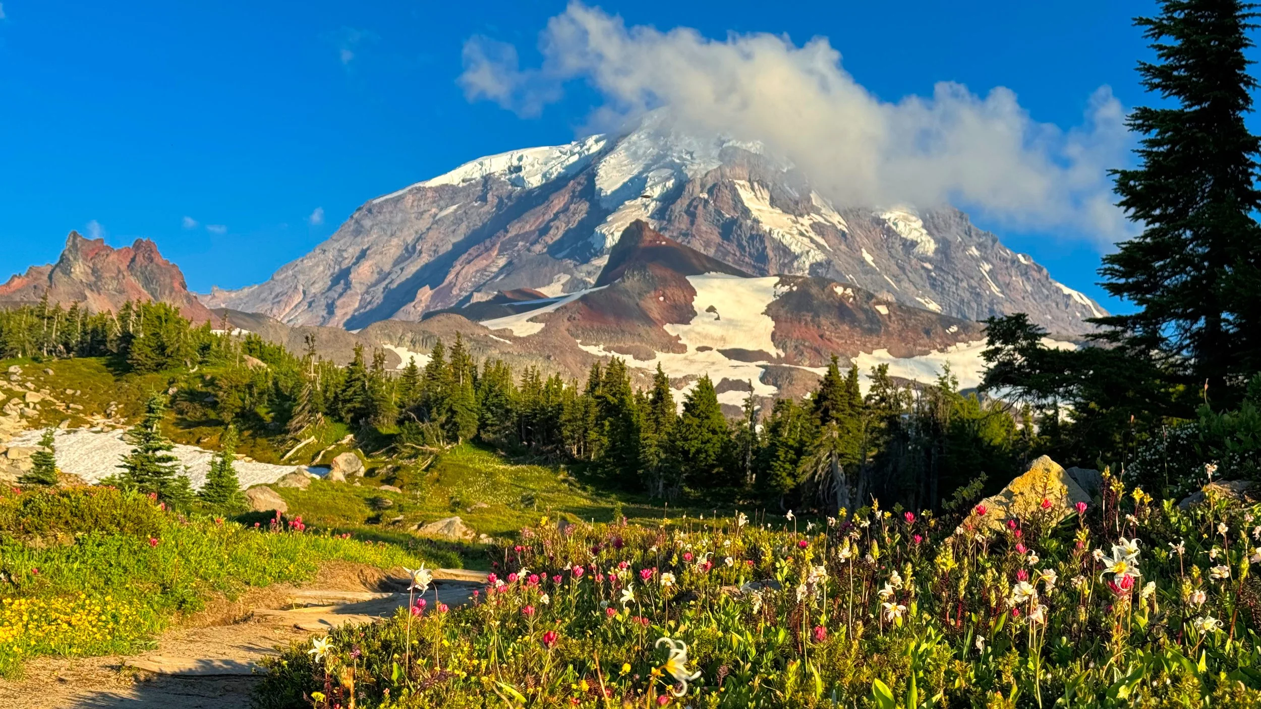
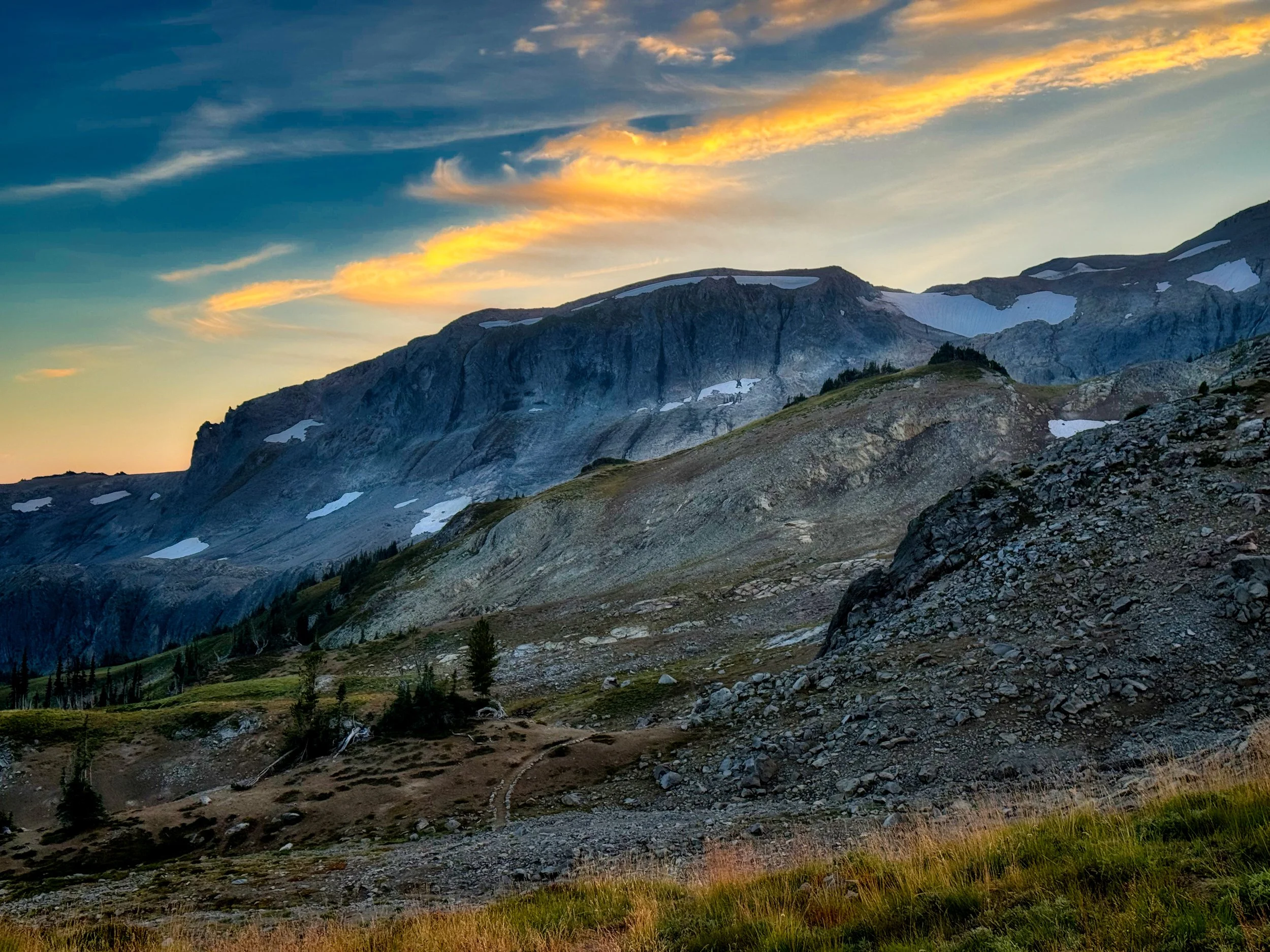
Spray Park view on the Wonderland Alternate Route
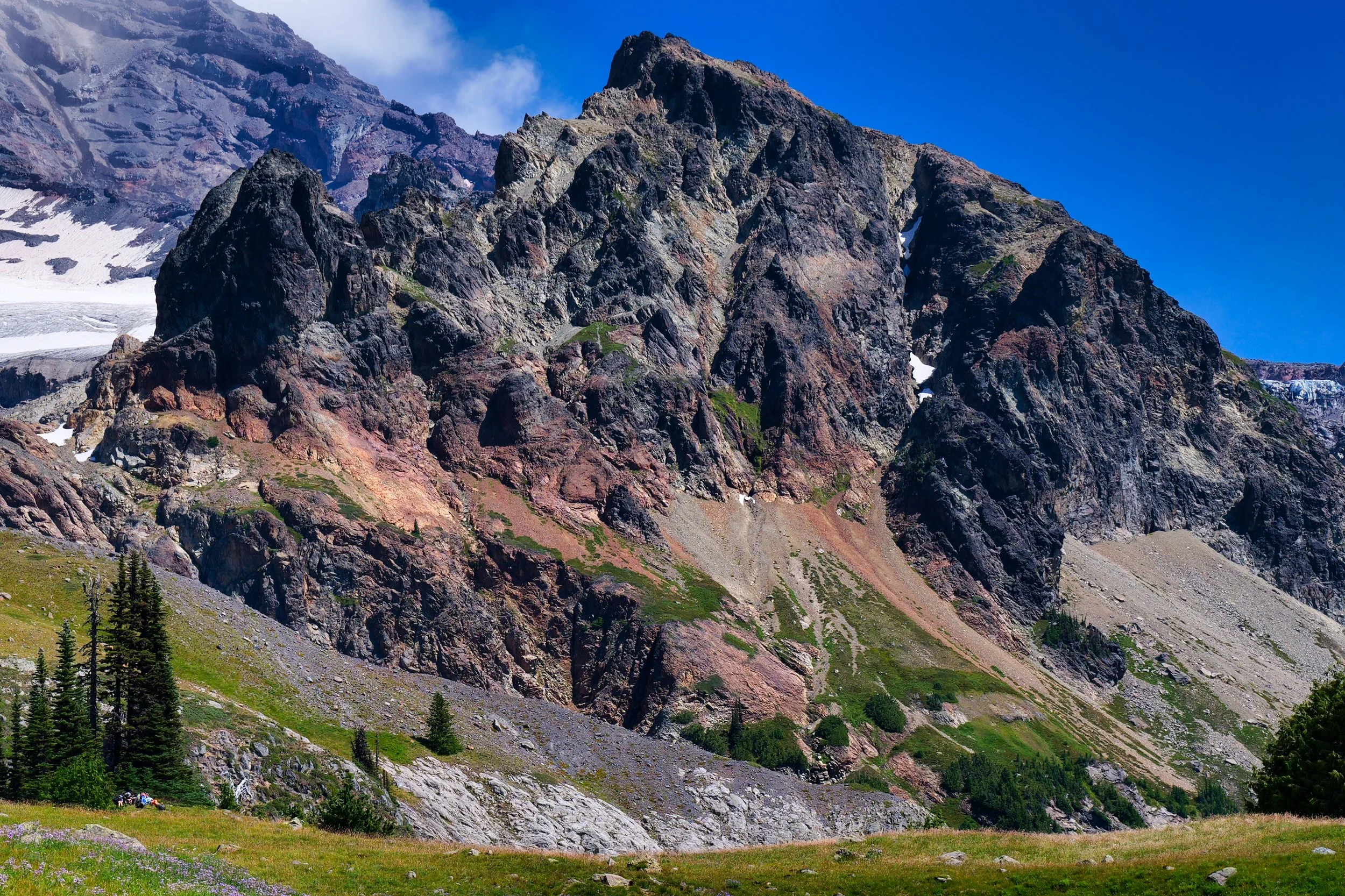
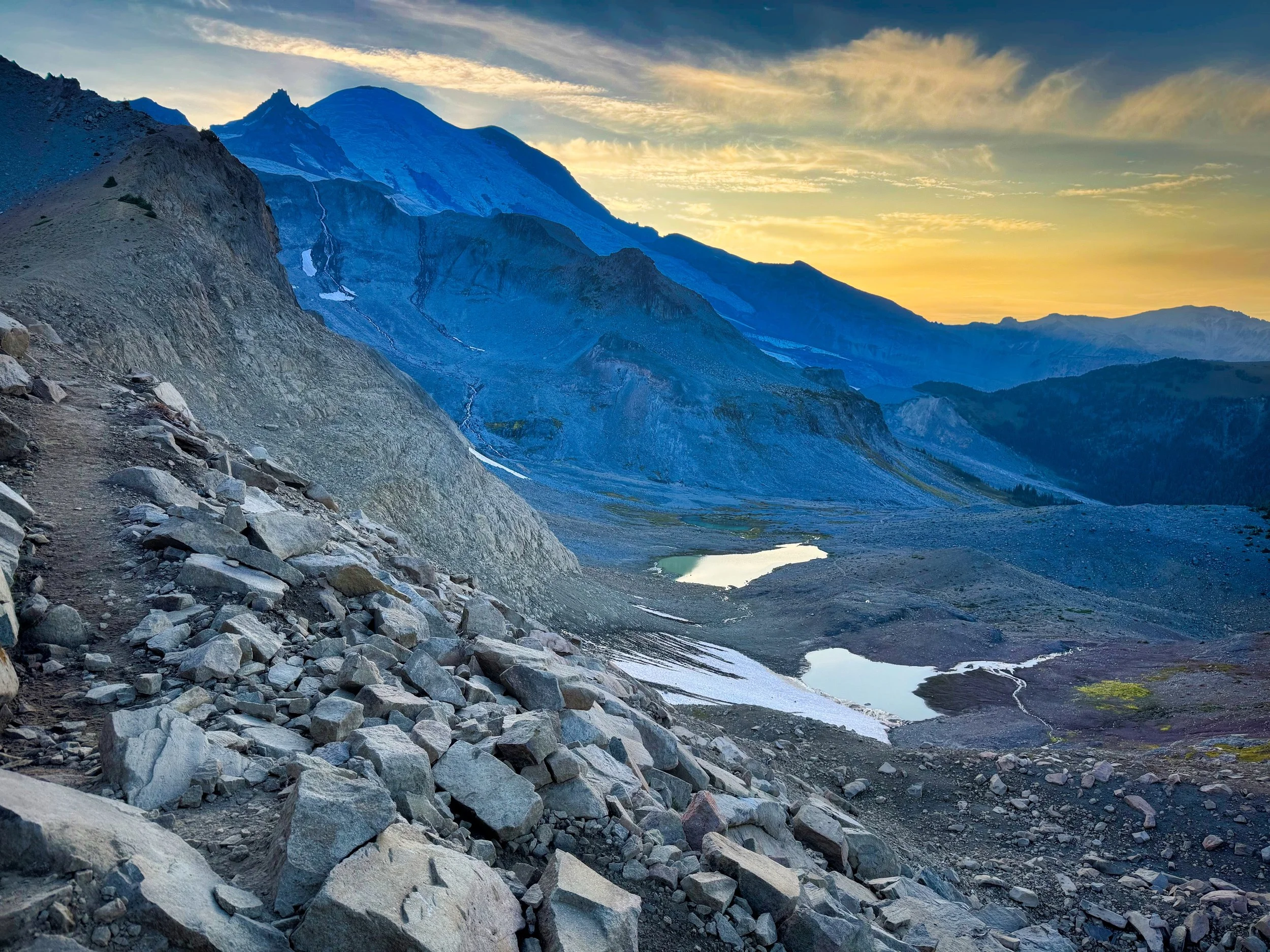
Below Mystic Pass

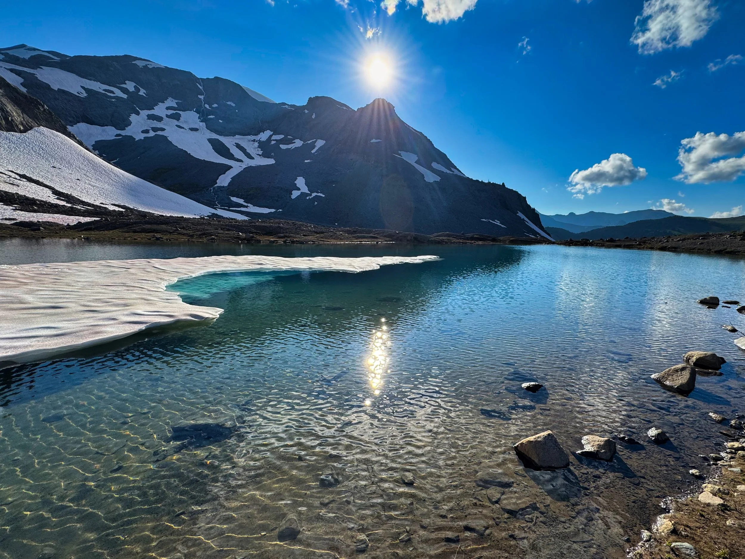
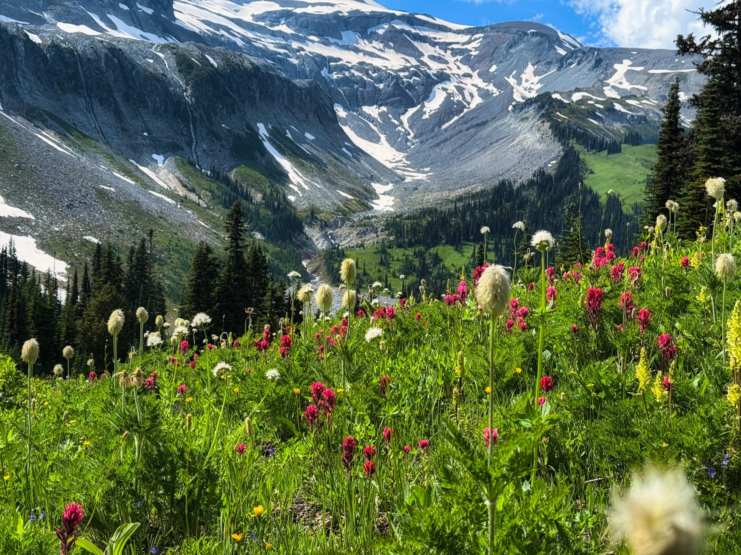
Day 3: Mystic Camp to Nickel Creek (31 miles/7,400' elev). Time for a long day, I set off for Sunrise and beyond. The day was clear and cool, perfect hiking weather. I ran into groups of people around Sunrise, looked like a guided thing going on. I made easy time going down to White River, where I stopped for a good break, washed my feet, applied some tape, changed socks etc. and disposed of trash. The White River was raging. I guess it was warmer than I thought, but that stretch of trail to Fryingpan Creek and then Summerland is just sublime. Wide boulevard, smooth trail, lack of rocks and roots, the smell of old growth forest; doesn't get much better. I transited Summerland after 5 PM, about the same time I would be there on a 3 day CCW hike. It was such a glorious evening, no wonder I passed a few people lounging in portable camp chairs and soaking up the late afternoon sun. I lingered on the climb towards Panhandle Gap following a goat family of 5. They passed me below Panhandle Gap and went over a saddle behind me. It was so quiet I could hear the shale stones clattering under hoof as the Dad led the way. By now I figured I would be able to transit Ohanapecosh Park in dwindling daylight, and indeed finally turned on my headlamp on the descent to Indian Bar. I knew what was ahead on the Cowlitz Divide, some steep up and downs until finally descending on good forest tread all the way to Nickel Creek. I was startled by a loud screech and then a bunch of hooting. I looked up screech owls but my cursory search did not come up with an answer. It definitely was not a cat. I continued on my way, perhaps at a little faster pace, until I had some distance on the screecher. I rolled into Nickel Creek late, like 11 PM, found a site and set up the tent, which I noticed was costing me about 15 additional minutes on set up and get up time. Dealing with tie outs and stakes is a bit more fiddly than throwing down a bivy. Since the following day was a short one, I set my alarm for 7:30 AM but woke up at 6:30 needing to go, and ready to go.

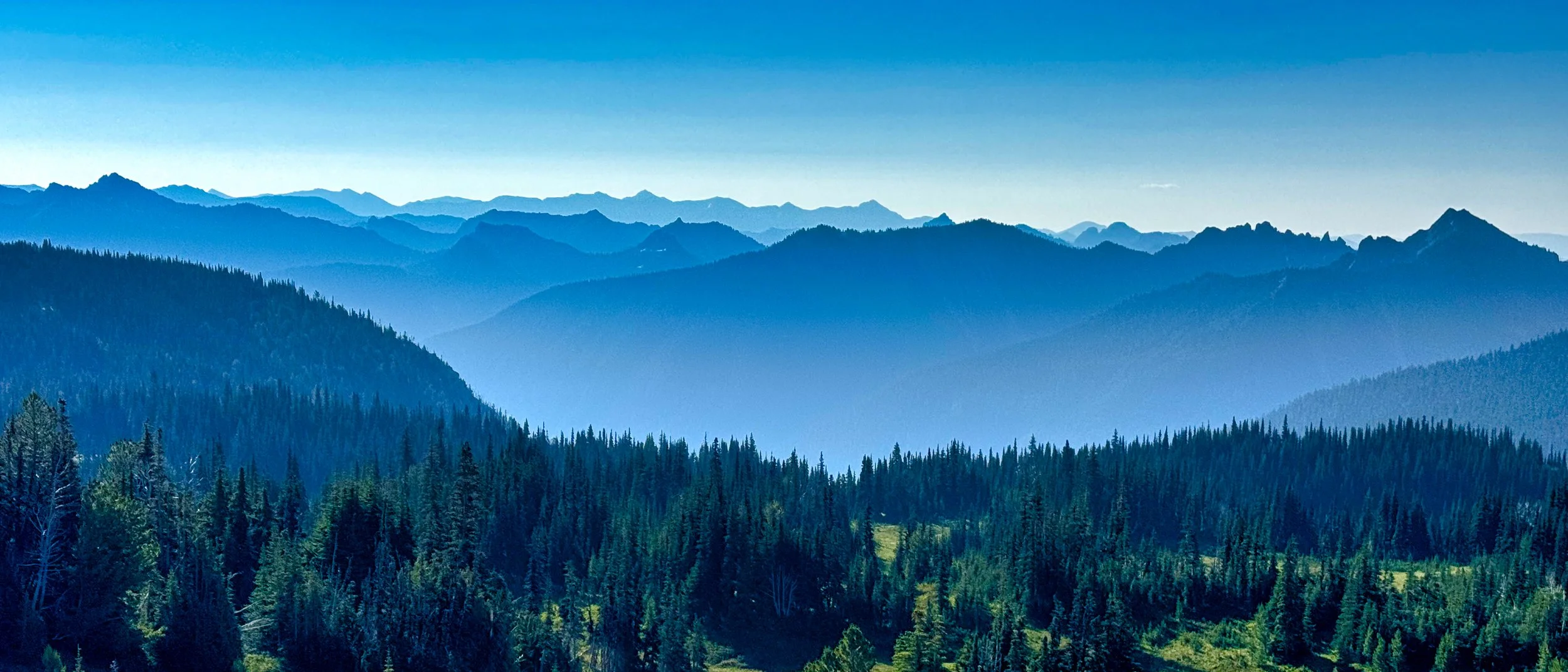
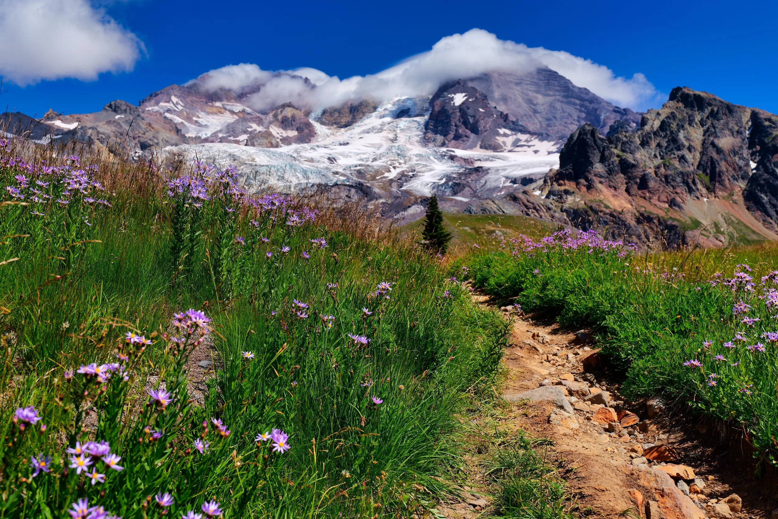
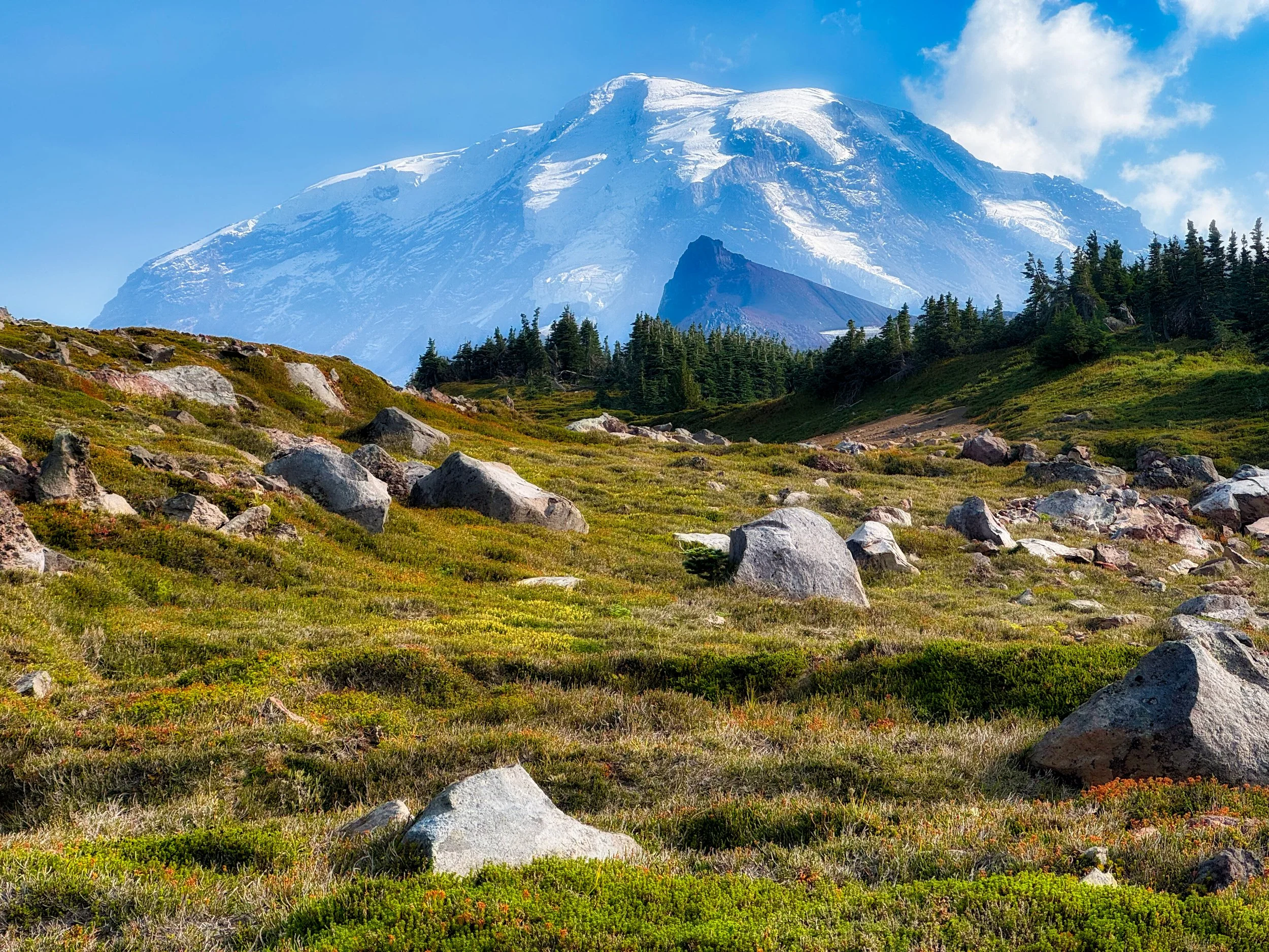
The spectacular view from Skyscraper Pass

Dwindling light transiting Ohanapecosh Park

Panhandle Gap (6780’)

Sunset in Summerland

Day 4: Nickel Creek to Longmire (14.5 miles/2,700' elev). This was truly a leisure day, and I anticipated getting into Longmire in time for lunch. Now, unbeknownst to me, my wife had planned a little surprise. The day before I had called her from Panhandle Gap and said I may hitch a ride from Box Canyon, which is only .8 miles from Nickel Creek, back to Longmire. I had already done this eastern section the week before. She encouraged me to "just do the whole thing, it's your 40th so make it a continuous hike." Well, she knows best and the weather was great. My legs felt pretty fresh, even after the 31 mile day, so I was making good time on the downhill from Reflection Lake. The dig was, my daughter was driving into the park to meet me on the trail with goodies, but she was stuck in traffic, an hour and a half, just getting through the entrance. My wife is texting her via inReach on my whereabouts. As it turned out, my daughter met me about 100 yards up the trail from Longmire, so actually worked out pretty well. I was very surprised to say the least. Then she presented me with some goodies including a cake with "40" on it and two t-shirts with a logo my wife had designed for me. I had plenty of time to drink a beer, take a shower in the van and my daughter and I had a nice lunch at the Inn. This was the best ending of any hike I've done, hands down.

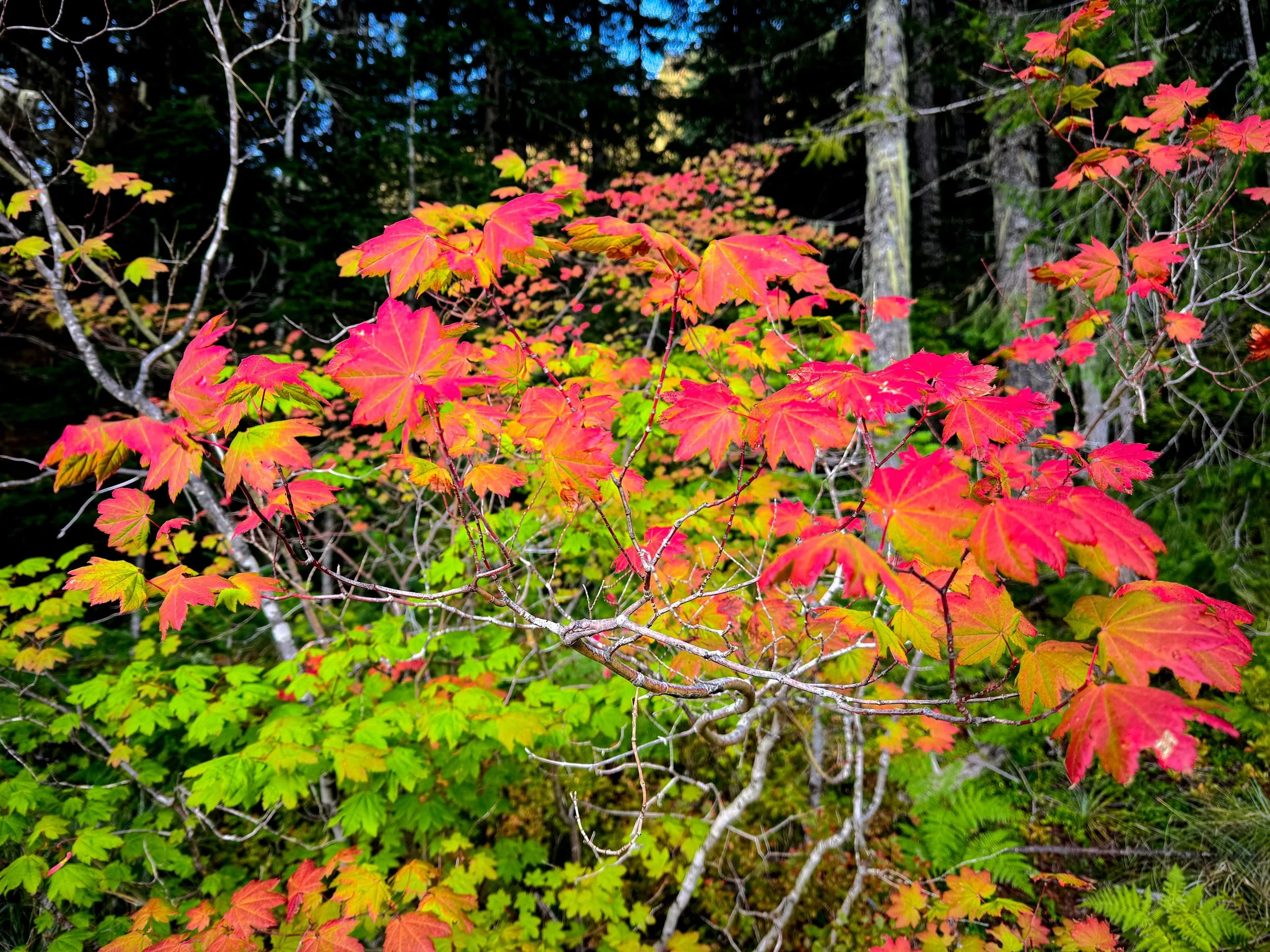
Fall is in the air in Stevens Canyon

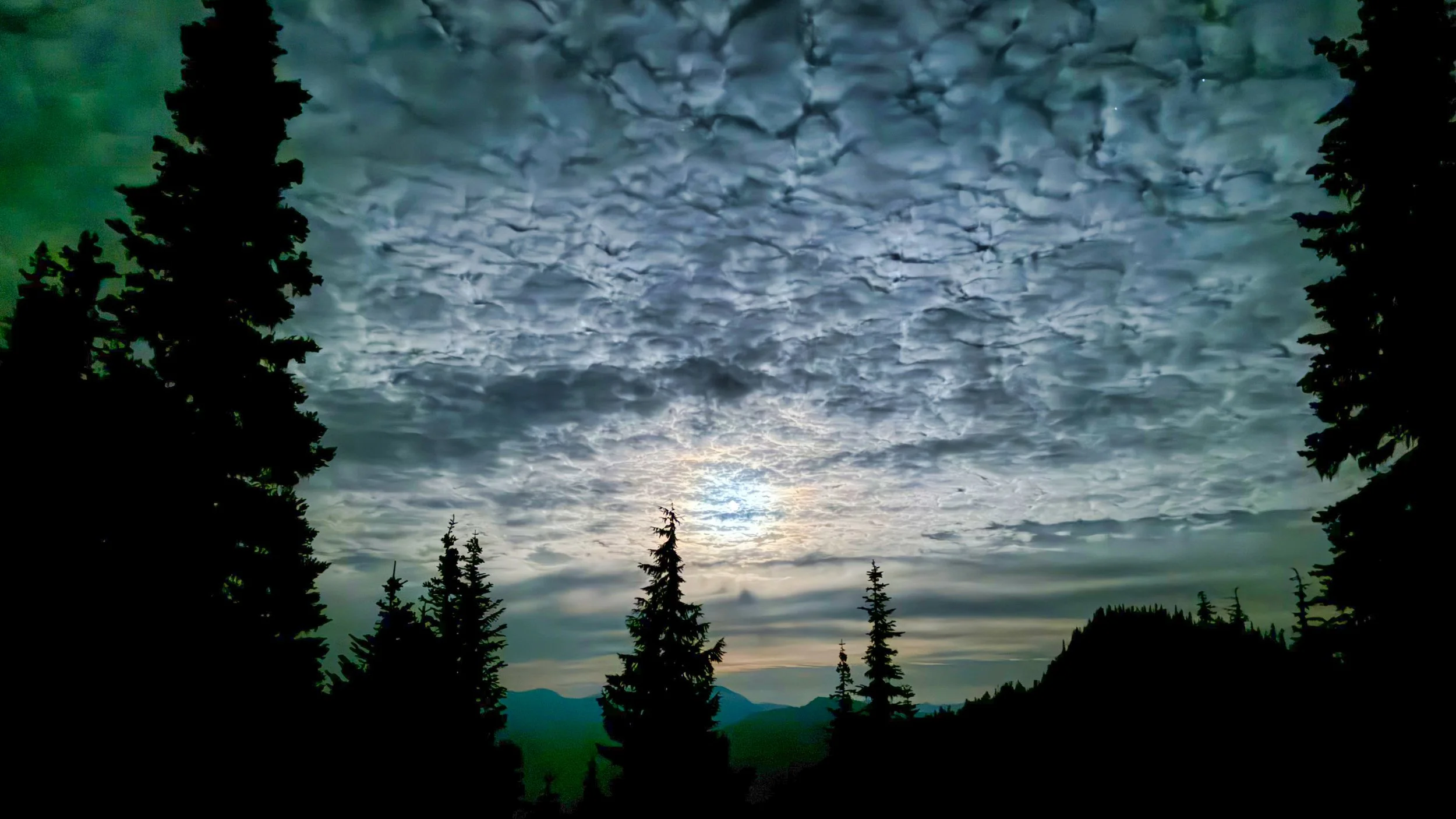
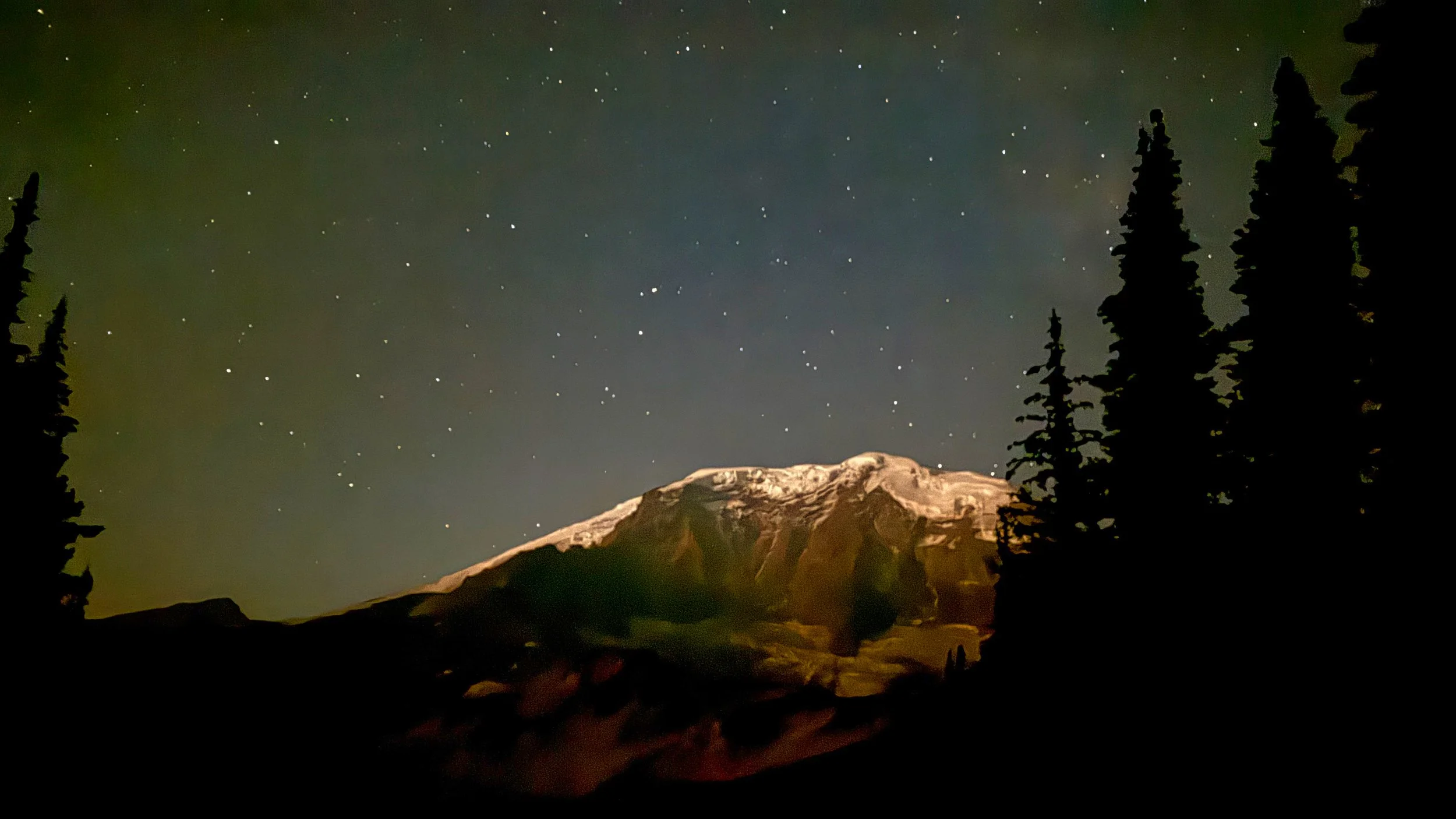
Night on the Cowlitz Divide, Day 3

Now I can relax from YoYo's and triples and just hike the Wonderland once per year, perhaps with a pie in the sky goal of doing #50 at age 80 with my daughter and grandson. I've used the Wonderland as a goal each year to help keep me fit as I age, and up to this point they've been mostly 3 day trips. I can still pull it off, as evidenced by two of them already this year, but I gotta wonder; why not kick back from here on out and do a 4 day trip? Or is it I just can't help myself? Time will tell. Happy Hiking!

Video of Willis Wall’s 40th celebratory hike can be found here

September 15, 2025 /Willis Wall
wonderland trail in 4 days, wonderland trail fastpack, wonderland trail blog
2 Comments

Reflection Lake on Day 1 of Wonderland Hike #38

Wonderland Trail #38 (7/22-24/25*)

August 15, 2025 by Willis Wall

I think of this hike as something I had to go back and “repair.” I'm planning on doing the Wonderland 3 times this year to bring my total to 40 at age 70. That way I can tick off one per year as I march on towards 80 Y/O and aim for a total of 50x. These yearly jaunts on the Wonderland are one of the goals that keep me moving. As usual I planned on a 3 day trip, probably 'cause I'm just used to it. 3 days logistically are much easier, as I can always get a walk up permit and target days with good weather, plus 3 days of food is very manageable. However, I have to admit, on day two this year as I was climbing to Spray Park I was thinking to myself WTF am I doing. But at the same time the weather was pristine and the flower show was non stop in the alpine, so it was a mixed bag of suffering and reveling. But let’s backtrack a bit. I have been using Inov8 shoes for over 11 years. I can always buy a size 11.5 off the shelf and be assured of a good fit. But recently it's been harder to find them on sale so I deviated this year and bought a pair of La Sportiva trail runners, as they have a narrow last for my narrow feet. I put 100 miles on them hiking in Switzerland and Rainier, including one 26 mile day, and things seemed dialed in. BUT, these days were long and lots continuous foot flexing adjusting to varying terrain.

Sunset over the tarn above Summerland

Day 1: Longmire to White River CCW (33 miles/8800' elevation) This day went as planned, covering the east side of the park with a splendid trip over Ohanapecosh Park and Panhandle Gap. I had company for a while with 3 ultra runners who were doing the Aspire supported thing. We kept pace with each other in Ohanapecosh and Panhandle Gap, and I stopped with Mike to film him taking a dip off an "ice berg" in the Green Tarn. After that he turned on the burners and dropped me to catch up with his other partners, so I enjoyed quiet solitude in Summerland and all the way to White River, only having to use my headlamp for the last hour or so. When I arrived at White River I saw Mike at the Aspire site, and while chatting the Aspire guys offered up beer and chips. That was an unexpected treat for sure. I settled down in my very minimal sleep system (Borah Gear bivy/NeoAir NXT short pad/Timmermade custom Alpha Direct overquilt: 24 ozs total) and got decent sleep, waking up around 5:30 and back on my feet by 6.

Above Indian Bar

Day 2: White River to Mowich Lake (26 miles/8200' elevation) Sometime during this day I started to notice my outside heels talking smack. When I inspected the feet, there was only callus there. Onward. At some point between Mystic Lake and the Carbon Glacier, I ran into Rita who recognized me from YouTube. She was also doing a 3 day trip going opposite direction, CW, and we had a nice chat. She asked if I was going over Spray Park and I said that if I hit the bridge before 5 PM, then I'd do it, assuring I had plenty of light. As it turned out I was at the bridge by 4, so set off on the climb. By now it was becoming obvious that my heels had a problem and upon closer inspection I knew that I was developing blisters under the callus. Turns out my shoes were just a bit too stiff, and contorting over roots and rocks over two days of practically constant movement for 16 hours a day; well, by then it was too late to do anything about it except slow down and try to be very cognizant of foot placement. I was dealing with the PITA of babying my feet and at the same time soaking in the glorious late afternoon sun backlighting every species of wildflower one can imagine. It was especially cool to see large patches of Avalanche Lilies sprouting where snow had obviously been just maybe a week before. Speaking of which, there was some snow to contend with but very normal for this time of year. I slowly limped into Mowich Lake around 10 PM and set up my system. Mowich can be on the raw side and I had to make some adjustments to my sleep system, feeling cold moist air on my back when side sleeping. I draped an original 3 oz zpacks tarp over the left side of my bivy to block the air and also donned a silpoly rain pullover, and this seemed to block most of the chilly intrusion so I could get some consistent sleep. I woke up and saw no stars in the sky, telling me that predawn was here so I packed up at 4:30 AM and was on the trail by 5.

The purple riot in full swing

Spray Park in the golden hour

Layers leaving Sunrise

Day 3: Mowich Lake to Longmire (36 miles/6200' elevation) This was a tough day dealing with my feet, and my pace had slowed somewhat. However, there were long stretches of trail that allowed even foot placement so my suffer meter was lower range. The descent to the Mowich Rivers (pretty much unchanged from last year) and nice steady grade up to Golden Lakes went well. The bugs had not been bad and the climbing was mostly shaded. The North Puyallup was aroaring and the climb to Klapatche Park was overgrown. I was glad to see Aurora Lake still full, as my usual transits later in the summer see no lake to speak of. When I arrived at St. Andrews Lake I had a good foot soak, and a couple who I had seen off and on most of the day offered me some Leukotape (gotta get me some), which is slightly slippery on the outside and very sticky so stays put (unlike moleskin). By now I could see the blisters poking through the callus so the tape over a padded bandaid gave me a great deal of relief. I was also thinking of an alternate plan; exiting the Wonderland at the South Puyallup camp to the West Side Road, then walking the road to the main drag. Although I was at the South Puyallup junction with plenty of time to have daylight over Emerald Ridge, I was concerned about the final outcome on my feet having to do so many more hours over rocky, rooty terrain. The road would allow normal foot placement and then it is just a matter of self extricating and walking out. When I hit the main road it was past 11 PM and only two cars passed me as I walked towards Longmire; can't say I blame them for not stopping. Around 1:30 AM a car approached from the opposite direction, and it turned out to be Rita, who had just finished her CW 3 day loop and was heading home. She slowed down and said hi ("It's Rita!"), turned around and saved me a few miles of road walking. Rita is an angel.

St. Andrews Lake

The Cowlitz Divide

* Forward a few weeks to August 13. In good conscience I couldn’t count #38 truly done until I actually hiked that last bit of trail from So. Puyallup to Longmire. I parked at Longmire and set off at 8:30 AM, biked to the parking area on the West Side Road, then walked the road to Round Pass, then hiked the Round Pass Trail to the So. Puyallup River Trail and the intersection with the Wonderland. I guess you could consider this extra mileage to get there (8.5 miles biking/6.5 miles hiking) a downside, but the upside was I could do this whole remaining section to Longmire in daylight, good for video and photos! I carried my full frame S9 since it was only a day hike. It stayed cool the entire day and even blustery, but the breeze felt great and the sweat factor was near zero. Bonus, flowers were still hanging in there. I ambled into Longmire at 6:30 PM with plenty of time to shower in the van and have dinner at the Inn.

Tahoma Glacier, on the climb to Emerald Ridge

Glacier Island

This extra make-up-bit compressed my time between hikes, so next week I will embark on WT #39. Let’s hope the old legs will scream a little less this time around. Link to #38/39 video Happy Hiking!

Emerald Ridge

August 15, 2025 /Willis Wall
wonderland trail, wonderland trail blog
Comment
Calm before the storm

Calm before the storm

Wonderland Trail Planning 2016: Permit Chaos

March 25, 2016 by Willis Wall

It's hard to believe that an entire computer system could be taken out with no backup, but that is apparently what happened this year at Mt. Rainier NPS. Read all about it here. The bottom line, all permits for 2016 will be walk up. For locals this may not be a big deal, but for those non Washingtonians who have vacation planned and are flying into the state to hike the Wonderland, it throws a big monkey wrench in there and creates a whole lot of uncertainty. From the NPS website:

Permits must be obtained in person at the Longmire Wilderness Information Center (7:30 am - 5:00 pm), White River Wilderness Information Center (7:30 am - 5:00 pm), or the Carbon River Ranger Station (hours vary, call in advance). Remember to bring: 

  • An emergency contact phone number
  • The license plate number of any vehicle being left behind in the park
  • The make, model, and color of the vehicle

There is no fee for a first-come, first-served permit.

What about caching food? Do I try to get a permit the day before and then drop off a food cache, drive to the other side of the mountain and start my hike there? How long will the Park Service store the food? Do the caches need specific pick up dates? Lots of questions arise from this scenario when one can't count on reserved sites on specific dates for advance planning. One can only guess about lines at opening times; perhaps people will abandon Wonderland plans this year and go somewhere else, dramatically dropping thru hiker numbers? Or perhaps long lines will necessitate hours long waits just to talk to a ranger? From my experience doing only walk up permits, frustration can creep in as the people before you chat and waffle on where they want to stay, asking endless questions that point to a lack of planning. One thing is for sure, if you plan on going through this process make sure you have multiple options written down so you can go to plan B or C and so on.

This could be a bonanza year for fit hikers that can cover long distances, allowing for myriad possibilities on the walk ups, especially if not caching food. The walk up scenario certainly better fits this demographic versus people who were planning on 10 to 14 day hikes and the attendant logistics, not to mention the vagaries of where to stay if backcountry camps are unavailable for a planned 10 mile day max.

Because of my familiarity with the park, future posts will present some itineraries that better suit this walk up permit only system. For example, shorter loop hikes that require only one or two night stays, like the "Eastern Loop Trail." There are innumerable ways to explore Mt. Rainier National Park without resorting to a 10 day Wonderland Trail hike. I'll present some shorter jaunts in the following list but stay tuned for more suggestions on how to take advantage of this park hiccup for 2016.


Mt. Rainier: The 7Up Hikes

Mowich Lake Loop

Mt. Rainier Grand Tour:

Part 1 (East)           Part 2 (Elysian/Moraine Loop)             Part 3 (North)


March 25, 2016 /Willis Wall
wonderland trail planning 2016, wonderland trail permits 2016, wonderland trail blog, wonderland trail williswall

© 2025 Willis Wall Multimedia

all rights reserved