
Mt. Rainier NP: Tamanos Mountain (6790') 10/04/2020
I woke at 3:30 to tend to old man matters. Soon after crawling back into bed, I heard "rustle scritch scritch rustle." We all know what that means; a mouse had found its way into my castle. My day pack was up between the front seats and it still had a bag of snacks in it. Lights on, shoe in hand, I saw the little b@stard scurry under the drivers seat. I opened the door and slammed the floor with a shoe, trying to force him outside. I still don't know if it worked, but I went back to sleep with the lights on and awoke to my 6 AM alarm. The White River overnight parking lot was still pretty full, being a Sunday morning with this incredible weather. I wanted to get to the Owyhigh Lakes trailhead early to have a parking spot. I needn't have worried. I was the only one there when I left, and the only one there when I arrived back from the hike. I checked my container of food under the bed for evidence of mouse chewing but found none, so I got to work cooking up a huge breakfast to last me the day.
With my earliest start since doing the Wonderland, I set off at 7:23 AM to Owyhigh Lakes and soon found the way trail that would lead me to the saddle for Tamanos. I had been here before so knew the view that awaited me, climbing the golden meadow as Rainier crowned and arose in the distance. What a view, with Goat Island Mountain, Summerland, the Sarvant glacier with Banshee and the Cowlitz Chimneys stealing the show below The Rock. I also had a clear view to Whitman Crest and the ski route I did last year. As impressive as the saddle view was, I was hoping for a topper on Tamanos so set off in that direction. There is a nice clear path most of the way to the top, skirting the rocky outcroppings on the left when necessary. Even with little exposure I felt a little giddy transiting the rocks to the summit. I never have enjoyed heights, but I sure enjoy the views! And in keeping with what is now tradition, I FaceTimed my daughter and shared the views with her, this being another 4 bar summit. The skies were severe clear, the breeze was light and cool, the body was tuned to all the sensory input (big bird caws and howling coyotes!). A day in the mountains doesn't get any better than this. The descent was just as enjoyable and when I arrived at the saddle again, I laid in the grass for 30 minutes munching on peanut butter M&Ms and double stuff Oreo cookies, all the while taking in the vast expanse before me. I had already decided on a single peak, putting Barrier aside...I needed to get back to civilization and get some mouse traps, just in case. Stats: 11 miles/3400'
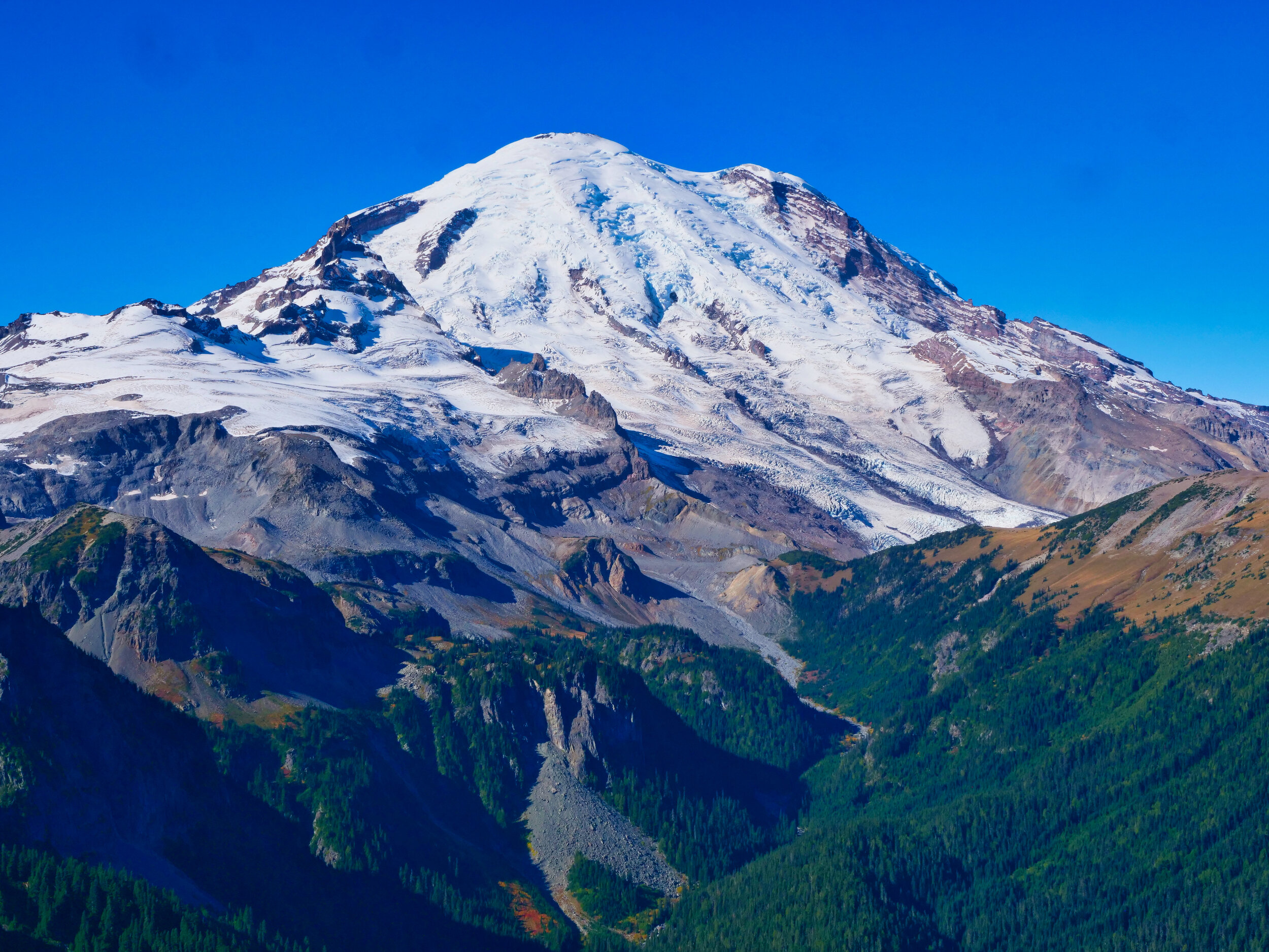
Mt. Rainier towers above Summerland from the summit of Tamanos Mountain (6790’)

Fall is upon us below Tamanos Mountain, Mt. Rainier NP

Owyhigh Lakes with Governors Ridge, Mt. Rainier NP

The weather, it be a changin’ (October 4th, 2020)