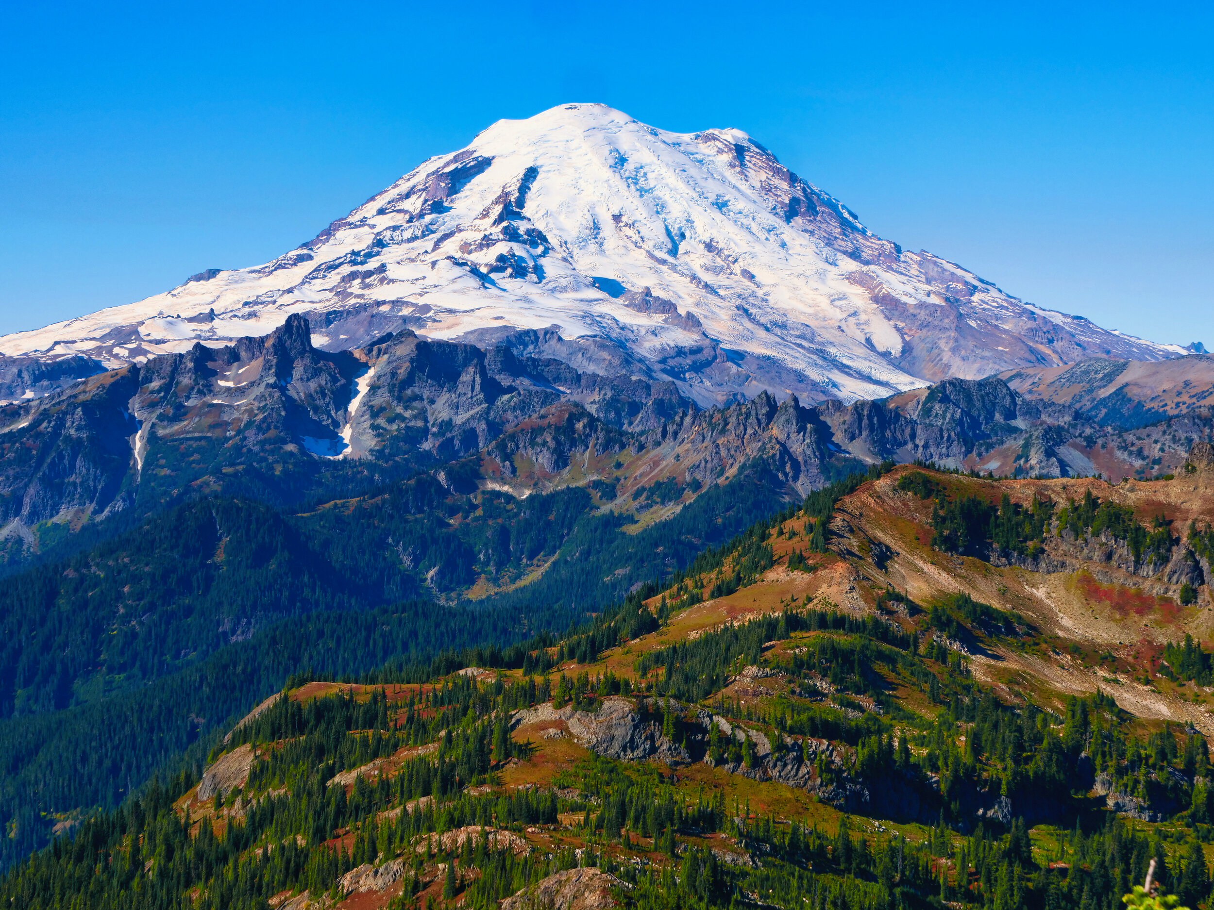
Mt. Rainier NP: Tahtlum Peak (6567') 10/03/20
After a recovery day in Packwood on Friday, I went back into the thick of weekend traffic in beautiful weather with a trip up 123 to Chinook Pass. I really only had one peak in mind, that being Tahtlum, with Seymour (6337’) as a maybe. My feet were still slightly off kilter, despite soaking them in hot soapy water for 30 minutes the day before. I found a nice spot to park and headed south on the PCT. Although I use a guidebook for these peaks, the descriptions are sometimes vague….”at 5900’ head left for Tahtlum Peak.” It’s probably a good thing, one must make decisions and discover their own way sometimes. That wasn’t really necessary for this peak, as a climbers trail made the navigation quite easy. If I can use poles all the way to the summit then the way isn’t so bad, and Tahtlum fit the bill. I made my way over two bumps and started the ridge upwards. If the trail disappeared it was soon rediscovered by scouting best terrain and using one’s noggin. I was quite pleased to pop up on the summit and find a van sized level spot with astounding 360 degree views, unimpeded by trees. Speaking of van, I was able to see my white beauty glistening in the sun down at Chinook Pass. Soak up them rays, Mr. Solar, gimme dat energy! I rotated constantly….east to Rainier, north following highway 410 as it arrowed towards Yakima, south to Mt. Adams and Goat Rocks….hey look, what a nice view of Dewey Lake! Let’s turn off airplane mode and see if there’s any coverage…..4 bars! Time to FaceTime my wife and my daughter and show them the views. It’s a thing for us now. I sat on the pointy rocks and had a snack, taking in the views and the soft breeze. I studied Seymour and wondered if I could fit it in, so departed and made my way back from whence I came. I turned left (south) on the PCT and thought I might at least check out the way trail to Seymour. After some distance but before Dewey Lake, I spied a faint path that seemed like the right place and launched into the unknown. Although I lost it a few times I soon found it again, and I continued on it for a while until I came to a large blowdown. By now it was 1:30 and I hadn’t even come to a place to head up to the Dewey-Seymour saddle. I just didn’t want to go that late and push it, so I retraced my steps back to the PCT and regained my mobile abode at 2:30. There were (as could be expected) throngs of people on the way back. However, I had lots of alone time when off the main course so didn’t mind. I had a sudden thought to check out Naches Peak, very close to where I parked. Then I read the description….”difficult scramble, short, very exposed section near the top.” Not today. I drove down to the White River entrance and parked in the overnight lot at the campground, which officially closed last weekend on September 27th. One thing about a van that is under 20 feet….I can fit in regular parking spaces. Here I sit, typing this after processing photos and video with a clean body and full belly. What should I do tomorrow? Stats: 8 miles/2600’
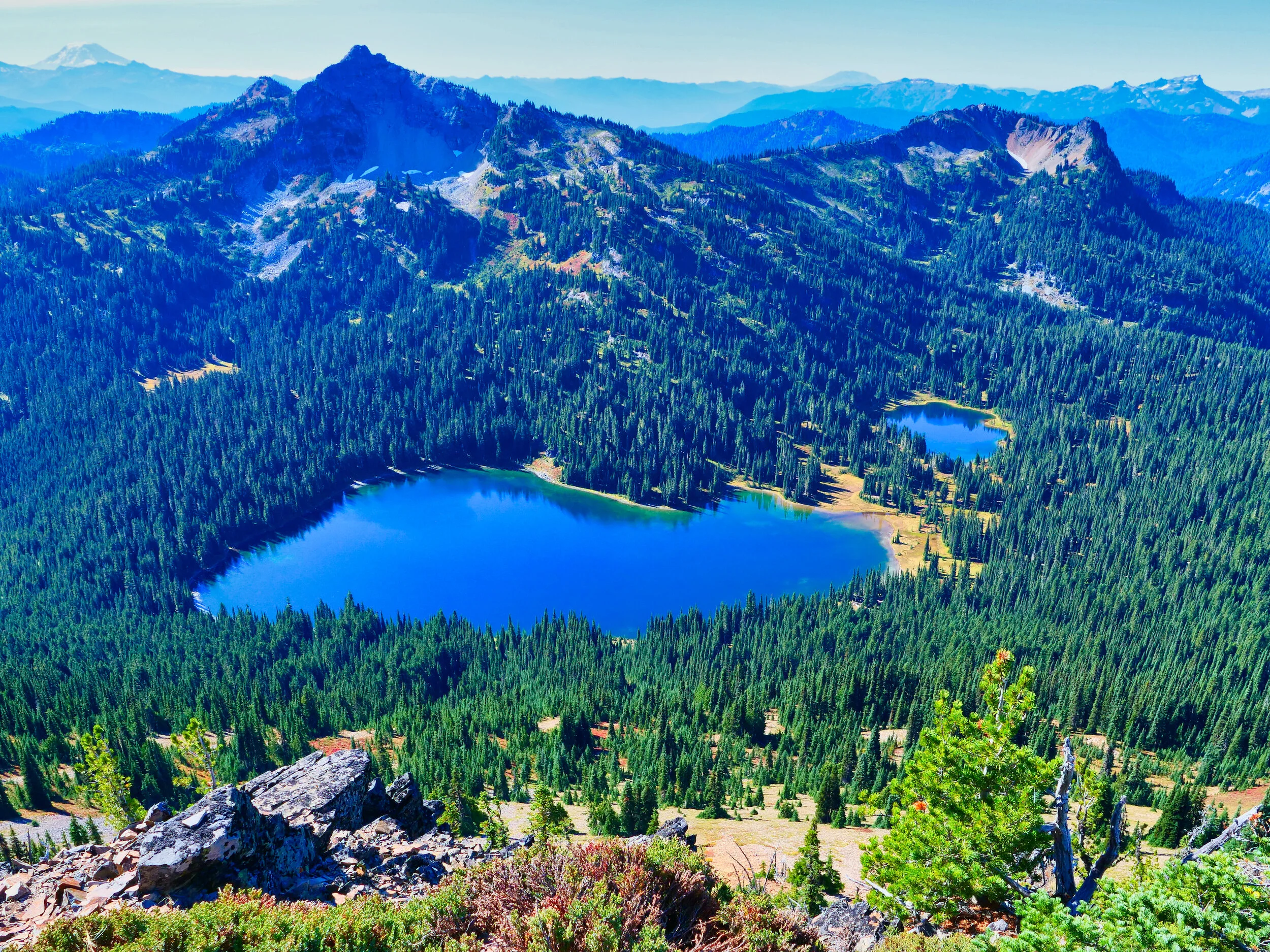
Dewey Lake from Tahtlum summit, Mt. Rainier NP

Mt. Adams and Goat Rocks looking south from Tahtlum summit