Mt. Rainier NP: Wahpenayo/Chutla/Eagle Peaks 9/28/20
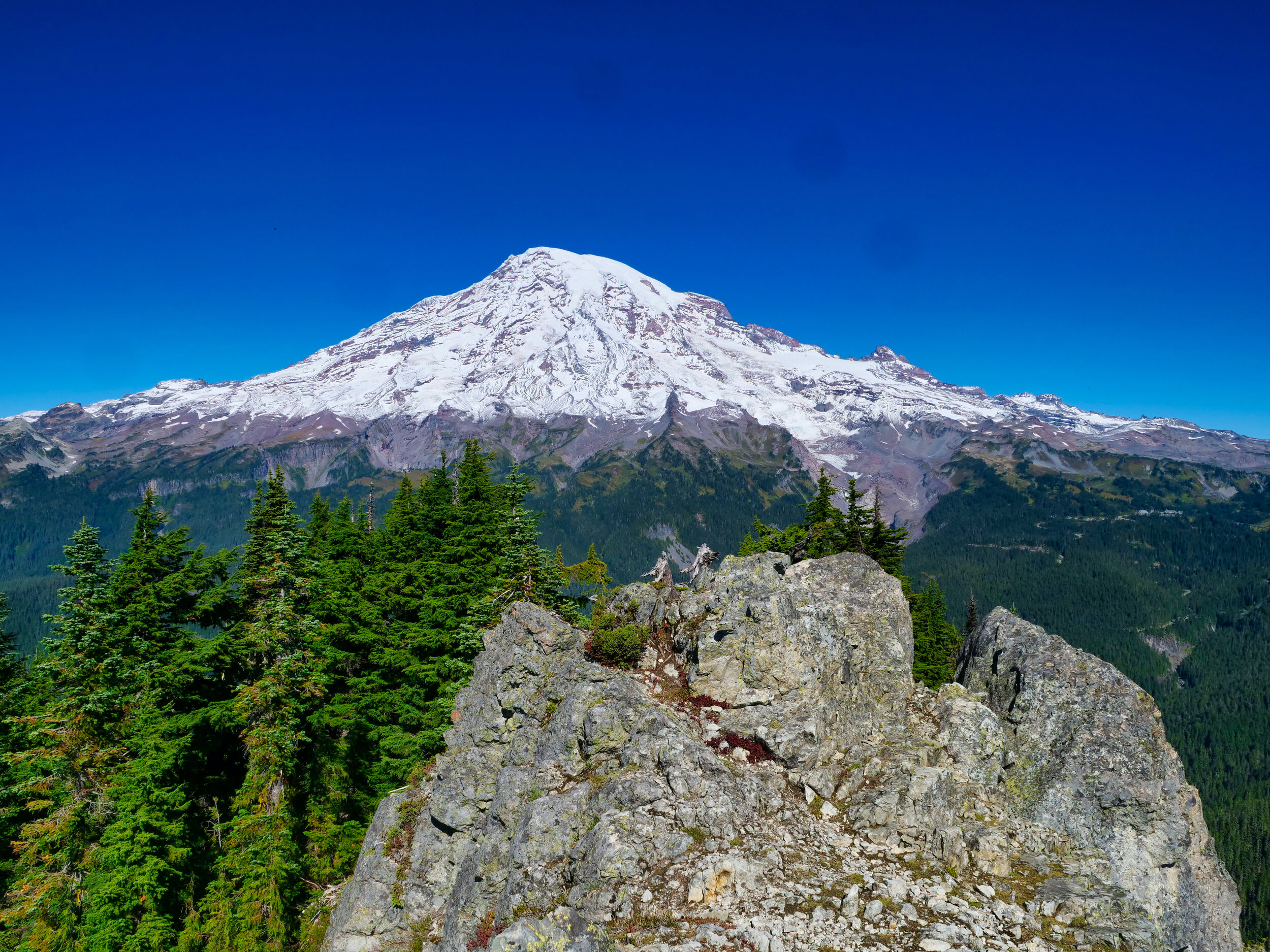
On Sunday, Sep 27, I drove to Mt. Rainier National Park with a peak bagging plan to take advantage of a superb weather forecast. The first part of the plan was to camp at Cougar Rock again for 2 nights, as I had a permit in hand for the Tyee Peak cross country zone on the night of Sep 30th. That trip will involve most of the Northern Loop Trail, but I needed to be in place at Sunrise on the night of the 29th to get a decent start. Last time I checked Highway 410 was still closed, so on this first day of good weather I could do the short drive to Longmire and park at the Eagle Peak trail head. After breakfast and a good night’s sleep, I hit the trail at 8:17 AM. The Eagle Peak trail is fine, gaining 3200’ without undue stress. However, I broke off the trail at 5000’ and proceeded cross country to the Wahpenayo-Chutla saddle. This off trail stuff is slow going but I picked up a faint boot track off and on which deposited me at the saddle. Lots of huffing and puffing on the steep parts. The description of Wahpenayo (6231’) rates it a moderate scramble with an exposed section but I found it straight forward. The views on the ridge were incredible, with Rainier in your face with a distinct new snow line and the Tatoosh range to the east. Mt Adams and St. Helens were also vying for attention. I spent a short time on the summit, hoping there would be a way to continue from the saddle to Chutla, but it was too cliffy. I descended the way I came and contoured below the cliffs, eventually making my way up a steep meadow. Huff and puff. I was guessing where I could attain the saddle but lucky me, I intercepted the boot path for Chutla and climbed this steepish bit to the saddle. Chutla (6000’) is an easy walk from the saddle but I was starting to get tired from all the steep work. For shitz and grins I took my phone off airplane mode on the summit and voila….4 bars! I called my wife, texted some photos and FaceTimed my daughter. Luckily she picked up at work so I was able to show her the 360 views from the summit. This is the 3rd time I’ve been able to connect with her on a hike, it’s getting to be a thing. So again, no direct route to the Eagle/Chutla saddle so I went back down and continued on the way trail to the saddle.
Now I was hot, thirsty and feeling a little worked. I took a break in the shade and made myself steel up for Eagle, which looked daunting. From the description there was supposed to be an exposed step close to the summit, but I guess I followed the boot path to a ledge lower down, described as somewhat exposed but straight forward scrambling. This proved to be true, my trousers were still empty and after carefully negotiating the ledge the trail led easily to the summit. Yet another in your face view of Rainier, and from each of the summits I could see Paradise. On Eagle (5958’), the Nisqually bridge was also in view. After decades of doing the Muir snowfield and looking at the rugged Tatoosh range on the descent, it was quite satisfying to look back from over here. Now all I had to do was descend and down climb those sections, which I find more difficult than ascending. Once off the ledge I breathed a sigh of relief, especially when I made the saddle and the trail was now before me. I took off my helmet and unpacked my poles for the 3200’ descent, glad to be back in the woods and out of the sun as I had depleted my water and was feeling a little dry. But not dry enough to bother with filling up the bottle at the creek I crossed as I knew I would suck down a couple of Limoncello soda waters at the van. This was a hard day for me with all the scrambling but I figured if I was gonna be up there I needed to bag all three peaks. I write this after a hot shower, a large influx of liquids and a huge dinner with a frozen snickers ice cream bar for dessert. Tonight I’m going to head up to Reflection Lake and see if I can capture the Aurora. After a nap. Stats: 11.3 miles/6600’

Mt. Adams to the south of the Tatoosh Range, Mt. Rainier NP

Eagle Peak (5958’) from Chutla (6000’), Mt. Rainier NP