
Mt. Rainier Grand Tour: Observation Rock, Ptarmigan Ridge
This was the last spot for me to hike on the Mt. Rainier Grand Tour, a self concocted trip forging up ridges and cleavers to afford astounding in-your-face views of Mt. Rainier's exquisite glacial topography. If done all at once as an orbit, the Tour entails 150 miles of hiking and 50,000 feet of vertical. However, you will do a bit more than that if taken in sections as I have done. This day trip turned out to be 15.5 miles with 4700 feet of elevation gain/loss. With tricky weather of late, I tried to take advantage of favorable conditions on Saturday September 24, hitting the trail at 7:45 AM after enduring the washboard road from hell to Mowich Lake. The weather held well enough but trended towards clouding up as the afternoon waned. However, I was able to summit Observation Rock (8376') with still open views; only the upper mountain was clouded over. After Observation I made my way up Ptarmigan Ridge to an obvious prominence and was rewarded with stunning vistas all around on the tiny summit, which my GPS put at 8670 feet. Like so many of the other points on the Tour, getting to these elevations allow one to gaze down upon the glaciers for intimate viewings of the world of rock and ice. Then just turn around and survey away from the mountain, picking out points passed on the Wonderland or climbed on the Tour. My objective in concocting the Grand Tour was to experience Mt. Rainier National Park both high and low, without the need for technical gear. I have hit every point on the Tour wearing trail runners (no microspikes or ice axe) and only aided by trekking poles or my ZPacks staff. Granted, on today's hike the Flett Glacier was a bit consolidated in the morning, so I crossed it twice on low angled spots, starting out climbing the ridge on the left, then right, and finally crossing over to Echo Rock and beyond. From that point I stayed on the rocks, scree, and pumiced marbles; just using the Flett Glacier would have been much easier, but I had already witnessed a booting skier slide into some rocks when he lost his footing, requiring some minor bandaging. My somewhat convoluted ascent and descent kept me off any hazardous angles. Complete photo set here.

Observation Rock (8376')
When I arrived at a saddle giving access to climbing Observation rock, a cold 20 knot wind necessitated donning 3 layers, a beanie and mittens. My clothing combo was perfect in that I was not cold and never came close to over heating while climbing. After Observation Rock I found Ptarmigan Ridge to be mild and low angled, making for a very pleasant ascent to the prominence. However, the tiny summit had me sitting down for most of my photography because of the airiness. I had left the option of climbing Echo Rock last but the clouds were moving in on the descent and I elected to save that summit for another day. Fog accompanied me from the bottom of the Flett until I reached lower Spray Park, and in the process I happened upon 3 mountain goats. We all exchanged looks and went about our business, and 11 hours after I set out I was back at my vehicle, ecstatic that I was able to finish the Tour before schedules and weather shut the door.
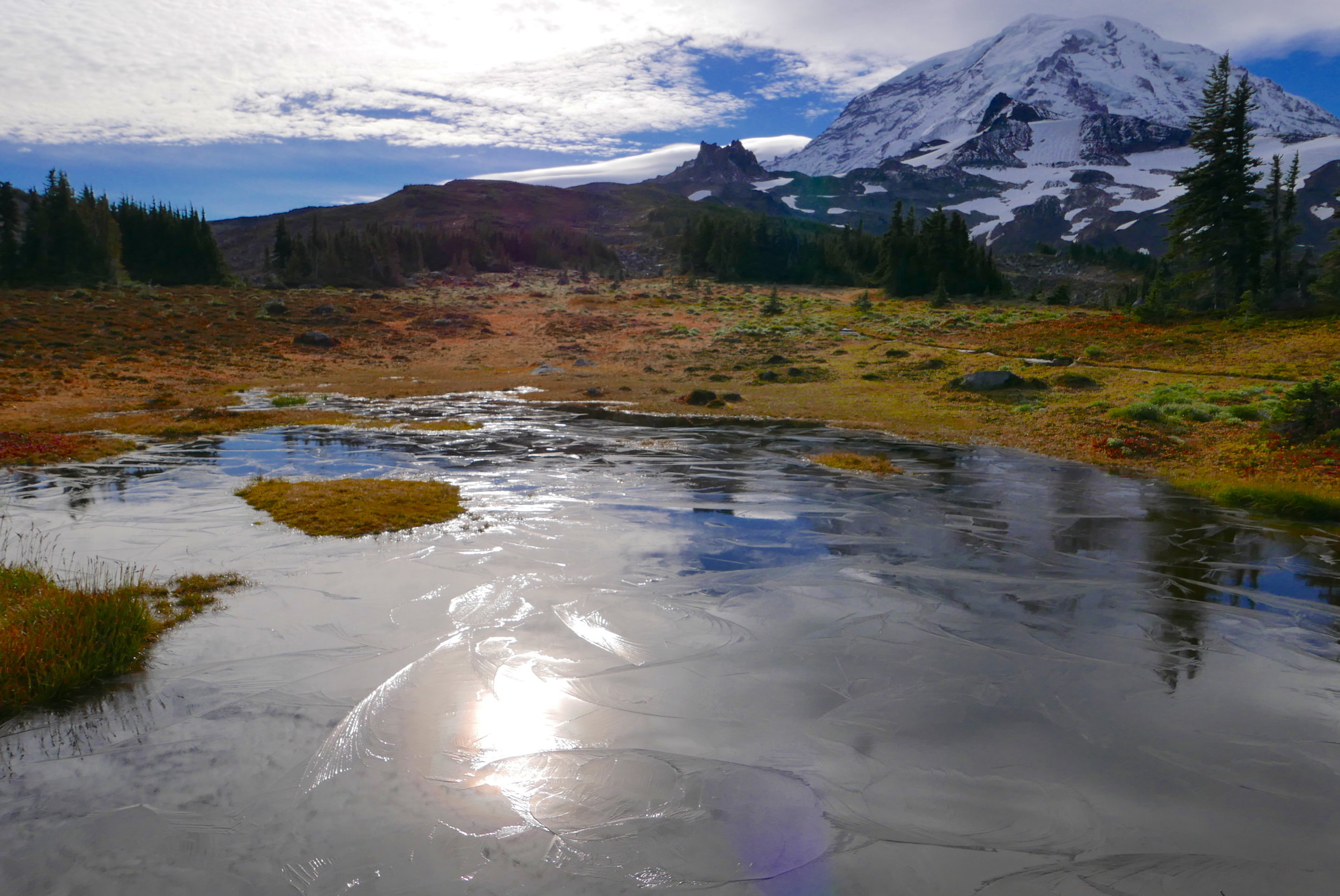
frozen tarn in Spray Park, looking at Echo and Observation Rocks


