
Mt. Shasta: Avalanche Gulch to 10,300' 8/21/2020
I fled the unhealthy air of Redding after prepping the van and decided not to return, saving myself almost 3 hours of driving after this day and reveling in clean air and cool breezes. I drove up the Everitt Memorial Highway to Bunny Flat (6950’) with the intention of saying there for the night. After lunch I departed around noon and made my way to Horse Camp, which has the iconic Sierra Club hut. There were a few people about but they soon left and I had a nice chat with the caretaker, socially distanced of course. The Avalanche Gulch climbing route has the quite interesting “Oberman’s Causeway”, a lengthy series of rocks put in place to prevent erosion. I had fun skipping along this path which went quite a distance, and it appears I missed the height of lupine bloom by a week or two. Nonetheless, the flowered meadows still had a bit of charm. Eventually these charms faded and I reacquainted myself with the joys of volcano climbing; scree and rocks. My intention was to reach 10,000’ and this milestone was reached in an opportune place, the last hummock at the snowfield before the climb just continues up to the pinkish top part in view. There are numerous wind break bivy spots here; makes a lot of sense for a two day climb. I enjoyed the cool breezes and expansive views in all directions, looking down on civilization and south to the smoky layers of hills. I also had a nice view of Green Butte, which I had climbed the day before, notable for its light brown shading in contrast to the surroundings. After a snack and some water, I started the descent at 3:30 PM with plenty of time to enjoy the afternoon sun on the way back to Bunny Flat.
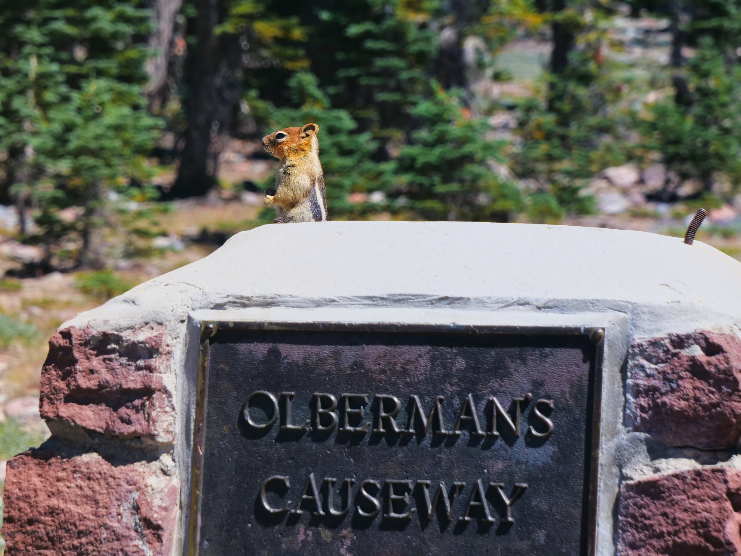
The lookout of Oberman’s Causeway
Once again I was able to take a hot shower, change into clean clothes and cook a nice dinner, all the while with the van opened up with cool breezes keeping me company. Not many vehicles in the lot, and those thinned considerably as darkness fell….it is legal to overnight at Bunny Flat, but it seems with the onset of school (in one form or another), the crowds of July have dissipated, leaving me to my solitude on the trails once again. I’m enjoying the cellphone service here and had a nice chat with my wife and daughter, processed a few photos and am able to post this blog before I hit the hay. 9 PM is getting to be my bedtime on this trip, slowly eroding my night owl tendencies. This is not a bad thing. Todays stats: 8.7 miles/3400’

Mt. Shasta from 10,300’

Interesting features on the upper mountain