Success Cleaver, Mt. Rainier National Park
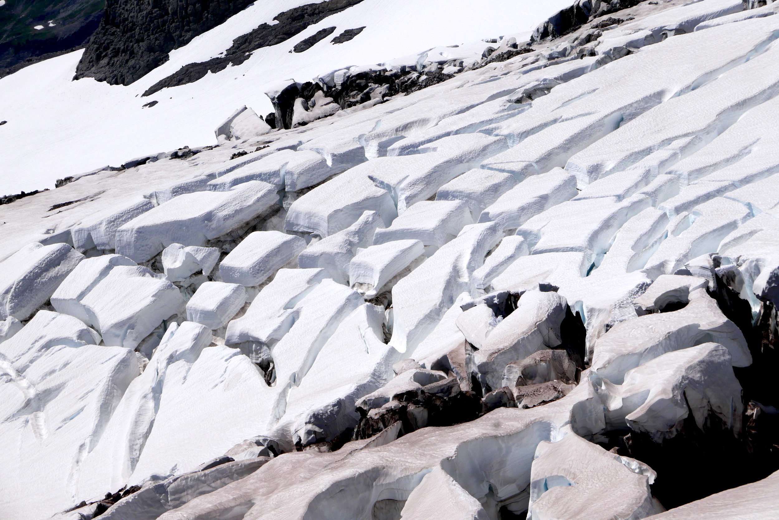
No, this was not a climbing trip. The Success Cleaver route is touted as the only route on Mt. Rainier where one can summit without stepping foot on a glacier, but very long and tedious, best done early season when the route is mostly snow covered. However, as a day hike it delivers on solitude, views and effort. On Tuesday, August 1st, I departed Longmire with the goal of trying to forge up to 9,000 feet on the cleaver. The first 7 miles are on the Wonderland Trail to Indian Henry's Hunting Ground, then proceeds via the Mirror Lake trail to Pyramid Peak. Two years ago I did a day hike to the top of the Success Divide at 7800', but the extra 600 feet of elevation gain on this trip to 8300' gained access to the bottom of the Success Cleaver. Matter of semantics, I guess. Once contouring around Pyramid Peak, I dropped to the col for the scree, loose boulder choss fest, noticing that I had missed the obvious easier descent route, noting this for the return trip. The first part of the Divide isn't particularly rewarding, as I stayed right of the ridge for the easiest line, the ridge providing the best views. Contending with heat and insane bugs, one must be determined and dedicated to ascend higher, slowly watching Mt. St. Helens appear on the horizon and Pyramid Peak sink. The lower portion has some short sections of class 3 scrambling, but eventually I gained the plateau that determines the transition from the Divide to the Cleaver, and travel became noticeably better. The narrowing Cleaver allowed me to peer right side to the Pyramid Glacier and beyond that, the Kautz Glacier. The real show, though, is the South Tahoma Glacier to climber's left, and with the abating of bugs above 7,000', cooler breezes and easier travel, I soaked in the views as reward for my labors. I followed goat track on a snow finger to my high point of 8300' not because I couldn't go any higher but because I was nearing my turnaround time of 3:30 PM. This is an area where one could climb to at least 10,000' in essentially non technical terrain, with enough time of course. Full photo set here.
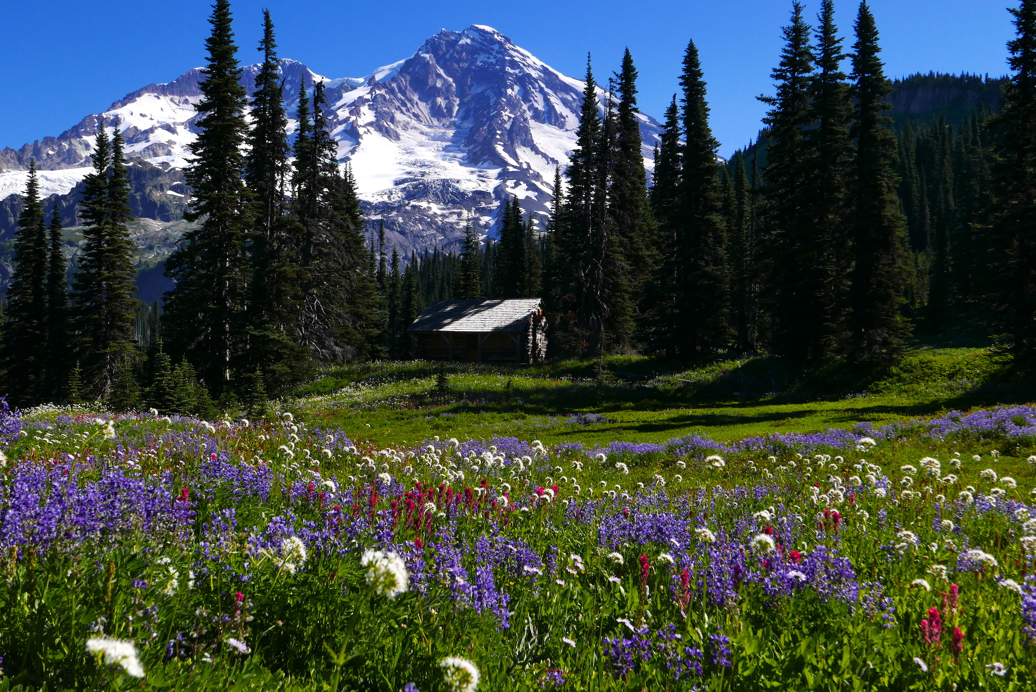
Flower show in full bloom, Indian Henry's Hunting Ground, Mt. Rainier
On NWHikers.net, a forum I contribute to, of late there have been discussions of wilderness areas overrun with visitors, discussions on the swelling population here, and the ethics of posting trip reports on visits to pristine areas, especially with GPS tracks. Many people avoid Mt. Rainier National Park because there are "just too many people" on the trails. I contend that one can find solitude and wilderness even in this park, and I have posted numerous trip reports attesting to the fact that I can go an entire day without seeing anybody. If one has the gumption to go off the beaten track, then solitude is there for the taking, but these trips are not leisurely strolls (this day hike involved @23 miles and 6,000' of hard earned climb, totaling 15 and a half hours). Yes, I am older (Senior Pass holder) and things are more difficult than when I was decades younger, but I'm not seeing 20 somethings out here either. My point being that, armed with only a map and an idea, one can still find pristine areas seldom visited, even in this National Park; you just have to work for it.

looking up the Success Cleaver to Success Point from 8300' (Mt. Rainier)