
Mt. Adams Round-The-Mountain (Truly)
This copped title is from Mike Woodmansee's book, "Trekking Washington." Mt. Adams "round the mountain" trail doesn't go round the mountain. There is a rugged no-man's land on the east side, seeing few visitors with approximately 5 miles of terrain extending from the viewpoint overlooking Hellroaring Meadow to a minimal trail on the far side of Avalanche Valley. On this 2 day trip (full photo set here), day one started from the Cold Springs campground (where I truck camped the night before) and proceeded CCW on good trail through the lovely Bird Creek Meadows area, ending on an overlook at 6500 feet. It took me nearly 8 hours to negotiate this approximately 5 mile section, starting with a sketchy descent into Hellroaring Meadow, a strenuous climb on the other side to the left of Little Mt Adams, then on to the Ridge of Wonders. I used the description for crossing this area from Woodmansee's book, relying mostly on an altimeter and line of sight. A GPS and map are of little use here, where I found that the day was characterised by constant assessment of terrain, problem solving and risk mitigation. This solo hike was true wilderness, I saw not one person through the entire first day. This definitely ranks as one of the hardest days I have ever had, including mountaineering, but I reveled in the solitude and problem solving, a far cry from day 2 on good trail where one can just perambulate with wandering thoughts. The only time I perhaps hung it out a little was crossing the Big Muddy, where I was looking at a 5 or 600 foot climb to find an appropriate rock hop (according to Woodmansee's description) or perhaps even ascending to the glacier for the crossing. However, after careful consideration at around the 6000 foot level, I saw an area with favorable hydraulics and decided to ford at this point. I was able to use a huge boulder to get to the center of the torrent, and taking advantage of my ZPacks staff, could scope out the footing for making it to another boulder to hold on to. Woodmansee describes the Big Muddy as not big and not muddy, but I beg to differ, especially in late afternoon. Crossing Avalanche Valley was a series of countless ridges and more creek crossings, belying the photos I took from afar where it doesn't look like a big deal. Let's just say I was knackered when I finally crossed the last fork of Rusk Creek and finally made my way to the trail portion. This section also took a toll on my feet, noticeable on day two even when I was on manicured trail. When I say I was back on trail, I should qualify that with a "mostly" as the trail leading through Devils Garden was sketchy and required due diligence and countless reacquirements in the process. I still had good light though and the views from the high point of 7700 feet were sublime. From this point the trail became more established and when I came across a nice sandy patch with a view of the mountain at about 8:30 PM, I decided to call it a day and catch some zzzs.
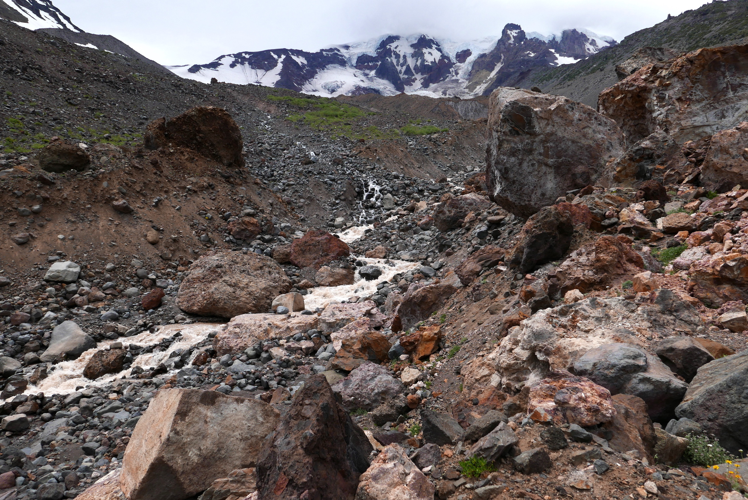
after crossing the Big Muddy
Day 2 was chacterised by lupine fields and great trail, with not much elevation gain or loss....and my feet really appreciated it. I wasn't moving as quickly as I thought I should have, a recurring theme of late, and the heat was becoming oppressive, but I simply outlasted the troubles and tried to enjoy the visual palette laid before me. The route utilizes the Highline trail on the north and the PCT on the west, before rejoining the Round the Mountain trail and finally the short section returning me to my truck, which I gained at 6 PM. It sure felt good to shower and clean up, and I partook of some still cold food provided by my thoughtful wife. The most difficult part of this day was trying to get into my house after sitting in my vehicle for nearly 5 hours, I was a bit seized to say the least.

wild horizon: Devil's Garden, Mt. Adams
To help with people contemplating this trek (35 miles/8000') I attached a GoPro to my shoulder strap and set it to capture 2 photo frames per second. This is now available on Vimeo for anyone to view or download. Anyone contemplating this trek should have strong ankles, complete confidence in one's ability to assess terrain and strong cross country skills, and be in pretty good shape. However, the rewards of trekking through some of the most remote and rugged landscape around Adams will compensate you immeasurably in many ways. I wanted to tackle some difficult stuff this season in celebration of turning 60 and this definitely served its purpose.