
Natural Bridge
These posts will cover all the areas I'm visiting in the confines of Mt. Rainier National Park in celebration of 35 years exploring here, including new places with a smattering of old.
I am very familiar with Mt. Rainier’s Northern Loop Trail; it is a perfect trainer for ultra marathons, being about 35 miles with 9200’ of climb. Of course that mileage has changed as one must add 10 miles of biking to the formula if accessing from the Carbon River side. The trail to Natural Bridge is a short distance past Windy Gap if approaching from the Carbon side (vice coming from Sunrise). This .7 mile trail is one I never checked out….in my haste to make time on this loop I had no desire to add 1.4 miles in the process.
Well today is a different day, and in order to hike this trail and check out the formation, I had to hike in about 13 miles. Well actually, I biked the Ipsut Creek trail (5 miles) and proceeded on foot to the NLT. The weather was unsettled, with low snow levels (@6500’) in the forecast with a chance of rain showers and thunderstorms in the afternoon. But with summer seemingly suddenly shutting down I couldn’t wait for perfect weather as it was nowhere to be seen in a 10 day forecast. I set off with appropriate gear for this outing, packing my Zpacks poncho instead of a rain jacket, wearing waterproof socks, and various upper body wear and hand wear for the anticipated conditions.

Now unused stranded bridges in the Carbon River flood plain
If you’re reading this you know I’ve been coming here for 35 years, and in the hundreds of Carbon River crossings over these decades I’ve witnessed the main river channel wander to and fro. Currently it has looped above the Ipsut Creek campground, occupying a creek channel, and shortly below the camp makes its way back to the main channel area. The wide flood plain of the Carbon bears witness to these wanderings with stranded log bridges mired in gravel and rocks and piles of stones upwards of 10 feet high, sometimes jammed into trees or sitting atop improbable places. This evidence of the power of water is truly a spectacle.

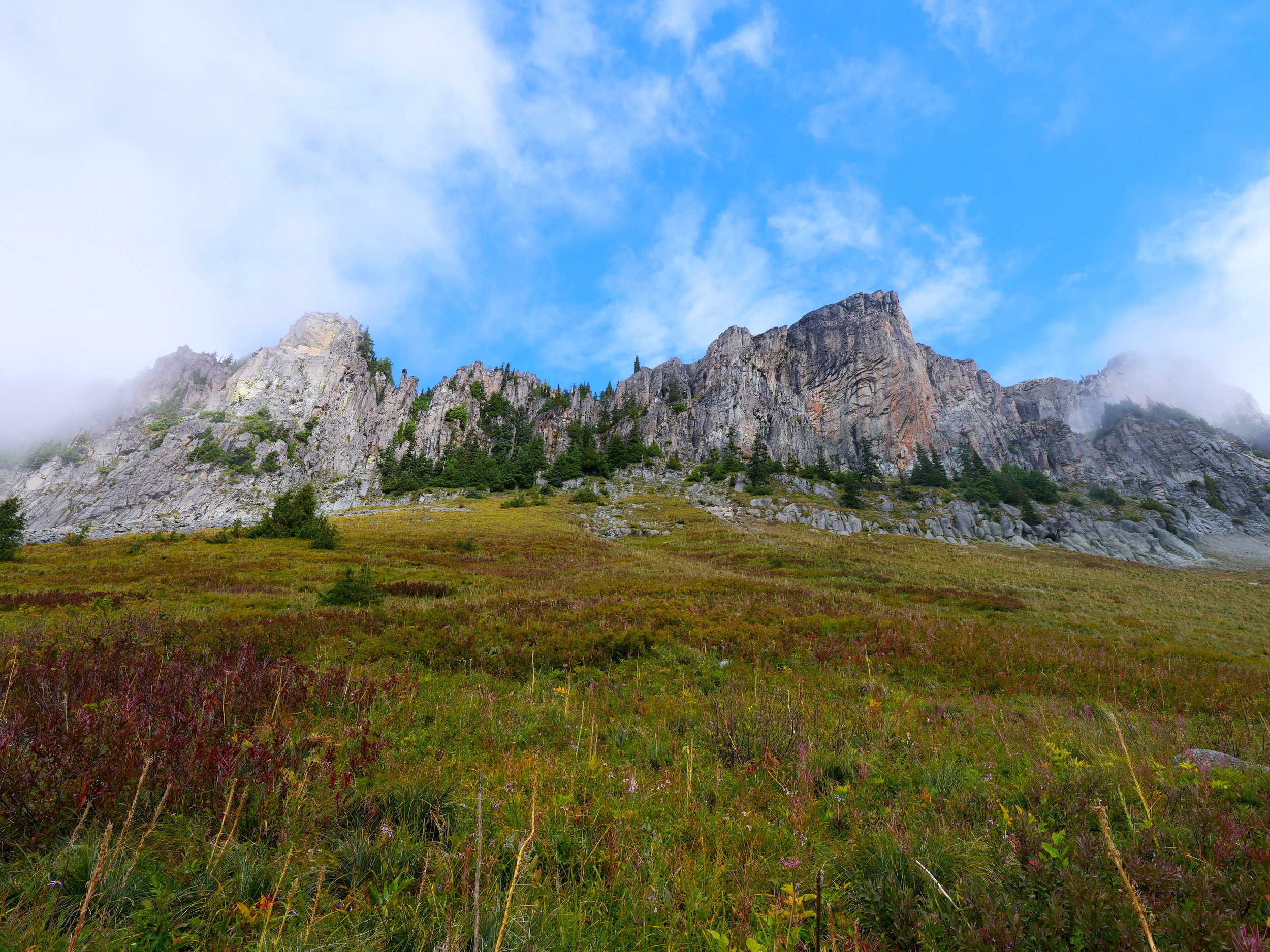
Trees in the mist on the 3000 foot climb to Windy Gap on the NLT
Once across I turned left on the NLT and started the switch backing 3000 foot climb towards Windy Gap (5830’). The trees disappeared into misty surroundings and the roar of the Carbon eventually subsided into the background during the ascent. I was treated with a view of the Yellowstone cliffs during a sun break and espied two goats grazing below them. Although the rain had yet to make an appearance, a stiff breeze at Windy Gap made me don an extra layer and some gloves as I made my way along the trail in the mist. I finally came to the turnoff for Natural Bridge and set foot to it for the first time. What awaits at the end is aptly named; Natural Bridge is exactly that, an arch of stone barely a foot wide across the top. Lakes James and Ethel can be seen in the background. In solitude I enjoyed the vista, snapping photos and eating lunch. As I packed up to leave the rain started and stayed with me through most of the return trip. However, I was toasty and comfortable inside the micro climate of Polartech Alpha (Beyond Clothing) that resided beneath the poncho, which also covered my back and front packs.
The Yellowstone cliffs make an appearance during a rare sun break on the NLT
On the bike ride back I stowed the poncho and wore a biking rain jacket I had stowed in the saddle bag, taking the time to visit Chenuis Falls (necessitating another crossing of the Carbon over 3 bridges). The rain tapered off during this side trip and I finished this outing sucking in the rain forest moist air with little pedaling on the road/trail. It took me 8 hours for this sojourn. The goal of hiking all the trails in the park is proving to be extremely rewarding on all counts. Stats: 27 miles (10 biking) and 5200 feet of climb/descent.

Chenuis Falls, a side trip on the Ipsut Creek trail