Huckleberry/Grand Park Loop
These posts will cover all the areas I'm visiting in the confines of Mt. Rainier National Park in celebration of 35 years exploring here, including new places with a smattering of old.
For a more formal loop description click here to link to the williswall blog.
To finish off my series of hikes over a few days in August whilst camping at Mt. Rainier's White River campground, I drove back up to Sunrise and started this loop at 7:30 AM on August 23rd with much chillier temperatures than I had experienced the past month in the park. I don't mean cold chilly, but just a hint of fall in the air necessitating a light wind shirt to retain just a tad more warmth in the winds that made themselves known at 6500 feet elevation. Back on the Huckleberry Creek trail, I passed the point where I had peeled off a few days prior for McNeeley Peak and continued the steady drop into the valley, soon enough stowing the extra layer. Although clear at elevation, I could see smoke in the valley below. The 9 mile downhill jaunt along Huckleberry Creek ended with exiting the park (passing an unused patrol cabin) and entering national forest land and FS 73.
LINK to RAW footage of this loop hike (unedited). Scroll down the RAW page; hiked on July 16/2025

Huckleberry Creek feeder in old growth splendor

Late afternoon sun casts long shadows on the trail approaching Sunrise
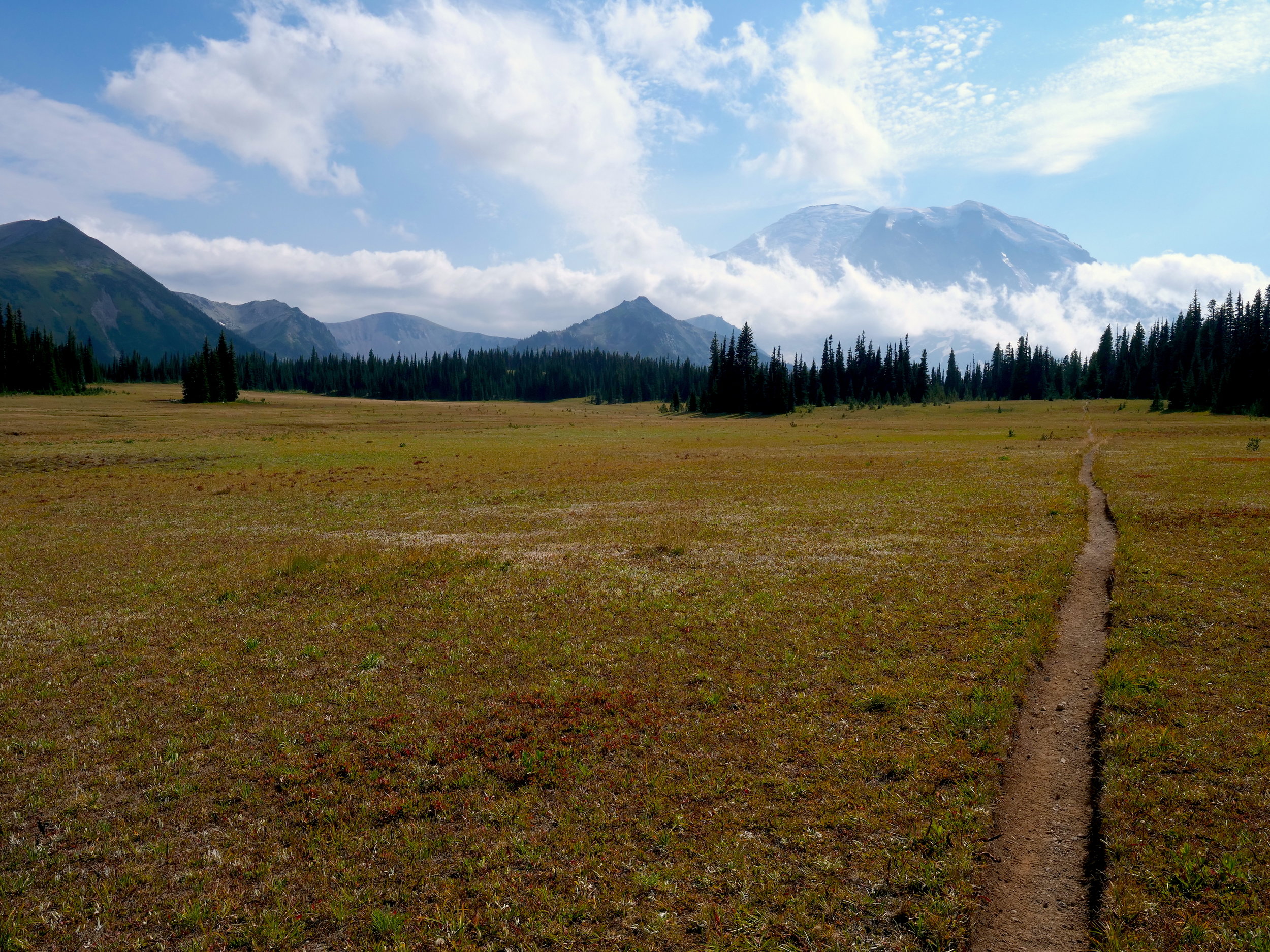
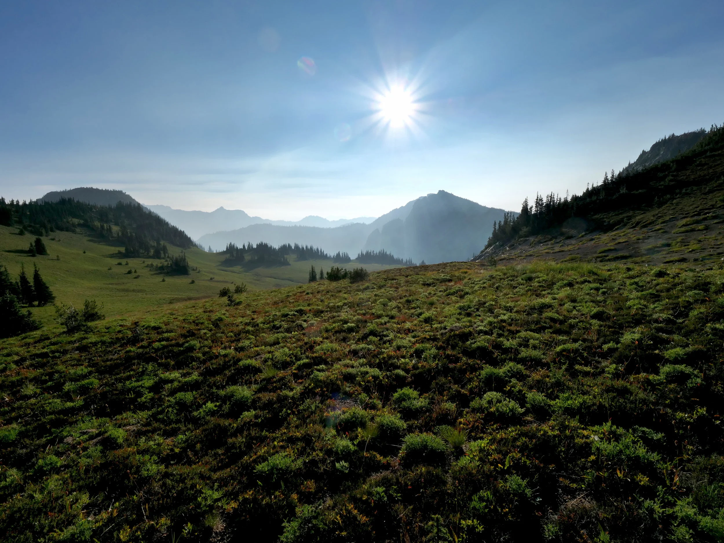
The next 4 miles or so were spent climbing steadily on FS 73 with nary a vehicle in sight. The smoke commingled with mist to keep the temperatures down, then magically disappeared as I reentered the park on a trail to Lake Eleanor. The rest of the day brought blue skies and thin patchy clouds with temperatures remaining comfortable and basically sweat free during the ascent. Although Forest Lake, old growth forest and Lake Eleanor were pretty enough, there's nothing quite like transiting the entire length of Grand Park. One can revel in flatness in a decidedly unflat environment. Follow that up with Lodi Creek bubbling in and out of sight through Berkeley Park and top it off with the sun at your back in the open alpine environment back to Sunrise (accompanied by stiff breezes) and this 26 mile loop is sure to peg your outdoors pleasure meter. In the process I checked off two more unvisited trails by yours truly, Huckleberry Creek and Lake Eleanor/Grand Park to the intersection with the Northern Loop Trail. 5500 feet of elevation loss/gain makes this a worthy hike whether doing it in one day or 4. Places to camp along the way.....Forest Lake Camp, NOT Lake Eleanor Camp (at this writing closed due to hazard trees), Fire Creek Camp (not too far north on the NLT) and Berkeley Camp. If you desire to also stay at Sunrise then there is the close at hand Sunrise Camp. Lots to see and lots to offer if one doesn't mind the walk on FS 73.
Upper Huckleberry Creek trail early morning
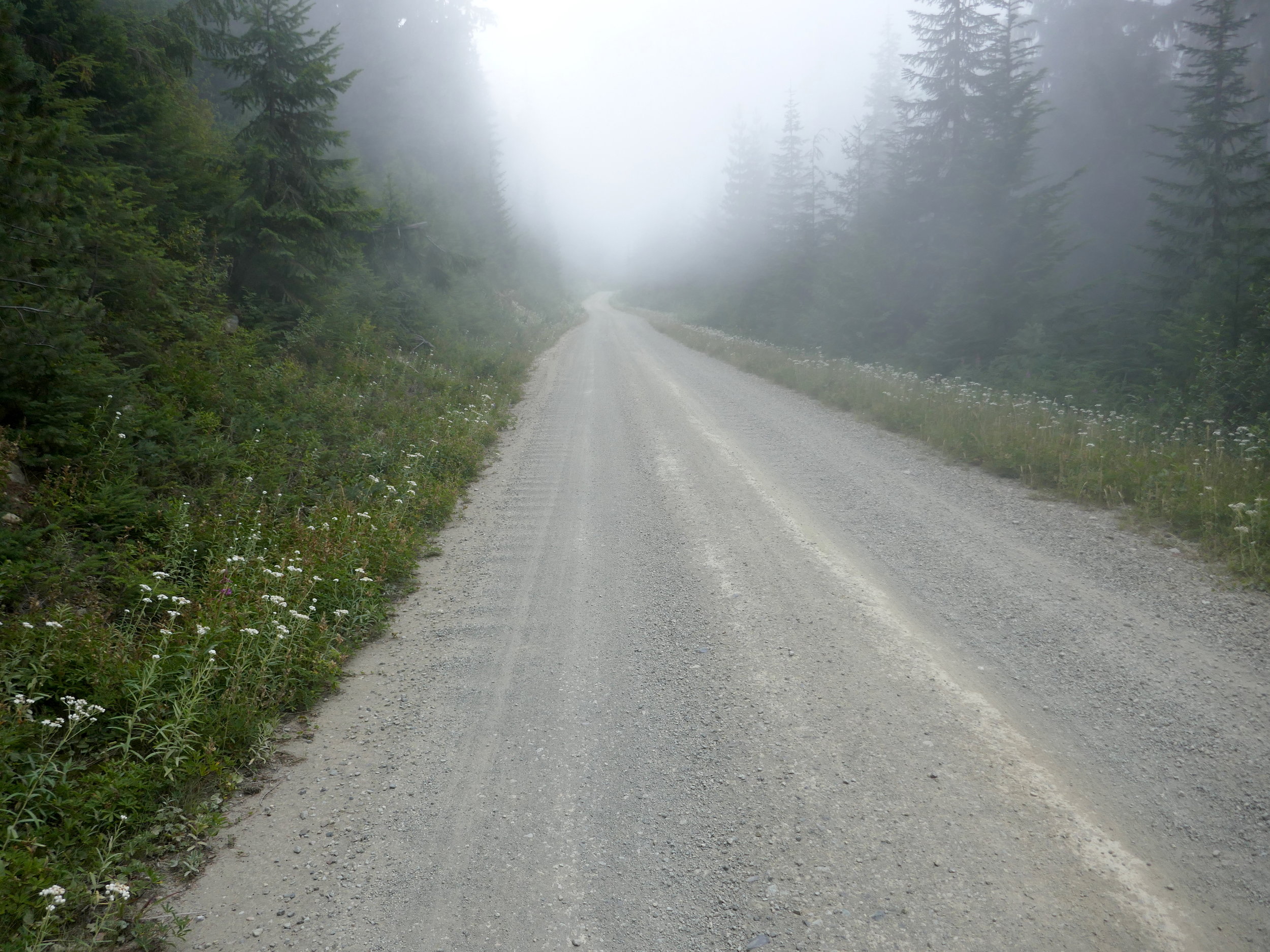
The not unpleasant walk up FS 73 to connect northern trails on the loop

Shuttered patrol cabin on the northern park border, Huckleberry Creek Trail