
The 7Up Hikes: Tokaloo Rock Loop
September 17, 2014
This is the last in this year's "7Up Hikes" series. My goal of hikes around Rainier taking advantage of off trail segments and touching points above 7000 feet certainly delivered a unique and different experience of the park beyond the Wonderland. That said, this last hike (September 10th) I ended up scaling back quite a bit as the original included another high point on a cleaver and 41 miles of hiking and biking, probably too much for this old man. This one was juuust right, doable in 12 hours: Stats: 25 miles (8 miles biking)/5300' elevation gain and loss.
I had serious incentive to be done and at the Cougar Rock campground by 6:30 PM as some friends were staying there and steak and wine were on the menu. The Tokaloo time map annotates position reports sent from my InReach on this clockwise loop.
I started at the road parking outside the closed area on the West Side Road at 6:06 AM and biked to Round Pass where I stashed the bike. Then it was on trail taking the Round Pass trail to the South Puyallup River trail and on the road for 3 miles until I arrived at the St. Andrews Creek trail. The morning was clear and nice and the going was good up to Klapatche Park, only getting a little damp on the legs and feet from the wet brush. I lingered at Klapatche for a while looking at the maturing froglings in the dwindling Aurora Lake and then it was off for St. Andrews Lake, where I would start the off trail segment. Unbeknownst to me it would take me four and a half hours to do the round trip to Tokaloo Rock.

Old stoneworks on the West Side Road

Aurora Lake (Klapatche Park) nearly dry at end of season

Tokaloo rock destination in sight, left of the jutting Tokaloo Spire

looking across the Tahoma Glacier to Emerald Ridge

tarn on off trail portion, looking south

terrain leading to Tokaloo rock, the summit visible now just left of Tokaloo Spire
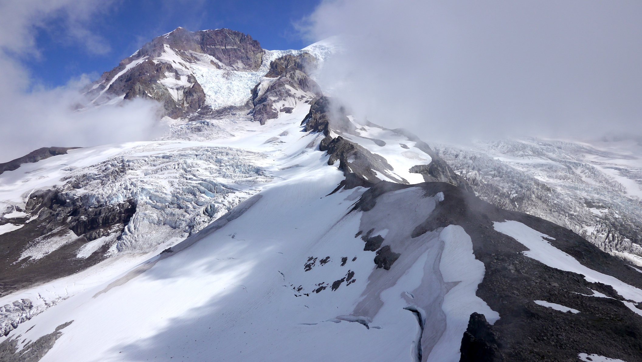
looking up the Puyallup Cleaver from Tokaloo Rock summit
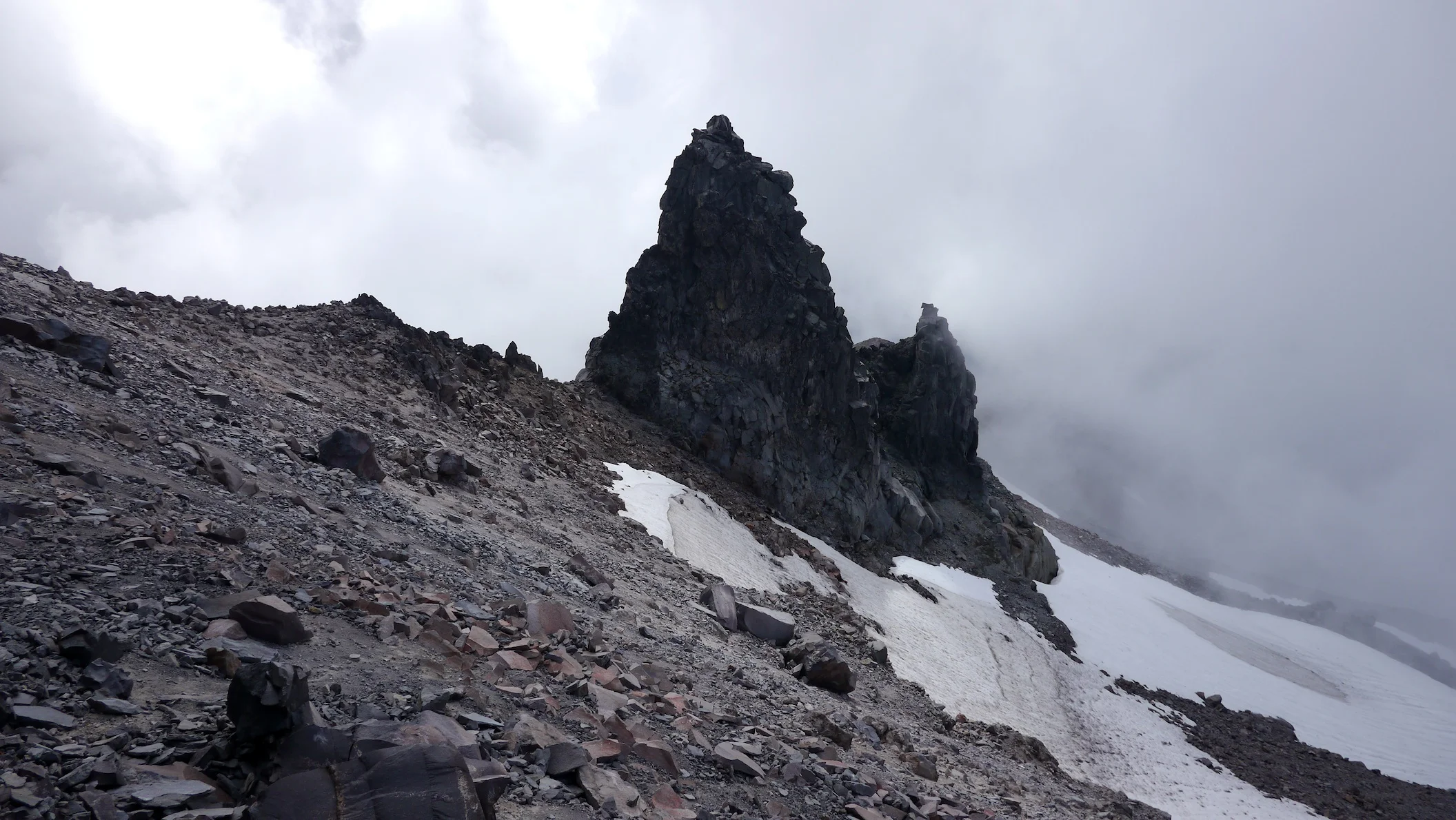
clouds move in as I look down on Tokaloo Spire
Happy to be back on trail and on schedule, I trotted the "Wonderful Trail" down to the South Puyallup River camp as the clouds slowly parted for me. Some photo ops delayed me there but I regained my trusty steed at Round Pass and pedaled maybe 6 strokes all the way back to my vehicle. I did stop to photo the boulders that cratered the parking lot and closed it, pretty impressive. I found it interesting that my end position report was at 6:06 PM, exactly 12 hours after I started, and I made it to Cougar Rock campground at 6:33:40 PM, only 3 minutes and 40 seconds late. After being chastised for my tardiness I cleaned up and was treated to one of the best steak dinners you could have sitting at a picnic table, a fine day indeed!

basalt formations at the South Puyallup River Camp
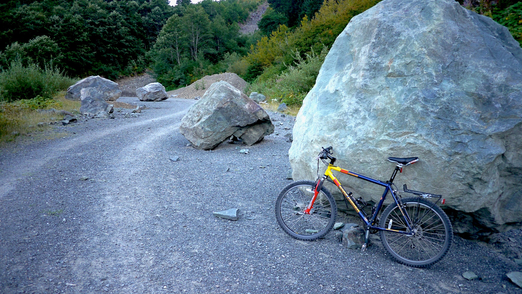
boulders that cratered the West Side Road, closing the parking area