Willis Wall Year in Review: 2014
Following last year's "Willis Wall Snippets: 2013" and "Happy Holidays from Gossamer Gear" I decided to start an annual review/Holiday message, incorporating video and photos I've had the pleasure to collect over this past year. Here's wishing all readers a Wonderland Holiday season and best wishes for 2015.
ZPacks Arc Slim review
ZPacks Duplex Tent review
2 Rare Transition Hikes
DeLorme map with position report timesHIKE 1: (12 miles/3000')
When I write rare, I mean the opportunity to do a great hike in weather that seasonally is not so cooperative. For October, this turned out to be on the 19th. My daughter was home for a few days from school and was craving a taste of North West outdoors, it didn't matter if it was in rain, she just wanted to get out. Staying within a two hour drive, we traveled to Mt. Rainier National Park to try something new, a loop hike starting at Mowich Lake that would take us up above 7000 feet with a possible summit of Observation Rock if time allowed.
Mt Rainier: Pyramid Peak
40 Hours on the Wonderland Trail
time map for position reports on the WTThis trip had an interesting start, as I was back from London without much sleep and decided to take advantage of good weather on Monday and Tuesday (Sep 15-16) to head out. But first I was supposed to pick up some new pants from Beyond Clothing, and waited at the Seattle store for the UPS truck to arrive with said trousers. As I finally had to head out the door from the no show truck, they sent me to their warehouse in Kent to pick up a pair on the way to the mountain.
Mt Rainier: The 7Up Hikes-Tokaloo Rock Loop
This is the last in this year's "7Up Hikes" series. My goal of hikes around Rainier taking advantage of off trail segments and touching points above 7000 feet certainly delivered a unique and different experience of the park beyond the Wonderland. That said, this last hike (September 10th) I ended up scaling back quite a bit as the original included another high point on a cleaver and 41 miles of hiking and biking, probably too much for this old man. This one was juuust right, doable in 12 hours: Stats: 25 miles (8 miles biking)/5300' elevation gain and loss.
Mt. Rainier: The 7Up Hikes/Curtis Ridge-Old Desolate "T"
Curtis Ridge/Old Desolate "T"Get ready for a spanking on this one, as it provides 26 miles and 8200 feet of vertical, the hardest parts off trail. It took me nearly 17 hours to complete. This is the third in a series of hikes I planned for Mt. Rainier National Park where vistas above 7000 feet and off trail travel let one experience a whole different world outside of the Wonderland Trail. Although already planned, the timing was spur of the moment.
8 Days in the Pasayten Wilderness-Aug/2014
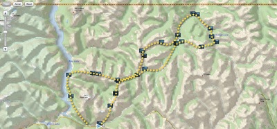
from the DeLorme map of positions reports sent on tripOverview
Originally planned as a 200 mile trip, my daughter's recovering hip, rehabbed enough to get the go ahead for hiking, had us entering this foray with different criteria: plan on 10 days max and venture into the heart of the Pasayten wilderness as far as current fires, physical limitations and trail conditions allowed before looping back. The meager stats (101 miles, 16,000' of elevation gain) don't do justice to the difficulties we faced….pea sized hail and thunderstorms at 7000', trails and phantom trails with meager tread, river crossings, soaking head high grasses and fireweed leaving our lower bodies in a constant state of saturation, and hundreds of blowdowns and deadfall to name a few. But what a trip!